Over hill, over dale,
Through bush, through briar,
Over park, over pale,
Through blood, through fire,
I do wander everywhere…
(Shakespeare, from "Midsummer Night's Dream")
“There’s snow on the ground.”
I said it without much emotion really. A simple statement of fact. And then followed it with the equally dry, “I wasn’t expecting that.”
We had gotten quite a bit of snow in the Northern Virginia area the weekend before, some 16-20 inches, depending where in relation to the beltway you lived. But it had rained for a couple of days later in the week, and warmed up a bit, and the snow was pretty much gone.
So as Adam wheeled the Volvo onto State Route 675 toward Wolf Gap Recreation Area, where we’d park during our quick weekend adventure, I was surprised to see four to six inches of snow on the ground. And it was a hard, crusty snow, as we’d soon find out.
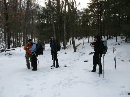
Seven of us, part of a backpacking meetup group in the Washington, D.C./Northern Virginia area, decided to ‘start the new year right’ with a 27-mile loop in the George Washington National Forest, starting from Wolf Gap parking area, a caribiner’s throw over the Virginia border. We’d circumnavigate Trout Run Valley, counterclockwise, and enjoy its eight grand vistas (or so said the online trail guide). Our plan was a fairly easy three-day trek — around eight to nine miles on Jan. 1, perhaps up to 12 on Jan. 2, and then a short Sunday back to the cars and the two- to three-hour drive home.
We knew it would be cold. The forecast called for partly cloudy skies, temps in the 20s during the day, teens or below each night, getting gradually colder as the weekend progressed, with winds around 20 miles per hour, gusts up to 45. Or, as Jason put it, partly cloudy with a chance of Brrrrrr!
But we weren’t really expecting the snow. And even though it was only four to six inches, we found ourselves tiring quicker than usual as we lifted our feet higher than usual with each step as we plodded forward.
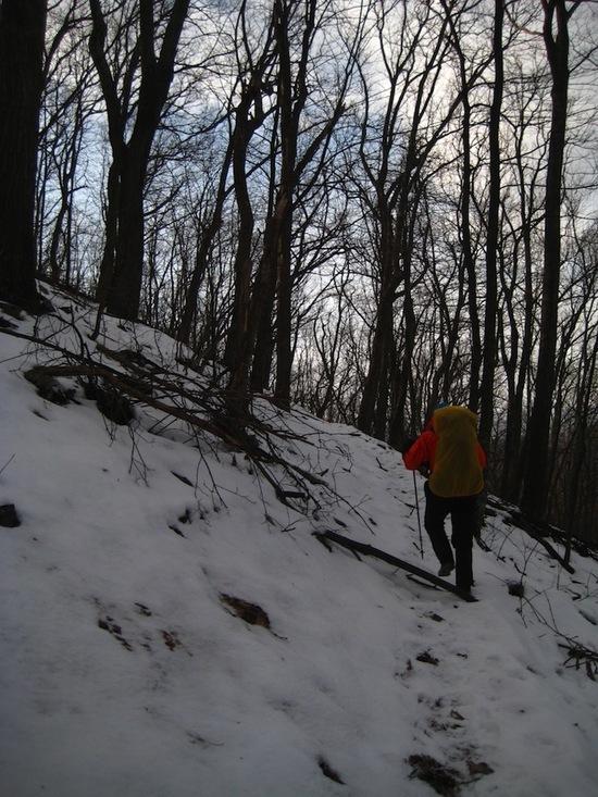
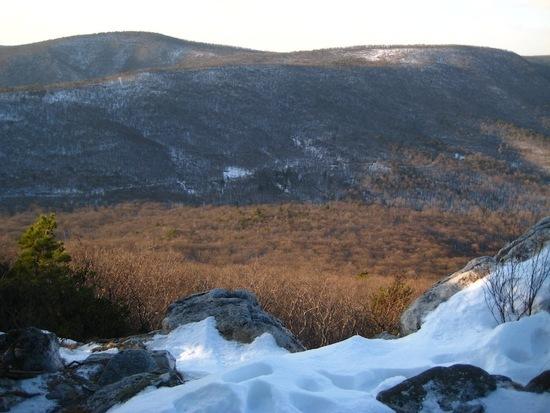
From the parking area we immediately headed up the orange-blazed Mill Mountain Trail, crunching through the snow, for about a mile until we reached the ridge. We were rewarded at the top with the first of the vistas, with views of Little Sluice and Massanutten mountains. It was cold, but the air was still for the moment. We enjoyed the view through the haze of our breaths as we stopped momentarily.
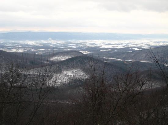
Views of Little Sluice and Massanutten mountains. Photo by Adam
We pushed on, ambling along the ridge for quite some time, dropping down to Sandstone Spring and then climbing again — a long, slow, steady climb — up one of the ridges of Mill Mountain before dropping again to the Tuscarora Pond Trail.
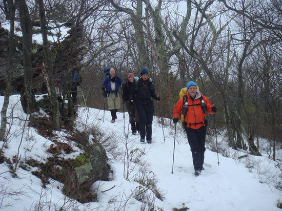
Hiking along a ridge on Mill Mountain. Photo by Jason
We headed left, down the yellow-blazed, rolling Halfmoon Trail, for half a mile, stopping at its junction with Bucktail Connector Trail for the night. We got in early, around 4 p.m., but felt it was the best camping spot in the area — we were near a running stream and had plenty of fairly level ground for our six shelters. We had hiked approximately nine miles, though thanks to the snow-covered trail, we felt like we had hiked more than a dozen!
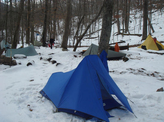
Our Friday night campsite. If you look closely, you'll see Jeremy's SuperMid (yellow), Adam's Grace Solo tarp, and in back on the left, my DuoMid. It was an MLD campsite! Photo by Jason, who's Contrail is also in the photo
After erecting our shelters and hanging our bear bags, we gathered around a roaring fire, drinking some shared home-made eggnog (with bourbon, applejack brandy, and a touch of rum), toasting the hike, swapping stories about the day and downing dinner.
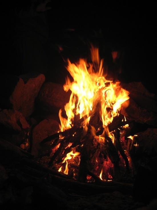
Nothing like a fire to warm the bones! And other bits as well…. Photo by Adam
The nighttime temps dropped to 14 degrees (F). A strong wind occasionally danced through the camp during the evening, shaking shelters and creeping and crawling under tarps and around bivies, but we all stayed warm enough huddled in our bags and under our quilts.

What a happy breakfast group! Photo by Jason
We started an icy Saturday morning with Steripen woes and semi-frozen Aquamira, but still enjoyed a hot breakfast and looked forward to the day’s hike. We headed down the pink-blazed Bucktail Connector Trail for two and a half miles, crossing Trout Run Road and picking up the yellow-blazed Long Mountain Trail. We’d be on this trail for the next eight miles, doing the As and Ds (ascending and descending) for much of the day. The snow on the trail occasionally gave way to the brown leaves underneath for short stretches, allowing us to pick up the pace in fits and starts.

It wasn't all snow! Photo by Adam
Checking the map and route at the end of the Bucktail Connector Trail. Photo by Doug
But our pace wasn’t the only thing picking up. Unlike Friday, the wind decided to keep us company on Saturday. And it was a cold, belligerent companion, pushing past our balaclavas and fleece-lined mitts, our wool base layers and (alleged) wind-blocking beanies to wrap its icy grip around our very bones. By the time we reached the Devil’s Hole Trail (really, a slick, frozen State Highway 691), we decided to push on for the last five miles to the cars instead of staying out for another evening. Yeah, we wussed out. But we were okay with it.
Nearing the Devil's Hole Trail. Photo by Adam
As we skated down the tire-worn ruts on the road, a pickup truck brimming with campers slowly pulled up beside us and stopped. The driver, a youngish looking blond man with a day’s stubble, lowered his window.
“Where you headed?” he said amiably.
“Wolf Gap,” we replied.
“Where’d you start?” he inquired.
“Wolf Gap,” we again replied. “We started yesterday morning,” added Kelly.
“You stayed out overnight in this,” he asked, a bit incredulous.
“It only got down to 14 degrees last night,” I offered.
The rest of the truck's camo-clad inhabitants looked at each other with that “nut cases” look. The driver looked at his dashboard, and then turned back to us and exclaimed, “It’s only 12 degrees now! And that’s without the wind chill!”
A few pleasantries later and the hunters slowly drove away shaking their heads. We were all smiling. At that moment we didn’t even care if our blue-tinged lips were freezing.
We continued on, moving gingerly over the icy road. Adam put on his MicroSpikes. He’s a smart kid. We reached the yellow-blazed Tibbet Knob Trail and trudged back into the snow for the last two and a half miles of our winter adventure. The wind, sensing we were nearing the end of the hike, started howling in disapproval.
We climbed up to a rocky outcrop, scrambled over the rocks, and then hiked on through more As and Ds. We were shielded from most of the wind in the woods, but every vista exposed us to winds strong enough to nearly knock us off our feet. Our trekking poles surely earned their keep during that section of trail.
Great view, but the wind nearly knocked us off our feet! We stayed away from the edge. Photo by Adam
By the time we saw the picnic tables, after many a hill (where were the dales!?), which let us know we were near the cars, we were chilled, tired, and quite hungry. Some fresh clothes and heaters turned up to the ‘hell’s furnace’ setting took care of the first two. A long, belly-stuffing stop at Cracker Barrel took care of the last.
It was a delightful, if nose-numbing, weekend. I’d love to hike the trail in the fall, I imagine it would be quite beautiful. And it sure would be nice if Cracker Barrel would install a purging trough.

