hey all i'm planning a nine day trip along the high sierra trail starting 10 days from now. i've seen a couple firsthand reports that the smoke hasn't been too bad thus far, but wind direction could change that quickly. so we are thinking of escape hatch back up plans. if you wanted to do something similar to our high sierra trip, starting very soon, where would you go? things we like: mountains, cool lakes, on and off trail options, not-impossible last-minute permitting, and somewhere between 5 and 8 nights. a few ideas: 1. high uintas – similar to sequoia, and perhaps we could add a trip to coyote gulch (or another canyon) to shake it up, though adds travel days. 2. glacier – beautiful, but the shared backcountry campsites cut down on the solitude we are hoping for. 3. wind river – also similar to the sierra. might be getting really cold by mid/late sept? what am i missing? :) thanks!
Topic
alternatives to sierras
Become a member to post in the forums.
- This topic is empty.
The fire and wind will only reach a certain distance. Just staying out of its range still gives you 90% of the high Sierra to play in. If I had that time, I would start clockwise on the Rea Lakes Loop and keep going over Forrester into Rocky Lakes Basin. Then head back through Whaleback and bag Brewer before heading down.
hey aaron i've definitely looked into other high sierra plans and that sounds like a great one, but isn't that just as close to the rough fire as the HST?? i saw reports of horrible smoke over kearsage pass this weekend. it's true we could change our tickets to SF (from LA) and perhaps do something in yosemite, maybe the northern end of the JMT?
Permits for Rae Lakes Loop out of roads end have been canceled. The area around Kearsage Pass has been pretty smokey, but may change with the wind. I'm not sure how it is once you get up into the Rae Lakes area.
any ideas for a good week-long trip in the northern sierra far enough from the rough fire? it's such a vast area, and i'm just starting to get my head wrapped around pieces of it. a loop would be ideal, but not necessary if taxi/shuttle's are at all possible. we can have a rental car at one end. we've thought of a chunk of the PCT, maybe tuolomne to sonora pass. desolation wilderness sounds great but perhaps too small to contain a 7 night journey. doing the JMT northbound from red's meadow to happy isles should be far enough away, but probably wouldn't offer the kind of solitude we're after. appreciate any ideas here, or elsewhere. we can change our flight last minute. thank you!
I did the Trinity Alps for the first time about a month ago, and it was fantastic. You get very similar alpine terrain at much lower altitudes, there is more wildlife, and far fewer people than in the Sierras. I went in at Stuart Fork up to Emerald, Sapphire and Mirror lakes, then up and over the Sawtooth Ridge to the Caribou lakes, then northeast and out at Big Flat Campground. Hitched a ride back down to the cars at the Stuart Fork trailhead.
Check fire status in Weaverville before going. New fire last week.
hi david ah yes, i did look into the trinities too. looks beautiful! out of curiosity, about how long was your trip, nights & mileage? 70k acre 'river complex' fire burning about 20 mile west of stuart fork though. might not be a good backup plan this time out. it does seem there is some room to breathe so to speak between yosemite and tahoe, as mentioned above. but i don't have a great sense of that area. i gather it's a bit flatter.
http://viewer.smoke.airfire.org/run/standard/PNW-4km/2015090100 Forest Service website where fires are and where the smoke is going It is much less than it was a couple weeks ago There were a bunch of fires West of Trinities that aren't shown anymore, which must mean they're no longer blowing smoke at Trinities
http://viewer.smoke.airfire.org/run/standard/PNW-4km/2015080300 what it was a month ago
jerry, that's an amazing website! i was not familiar. according to a ranger report from a week ago (http://www.fs.usda.gov/Internet/FSE_DOCUMENTS/stelprdb5154861.pdf), "Currently, every one out of three days is basically a clear day." which doesn't sound ideal. but we don't leave for another week. so i'll keep an eye out. i'm googling trinity backpacking trips and it seems most are in the 4-5 day range. we were looking for something closer to 8. thanks all
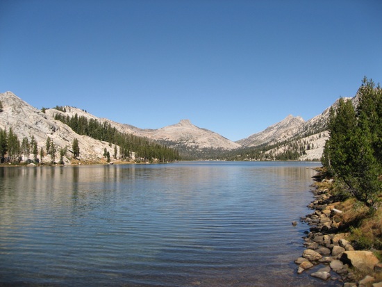
take a look at Tilden lake in N. Yosemite. not quite Kings Canyon but very nice. Couple of options. Hike out of Hetch Hetchy and loop it. Second hike out of Sonora Pass on the PCT. Want to loop it? There is a great little use trail from the headwaters of Tilden like that goes up Tilden Creek, past Mary Lake, over an easy pass, maybe Tower and down to Tower Lake. there is a trail that follows the Walker River on out toward Sonora. I did this trip many years ago and it resulted in me hiking the PCT a couple years later so be careful.
Tilden Lake
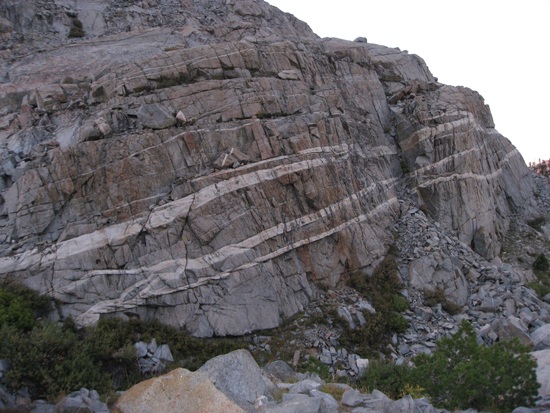
Walker Canyon
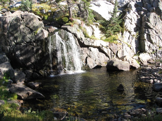
Falls on Tilden Creek
Our trip was about 30 miles in 5 days, 1 of the 5 being a layover day. We were hiking with a college buddy who is completely old-school whose pack weighed – I kid you not – over 75 lbs. He brought a complete set of full-sized nestled steel pots, a huge stove that looked like 1/2 of a propane car camping rig, a 2-man tent, a folding chair, a hatchet, steaks, whiskey in glass bottles, etc. We were fortunate and didn't have any smoke until the last day. Good web site tips for checking conditions!
well i'm sure the steaks were delicious… thanks for the hetch hetchy idea. sonora pass does sound appealing. since i don't have good maps for that area yet, about how many miles would a sonora 'loop' be?
I checked my PCT journal and it was about 20 from Sonora into Yosemite. Double it to get out and add another 20 with Yosemite and I estimate about 60 miles.
hey thanks so much. to be clear, you're saying 20m from sonora to yosemite, 20m doing sundry other hikes around yosemite, and 20m back to sonora on the trail following walker river? it's really hard to find good maps online and i don't own any for the area yet so i'm trying to use these vague NPS maps (http://www.nps.gov/yose/planyourvisit/upload/YOSEmap1.pdf)! thanks again
Ben, let us all know how it went when you get back! I'm interested on where you went, and the conditions experienced first hand.
paul – we just got back from 8 days on the high sierra trail. we got very lucky with weather – it rained all day the first day, was a bit foggy the second, and on our last night above guitar lake we saw smoke rolling in to our north and west… but otherwise it was crystal clear and gorgeous. a few mornings were colder than we expected, but that probably says more about our expectations than anything! all the other options look great but had their own issues: the wind river range sounded cold and the possibility of a major snow storm was a major downer, hiking malto got me into the northern yosemite idea (either the PCT/walker river trail loop or a loop of kerrick/matterhorn canyons from mono village), but the butte fire was raging and blowing straight east when we left for the west coast – it actually made CNN while we were at the gate at JFK!, the trinities had their own fire going, and glacier had similar issues to wind river. ultimately, we just got lucky. the rough fire has mostly been pushing smoke north of the high sierra trail and continued to do that while we were there. it was amazing.
Ben, Thanks for taking the time to respond! I'm thrilled your trip went off well, albeit with the rain. My preferred itinerary is Rae Lakes/60 Lakes Basin from Kersarge pass. (Oct 3,4,5) 3 days, 1 day to hike in (10miles?), 1 day to explore, and 1 day to hike out (10 miles?) (flight to catch in LA at 10pm) Alternates seem to be: Cottonwood Lakes Mineral King Whitney Portal Crescent Meadow (HST) Any others I'm missing? Or suggestions/advice? It seemed like Rae Lakes is typically very popular, and with the fire, and time of year I might miss most of the crowds.
paul, i'm the wrong guy to ask about the sierra. i'm from nyc and my knowledge is limited to the 8 days we just did. i know rae lakes is supposed to be beautiful. i'd just keep checking the various smoke and fire reports: https://earthdata.nasa.gov/labs/worldview/?p=geographic&l=MODIS_Aqua_CorrectedReflectance_TrueColor(hidden),MODIS_Terra_CorrectedReflectance_TrueColor,Reference_Labels,Reference_Features(hidden),Coastlines&t=2015-09-23&v=-120.18440946049164,35.47352418458229,-117.40047391361664,37.72791871583229 http://www.wunderground.com/wundermap/?lat=36.71768&lon=-118.65469&zoom=10&type=terrain&units=english&tl.play=0&tl.spd=2&tl.dur=1&tl.frames=20&tl.mode=simple&groupSevere=1&groupHurricane=1&groupFire=1&groupCamsPhotos=1&groupRealEstate=1&eyedropper=0&drought=0&extremes=0&fault=0&favs=0&FemaFlood=0&fire=1&fire.sat=0&fire.smk=1&fire.perim=1&fire.mode=0&fire.opa=100&firewfas=0&fissures=0&fronts=0&hurrevac=0&hur=0&labels=0&lightning=0&livesurge=0&mm=0&ndfd=0&rad=1&rad.num=1&rad.spd=25&rad.opa=70&rad.type=00Q&rad.type2=&rad.smo=1&rad.noc=1&rad.stm=0&dir=1&dir.mode=driving&sst=0&sat=0&seismicrisk=0&svr=0&ski=0&snowfall=0&StateLines=0&stormreports=0&tor=0&tfk=0&tsunami=0&riv=0&wxsn=0&cams=0&pix=0&PrecipStart=0 http://inciweb.nwcg.gov/incident/4456/ etc
Become a member to post in the forums.