Topic
2016 Bob Marshall Wilderness Open
Forum Posting
A Membership is required to post in the forums. Login or become a member to post in the member forums!
Home › Forums › Campfire › Hiking Partners / Group Trips › 2016 Bob Marshall Wilderness Open
- This topic has 377 replies, 28 voices, and was last updated 8 years, 8 months ago by
 Mike M.
-
AuthorPosts
-
May 5, 2016 at 12:38 pm #3400130
I should also mention that the skeeters are out a bit earlier than usual. Depending on the weather they could be quite obnoxious by the end of the month.
May 7, 2016 at 4:31 pm #340077575 and sunny today. Rivers big but not huge. Frankly these mild springs are lame. If we don’t have snow Memorial Day weekend I’m moving the start date for next year back six weeks.
May 7, 2016 at 5:08 pm #3400781it’s crazy; supposedly next year we’re looking at a La Nina so maybe you won’t have to :)
ran a 30k race today w/ a little over a mile of vert- I wish I could say that it was a walk in the park due to my great training, but I’m sore, tired and my stomach has just finally gotten back to normal
May 8, 2016 at 3:58 pm #3400951“If we don’t have snow Memorial Day weekend I’m moving the start date for next year back six weeks.”
+ 1. Maybe Easter weekend.
May 8, 2016 at 10:39 pm #3401052It doesn’t bode well for late summer, but it’s hard not to enjoy the great weather we have had the last couple weekends. May as well enjoy it while we can – it looks like we are on track for fires and closures in the Bob again by late July. I love the Memorial Day date for the BMWO. It works well to have it over a long weekend, and you could get any weather/conditions that time of year. It does make sense though to move it up for a year after multiple mild springs in a row to ensure a year with more snow. I think a permanent move would see less participation and probably limit the entry/exit point options due to accessibility.
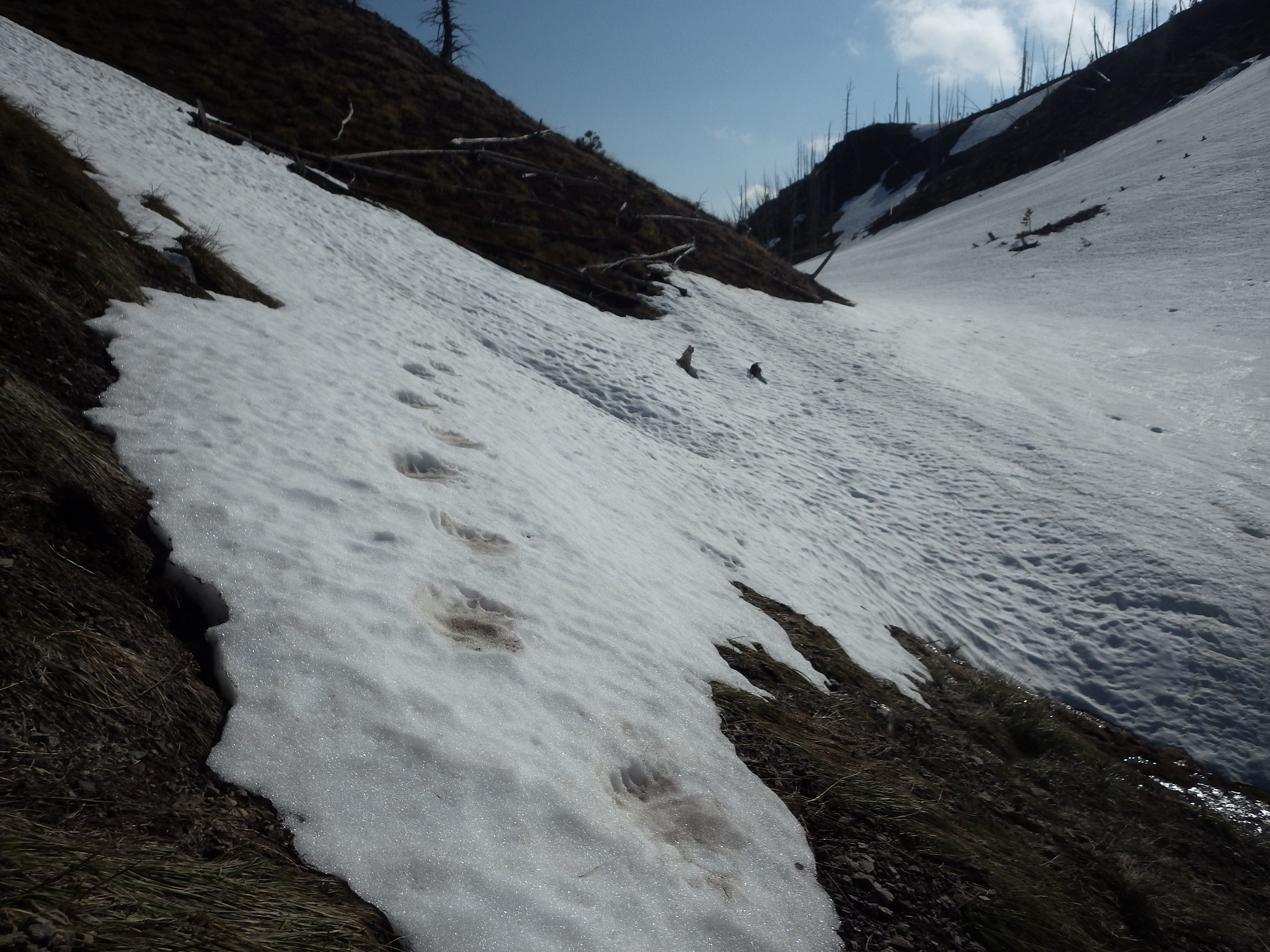
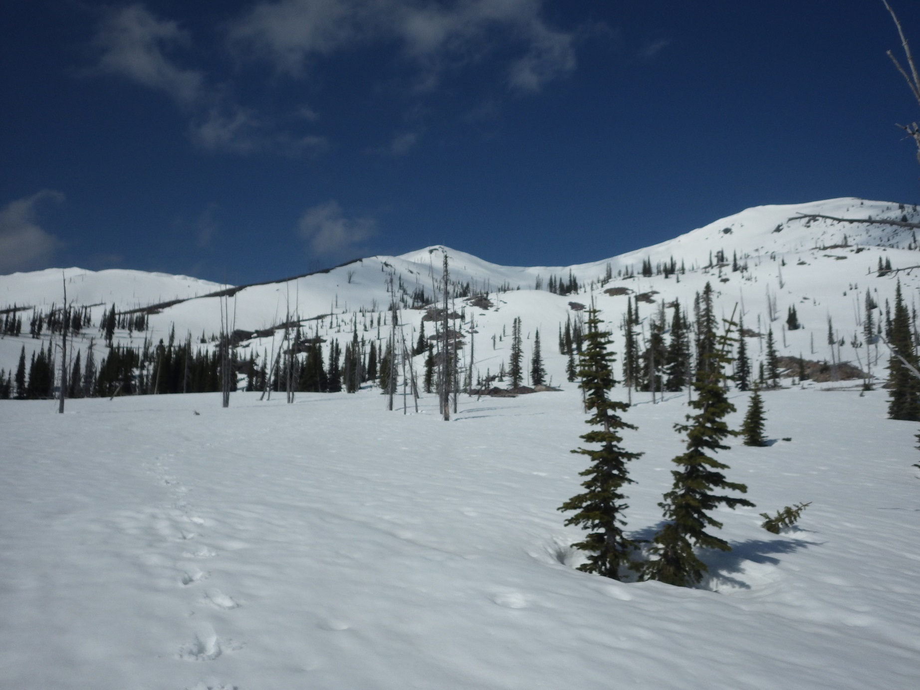
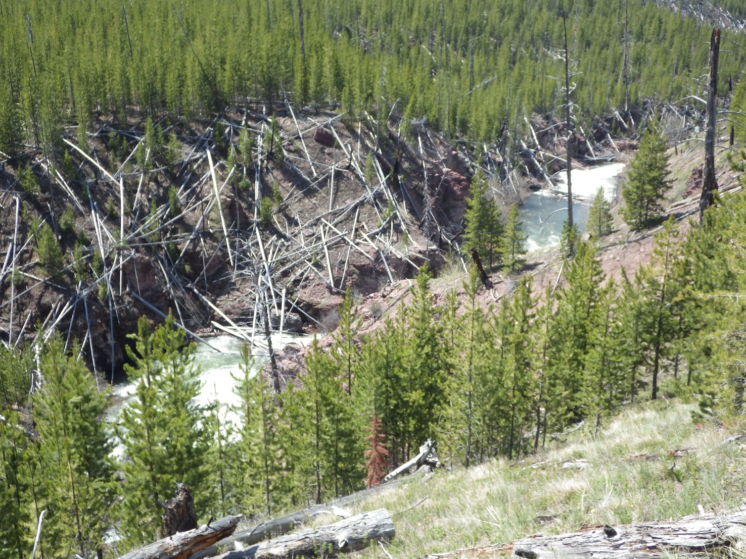
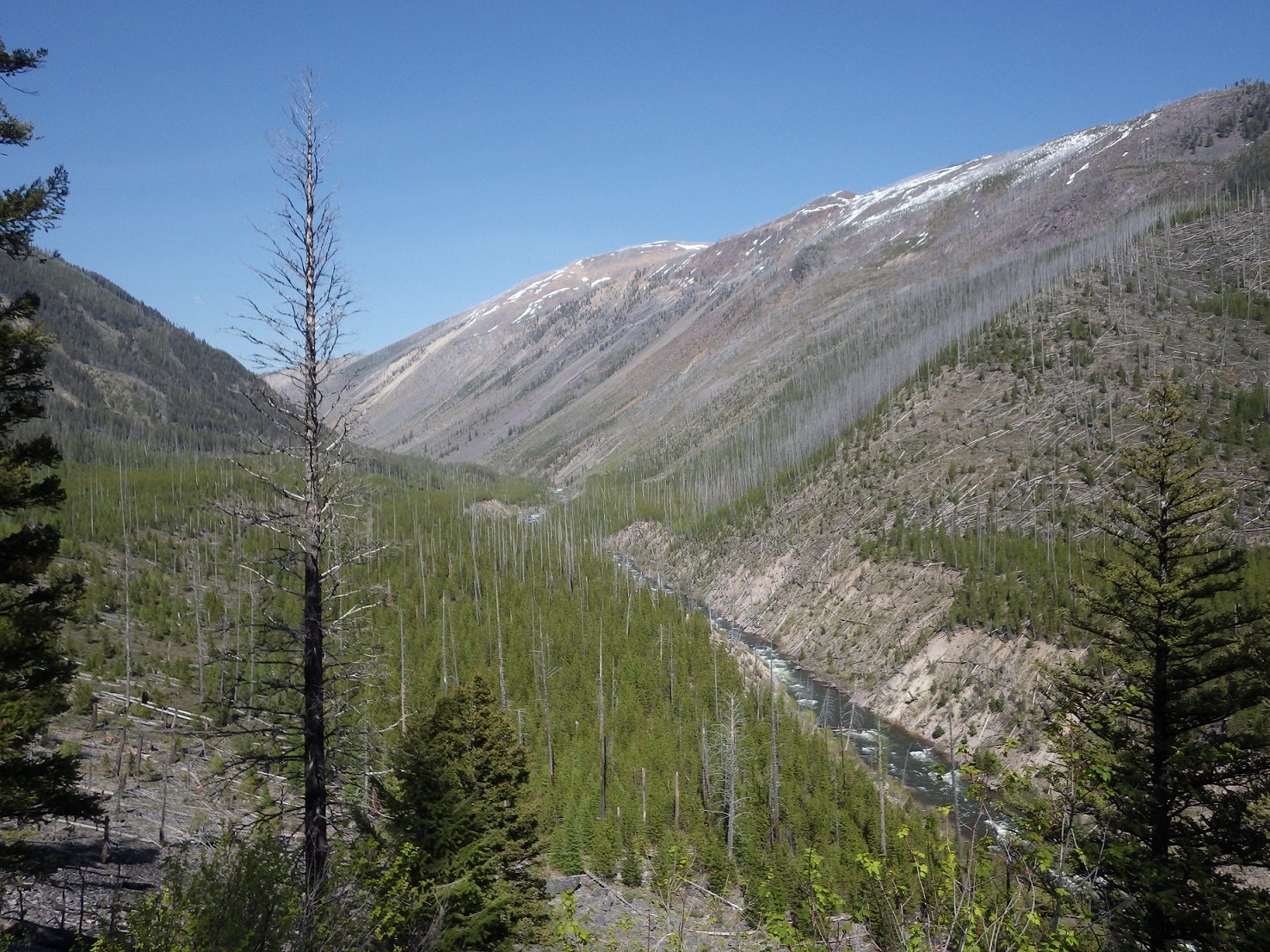
You never know, we might get a winter storm over Memorial Day, but for now it’s looking like mid summer out there. 70+ degrees felt like 90 to me on Saturday. It felt like a July walk in the woods, without the horse flies. Below are some thoughts and pictures from Bear Creek to NF Blackfoot trailhead.
-The Bob complex is awesome, especially before most people start going in there. I love the transitions from trail to snow and back to trail with animal tracks being the only evidence of activity.
-Mineral Creek would be a fun area to ski. Fires clearing out entire forests have their perks.
-You can find lots of snow still, but you have to be well above 6000′ and on the right aspects
-Mineral Creek has too much wood to float. The East Fork looked fast and fun, but probably not floatable for long enough stretches to be efficient (narrow gorges and big wood jams near the NF). The NF looked like a good float at 1200 cfs from the cabin down to near the first pack bridge. Too much water for my liking below that, but there were kayakers out running it.
-Brought a raft thinking I might need it to cross the NF, but walked across in thigh high water
-downfall could be a problem in some areas this year. Most of the area I was in had burned long enough ago that there isn’t much left to fall, but there was a good windstorm last fall and the short stretch from Bear Creek TH to McDermott Creek was pretty bad.
-this route would be a fun nearly marathon distance trail run later in the summer for you crazy ultra runners out there. I shuttled with a bike, but you’d be near 30 miles if you ran the shuttle.
Follow the Griz over the pass

Snow

Lower East Fork

Snow?
 May 9, 2016 at 7:12 am #3401105
I should have printed the headline from last weeks paper predicting normal fire season for Montana- well below normal snowpack in most areas, well below precip in most areas, well above normal temps (and wind) everywhere- unless they had a crystal ball seeing well above normal precip for May and June, not sure where they came up with their prediction??? I hope they’re right, but not sure what they are basing their optimistic forecast on.
May 10, 2016 at 9:03 am #3401467Badger Pass got a bit of the fluffy stuff overnight. I have had several weeks of training in 90-100F+ degree weather and would like the opportunity to make snow angels atop White River Pass 18 days from now. Lingering unanswered questions:
So, is that burger joint in Augusta locked in?
Is there a solid carpool plan from Cedar Creek Campground?
I might not have cell service when I hit the ground in Montana on May 25th, so it would be awesome to have the logistics figured out prior to that date.
On May 26th, I’ll be around Bean Lake and Benchmark to check out a few things if anyone’s in the area. Prior to linking up for a carpool the next day (fingers crossed), I will be doing the same thing on the west side of the BMWC.
Man, this is getting close…
May 10, 2016 at 11:31 am #3401512Hello,
I’ve been following this event for the last few years and reading along with your trail reports. Enjoying the reads. I’ve done a fair share of backcountry camping, fishing, and hunting but never the point to point with the intentions of just moving as fast as possible. Went into the Bob last year with the wife for a 4 day trip up the SF Flathead to fish and chill. Big Country back their. I’ve been watching everything this year and doing research and although I feel the length of this trip and fording skills may be a bit outside my normal comfort zone, I’m thinking of giving it a go. My biggest concern is trail finding in the snow and over the passes, which might not be to bad this year from the looks of it aside from the storm presently brewing outside. I’m pretty sure at the very least I will be up there Friday night and start with you guys, can’t promise a finish. I’m on the less than 25mi / day plan.
Scott
Bozeman, MT
May 10, 2016 at 11:42 am #3401518Welcome Scott. Getting out of the snow (in the right spot) coming down from passes is always a headache. You’d have to work hard to actually get lost doing it, but you can kill a lot of time and energy getting it wrong. Something to have a good plan for, for sure.
Memorial Day weekend has many virtues. Between providing an actual ski option and the numerous folks who have work issues with the memorial day timing I’ll probably move things at least a bit next year.
Winter isn’t totally done with this year. Got snowed and sleeted on in the Little Belts this past weekend, and driving from White Sulphur Springs to Helena yesterday was a near whiteout experience with 40 mph sideways snow. Good stuff. I’m praying for horrible weather for memorial day. The last three years have been pretty mild (for those who got out of the woods in three days).
John and I will be arriving at the Bean Lake CG mid-afternoon, looks like, and claiming a campsite. I’ll have dinner at the campground, though the Buckhorn is recommended.
May 10, 2016 at 12:38 pm #3401538Scott – if you haven’t already, I would definitely pick up the Cairn maps for the Bob. You would just need the South half this year unless you are getting wild with your route. The trails are far more accurate than on the old USGS topo maps. I spend quite a bit of time looking at the Cairn maps and Google Earth to make sure I have a good idea of where the trail is going to be. Probably not relevant to the BMWO, but here is a good idea of how different the actual trail location can be from where USGS maps have it located. My route from Saturday is in black, which is more or less where the trail is and drawn so on the Cairn maps. Incidentally, if you can pick up a bear track, they know exactly what they are doing. The bear I followed Saturday went straight down drainage from the pass, side hilled a bit, then glissaded into the creek bottom and popped out on the trail about 100 yards below continuous snow. If Cairn and bears don’t help, just follow Derek’s trail of snow angels.

Dave, I’ll be countering your prayers with my own wishing for 50-60 degree dry days and 30 degree nights. I’ll take mild. It would be a hard sell to head out into the junk we’re getting in Bozeman these last couple days.
May 10, 2016 at 12:53 pm #3401543We are tentatively planning on being in Augusta Friday evening for supper and refreshments @ the Buckhorn- it’s pretty roomy with lots of large tables (burgers and brews are top notch too).
Hope to see everyone there.
I’ll vote for mild too, 50’s would be perfect and there is too much nice looking country to miss out on if it’s precipitating heavily. Unfortunately our votes don’t count, big guy gets to call those shots :)
Getting some much welcomed snow/rain here as well.
May 10, 2016 at 4:45 pm #3401600Please no repeat of the 2012 weather that was tough! Although the snow and water on the ground in the Bob Memorial day weekend of 2014 was epic and I loved it. Watched and heard avalanches breaking all along the Chinese wall. Of course that was the year my daughter graduated so I had to head back home around the time the “Open” started.
May 10, 2016 at 7:54 pm #3401668Mike, I’ll gladly meet you guys at the Buckhorn for a few brews and a big meal, once I figure out how to make that happen. I’m a little paranoid at the moment with the minimal amount of ride-sharing chatter, but hope it all works out in the end.
May 10, 2016 at 8:16 pm #3401676Derek- when/where are you flying in at? are you renting a vehicle?
Mike
May 10, 2016 at 8:31 pm #3401680Mike,
I’m flying into Great Falls on May 25th and flying out of Kalispell on June 1st. After flying in, I plan to chill in Great Falls for the day, gather food/supplies, and stay at the Malstrom Inn. The next morning, May 26th, I would like to check out a few things (via car rental) on the eastside of The Bob (Wood Creek/ Straight Creek/routes leading to Benchmark through private land and speak to the landowners). I had considered staying at a campground or Kenck Cabin on the night of the 26th before linking up with someone on the westside of the BMWC to carpool to the start. I’m flexible to do just about anything, though. I imagine there must be some easy way to get to Augusta from Great Falls (if I stayed for two nights) and can contact either Chamber of Commerce (Great Falls/Augusta) to see what options exist.
Edit: Basically, I’m ok with just getting to the start if the carpool option doesn’t work out, and would rather not have to return to the start to pick up a rental.
May 11, 2016 at 7:05 am #3401738just thinking out loud, but sounds like if you could meet up with someone on the west side Thursday or Friday, where you could drop the rental off at Cedar Ck and then jump in with them to get to the start???
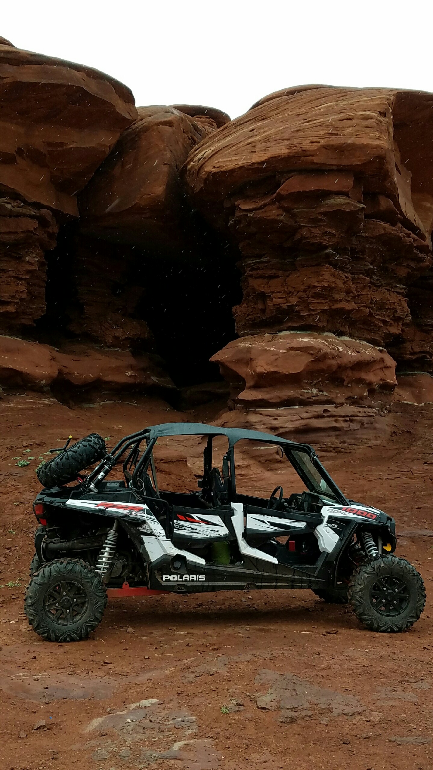
May 12, 2016 at 9:00 am #3401998My tentative plan is to drive out after work on Thursday, arriving on the west side around 2:00 pm Friday. I plan to leave my truck and toy hauler there, then drive my Polaris RZR 1000 back to the start. I figure it will be about a 3 hour drive in the buggy, but it could be really miserable if the weather is anything like it was the first year Dave drove us over rogers pass for the open. I have 4 seats in my ride if anyone needs a lift.
May 12, 2016 at 9:51 am #3402000I think the NW folks (me, Dan, Jessica) are all still in need of a ride Cyrus.
May 12, 2016 at 10:42 am #3402009You are all welcome to a ride. I just want to be clear this may be a miserable ride, I have a windshield, and a roof, but it is open and can be cold if the weather is cold.
 May 12, 2016 at 10:56 am #3402014
Sweet little ride! :)
May 12, 2016 at 4:02 pm #3402076Cyrus, thank you for the generous offer but if I go (looking pretty tentative at this point) I wouldn’t be able to get to MT until Friday anyway.
May 12, 2016 at 5:48 pm #3402106Cyrus, you sure know how to travel. Many people use those as cars where I currently live.
May 12, 2016 at 10:20 pm #3402173That’s an awesome plan Cyrus. You could do dirt roads all the way from Seeley to Lincoln and in that thing it should be just as fast, and more scenic.
May 13, 2016 at 8:19 am #3402231Tanner, Thanks I have been looking at the Cairn maps extensively as well as caltopo for more fine detailed zooms.
Good to know that getting lost on the passes in not that easy.
Question. Does anyone use GPS or is that frowned upon? I have an Oregon 640 (I think) and have the Onyx Hunt maps for MT which I use when hunting backcounty and did bring it last year on the SF Flathead trip but really didn’t turn it on much so I can’t remember how accurate it was.
My route is looking to be around 90-100 miles!!! does that sound about right to everyone?
May 13, 2016 at 8:38 am #3402239Scott – not getting lost is definitely encouraged, so I am pretty sure there is no problem with having a GPS along for the ride. I use the GAIA app on my phone. I like the tracking feature for day trips because I’m a stats nerd, but on multi-day trips my phone stays off in my pack where it won’t get wet and rarely comes out. It can be very helpful though finding trails coming out of the snow, and at unmarked (or poorly marked) junctions which are common in the Bob. If nothing else, it’s good for your peace of mind to know you are on the right track.
-
AuthorPosts
- You must be logged in to reply to this topic.
Forum Posting
A Membership is required to post in the forums. Login or become a member to post in the member forums!
Trail Days Online! 2025 is this week:
Thursday, February 27 through Saturday, March 1 - Registration is Free.
Our Community Posts are Moderated
Backpacking Light community posts are moderated and here to foster helpful and positive discussions about lightweight backpacking. Please be mindful of our values and boundaries and review our Community Guidelines prior to posting.
Get the Newsletter
Gear Research & Discovery Tools
- Browse our curated Gear Shop
- See the latest Gear Deals and Sales
- Our Recommendations
- Search for Gear on Sale with the Gear Finder
- Used Gear Swap
- Member Gear Reviews and BPL Gear Review Articles
- Browse by Gear Type or Brand.

