

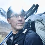
At camp, the terrain was dry, the temperatures were warm, and sunshine was coming through partly cloudy skies. It was temptingly nice fall weather for the high route we were considering over a high pass in Rocky Mountain National Park.
At 7 a.m., I retrieved a weather forecast on my satellite messenger. It suggested rain could begin around 11 a.m., turning to snow around 1 p.m. It also called for strong winds and heavy precipitation. Our elevation adjustment of the projected temperatures put the pass in the low-to-mid 30s Fahrenheit, which led us to expect heavy, wet snow up high.
We had planned to leave camp at 8 a.m. By 11 a.m., we expected to be on the final approach to the top of Cony Pass. The forecast put deteriorating weather over the pass while we would still be negotiating difficult terrain, with the crossing and descent ahead of us. We chose the lower route.
Two routes, different exposure
The map below is from my recent presentation for the ZOLEO Campfire Chat series about off-trail planning, pacing, mindset, and risk management. Both options connected our campsites. The high route crossed alpine talus and scree over a steep pass west of Copeland Mountain. The lower route went around the eastern side through subalpine terrain, with meadows, forest, and some talus.
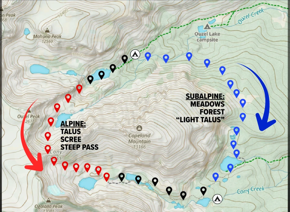
Our concern was the combination of footing, exposure, and navigation. Rain followed by wet snow could make the rocks more difficult to cross. Strong winds and cold, wet conditions would increase exposure. We also anticipated that blowing snow and low visibility could make precise routefinding across the high terrain slower and more challenging.
Those difficulties could reinforce each other: slower movement would mean more time exposed to the weather, while deteriorating conditions could further slow our movement. The lower route reduced those demands, although it still required us to negotiate wet talus.
The lower route still took time
Choosing the lower route made the morning feel less urgent, and we delayed our departure until 9 a.m. Along the route, we encountered moderate rain and temperatures down into the low 40s, followed by heavy rain and falling temperatures by the time we reached camp at 3 p.m.
The six-hour day included approximately four and a half hours moving and an hour and a half stopping for rest, food, and routefinding. Rain slowed our travel across the talus. Our planning estimate for the lower route in wet or snowy conditions was about four hours of moving time; our actual movement took roughly half an hour longer, and the stops added substantially to the elapsed time.
The next morning, we woke to clear, bluebird skies. Looking back toward the mountains, we could see they were covered with snow.
Match the forecast to your expected location
A decision gate is a time, place, or condition at which you deliberately assess whether a plan remains suitable. Ours was at camp, before committing to either route. Given the overlap between the forecast and our expected position, we judged the high route unsuitable under that forecast.
Watch this video for a 3-minute lesson about decision gates:

The alternative also needed a realistic time allowance. Brush, obstacles, and unstable footing change the effort required to travel off trail, and our wet talus provided a reminder that a lower route can still be slow. Episode 137: The Risk Control Continuum explores how to recognize and respond as your remaining margins diminish.
Try the comparison on your next trip
Choose an exposed or uncertain section of your route and write down:
- Your expected position when conditions change. Include the approach, breaks, and routefinding time. Identify where you expect to be when rain, wind, heat, or another forecast condition becomes a concern.
- What those conditions would change. Specify their effects on footing, exposure, visibility, pace, or another requirement of the route.
- An alternative and its demands. Estimate both moving and stopped time under the conditions that would cause you to use it. Check whether the same weather also compromises that route.
Here is that comparison using only the information available when we made our decision:
Decision point
At camp, after retrieving the forecast at 7 a.m.
Expected position
With our planned 8 a.m. departure, we expected to be on the final approach to Cony Pass around 11 a.m.
Forecast conflict
Rain could begin around 11 a.m., turning to snow around 1 p.m., with strong winds and heavy precipitation. Our elevation-adjusted temperature estimate supported an expectation of heavy, wet snow at the pass, with concerns about footing, cold exposure, and visibility.
Chosen alternative
The lower route through subalpine terrain. Its planning estimate in wet or snowy conditions was about four hours of moving time; stops and routefinding would require additional time.
The actual 4½ hours moving and 1½ hours stopped were known afterward, as described above. They help us evaluate the estimate, but were not information we had at camp.
For your own route, make the comparison before committing, then update your estimates as you travel. Complete this statement with your group:
At _____ [decision point], we expect to reach _____ [critical terrain] around _____ [time]. If _____ [forecast or observed conditions] overlap with that travel and make it unsuitable, we will assess _____ [alternative]. We expect it to require _____ [moving time] plus _____ [stopped time], and will use it only if _____ [conditions needed for feasibility] still hold.
Identify what you can do if neither route remains suitable. Reassess the comparison as forecasts, conditions, and your group’s progress change.
Watch the full presentation
My presentation develops the relationships between effort, fatigue, terrain, and decisions through additional route examples and the Wilderness Systems Framework.

Apply this approach to your own routes
For your next trip, you may need to compare an exposed route with a sheltered alternative, assess the terrain on each, and estimate how long your group will take under different conditions.
The Trek Planning Masterclass provides structured instruction for that work. Start with its lessons on terrain assessment and route comparison, then use the worked trip examples to examine how time and energy requirements are estimated.
Unlimited membership includes this masterclass and our full self-paced course and article libraries. You can return to the instruction as you plan different trips, investigate specific questions in greater depth, and discuss what you learn with the BPL community.


Discussion
Become a member to post in the forums.
Companion forum thread to: Why We Chose the Lower Route on a Sunny Morning
Warm sunshine at camp made a high pass route inviting. A forecast of rain, wind, and snow changed our plan. Follow the decision with a route map, field observations, and a practical exercise for assessing alternatives on your own trips.
Question:
Describe a point on a trip where you changed (or wish you had changed!) the plan. What did you observe, and which alternatives were still available? What affected your decision?
Become a member to post in the forums.