Introduction
The Desert Trail (DT) runs some 1500 miles from Mexico to Oregon through eastern California and western Nevada. Despite the name, it is not a trail but a route, a passable corridor through public lands. It is composed mostly of cross-country travel with a few jeep trails mixed in.
By early spring I suffer from a hiking deficit that ski and snowshoe trips are unable to satisfy. Deserts are the cure for this malady. In April 2019 I did a 5-day/75-mile section of the DT through the Anza-Borrego desert. I liked it well enough that I went back for a 10-day/150-mile chunk through the Mojave desert in March 2020 – just as the country was being swept by the coronavirus. With little phone service, I was a desert version of Schroedinger’s cat, simultaneously both aware and ignorant of the pandemic. That blissful state of quantum uncertainty collapsed when my brother picked me up at I-40 and brought me back to a changed reality.

Narrative
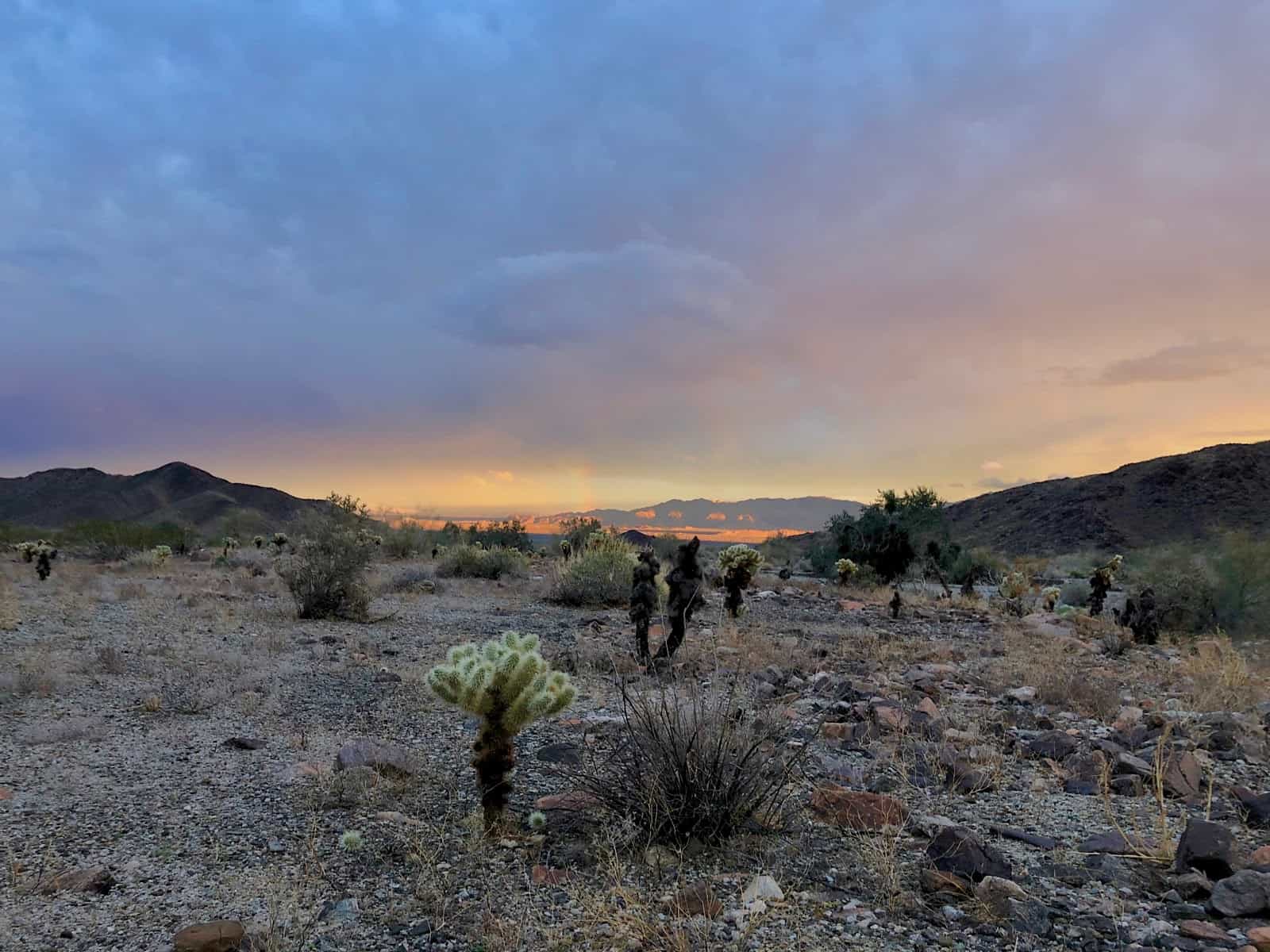
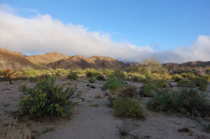
Day 1, Mecca Hills to Hidden Springs Canyon
I am not a trail completist, and so I had no problem skipping a long dreary road walk around the Salton Sea and starting this year’s hike in the Mecca Hills.
It felt like a bad start when I discovered I had packed shorts rather than convertible pants for the hike. I was not worried about my legs getting cold, but I was worried about them getting shredded. Cat’s Claw can be hell on your hide.
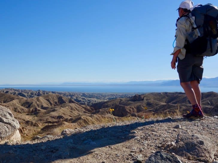
This section starts near Ladder Canyon:
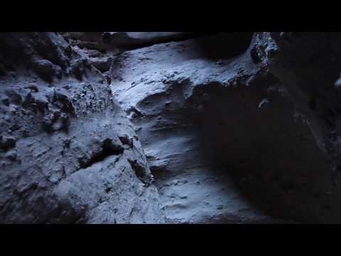
Ladder Canyon is comprised of a series of dryfall slots where the BLM thoughtfully placed ladders for the convenience of canyoneers.
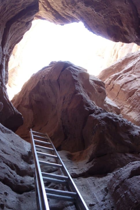
I spent an hour on a side trip into Ladder Canyon and then headed up the main canyon. With just a few missed turns, I emerged up on the crest of the hills and enjoyed a fine afternoon of easy walking with spectacular views in all directions.
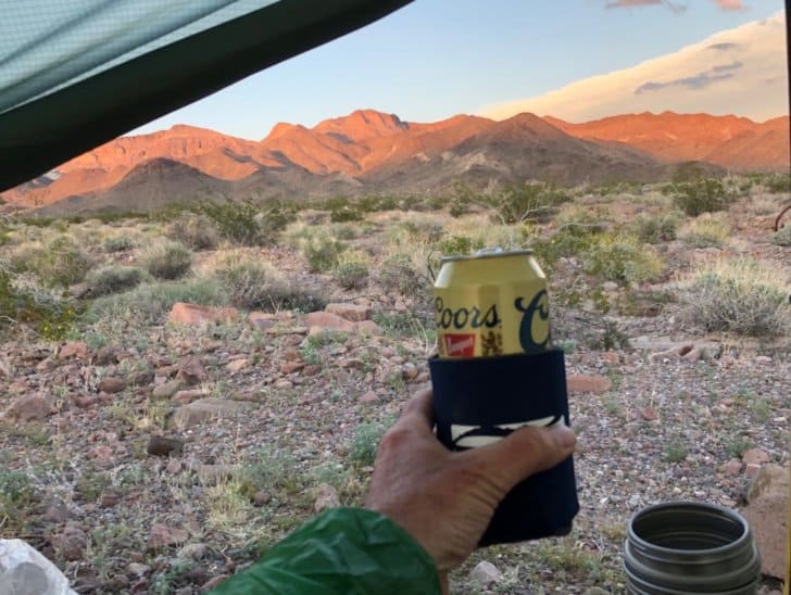
The only other hiker I encountered today was wearing a hat and boots and nothing in between save a grin. A disciple of Colin Fletcher, no doubt. I made it to my first cache in Box Canyon and discovered I had drunk only half the water I allotted for this first leg. I cut back the water for the next leg from 7.5 to 6.5 L. I probably could carry less but I hate being out of water. As always, we carry our fears in our packs. But 6.5 L of water weighs about 14 lb, so those are some pretty heavy fears.
And we also carry beers. Or at least one beer, the Coors tallboy I included in the cache.
Day 2 – Hidden Springs Canyon to below Orocopia Mountain.
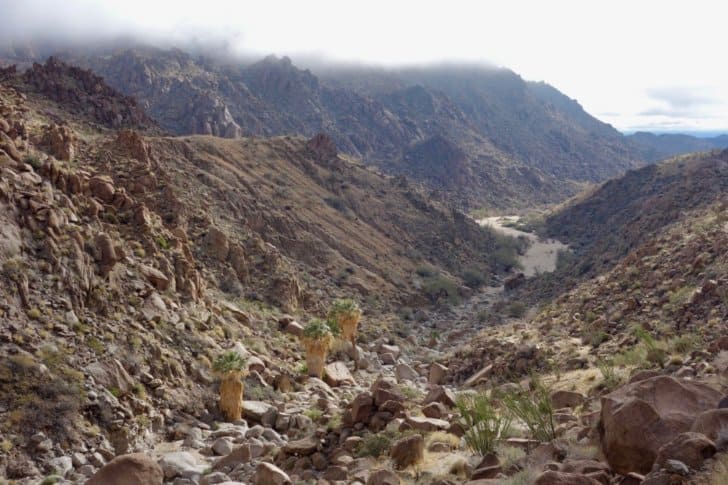
The route wound over a series of rugged ridges dividing broad washes then followed Orocopia Wash to the base of Orocopia Mountain. This was the launching point for the biggest, steepest climb of the hike: some 2000 feet up in a distance of about 2 miles. It was a hard climb over slopes covered with loose shale and I don’t mind admitting I was pretty whipped by the time I made it to the top.
I pulled out the summit register and it fell open to where my friend Dirtmonger had signed it a couple of years ago. He is one of the few other people twisted enough to think this kind of hiking is good fun.
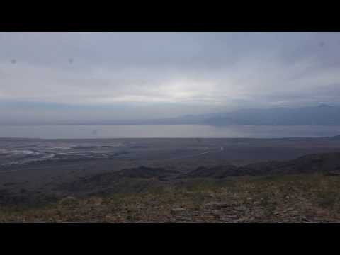
I took a video of the summit view. As a storm was approaching, I thought it best to head down to find a camp on a bench a few hundred feet below. It began raining soon after I pitched my fly and kept up until morning.
Day 3 – Orocopia Mountain to Lost Palms Canyon Wash
Rain in the morning meant answering the call of nature under challenging conditions. Fortunately, I brought an umbrella to ward off the desert sun, and it turns out that it wards off the desert rain as well. Business concluded, I was able to pack up and start walking without getting too wet.
I was fortunate to stop and camp where I did. The next two miles were a series of downclimbs in a narrow rocky canyon with no possible place to pitch a tent. If I had pushed on I would have been scaling down rockfalls in the dark, and in the wet. That’s not exactly a best practice.
The storm moved back in as I approached I-10, and I walked up to the coffee shop at Chiriaco Summit draped in my poncho, looking pretty much like a hobo. A wet, smelly hobo.
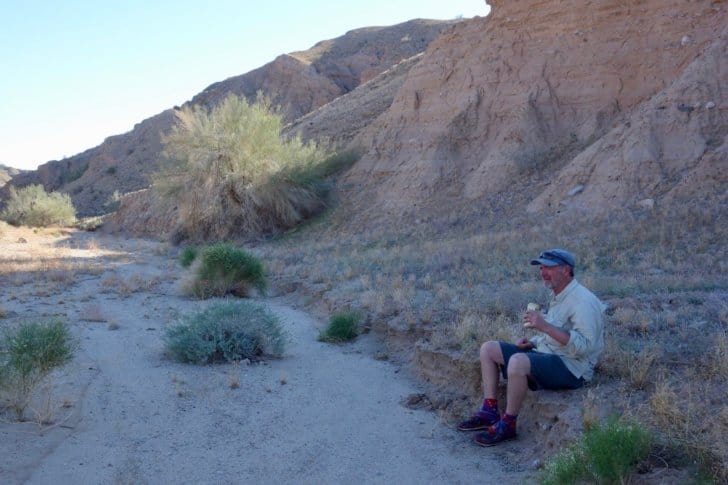
But they made me feel welcome there. I had a chili burger and a couple of beers, hoping for a break in the rain. One appeared and I hustled up the canyon, dug out my food cache, and made camp further up the wash.
Day 4 – Lost Palms Canyon to Valley North of Eagle Mountains, JTNP
The sun rose after a night of rain and began burning clouds off the Cottonwood Mountains.
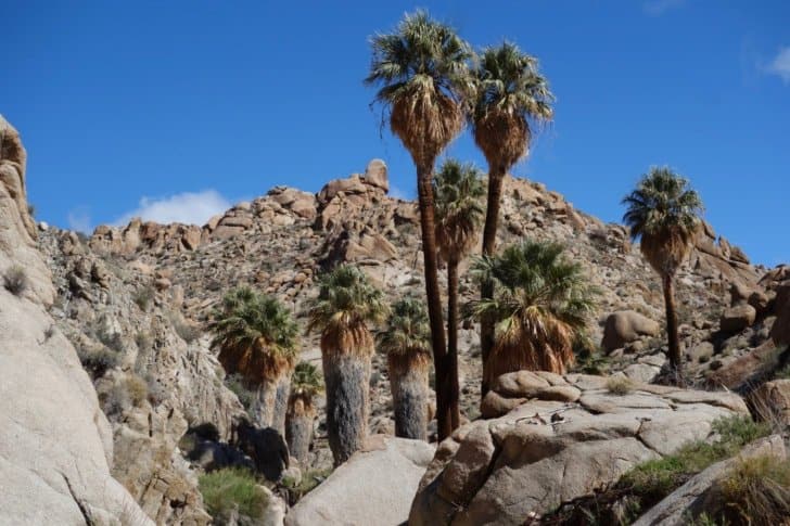
The route turned from a broad flat wash to a narrow canyon filled with car-sized boulders. I enjoyed the luxury of palm tree shade at Victory Oasis, and then was forced to climb up and above the canyon for a kilometer or so until Lost Palms Oasis.
There is a trail – a real trail – to Cottonwood Springs about 3 miles away, and I gladly made use of a route that was free of rocks and Cat’s Claw.
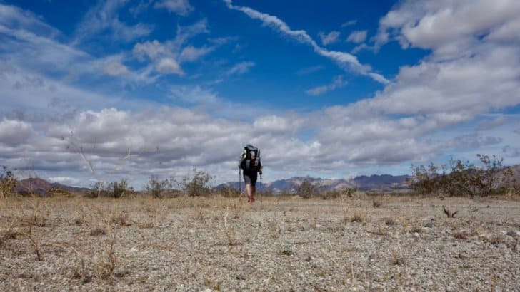
I arrived at the Cottonwood campground, filled up on water, had a bit of a siesta and headed east through the trailless valleys of eastern Joshua Tree. I walked until my feet tired of carrying 8 days of food and 6 L of water and then stopped and set up camp after a very fine day of hiking.
Day 5 – On to Big Wash, JTNP
I woke again to the sound of raindrops on the tent. Rather than go out and get wet, I dawdled inside for a couple of hours, thinking to wait it out.
Instead, the rain kept increasing. I finally faced up to reality (a hiker has to hike), packed my pack, and took down the tarp in a steady drizzle.
At first, the drizzle was well-contained by my umbrella. A few transient breaks in the clouds allowed me to convince myself that fair weather was just ahead. No need to put on my poncho.
Then the real storm began. Drenching rain accompanied by 20-30 mph winds soon had me soaked. I finally put on my poncho, but at this point it couldn’t keep me dry. It just slowed down the rate at which I got wet. I think a small spot on my back stayed dry, but that was all.
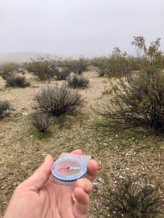
I was fortunate that today’s route was simple. Much of the DT has directions like “follow the wash until it makes a bend to azimuth 40 degrees, then climb the third gully on the right until you get to the ridge where you follow it at azimuth 135 degrees for half a mile then descend down the gully on the left.”
That kind of route-finding would have been impossible today. I had my phone with a GPS route laid out on it, but hadn’t thought to bring a waterproof phone pouch to the desert, and couldn’t use it. I had paper maps, but they would have been destroyed by the wind and rain in about 30 seconds. Fortunately, all I had to do was head slightly north of east for about 8 miles over a low divide and then slightly south of east. Visibility in the rain was about 200 yards.
The only way I could keep on track in the broad valley was to walk with a compass in my hand, constantly looking down at it. I found that if I put it away for a few minutes, I always went off track, always to my right. Even after I noticed this and tried to compensate, I still did it.
My satellite beacon beeped with a message from my brother: flash-flood warning for eastern JTNP. Not a surprise, but not welcome news either.
By late afternoon I could hear thunder ahead. There was a bench up out of the wash to my right. Time to stop and put up my tarp.
It was still raining, but the wind was a bigger problem. It took me nearly half an hour to get the tarp pitched and stabilized so I could crawl inside and be out of the storm. I unpacked and found that my merino hoody was still dry. As was my quilt. And my whiskey was still clean. Life was beginning to look good again. The sky seemed to lighten a bit. I peeked outside, and there it was. I had held on through the rain and gotten my rainbow.

Day 6 – Big Wash to the Coxcomb Mountains
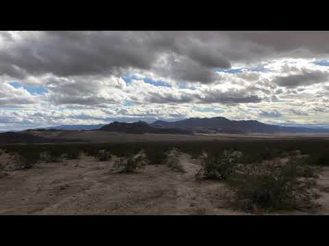
I lounged in camp until nearly eight o’clock, luxuriating in a morning with no wind or rain. I hiked the few miles to my water cache, then turned north to cross the immensity of Pinto Basin.
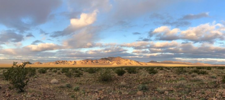
Clouds played across the mountains, shadows stalking the land like ancient formless giants. You can’t really capture the scale and immensity with a picture. A video is only slightly more effective. You have to be there. And you have to be prepared to feel very small and humble and unimportant. Because you are.
Day 7 – Coxcomb Mountains to the Sheephole Valley
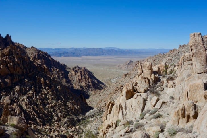
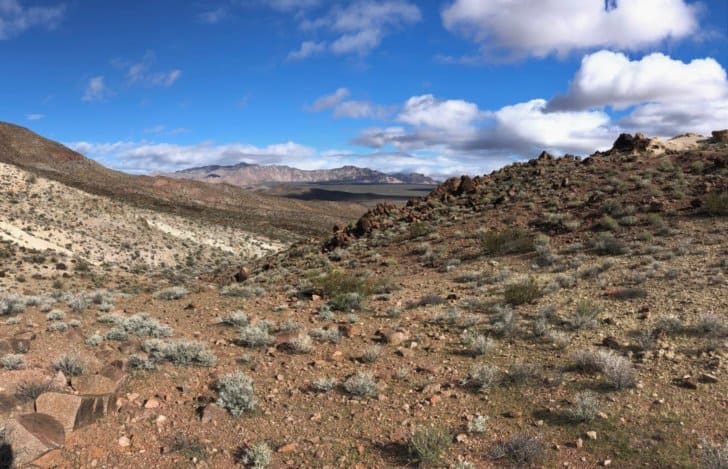
The easy striding of yesterday ended immediately as I began climbing up into the Coxcomb Mountains. The high alluvial valley I camped in last night turned into a rocky but passable canyon, and that canyon turned into an even rockier but climbable couloir that slips between the teeth of the comb that comprises the crest.
It was maybe a mile to the top and a 1500 foot climb and it took nearly two hours. Slow going, but nothing too harrowing or strenuous. Just steadily working my way up the couloir, rock by rock. The reward was fine views from the top through the notch in the mountain.
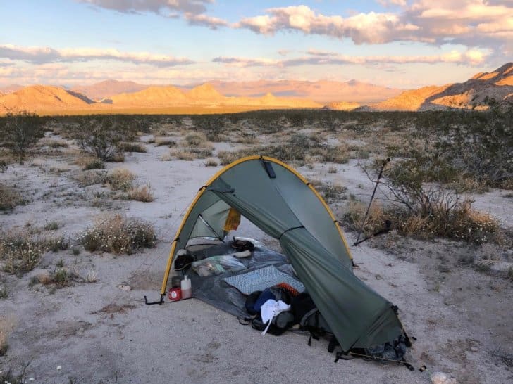
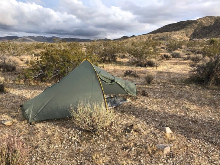
I took several wrong turns on my way out of the Coxcombs but finally navigated through a quicksand-infested canyon and out to the Sheephole Valley. I recovered my water cache near Highway 62, then walked a few miles further and made a fine scenic campsite in the sand and wind.
You’ll notice my sleeping pad in the picture above. It’s a Nemo Switchback 72-inch foam pad cut in half.
Despite such scanty padding, and my advanced years, I sleep great on it. One trick is that I dig out a circular pit about a foot wide and two inches deep with my trowel. That takes the pressure off my lower back when I’m on my back, and off my hips when I sleep on my side.
But it’s more than that. I prefer not having a big soft inflatable cushion between me and the ground. I like feeling the ground, and thus the Earth, when I lie down. It makes me feel connected with all that’s around me. I can sense (or imagine I do), the world turning on its axis, spinning through space, carrying us all on to a destiny that remains unknown and unknowable. That sense of connection provides me with a more comfortable sleep than a whole pile of mattresses ever will.
Day 8 – Sheephole Valley to Calumet Hills
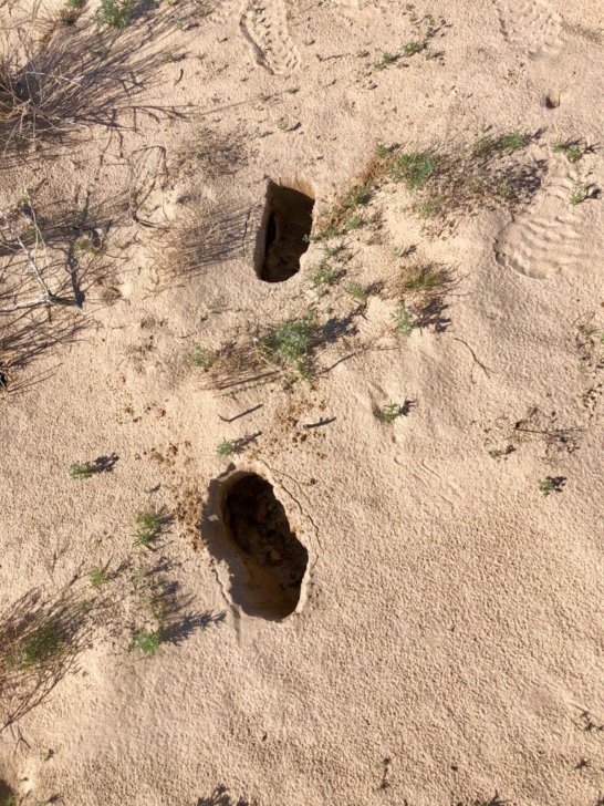
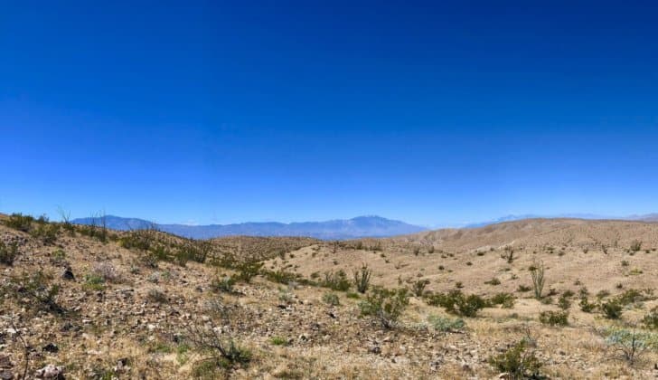
Classic basin and range country now. The ranges are narrow, just a mile or two across. The basins that separate the ranges are 15-20 miles wide. The upshot is that I mostly walked through open desert. I did go through a 6-mile long fault canyon that separates two halves of the Calumet Range, but everything else was gently rising and falling alluvial outflows. The biggest obstacles were the kangaroo rat tunnels that undermine the basin floor and collapse underfoot.
Day 9 – Calumet Hills to Marble Mountains
Another walk across a wide basin. The views were expansive. I watched a storm front approach, cloud the mountain peaks, but then rotate east and stay north of me before it was chased away by blue sky.
I arrived at my cache just south of Route 66 and dug it up, everything intact. The cool weather means I don’t need all the water I buried, and I decided to use the excess for a little desert laundry.
On mountain hikes, where I expect to encounter water at least daily, I typically wash out my boxers and socks (I carry a spare of each) every other day. This system doesn’t work for a waterless desert. Other than getting my clothes soaked in a rainstorm, they have been steadily accumulating dust and sweat and grime for over a week.
Laundry done, I headed toward my last mountain range, the Marble Mountains. My target is an alluvial re-entrant valley about half-way along the range, five miles distant. But the quickest path is not a straight line. The terrain adjacent to the mountains is broken and fissured, littered with rocks large and small, scarcely a place to set my foot.
I swing out a mile to the west, where the ground is sandier and more walkable. Near sundown I find a small but suitable camp spot. I pitch the tarp to get out of the wind, then open the lee side to enjoy views and the beer from my cache. I cook dinner, play a few tunes on my uke, and lay down to sleep the sleep of the righteous.
Day 10 – Marble Mountains to I-40
I awoke to a still, clear morning, anxious to get up and get hiking. Another 13 miles or so and I would reach the end of my hike at I-40, meet up with my brother, and begin to wallow in the comforts of civilization once again.
The route does not look too challenging: a few miles of climbing up a broad wash, a couple of low summits in the middle of the range, a mile or two of a narrow, steep canyon but then a broad flat wash through some low hills to my destination. Easy peasy. I send Dave a text by satellite saying I should be there by two o’clock and head out.
I arrived at the interstate and Dave soon pulled up. We embraced, I tossed my pack in his car and got in. I savored being enveloped in a cocoon of modern automotive comfort as we drove to Hole-in-the-Rock Campground.
My comfort quickly evaporated. Dave filled me in on the alarming developments about the coronavirus pandemic. His wife Karen, a schoolteacher, was trying to teach first-graders remotely from home. Restaurants were closed. Non-essential businesses were shutting down and sending employees home. Both the basketball and baseball seasons were suspended. Concerts were banned. Movie theaters were closed. Hospitals in Italy and Spain were overwhelmed, and US hospitals expected the same. The stock market was crashing. A recession dwarfing that of 2009 was all but inevitable.
I was shocked and stunned and surprised. When I set out on the trail on March 8, I knew that these events were a distinct possibility. I had spent a career in biotechnology, much of it developing diagnostic tests for infectious diseases. I knew the threat a novel virus posed was grossly underappreciated. I knew that we had underfunded public health agencies and would be unprepared. I had written about how vulnerable we were to epidemics, how quickly our interconnected world would unravel if a highly contagious and lethal disease emerged.
It is one matter to know that such things are possible. It is quite another to witness them happening. I had walked out of one world and into another, as though the desert were a portal between two realities.
I wanted to go back. But there is no going back. Not to the trail, and not to the life of complacency towards infectious disease that once was possible. Just as the desert humbled me, so would this virus humble the world. Humility is the first step on the path to wisdom. That’s why I embrace the humblings that long trails dish out on a regular basis. Perhaps this virus will do the same for humanity. Maybe we will emerge – as we eventually will – on the other side a bit wiser. Slower to anger, quicker to forgive, more mindful of our place in the universe, more aware of how dependent we are on others and on the planet that supports us, more willing to care for both. One can hope.
Field Notes
The Desert Trail will challenge both your gear and your skills. The DT is a route, and there is very little trail or even jeep tracks to follow. You will mostly have to find your way cross-country. Expect extremes of temperature and plenty of wind. Violent rainstorms are also a possibility; snow is not out of the question. There are plenty of rock scrambles and thrashes through thorny brush. Resupply points are few, water is scarce and there will be no trail magic. It is unlikely you will encounter another hiker. This is not the PCT.
- A heavy-duty pack is appropriate for the rough conditions and long water and food carries. I took a Seek Outside Divide 4500 in order to review it for BPL. I was taken aback by its weight (54 oz) when packing, but that weight provided good value in the form of comfortable carriage of heavy loads, resistance to abrasion and tears, and waterproofness. Read my Seek Outside Divide 4500 backpack review.
- My shelter was the fly from a Tarptent Moment DW . At 24 oz it was considerably heavier than my usual desert shelter, an MLD Pro Poncho Tarp. But this weight also provided good value in the form of excellent wind protection and livable space in rainstorms. Read our Tarptent Moment DW review. BPL review.
- Caching water and food (and beer) – and then locating those caches – is essential on the DT. In sandy areas, I completely buried my caches. In rocky areas I built a cairn of rocks over them. The likelihood of a varmint (whether two- or four-legged) disturbing them if left in the open is small but not zero. I used Gaia GPS to drop a waypoint on my caches, and took pictures with my phone. I also put a rock or stick above the buried caches and was glad I did – the rain completely washed away all signs of digging, and GPS only gets you so close to your cache. You really don’t want to be probing a 6-foot radius with a 6-inch trowel, trying to find your cache. Especially in a rainstorm.
- Navigation is a constant challenge on the DT. The official Desert Trail Guidebooks, by Steve Tabor (most of CA and NV) and George Huxtable (Death Valley), are essential. I transcribed the route from Steve’s excellent maps into Gaia GPS, and made paper copies of his written directions, as well as of USGS topo maps. I still made numerous wrong turns by virtue of not checking these resources often enough, thinking I understood the route. I always bring paper maps but in this century I have rarely combined them with compass work for precision navigation (GPS is just sooo much easier). As a result I hadn’t noticed that most of the number labeling on my compass dial was worn off. This complicated my efforts to navigate by compass during a heavy rainstorm.
- For rain protection I used a DCF Zpacks Groundsheet Poncho. I’ve been disappointed by many generations of waterproof-breathable jackets. They are fine for short squalls but fail miserably in all-day storms. A poncho made with non-breathable material like DCF is actually waterproof, and the open sides and bottom provide excellent ventilation. The Zpacks poncho is a shorty – although it covers your pack in back, it doesn’t quite reach to your knees in front. I’m OK with that. The big flaw in its design is the use of zippers for side closures. Given that it doubles as a ground cloth, it was no surprise when one of the zippers failed. I’ve since modded it with adhesive hook and loop strips to close the sides.
- My footwear was the Altra King MT trail runner. It has the same form factor as the more-popular Altra Lone Peak. It differs in having a grippier sole and better side support which can be cinched down with a hook and loop strap. I find the King MT model preferable to the Lone Peaks for off-trail travel.
- My Kala Waterman plastic ukulele now has about 1500 trail miles on it. It survives just fine through rain, sun, rocky scrapes, rough bushwhacks and freezes. No one would mistake it for a fine musical instrument (or me for a fine musician), but it sounds remarkably good for a cheap piece of plastic. Much better than a Martin backpacking guitar in my opinion.
Gear List
| Items | In pack | Worn | Consumable |
|---|---|---|---|
| CAMP & SHELTER | OZ | OZ | OZ |
| Therm-a-Rest Z-Lite SOL 20 x 36 foam pad (torso) | 8 | ||
| 12 x 12 foam pad (feet) | 0.5 | ||
Nitecore LED headlamp | 2.5 | ||
Sea-to-Summit inflatable pillow | 3 | ||
ZPacks DCF groundcloth poncho | 6.3 | ||
Enlightened Equipment down quilt, 20F | 21 | ||
Vargo V-channel takes & guylines | 2 | ||
Tarp | 24.1 | ||
Deuce trowel | 0.5 | ||
Ukulele | 16 | ||
| Subtotal (lbs) | 5.2 | ||
| CLOTHING | OZ | OZ | OZ |
| Darn Tough socks x 3 | 5.2 | 2.6 | |
| Bandana x 2 | 1 | 1 | |
| Ex Officio boxer briefs x 2 | 3.3 | 3.3 | |
| Buff | 1 | ||
| Sea to Summit Day pack/clothes bag | 2.7 | ||
| Go-lite down sweater (discontinued) | 6 | ||
| Minus 33 Merino balaclava | 2.1 | ||
| Minus 33 merino hoody | 8 | ||
| Outdoor Research shell gloves | 0.7 | ||
| pullover windshirt | 2 | ||
| Outdoor Research shorts | 8.5 | ||
| Ex Officio shirt | 8.2 | ||
| hat | 2.2 | ||
| Altra shoes | 17 | ||
| Kleenguard sunglasses | 3 | ||
| Dirty Girl gaiters | 1.9 | ||
| iPhone w/case | 6.3 | ||
| Victorinox pocket knife | 1.4 | ||
| Hiking poles | 18 | ||
| Wallet | 0.5 | ||
| Subtotal (lbs) | 2.1 | 4.4 | |
| ELECTRONICS | OZ | OZ | OZ |
| Sony camera | 8 | ||
| Garmin satellite communicator | 3.5 | ||
| solar battery | 7.7 | ||
| tripod | 1.7 | ||
| USB charger | 2 | ||
| USB cord x 2 | 1 | ||
| DCF zip pouch | 0.3 | ||
| Subtotal (lbs) | 1.5 | ||
| KITCHEN | OZ | OZ | OZ |
| Vargo 700 mL pot w/lid | 4.6 | ||
| Nalgene flask | 2 | ||
| MSR coffee filter | 0.7 | ||
| firestarter | 0.3 | ||
| Loksak odor-resistant food bag | 2 | ||
| lighter x 2 | 1.2 | ||
| long spork + spat | 1 | ||
| Soto upright canister stove | 2.7 | ||
| 8 oz fuel canister | 13.1 | ||
| breakfast x 8 | 32 | ||
| coffee | 4 | ||
| dried fruit | 14 | ||
| trail mix | 30 | ||
| salmon jerky | 4 | ||
| Snickers x 8 | 15.2 | ||
| dinners x 7 | 35 | ||
| whiskey | 14 | ||
| Subtotal (lbs) | 0.9 | 10.1 | |
| PERSONAL ITEMS | OZ | OZ | OZ |
| floss | 0.5 | ||
| hand sanitizer | 2 | ||
anti-chafing cream | 1 | ||
| sunscreen | 2 | ||
| tooth powder | 0.5 | ||
| toothbrush | 0.5 | ||
| toilet paper | 2 | ||
DCF zip pouch | 0.3 | ||
| subtotal lbs | 0.6 | ||
| Trail items | OZ | OZ | OZ |
0.5 L water bottle | 2 | ||
| 1 L collapsible water bottle x 2 | 2.6 | ||
| 2 L collapsible water bottle x 2 | 4.8 | ||
| 50 ft ZPacks ultralight cord | 0.9 | ||
| ClO2 drops | 2.4 | ||
| Brunton compass | 0.8 | ||
| first Aid kit | 5.4 | ||
| maps | 2 | ||
| Seek Outside pack | 54 | ||
| repair kit | 1.5 | ||
| Gossamer Gear sun umbrella | 8.2 | ||
| subtotal lbs | 5.3 | ||
| Base weight, lbs | 15.6 | ||
| Worn/carried, lbs | 4.4 | ||
| Consumables, lbs | 10.1 | ||
| Pack + consumables, lbs | 25.6 | ||
| Skin-out, lbs | 30 |
Notes:
- My repair kit consists of needle and thread, superglue, and Tenacious Tape.
- My first aid kit consists of antiseptic wipes, gauze pads, butterfly closures, adhesive bandages, leukotape, moleskin, antibiotic ointment, Imodium, ibuprofen, Benadryl and hydrocortisone cream.
- Food is what was in my day 3 resupply cache. My breakfasts and dinners were homemade dehydrated meals. Dried fruits and jerky were also homemade.
- Breakfasts: oatmeal (plus sugar, milk, dried peaches) x 3; muesli (plus milk, dried peaches) x 3; scrambled eggs w/salmon and sweet potatoes; scrambled eggs w/ham and veggies.
- Dinners: beef and bean chili; rice w/peanut sesame sauce and veggies; pasta w/cheesy tomato sauce; pork green chili; posole; navy beans and ham, peas and carrots; mashed carrot and sweet potato w/chicken; Adobo mac and cheese.

More
You can read my full trail journal starting here.
DISCLOSURE (Updated April 9, 2024)
- Backpacking Light does not accept compensation or donated/discounted products in exchange for product mentions or placements in editorial coverage. Some (but not all) of the links in this review may be affiliate links. If you click on one of these links and visit one of our affiliate partners (usually a retailer site), and subsequently place an order with that retailer, we receive a commission on your entire order, which varies between 3% and 15% of the purchase price. Affiliate commissions represent less than 15% of Backpacking Light's gross revenue. More than 70% of our revenue comes from Membership Fees. So if you'd really like to support our work, don't buy gear you don't need - support our consumer advocacy work and become a Member instead. Learn more about affiliate commissions, influencer marketing, and our consumer advocacy work by reading our article Stop wasting money on gear.

Home › Forums › Out of the Mojave and Into the Twilight Zone: Hiking the Desert Trail