Introduction
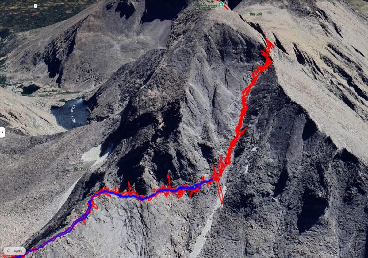
Imagine you are hiking on a sunny day to the summit of Longs Peak in Rocky Mountain National Park (RMNP), the only 14,000-foot peak in RMNP. After passing through the Keyhole, you are above the treeline, navigating steep, rugged terrain along a narrow, often loose route marked with painted Colorado emblems. Wandering a few feet from the path can result in a plunge of thousands of feet.
As you reach the summit, a storm suddenly hits. High winds, sleet, and snow drastically reduce visibility, making your descent perilous as the markers become invisible. Can you rely on your GPS device to guide you safely back down?
Obviously, you’d never want to place yourself in this situation. But, if you did, the latest GPS technology will improve the odds of following your recorded track back down the mountain. So far this year, my two attempts to summit Longs have been thwarted by unexpected changes in the weather. On the second attempt, well before the storms hit, I could follow my recorded track back down, which was not previously feasible.
Below, we will discuss what has changed in GPS devices to make this possible.
Member Exclusive
A Premium or Unlimited Membership* is required to view the rest of this article.
* A Basic Membership is required to view Member Q&A events

Home › Forums › By the Numbers: Can New GPS Technology Save Your Life? Under the Right Conditions, it just Might