“You’re gonna wanna watch out for danger noodles,” Ray Molina says as he steps into the shade of his house on the edge of the Organ Mountains-Desert Peaks National Monument.
“Minimalist” would be the trendy way of describing Molina’s desert sanctuary. Someone less kind or less millennial might use the word “shack”. It’s a one room affair, hand built by Molina from timber, concrete, and adobe in a style that easily pre-dates the Spanish conquistadors. The doors and windows are simple openings draped in plastic and cloth. An ancient lawn chair, baked into a sandy non color by the extreme solar radiation of the Chihuahuan desert, perches on the roof.
“Danger noodles?” I ask. I’ve only been in the southwest for a few months, and I assume Ray is referring to some, as yet unknown to me, species of cactus.
“Rattlers,” he calls from inside the house. I’m standing outside and staring at a skull that Molina has propped up next to the door, wondering if I need to make some gesture of respect before entering. Under the vast desert sky, the thought is not absurd.
“Usually they stay down in my basement but sometimes they come—”. A long silence followed by a creative string of cursing. Molina comes bouncing out of the house, his brown, bald pate shining. “Danger noodle! Danger noodle!”, he calls, and I can’t tell if the rise in his voice is fear, excitement, or both.
I look down at my feet and feel the hair on the back of my neck start to stand up. Molina is a bit of a packrat and all of a sudden my monkey brain is turning every scrap of hose, length of wire, and strand of rope that litters the yard into a “danger noodle”. I feel the urge to climb a tree and have to squelch a burst of panic as I realize that the low ground cover of thorns and prickles that surrounds me is not going to cut it.
It occurs to me, not for the first time, that the Chihuahuan Desert functions as a constant reminder of man’s vulnerabilities: his dependence on water, his tendency to fry in the sun, and his utter puncturability by flora and fauna alike. These are Cormac McCarthy’s old stomping grounds and truly it is no country for anybody, really, old men least of all. And yet, here we are, standing on the edge of a National Monument that protects pre-European archaeological sites. People have been dodging “danger noodles” here for a long, long time.

***
The Monument is an Obama era designation, spanning nearly half a million acres in four separate parcels just outside of Las Cruces, New Mexico. Heading west from San Antonio, drive five hundred miles across the expanse of Texas until you run out of state. Now you’re in El Paso. Now turn north and drive through almond orchards until you see the wrinkled stone of the Organ Mountains jutting up from the floor of the desert, and you’ve arrived in Las Cruces. It’s a sleepy city of a hundred thousand souls, but this is New Mexico, so that also makes it the second largest city in the state. There was a time when Las Cruces was simply a bathroom break between El Paso and the outdoor adventure that awaits in northern and central New Mexico: White Sands National Monument, the Gila Wilderness, the biking and skiing of Santa Fe. Then a group of disparate communities raised their voices together and, in a process that spanned over two decades, finally got the Monument designation. It was a victory of grassroots organizing that eventually involved small businesses, advocacy groups, native tribes, backpackers, mountain bikers, hunters, bird watchers, archaeologists, geologists, artists, trail runners, historians, and local politicians.
“This all just fell into place where a group of people were all committed to the same purpose. All of these voices were elevated at the same time, which is really incredible,” says Carrie Hamblen, CEO and President of the Las Cruces Green Chamber of Commerce.
According to Hamblen, the Green Chamber of Commerce became one of those voices in 2013, when it became evident that the Obama White House wanted an economic factor to bolster the ecological and archaeological arguments behind designating the monument.
“We commissioned an economic impact study that showed that with a monument designation fully running, $7.4 million dollars would come back in this community, eighty-eight jobs would be created and $560,000 in annual and local taxes would be created,” Hamblen says. We’re sitting in her office, the walls of which are papered with dramatic photographs of the Organ Mountains, maps of trail networks, and a framed copy of the Presidential Proclamation that transformed the desert surrounding Las Cruces into a National Monument.
One of Hamblen’s jobs is to work with local businesses to help them capitalize on the designation, and she appears to be good at it. Every restaurant in town, from local coffee shop to upscale winery, seems to have an OMDP themed offering on its menu. Every year the local business get together with the Convention and Visitors Bureau and Chambers of Commerce to throw a month long “Monument to Main Street” celebration. The festivities include music, entertainment, and vendors on Main Street, as well as tours and events in the Monument itself.
As I leave her office, Hamblen hands me a large green sticker with the silhouette of the Organ Mountains emblazoned in stark white. “People don’t call it the government’s monument. They call it our monument.” she says. Above the white peaks on my sticker, the words “Organ Mountains – Desert Peaks Means Business” are emblazoned in bold font.
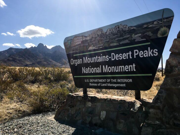
David Crider, owner and operator of Southwest Expeditions, agrees wholeheartedly with that sentiment. Crider was running rafting trips down the nearby Rio Grande long before the Monument was a thing. But when the Obama administration started to get serious about a designation, Crider sensed a business opportunity and got involved in the grassroots effort to push it forward.
“We want to make Las Cruces a destination city. And we’re trying to bring attention to the Monument itself,” says Crider. He’s an outside the box thinker, and his ideas extend well beyond walking and riding tours in the desert. Southwest Expeditions conducts aerial flyovers of the geologically unique areas and piles tourists into actual stagecoaches, bouncing them along the historic Butterfield Stagecoach trail.
“Any other place you look where there’s a National Monument, it increases businesses income, and I mean everybody from hotels to service businesses to touring operators like ourselves,” says Crider. “It’s a huge uptick. When you have National Monument status in a town, that attracts people from all over the world, not just your local area.”
It probably goes without saying that not everybody agrees. With a new administration in the White House, the Organ Mountain – Desert Peaks National Monument now finds itself existing in an uneasy limbo, caught between Secretary of the Interior Ryan Zinke, President Donald Trump, ranchers, corporate interests, the outdoor community, and the people of Las Cruces itself.
***
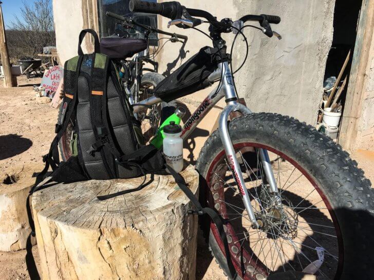
I’m hanging out with Ray Molina at his casita because he’s promised to take me on a bike tour of one of the Monument’s many signature sights, the Kilbourne Hole Volcanic Crater. Molina opts to leave the danger noodle resting comfortable against the wall of his house and we mount two of his fat bikes, pedaling into the soft sandy washes and arroyos of the western Monument.
Fat bikes are essentially mountain bikes with huge, soft, oversized tires. Think of a human powered dirt bike and you might be on the right track. As best as anyone can tell, they were originally developed in northern climates to deal with snow related traction issues but were quickly adopted by riders in the southwest to overcome the sandy pits and mushy gravel that litter the valley floors here. Ray was unquestionably one of the first people in the mountain bike community to use fat bikes, before they were commercially available he used to build them himself from spare parts. Possibly he was one of the inventors of fat bikes, that’s certainly what I’ve been told, but on this issue he is characteristically vague. In any case, he is expert in their use, guiding me through a thigh-high forest of evil looking plants and deep sand traps that would bring any normal bicycle, or even hiker, to an ungraceful halt.
The flora of the Monument is worth noting here. In my time backpacking, hiking, and mountain biking the high Chihuahuan desert I’ve yet to brush up against anything that doesn’t immediately draw blood. Prickly pear and barrel cactus sprinkle the landscape along with spine laden mesquite trees and the long, wavy spears of iconic ocotillo. Any and all of these plants will send a dagger straight up through the sole of your favorite minimalist trail running shoe or reach out from the side of the path and gouge a shallow furrow in your skin. Even bushes like the creosote, which don’t technically have thorns, are rough enough to give you scratches with a casual touch.
In my mind, the most dangerous of these plants is the lechuguilla, a type of agave plant with tough, broad, upthrust leaves that each end in a three-inch razor sharp tips at just below knee level. Locals call them “shin daggers.” The indigenous peoples of this area used lechuguilla tips as actual needles, a fact which comes as no surprise to me when I step off my bicycle for a restroom break and sink two of the barbs directly into the fleshy muscle of my calf. The tips are so sharp that the puncture doesn’t even register until I remove my leg, at which point the sensation is one of exquisite pain. As I watch inch after inch of vegetation slide out of my skin, Molina takes the opportunity to tell me a story about someone he knows who fell off a mountain bike and landed on a lechuguilla. This unfortunate soul promptly had his lung punctured. Ray’s tales are always tall but this one I believe. By the time I am home that night, the muscle of my calf will be so sore and contracted that I can barely walk. My wife will pour hydrogen peroxide into the tiny wounds and call me a sissy as I try not to wail like a small child.
So it’s with great care that Molina and I navigate around the vegetation. The landscape is sparse but dramatic. To the west the Potrillo Mountains rise above us. To the north, so do the Robledo and Uvas Mountains, and to the east: the Dona Ana and Organ ranges. The desert stretches out all around us, uniform and mostly flat, until suddenly we are on the lip of a volcanic crater two miles long and a mile and a half wide. Kilbourne Hole is a rarity, geologic evidence of volcanic activity without a mountainous rim.
A thunderous boom echoes across the crater, drawing our attention to the right. Two Toyota Tacomas are parked on a slight rise above the crater rim. Four or five young, fit looking men and women are lounging in camp chairs, drinking beer and chatting. One of them is lying prone on a blanket, pointing a long rifle into the crater. The boom comes again, and the sun glints off a spent shell casing as it spirals through the air to join a litter of brass on the desert floor.
“Rattleheads,” Molina says. I assume this means “firearm enthusiasts” but before I can ask he is pedaling towards them. “Gotta let them know we are headed down there so they don’t shoot us,” he calls over his shoulder. “Plus, they have beer!”
***
Here is the interesting thing about the Organ Mountain – Desert Peaks National Monument. Before it was a National Monument it was already federally owned land, overseen by the Bureau of Land Management. On BLM land, almost anything goes. You can walk where you want, camp where you want, fly drones, bring dogs, ride horses, slackline across canyons, and fire rifles into volcanic craters. In late 2017, a flat earth conspiracy theorist and amateur steam powered rocket scientist decided to launch himself into the atmosphere to prove that the earth is shaped like a frisbee. His launch site of choice? BLM land. To the BLM’s credit, they quickly halted his launch. But the point is, he thought they might have allowed it.
The BLM seems to exist in a different time and place, a slice of western history where you are free to do whatever fool thing you want as long as you don’t bother anyone else while doing it. When the land around Las Cruces was designated as a Monument, the BLM retained control and management of the acreage, which means to a large degree that freewheeling spirit remains intact.
As someone who’s formative outdoor experiences occurred in the beautiful but tightly managed and heavily populated Appalachian Mountains, I find this disorienting and more than a little anxiety inducing.
“Stay on the trail,” my inner voice whispers as I follow Molina down into the crater after notifying the rattleheads of our presence but failing to receive any free beer.
“What trail?” I whisper back to myself. “There is NO trail!” The implication, at least in my head, is one of isolation. You are on your own here. If you hurt yourself following a man you barely know into an ancient volcanic crater, if you succumb to snakebite or bullet or sudden onset cactus wound infection, there is no easy way for anyone to get you out. We are currently an hour by four wheel drive from the nearest road, and from there a while still to anyone with a medical degree. I’m an experienced backpacker with nearly 3,000 trail miles under my belt, much of it in areas technically more remote than this, but something about the Chihuahuan Desert feels more lonely and more intimidating than anything else I’ve ever experienced.
The bottom of Kilbourne Hole is sandy and crystalline, the remains of the lake that once filled the crater after the volcanic activity ceased. Astronauts from the nearby NASA facility once trained here, and it’s easy to see why. Though not exactly alien, the landscape is harsh enough that you can imagine it putting the proper fear of suit pressure loss into prospective space travelers.
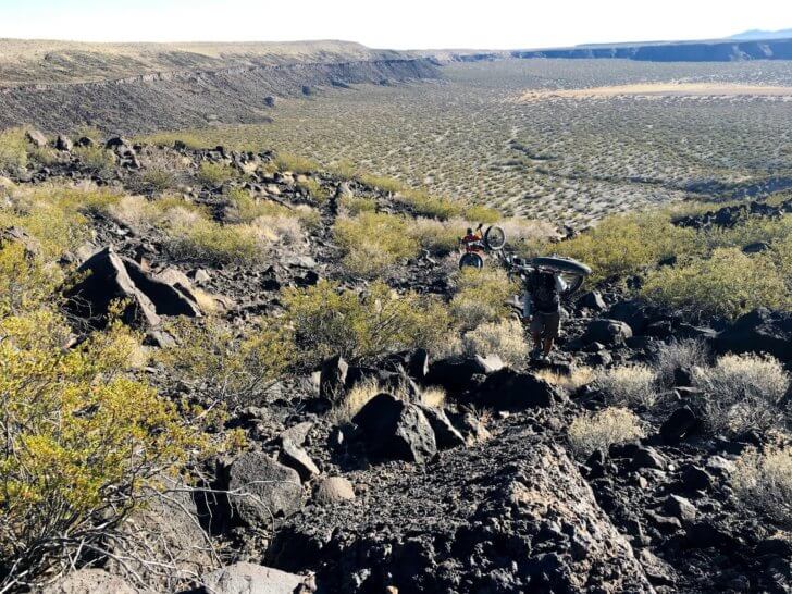
Reaching the end of the crater, Molina and I stare up at the basalt cliffs that rim the entire formation except for the narrow cleft we had originally descended two miles earlier.
“Hmmmm,” Molina says, eyeing the nearly vertical rock fall. It stretches forty feet above us, something I know because I looked it up after I got home, under the mistaken impression that having an exact figure would make me feel less queasy about having climbed it. “I thought there would be an exit here.”
“You’ve…never done this before? So we turn around and go back the way we came, right?” I ask. Molina shakes his head and grins.
“No man, it’s an adventure!” he says. It’s hard to argue with that, and I follow Molina’s lead, slinging the fat bike over my shoulder and picking my way up the cliff face.
“Watch out for danger noodles!” Molina calls from ahead of me. “They love this shit.”
Thirty adrenaline filled but rattlesnake free minutes later, Ray and I are safely out of the crater and working our way back towards his house. He stops to talk to the rattleheads one more time on the way back, this time managing to score a beer.
A few weeks later I’m mountain biking on a different trail network in El Paso and I bump into Don, the man who introduced me to Ray Molina in the first place. I tell him about the ride, the danger noodles, the crater, the precarious cliff ascent, which despite my light tone might be one of the most dangerous things I’ve ever done in the backcountry. Don shakes his head and grins.
“Nobody does crazy stuff like Ray. Nobody.”
***
This is one of the most salient points to remember about the Monument, what I keep coming back to in conversation after conversation. It’s BLM land. Outdoor enthusiasts are free to do basically whatever they want, whenever they want. The crazier the better. Four wheeling, dirt biking, hot air ballooning, you name it. People can and do take advantage of this freedom. The flip side is that it has far less developed sections than public land managed by, say, the park service.
I ask about this while talking with Angel Peña, the Regional Conservation Director for the Conservation Lands Foundation, and Patrick Nolan, the Executive Director of Friends of the Organ Mountains.
“BLM land is room to roam,” Peña says. “Walk that way and go for it. There’s parts out here that you need a four by four to see. And I think that people appreciate the lonely nature of it.”
“It’s part of the attraction,” adds Nolan.
I remark that it can be intimidating for the average family, seeking a little outdoor bonding time, to explore.
“I think it’s big enough to do both,” Nolan says.
It is, of course, one of the classic conservation dilemmas. The more rigid the protections on public land, the more difficult it is to get the public to use the land. It’s an argument that can occasionally divide groups who would otherwise be on the same side of the issue. The OMDP is no exception, with various interest promoting and speaking out against further development and infrastructure. Nolan is hopeful, though.
“That’s something we need to figure out for sure,” he says, referring to the infrastructure vs. conservation dilemma. “But we’ve demonstrated an ability to come to a consensus in building this monument and getting it designated, so I don’t think that’s going to be an issue for us.”
***
In my quest to better understand the OMDP, I set out to explore the developed sections that are easily accessible to the general public.
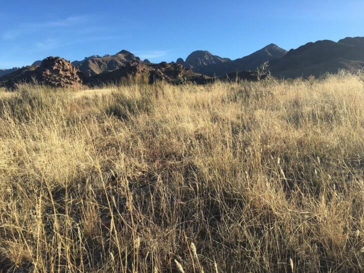
One such route is the Sierra Vista Trail, which winds along the base of the Organs from Las Cruces, tracking thirty miles south to the northern limits of El Paso. A good two day/one night hike or one day mountain bike ride, the trail is technically moderate in terms of elevation and strenuousness. I traveled it twice, once on foot and once on bike, and found it to be more challenging than it looked on paper, mostly because of the tread. The ground underfoot gets alternately more rocky and more sandy the further south you go. Like a lot of places in the Monument, you will occasionally be watched by cattle, who will definitely have a better idea of where they are than you will.
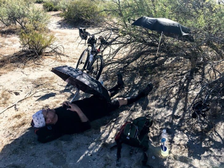
Roughly twenty miles in the trail simply vanishes into the desert, leaving you to navigate by dead reckoning, landmarks, and compass before it reappears some ten miles later. Given the open views this is not a daunting task, but of course, it’s made more challenging by the fact that the second you lift your eyes up to the horizon you are going to walk straight into a lechuguilla. Trust me.
North of the Sierra Vista Trail is the Dripping Springs Campground, from which you can hike the Baylor Pass Trail, a challenging sixteen mile out and back, or the Pine Tree Trail, a more moderate four-mile loop through a shady ponderosa forest. Shade of any kind is rare enough in this landscape for this to be a unique experience. This is still the OMDP, however, and it is not interested in coddling you. Even the well-marked and highly trafficked Baylor Pass Trail is preceded by a weather beaten yellow sign which states, “Caution: People have died while climbing in these mountains.” This gives my wife, joining me for this hike, a moment of pause.
We stop at the base of the sign to check our packs one last time for water, food, umbrellas (for shade), sunscreen, duct tape and band-aids, lighters, fully charged phones, back up batteries, pocket knives, paper maps, and other odds and ends. Overkill, you might say, for a sixteen-mile day hike, but my feelings of anxiety about this desert, first planted adventuring with Ray Molina and brought to flower after losing the Sierra Vista Trail, are now well established.

We start up the path and much to my surprise enjoy a perfectly lovely, blessedly danger free day. The colors that surround us are the yellow ochre and turquoise blue that you only seem to find in the southwest, and the higher up we go the more the browns give way to increasingly vibrant greens. Coming over the pass and turning around, the dramatic face of the Organs loom directly over us. In the distance we see a sparkle on the mountain side – a stream. Actual running water, with all of the lush vegetation that accompanies it. We stop to eat lunch on its banks and I experience a moment of dissonance – ten miles and two weeks to the west I’d been riding along on a fat bike behind Molina with the absolute certainty that an unrepairable flat would mean, at minimum, dangerous dehydration and severe sunburn. That’s assuming the danger noodles didn’t get me first. Now I’m on a well-marked trail eating pistachios with my wife and looking forward to a leisurely stroll back to the car. In fact, I find myself feeling disappointed that our hike didn’t involve a possibility of bodily harm. Patrick Nolan was right. The OMDP is big enough for both experiences.

***
The real question is this: is it big enough for all interests?
When Donald Trump took office, he appointed as his Secretary of the Interior Ryan Zinke, a former member of Congress with a 4% lifetime score from the League of Conservation Voters. Like Trump’s other cabinet members, much ink has been spilled concerning Zinke’s qualifications, the “fox guarding the henhouse” nature of his appointment, the various scandals that have surfaced during his time at Interior. Perhaps less well known to the general public is that Secretary Zinke, under orders from President Trump, recommended major changes to ten of the nation’s National Monuments. The most famous and contentious of these Monuments are Bears Ears and Grand Staircase – Escalante. But Organ Mountain-Desert Peaks, tucked away in a quiet corner of New Mexico, made the list as well.
To Zinke’s credit, he traveled to New Mexico to see the Monument for himself, interact with the community, and speak to local business. But according to everyone interviewed for this story, the “community, and local businesses” ended up being a pretty specific group of folks.
“He met with a small group of about ten people. People that oppose the monument. So he didn’t take the time to talk to folks who support it,” Patrick Nolan says. He comes from a background of community organizing, and there is real bitterness in his voice. Carrie Hamblen agrees.
“The thing that was concerning is that Secretary Zinke was up at the Farm and Ranch museum meeting with select people for forty-five minutes at a time, for four hours. It was very tight-lipped. Very controlled. And very concerning that it was that controlled.”
“And that’s where we were all protesting,” says Angel Peña, taking up the story later. “And he just drove right past us to meet with ranchers and the Farm Bureau and the Cattlemen’s Association. He had a meeting with tribes where the tribes felt like they weren’t listened to. And then one with elected officials, where all but one support the monument.”
When asked to address these statements, the office of Secretary Zinke did not respond.
Back to Carrie Hamblen. The edge in her voice is a combination of weariness and anger: “During the time that Secretary Zinke was here, we had a town rally, and he was invited,” she says. “And we had about six hundred to seven hundred people at the convention center who were all supporting the monument, and he did not show. So, we were really concerned that he was not considering the majority of people in this community. He was listening to a select group of voices, mainly ranchers, and we were worried that they had his ear.”
So now we’ve arrived at the ranchers, the final group of people involved in this increasingly tangled story. Many of the businessmen and women raising cattle on this land have done so for generations. And while they do not make up the majority of the Las Cruces community, they have the ear of Congressman Steve Pearce, the only member of the New Mexico delegation that didn’t fully support the designation. To be clear, Congressman Pearce’s stance is that the Monument should only cover the Organ Mountains (the area containing most of the developed sections previously mentioned). Not the Potrillo section where I rode with Ray Molino, not the Robledo and Uvas sections containing most of the archaeological sites, and not the Dona Ana section to the north of the Organs.
When asked for a comment, the Congressman Pearce’s office directed me to a statement he released after Secretary Zinke’s visit.
It reads in part, “Since 2008, I have been working with the local community to establish a compromise that protects the Organ Mountains-Desert Peaks National Monument (OMDP) while preserving the multiple uses that public lands provide. By designating this monument under the Antiquities Act, the Obama Administration ignored this work and created an overly burdensome and harmful footprint – roughly 500,000 acres extending roughly 59 miles from corner to corner. The size and complexity of the Organ Mountains raise serious economic, security, and access concerns that cannot be appropriately addressed without resizing the monument’s footprint.”
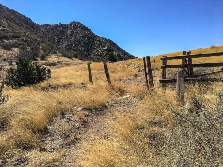
Given who Secretary Zinke met with during his time in New Mexico, and given his well-known stance on other issues, most everyone was expecting him to recommend shrinking the size of the Monument. He certainly did so with Bears Ears, Grand Staircase – Escalante, Katahdin Waters, and others. So everyone, pro and anti-monument voices alike, were shocked when he recommended not to shrink the boundaries. Instead, his recommendations focus on border security, risk assessment of the nearby military facilities, and infrastructure development.
So why didn’t he shrink the boundaries? The text of his recommendation is not clear on this point, and once again when asked for comment his office did not respond.
David Crider, who showed Zinke around the Monument during his visit, has a few ideas.
“In my opinion, there was enough pressure put on him from grassroots…what he saw with his own eyes out here, that led him to do that,” Crider says. “Seemed like he already had an agenda coming out. They were going to do their quick fact-finding, but they had already made a decision, that kind of thing. But when he came out and did not chop us up, it was like, okay maybe he listened. Maybe there was enough pressure put by enough organizations and enough grassroots that they backed off of that. We’ll take whatever we can get.”
Carrie Hamblen, Patrick Nolan, and Angel Peña all feel the relief as well. But they also feel unsatisfied and apprehensive. In his recommendations, Secretary Zinke also advocates changing the language of the Proclamation to be less restrictive on traditional uses (for this read ranching), and that has the pro-monument crowd both a little upset and a little confused.
“They want to open it up for ranching, but that’s where it gets too nuanced. I mean, you can already ranch out here. We will see cattle. And that hasn’t changed. So what does that mean?” asks Angel. “It was already federal land. It was, and it is. Managed by the BLM.”
Carrie Hamblen points out that Secretary Zinke’s recommendation is just that: a recommendation. President Trump is free to listen or not, and no one knows what the famously volatile Commander in Chief might end up doing. As Patrick Nolan puts it, “We don’t know what’s coming next. We have every anticipation that something else is going to happen. And we have to prepare for that.”
***
When Peña and Nolan offer to show me some archaeological sites in the Monument, I’m all for it. I show up to their offices in my hiking duds, backpack fully loaded, ready for more spine-tingling adventures. I feel a little silly when I notice neither of my guides looks like they are going on an expedition, as I do.
This place. I simply cannot get my danger meter correctly dialed in.
We clamber into Peña’s truck and roll out to the rutted BLM roads of the Monument, occasionally stopping to open cattle gates. Peña is excited to take me to one of his favorite spots.
“You’ll see, you’ll see. This place does all the talking for itself,” he says.
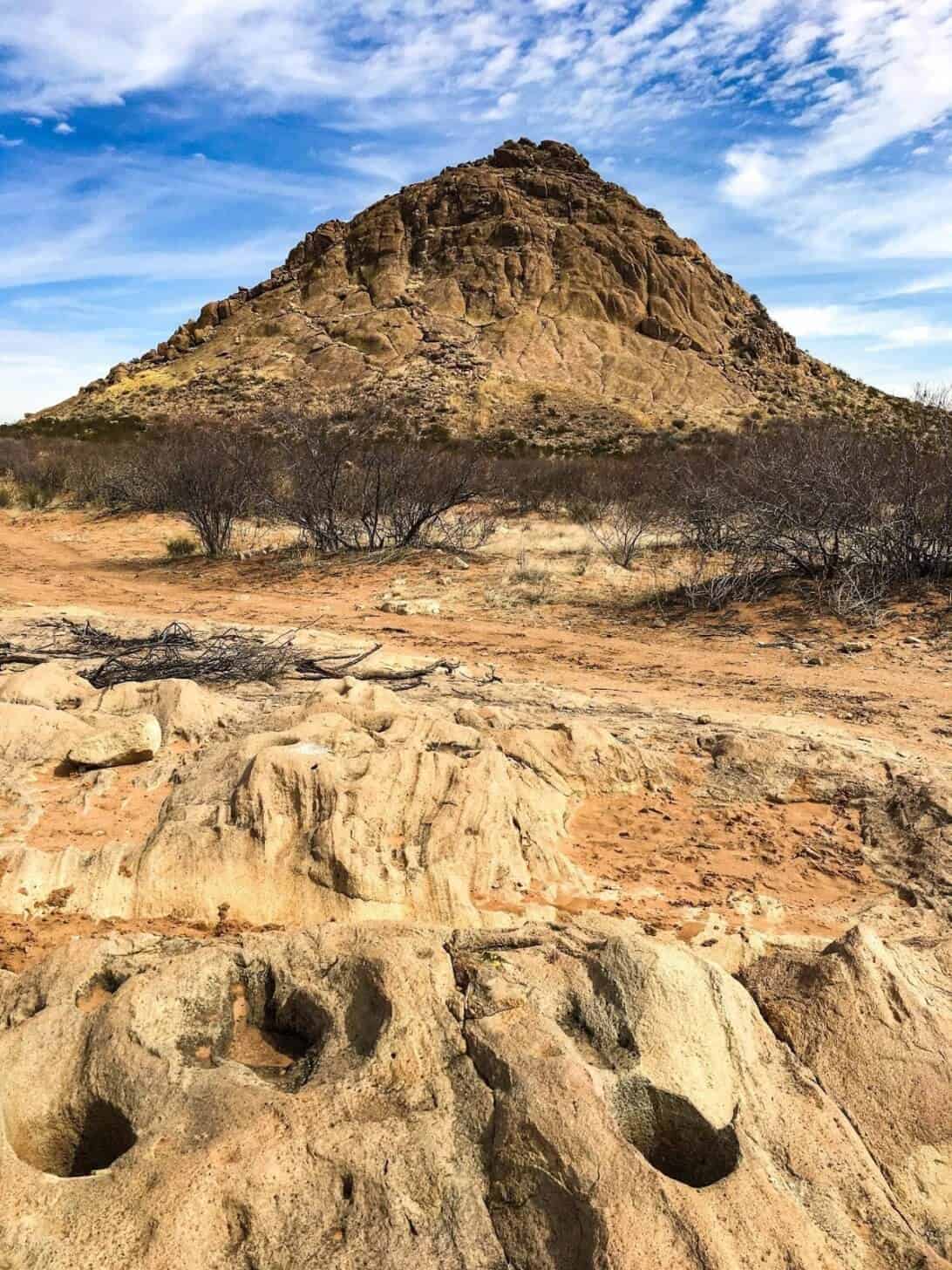
We park the truck between some creosote and hike to Providence Cone, a lonely, weathered knob rising a few hundred feet from the desert floor. Mountains surround us in every direction, and Peña points out landmarks, following each with a story or bit of local color. He’s quick to mention that Providence Cone’s nickname is Rattlesnake Peak.
“Because there are a lot of rattlesnakes, I assume?” I ask.
“Oh yeah, for sure,” he says, smiling. “Big juicy ones.”
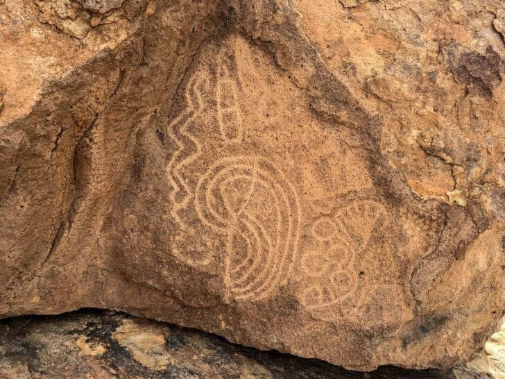
Happier now that at any moment I could be injected with life-threatening venom, I follow the group up the cone until we come across some faded petroglyphs: ancient markings chipped into the stone by ancient peoples. The rocks crawl with spirals, animals, human figures. Angel points out a fish-like creature with legs. From our vantage point, I can see the thin thread of I-10, quick flashes of steel and glass, but the sound of the road does not reach us. The air is motionless, rare for this dusty place, and there is no insect or animal noise. Only twice in my life have I experienced such absolute stillness. The first was in Colorado, at two in the morning, at thirteen thousand feet under the ridiculous sprawl of the Milky Way. The second is this moment here, technically within sight of a major American highway but in reality a thousand years in the past, in a place that was not America and belonged to people who were not American.

This is only one of many archaeological sites in the Monument, and the increased resources that should soon start flowing here to study and protect these areas goes a long way towards explaining why the designation was, for some, a necessity. But just as Zinke’s recommendations displeased the pro-monument crowd, so too did they irritate the anti-monument groups. Several ranchers spoke publicly in a joint statement released by Congressman Pearce in the days after the recommendations came down from Interior.
“Failing to reduce the monument’s footprint will create a ‘taking’ of our private deeded lands and our State of New Mexico grazing leases, which will destroy our operation…,” said John Keck, a local rancher.
Another rancher, Carol Cooper, had this to say: “The current boundary of the OMDP National Monument surrounds a number of ranches that have significant state or private lands. Without changing the footprint, private land and State Trust Lands will, inevitably, be controlled by the Federal Government. Reducing the footprint of the monument is the only way to protect individuals, businesses, and our community from the negative effects of the monument designation.”
In researching this article, I reached out to several members of the ranching community, particularly those who made the joint statement with Congressman Pearce. I was met with silence or, in one case, was accused of already having a viewpoint and not being interested in telling a fair story. For this reason, I can only speculate as to the ranching community’s concerns. Certainly, from an outside perspective, it seems that nothing has changed, that their access rights have not been curtailed and their businesses not harmed. Many of their statements, as well as the statement of Congressman Pearce, seem to reference what might happen – governmental abuse of power, future restrictions of grazing privileges – rather that what has happened.
“We still have not seen any data or anything supporting the rancher’s concerns, but we still want to hear their voice, and I’ve always encouraged them to be part of the public meetings that are concerning the management plan,” Carrie Hamblen says.
“There’s a historical distrust here, of the federal government. And I think they (Secretary Zinke and the Trump Administration) exploited that. There was a time when the federal government handed over monuments to the park service, and the park service then restricts all access to monuments. That’s why people don’t trust [the federal government],” says Angel Peña.
“They’re like ‘you’re just going to turn this national monument into a national park! And then I can’t even take my dog out there anymore.’ But that really is the cool thing about BLM national monuments. They are there for multiple use, you can continue to do these different types of things. It’s the nuance of the whole damn thing.”
Angel breaks off talking to me and begins to mimic two sides of a conversation, looking left and right as he speaks.
“I don’t trust you; they’ve done it everywhere else,”
“Yeah but that’s not BLM!”
“Well, you’re still the federal government!”
“It’s all the same, in their eyes,” he says, returning to normal conversation with me. “But they can all be managed differently, and they can all be based off what the community really wants, the best use of the land.”
***
Peña points out ridgeline, hazy on the horizon, where a massacre occurred in the 1800s. Exactly who was massacred, Apache or white settler, warrior or soldier, changes based on who you ask. Like a lot of things in the west, the story has endless vantage points, and what you see is dependent on where you are standing.
Below Providence Cone, Peña takes us to the remains of an ageless habitation. Walking the ruins, his expert eye identifies foundations, stone chips from toolmaking, fire rings, hollowed pits called metates that served as primitive grinding bowls for grain. He shows me how to identify shards of ceramic, and I squat down into the dust and pick up a thumbnail-sized piece of clay that was first shaped by human hands at least half a millennia ago. Next to it is a bullet shell, the brass bleached grey by sun and time. I hold them both in my hand and look out towards the massacre ridge.
Nuance. Vantage points. Everybody wants something from this land: excitement, danger, political leverage, beauty; to use it, to preserve it, to develop it for recreation or resources, to leave it untouched. Is there enough of it to go around, enough of it for everyone to get their way? Hasn’t that always been the problem? Even if everyone could get their way, does everyone deserve to? Are all concerns equally valid? I think back to the rancher who responded to my email with frustration and distrust, claiming that my article was already written in my head, my mind already made up.
I carefully place the shell casing and the ceramic shard back where I found them, under the linear shadow of an ocotillo, side by side in the ancient sand. I stand and follow the others back to the truck. I’m lost in thought, but not too distracted to look for danger noodles.


Home › Forums › Wandering in a Thirsty Country – Organ Mountains-Desert Peaks National Monument