Introduction
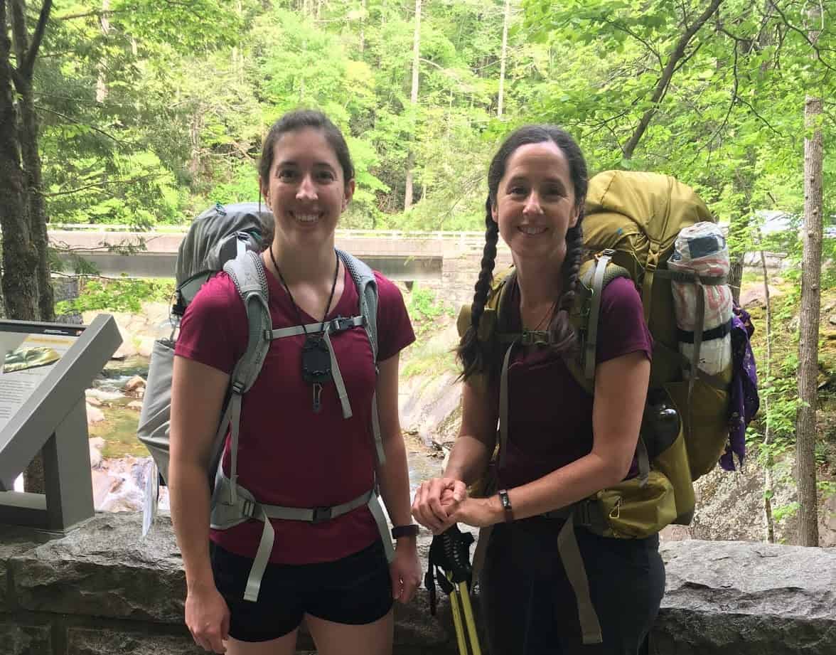
In May 2019, one other hiker and I completed a 76.1 mi (122.5 km) Great Smoky Mountains backpacking loop trip on the Tennessee side of the GSMNP. The trip lasted six days with no resupply, and followed a loop from the Sinks to the Little Tennessee River and back to the starting point.

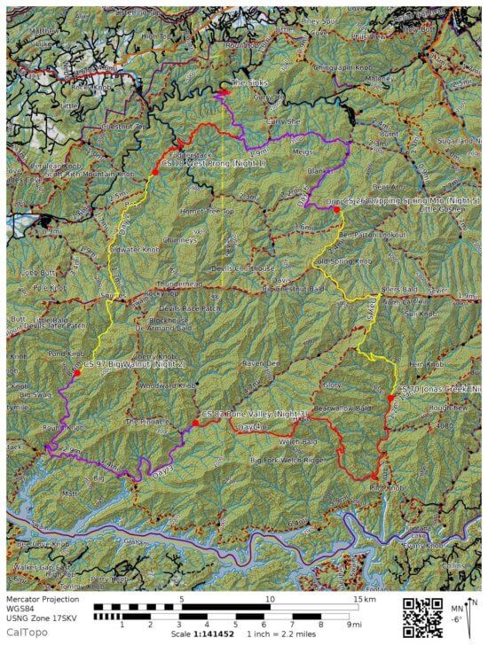
We hit 16 trails, which included difficult terrain, water crossings, and steep climbs. The route gained and lost 14,927 feet (4,550 meters) of elevation.

Trip Planning Notes
Water was one of the defining aspects of this trip. We dealt with excessive water crossings, including a day with more than 14 difficult creek crossings. We also had one day with 12 completely dry miles (19 km). A storm was coming in about the time of our scheduled start, so part of our planning involved estimating whether the increased water levels would make the crossings impassable. We also created an alternative route in case of high water.
The National Park Service requires backpackers in the Smokies to hang bear bags on cables provided at each campsite. We needed to make sure we had adequate bear bags, along with repair kits in case of damage by mice or storms. We also needed to plan our nightly routine to ensure we didn’t forget smellables in our packs or pockets after a long day of hiking.
I prepared for the terrain, elevation, and campsites by studying the “brown book”: Hiking Trails of the Smokies by the Great Smoky Mountains Natural History Association. It included narratives describing each trail in Great Smoky Mountains National Park, with history, special features, and dangers. The book also offered information about some of the campsites.
Meals
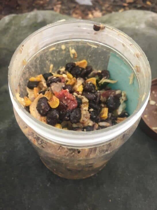
The bulk of my planning consisted of food preparation. I do not carry a stove, so I cold-soak all my meals. During the months leading up to the trip, I dehydrated all of my meals and most of my snacks. My only pre-packaged food consisted of a couple of Larabars and some chocolate.
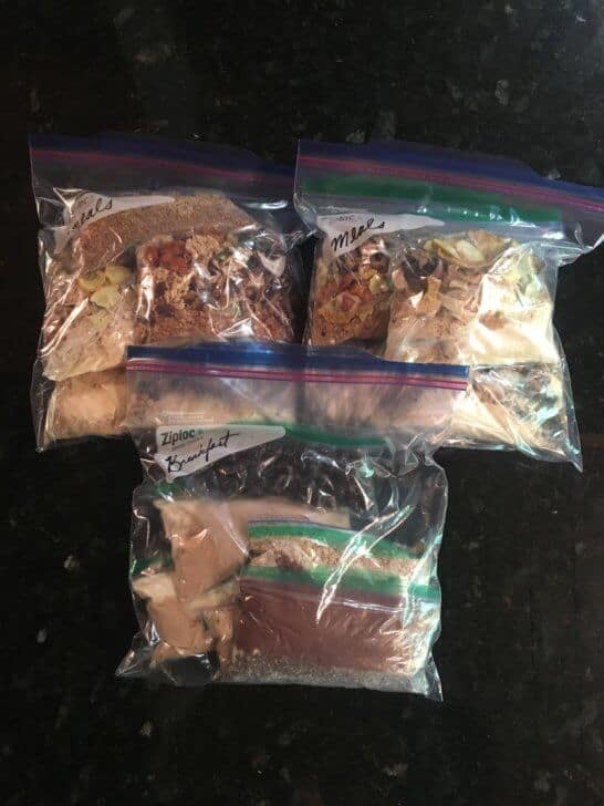
I put each meal into separate quart-sized freezer bags labeled with the number of calories. Before the trip, I consolidated the quart bags into gallon-sized freezer bags for easy access on the trail.
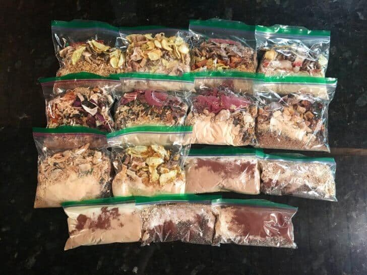
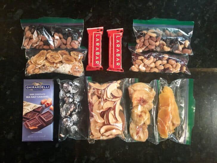
Since we were not going to resupply during the six-day trip, the food weight added up quickly. To minimize weight, my goal was to pack 100 calories per ounce (28 grams), which I just managed. Also, knowing that I function best on a high-protein diet, I added protein wherever possible. I bulked up my meals with dehydrated hummus and wound up with over 600 grams (21 ounces) of protein, nearly 40 percent of my total calories.
Since I planned to eat breakfast before leaving on Day One and dinner after returning on Day Six, I divided total calories by five and a half days and packed nearly 1,200 calories per day. Considering we would be hiking 10-15 miles (16-24 km) per day, I knew that would not be enough to maintain my weight during the trip, but I thought it should be enough to fuel my body during the six days.

Logistics
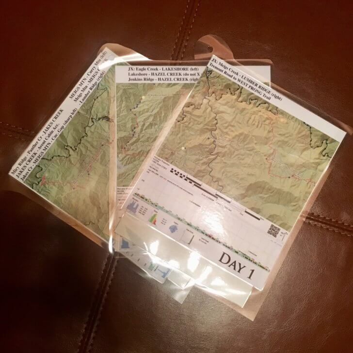
Because we did not resupply, and the route was a loop, the logistical considerations were minimal. The park requires backpackers to obtain a permit through an online system. I secured permits for myself and the other hiker, Jennifer, and printed a copy in case a ranger stopped us. I also printed copies of each day’s map and profile, which I laminated and attached to a retractable keychain on the outside of my pack.
Gear Choices
Clothing was one of my most challenging gear decisions. As those who have hiked in the Smokies know, the weather can be unpredictable, and May temperatures can range from cold to sweltering. During the week prior to the trip, I studied weather forecasts from several sources, and I tried to choose clothing that was versatile and would keep me comfortable in a wide range of temperatures. I chose a well-tested fleece sleep set, wool sleep socks, running shorts, a quick-dry short sleeve shirt, wool hiking socks with toe liners, and my trusty puffy.
I decided to use a new set of 30-degree (-1 C) hammock quilts during this trip. Unfortunately, I didn’t have many opportunities to test them. I sleep cold, so I worried that the chill might break through the underquilt and result in the dreaded “ice butt.” With no time left for test runs, I resigned myself to stick it out if I got chilly.
I chose not to bring gaiters or rain pants since my trail runners were not waterproof, packing only a rain jacket. Although I doubted we would be inclined to start a fire in May, especially with rain coming in, I never go into the woods without cotton balls, waterproof matches, and a pocket bellows.
My luxury items were:
- My trusty sit pad: 1.9 oz (54 g)
- Headphones to listen to audiobooks: 0.4 oz (11 g)
- A pen and paper: 1 oz (28 g)
Trip Narrative
Day One: Sunshine and Storms
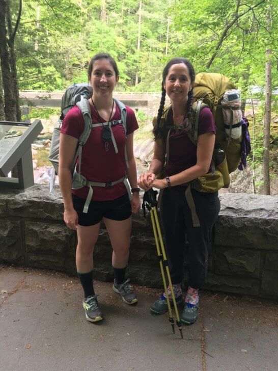
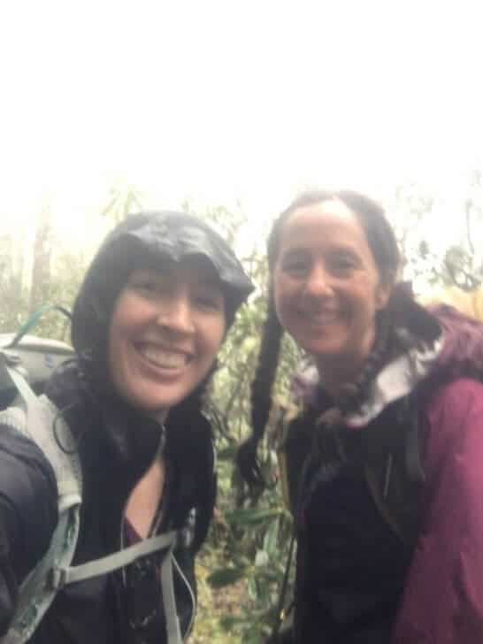
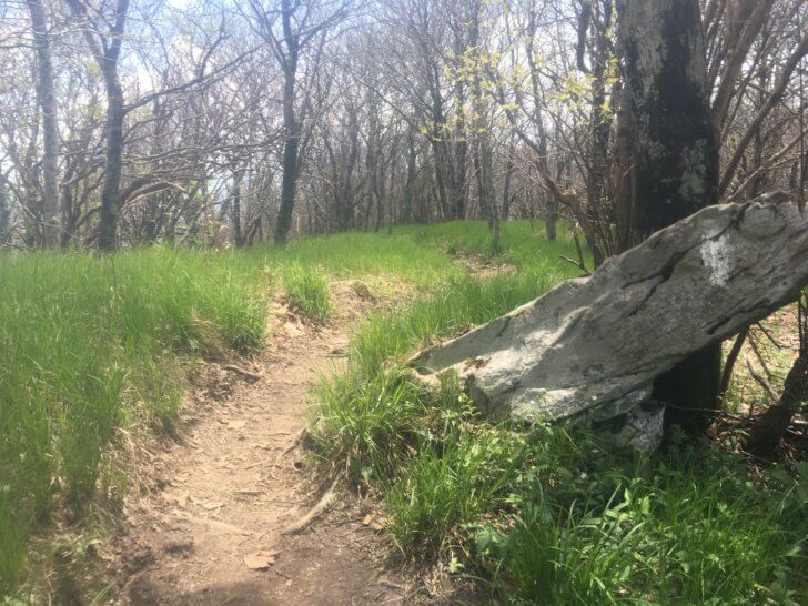
Jennifer and I parked at the Sinks in the Great Smoky Mountains National Park to begin our 6-day, 77-mile (122 km) trip. We took a photo in front of the water and felt excited and optimistic. We’d been planning this trip for months, and we were thrilled to get on the trail.
On the climb up Meigs Creek, we stopped to admire a waterfall on the right and chatted with a couple of groups of day hikers who were out enjoying the warming weather.
Prior to the trip, we knew strong storms were blowing in and watched them closely. We even considered postponing our adventure, since the route included some difficult creek crossings that we weren’t sure would be passable after the rainfall. But we decided the water levels were low enough that even with the rain, we should be able to get across the creeks.
We hiked on, enjoying the surprisingly good weather, and spotted some flaming azaleas.

Then we turned onto Lumber Ridge, noting Meigs Mountain Trail in the other direction, which would bring us back to the car six days later. We stopped a few miles later to enjoy our only fresh meals of the trip. Mine consisted of a peanut-butter-and-banana tortilla with fresh apple slices, and I had brought along no-bake cookies for us to enjoy. We took off down the trail again, our packs a little lighter and the sun still holding out above.
Storms Roll In
As we continued down Lumber Ridge, toward the Tremont Institute, the clouds rolled in quickly. The forest went quiet and seemed to go from day to night in five minutes. The storm hit fast. We stopped and put on rain gear, though my rain jacket kept me dry for about 60 seconds. Thunder boomed all around us, and lightning lit up the forest. We hiked more quickly than we should have down the muddy slope to get to the Institute, where we ducked inside the visitor center and dried off. The rain slowed a bit, which allowed us time to wring out socks and filter water from the river before heading off down West Prong Trail.
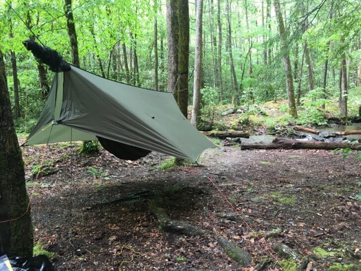
The rain had moved out by the time we reached the West Prong campsite, a large group camp that is one of my favorites in the Smokies. The campsite was beautiful and spacious, with tent sites on either side of the river connected by a footbridge. I hung my hammock near a smaller offshoot of the river, where I could enjoy the babbling sounds.
We set up camp in the dry and ate in comfort, enjoying the unexpectedly pleasant weather. My appetite was normal. I enjoyed my rehydrated meal and treated myself to some chocolate.
After supper, Jennifer and I hung our bear bags and stayed up talking, switching on our headlamps as we discussed the trip and our lives, with the clarity that only seems to come in the woods. Finally, well after hiker midnight, we turned in. The storms started again, but I’d staked my tarp low and wide and had placed some rocks on top of the stakes. I stayed warm and dry throughout the night and woke up ready to take on Day Two.
Day Two: Fighting the Weather
I woke to heavy rain on Day Two, but by the time I changed into my hiking clothes and packed my sleep set and quilts, the rain turned to a drizzle. We broke camp, ate breakfast, and continued climbing on West Prong Trail. Then we turned onto Bote Mountain Trail, which was steep, muddy, and filled with ditches from water runoff. Soon, the rain was coming down heavily. With 5.5 miles (8.9 km) of climbing in the mud and heavy rain, our spirits began to waver.
On any long trip, there’s at least one moment when you would gladly pack it in and head home. That was the moment for Jennifer. The combination of rain, mud, and climbing was enough to make her want to call it. At one point she stopped in the middle of the trail and yelled into the rain, but we kept going.
At the top of Bote Mountain, the rain stopped. We briefly touched the Appalachian Trail and then began to descend Eagle Creek Trail. Our moods were improving. I was happy to see the sun, and I sang 1960’s rock songs as we meandered down the trail. Jennifer and I were both happy the rain had let off before we hit the crossings on Eagle Creek. We had three tough ones coming up and pouring rain would have made them worse.
Navigating Upper Eagle Creek
The trail was fairly easy for about a mile (1.6 km), and then it got dicey – steep, narrow, muddy, and rocky. After two days of storms, descending the trail felt like walking down a Slip ‘N Slide pitched over the mountain. We both used trekking poles and treated the trail like a dangerous water crossing, with three points of contact at all times. I stepped with both poles down, tested the ground, shifted my weight, and only then moved the poles. We made slow progress.
Then I took a step and tested the ground. It felt stable, so I lifted my poles – and my foot slid out. I fell hard onto a sharp, grapefruit-sized rock. Pain shot through me and took my breath. I waved to Jennifer that I was fine, unsure whether I really was. When the pain and dizziness subsided, I was able to stand and continue, albeit, with a purple, darkening bruise planted firmly on my butt cheek. I’ll omit any pictures here, for modesty and for your sake, but suffice to say the bruise was far more impressive than any I acquired during eighteen years of softball.
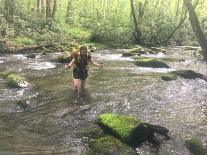
After my fall – which was painful but rather lucky in placement – we continued very slowly until the first crossing. We’d been holding our breath, still not fully sure the creek would be passable. Though the crossing was difficult, including a strong current and waist-high water, with caution and patience we got across.

Two additional crossings brought us to our second campsite, Big Walnut, where we found some artifacts, including a washtub and a sawmill blade. I hung my hammock on the edge of the small campsite, and we sat down to supper.

We also made a new friend while we were there.

Jennifer went into her tent after supper, promising she’d be right back, and I pulled out the pen and sheets of paper I’d brought to work on a fiction project. I wrote until dark and, unsurprisingly, did not see Jennifer again that night. Our time staying up and talking seemed to have ended quickly.
Day Three: Water Crossings Galore
After a good night’s sleep, we were ready to face the remainder of Eagle Creek Trail. The guidebook promised that the trail would be challenging, but our first full day of good weather gave us hope.
We managed to navigate all 14 of the remaining water crossings with little trouble, but they required patience and focus. Though we were both wearing non-waterproof shoes and did not remove our boots at each crossing, we still only managed about 1 mile per hour (1.6 km/h) on Eagle Creek Trail.
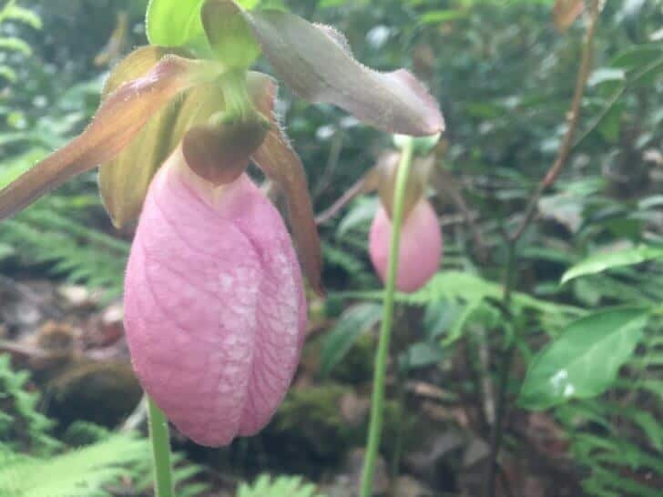
Along with creek crossings, Eagle Creek brought us beautiful pink lady slippers.
We celebrated after the final water crossing and began an unexpectedly steep climb up Lakeshore Trail. We then took Hazel Creek Trail, which was lovely and full of history. Although we were running later than we would have liked, we took some time to admire the Calhoun House.
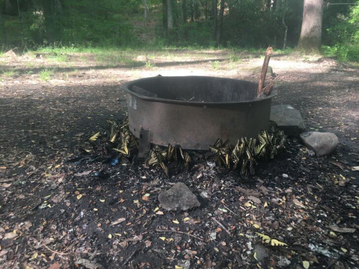
Between the water crossings and the climb, 14 miles (23 km) took longer than anticipated. A bit after 8 PM we dragged ourselves into a huge camp – the largest either of us had seen in the Smokies. Bone Valley campsite stretched along the creek and included several fire rings and spacious tent spots. We quickly made our choices and set up camp. We did take a moment to admire a cluster of butterflies puddling around a fire ring.
We then dropped next to the nicest of the fire rings, which had stones perfectly placed for backrests. We cleaned up, ate dinner quietly, and enjoyed airing out our tired feet. This was the first evening I was unable to finish my meal. Though I knew I had burned far more calories than I’d eaten, I simply had no appetite. So I saved the leftovers to add to lunch the next day.
I slept well but woke up about 4 AM with a chill. That was the only night I woke cold.
Day Four: My Breaking Point
The weather on Day Four was gorgeous – sunny and warm. We took our time getting ready in the morning and were out by our typical 8:30 AM. Although we had a steep climb up Cold Spring Gap Trail, we were glad to have the Eagle Creek crossings behind us. We began the day with a mild stroll down the remainder of Hazel Creek Trail.
In my research prior to the trip, I’d found that the Cold Spring Gap Trail was rocky, eroded, and steep. However, my sources did not emphasize how true this was. The trail consisted mainly of an old creek bed with far more rocks than dirt. We spent about 5 miles (8 km) climbing the steep trail, trying to find traction on wet rocks ranging from small stones to boulders. It was slow going, to say the least, and the swarms of gnats did not help. This trail was my breaking point, my moment during the trip when I would have taken any escape route.
We finally made it to the top of Cold Spring Gap, where I promptly collapsed onto the dirt. The junction was a terrible place to have lunch, overgrown and full of bugs. But both of us were too tired to take another step without food. So we stopped, enjoyed lunch, and took a breather.
![]() Downhill from Here
Downhill from Here
After we finished eating, we climbed approximately a half-mile (800 meters) on Welch Ridge Trail until we reached the junction with Bear Creek Trail. There, we spotted a pair of bald eagles flying above.
From Bear Creek Trail, we took Forney Creek Trail and descended about 9 miles (14 km) to the Jonas Creek campsite. Our descent was slow, as both of us were losing steam from hiking trails that were consistently more difficult than anticipated. We rolled into camp about 7:15 PM.
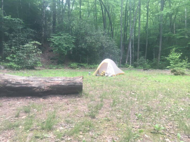
The campsite was located right next to the water and had plenty of space. Jennifer found an idyllic tent site, and I chose a nice pair of trees not too far away. After eating – again I did not finish my meal – we didn’t waste much time before settling in for the night.
I slept well until about 4:30 AM when I awoke with excruciating pain in my stomach. Initially, I attributed the pain to hunger pangs, since I hadn’t had much of an appetite the last couple of days. But as I lay in my hammock, the pain became worse, until I couldn’t tolerate any position. I got out of bed and made my way toward the fire pit, with the headlamp on low, where I sat and tried to find some relief. I’d taken Tylenol, but the pain was becoming worse.
Finally, about 5 AM, I woke Jennifer, and we sat in her tent until sunrise, hoping the pain would subside and trying to decide on a backup plan if it didn’t. We were about a day’s hike from the nearest road, but the route we planned for Day Five would double our distance from help. When the pain finally subsided, we decided it was worth pressing on. And I decided to add stronger medications to my first aid kit.
Day Five: Hiking Dry
I tried and failed to down a protein shake for breakfast. But otherwise, the morning was not as difficult as the night would have led me to expect. We hiked about 2 miles (3 km) in relative comfort, and then we met the day’s primary challenge: the final water source until camp. With nearly 12 miles (19 km) of the completely dry trail remaining, we drank, hydrated our lunch, and filled our containers. For me, that meant two 1-liter (35-ounce) bottles. With less tree cover than previous days, 2 liters (2.1 quarts) did not seem like much.
We continued the climb up Jonas Creek Trail. After turning around a switchback, I heard a grunt. At first, I thought we’d stumbled upon a bear, but in fact, it was a large, black boar. The boar took off in the other direction and veered off the trail. We continued, but I paused to blow my whistle at each blind switchback. Surprising a boar was certainly not in the plans for the day.
The lack of water took its toll. As we sipped and rationed, we quickly realized that 2 liters (2.1 quarts) would not be enough to reach camp in relative comfort. But it was all we had and we knew there would be no more, so we kept climbing and pushing through.
To the Appalachian Trail
At the junction with Welch Ridge, we stopped for lunch. As we sat with our backs against the trees, trying to find some shade, a group of horses with riders ascended the trail from the direction we’d come. We spoke to the riders and laughed, feeling our spirits rise a bit with the food and communication. We’d seen only one or two other hikers per day to this point and had yet to camp with another person.
After lunch, which included some stretching and ibuprofen, we continued up the trail toward the AT. The heat pounded on our backs, and the warming water in our packs seemed more and more insufficient, especially since we’d each sacrificed a half liter (17 ounces) to hydrate dinner.
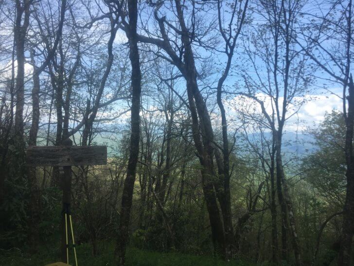
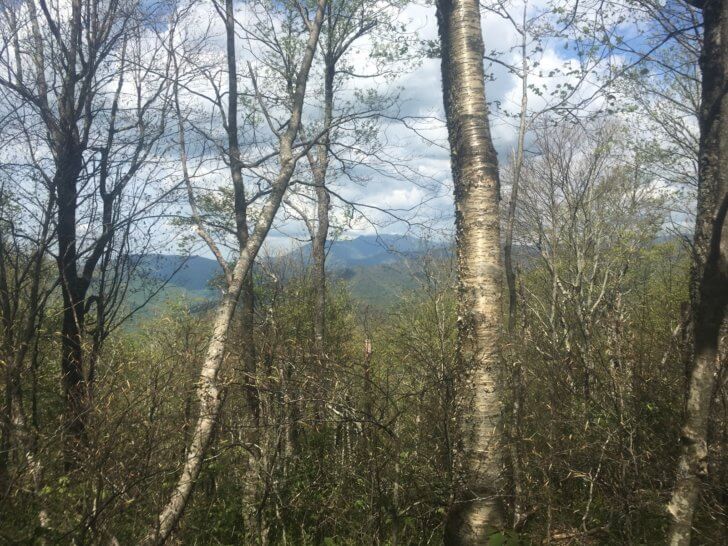
As we neared the top of the day’s climb, we passed the horses and riders on their way back down the rocky slope. Although the climb was trying, the view at the top was amazing. We hiked down the Appalachian Trail past Silers Bald Shelter and a group of thru-hikers. Then we spotted some turkeys in the open meadow and enjoyed the wide, well-traveled trail atop the rounded ridge.
Descending to Camp
We took our time descending approximately 5 miles (8 km) into camp. Our legs were moving slowly, and even though we’d shed much of our pack weight in eaten food, the heaviness in our bodies more than made up for the lost weight. The last few miles dragged on like a difficult climb. When we finally reached the camp, our water bottles were completely dry and we were parched and dehydrated. We turned off Miry Ridge Trail, through tall grass and toward the campsite hidden about a half-mile (800 meters) away.
My research said that the Dripping Spring Mountain campsite had a spring that was sometimes dry.. If it was dry, we would need to hike another half-mile (800 meters) down Lynn Camp Prong Trail to collect water and return to camp. We were both holding our breath as we picked our way down the hillside.
Thankfully, the spring was not dry. I filtered two liters of water, promptly downed them both, and then filtered two more to take back to camp.
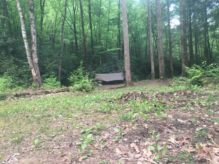
Dripping Spring Mountain, our final campsite, was also our first site that was not near water. Instead, the small camp was isolated, hidden in the trees, and out of sight of the trail. We had already set up camp and were having dinner when another hiker wandered in. He was the first hiker with whom we’d shared a site. He, like us, was tired and not inclined to chat. We all went about our business without too much discussion, as Jennifer and I enjoyed our last dinner on the trail.
While Jennifer had opted to bring several changes of clothes on the trip, I had chosen to hike in the same shirt, shorts, and socks all six days. As I climbed into my hammock that night, my hiking clothes, which I had hung on the ridgeline to dry, shifted toward the head end of the hammock. Although I hadn’t been smelling my own odor too strongly, I certainly smelled those socks. I never regretted my choice to forego a change of clothes, but I did move my wet hiking clothes firmly toward the foot of the hammock.
During the night, thunder rocked the mountains all around us. Although the storms skirted us and never dropped rain on the campsite, the treetops shook with heavy winds all night. The winds must have disturbed some turkeys roosting in the trees because they found their way into camp and raced around the site until sunrise. Between the sound of quick, roadrunner-like footsteps circling my hammock and the unsettling sound of high winds roaring through the canopy above, I was very glad to have earplugs.
Day Six: The Home Stretch
On the final day, we were dead tired but extremely excited. Although the day’s 14 mi (23 km) were mostly downhill, every small climb felt brutal. We’d planned from the beginning to celebrate the end of the trip with dinner at a Brazilian steakhouse in Knoxville, so as we hiked, we talked about the cuts of meat, salad, bread, and drinks we were going to enjoy. Against all odds, we made good time on the way out – much better time than we’d made the previous days.
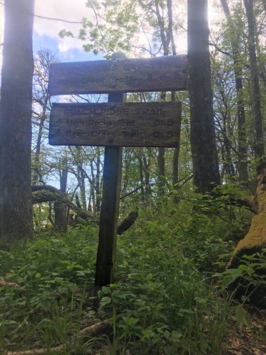
As we descended Meigs Creek Trail, we heard the rushing water from the Sinks below. We also heard the unfamiliar sound of cars, and we began to pass other hikers. At the trail sign, we celebrated and began looking around for someone to take an “after” picture.
Unfortunately, we didn’t get that picture. As I was asking someone to take a photo, Jennifer spotted her car, with plastic covering the window. While we were hiking, someone had thrown a rock through the glass, broken the back seats, and stolen our purses out of the trunk.
The park rangers had left a number for us to call, but there was no cell service. A kind couple offered us a ride to the ranger station, where we dealt with the break-in. It was a terrible way to end a wonderful trip. But by the time we had discussed everything with the rangers, we decided not to let someone’s terrible actions ruin our celebration. With the time we’d saved from our quick hiking pace, we were able to get to the restaurant on time for our dinner reservation and celebrate the end of our trip.
Trip Review
Route Planning
The big surprises with this trip had to do with the difficulty of the trails. At 10-15 miles per day (16-24 km), the mileage was entirely doable. However, every single day we were surprised by the difficulty of the terrain. Although I researched each path before the trip, my sources did not reveal the true nature of the trails. For example, the brown book states that Cold Spring Gap Trail is “steep” and “rocky.” It does not say, however, that the trail is basically an old creek bed and that we would be scrambling over rocks the entire climb.
After we returned, one of our hiking friends said I’d routed a “who’s who of the toughest trails in the Smokies.” I could have avoided the surprise by talking to hikers who had completed these paths.
Packing Changes
I also could have saved myself some pain with some simple additions to my first aid kit. I had plenty of medication for muscle pain and inflammation, but I was not prepared for things like stomach aches, which can turn into more than a nuisance on the trail. After the trip, I beefed up my first aid kit with additional medications.
My calorie intake for the trip was not far off my estimate. I ate all my snacks and had a meal and a half leftover. However, after the second day, I could not finish my meals and wound up hydrating half meals and combining the leftovers. Smaller meals would have better served me, perhaps 100 calories less, with more snacks. Overall I was able to get enough protein and calories to make it through the trip without ever feeling malnourished. I lost 3 pounds (1.4 kg) during the six days.
Personal Takeaways
The final thing I would change about this trip is, of course, the car. On similar trips in the future, I will not leave a car at the trailhead. I’ll ask a friend or family member to drive us there and pick us up afterward, even if the route is a loop. Because the Sinks is a well-trafficked area, I believed that the car would be safe. Clearly, that was not the case.
This trip was a huge milestone for me. I’d had hip surgery nine months prior and had only recently been able to return to hiking. Backpacking this distance, over difficult terrain, was a massive milestone in my recovery.
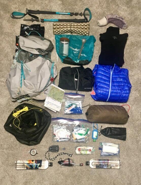
Gear List & Notes
Packed Gear
| Osprey Lumina 45 Pack | 28.1 oz (797 g) |
| Warbonnet Blackbird Hammock with Whoopies and Tree Straps | 22.1 oz (626 g) |
| Hammock Gear Econ Burrow 30 Top Quilt | 19 oz (539 g) |
| Hammock Gear Econ Incubator 30 Underquilt | 21.4 oz (607 g) |
| Warbonnet Thunderfly Tarp and Snakeskin | 15.9 oz (451 g) |
| 6 Dutchware Titanium Stakes and Stake Bag | 2.8 oz (79 g) |
| Mountain Hardwear Ghost Whisperer Puffy Jacket | 7.2 oz (204 g) |
| Columbia Rain Jacket | 8.1 oz (230 g) |
| Smartwool Sleep Socks | 3.1 oz (88 g) |
| Fleece Sleep Shirt | 5.2 oz (147 g) |
| Fleece Sleep Leggings | 5 oz (142 g) |
| MSR Trailshot Water Filter | 6.2 oz (176 g) |
| Hand Sanitizer | 2.8 oz (79 g) |
| Fire Kit | 2.6 oz (74 g) |
| Comfort Kit | 5.6 oz (159 g) |
| First Aid Kit | 4.7 oz (133 g) |
| TP and Wet Wipes | 1.5 oz (43 g) |
| Compass | 1.6 oz (45 g) |
| Two 1-liter (35 oz) Water Bottles | 3 oz (85 g) |
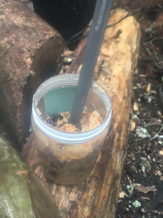
| Plastic Jar | 2.1 oz (60 g) |
| Sea to Summit Titanium Spork | 0.4 oz (11 g) |
| Bandana | 0.5 oz (14 g) |
| Osprey Ultralight Dry Bag | 1.9 oz (54 g) |
| Earbuds | 0.4 oz (11 g) |
| Portable Charger | 4.3 oz (122 g) |
| Charging Cords | 0.5 oz (14 g) |
| Five Pieces of Paper | 1 oz (28 g) |
| Pen | 0.2 oz (6 g) |
| Black Diamond Iota Headlamp | 1.8 oz (51 g) |
| Laminated Maps | 1.3 oz (37 g) |
| Retractable Keychain | 0.7 oz (20 g) |
| Waterproof Phone Pouch | 1.4 oz (40 g) |
| iPhone | 5.3 oz (150 g) |
| Pee Rag and Shock Cord | 0.6 oz (17 g) |
| Sit Pad | 1.9 oz (54 g) |
| Leaf Bag Pack Liner | 1.9 oz (54 g) |
Carried and Worn Gear
| Black Diamond Trekking Poles | 16.2 oz (459 g) |
| Titanium Neck Knife | 2 oz (57 g) |
| Running Shorts | 3.7 oz (105 g) |
| Sports Bra | 2.7 oz (77 g) |
| Quick-Dry Shirt | 3.5 oz (99 g) |
| Injinji Sock Liners | 1.1 oz (31 g) |
| Icebreaker Hiking Socks | 2.1 oz (60 g) |
| Brooks Cascadia Trail Running Shoes | 22 oz (624 g) |
Total Weights
| Base Weight | 12.00 lbs (5.44 kg) |
| Food Weight | 7.71 lbs (3.50 kg) |
| Full Pack Weight | 21.91 lbs (9.94 kg) |
| Skin-Out Weight | 25.24 lbs (11.45 kg) |
Gear Notes
The only piece of gear that truly disappointed me was my water filter. The MSR Trailshot slowed to the point that I was priming it with 90 pumps (yes, I counted) before the flow started. The main benefit of the Trailshot is its ability to pump water from the smallest of sources, but puddle-like water sources rarely exist in the Smokies. After the trip, I switched to the Katadyn BeFree water filter. The BeFree is much faster and lighter than the Trailshot. Also, the BeFree I chose includes a 1-liter (35-ounce) soft water bottle, which means that I could carry additional unfiltered water. That would have been invaluable on Day Five, during the 12 completely dry miles (19 km). I would have been able to carry three liters instead of two, which would have made those miles more comfortable.
I did not need the portable charger, primarily because I was extremely diligent about only using my phone’s GPS app only when necessary and after checking the printed maps. This, along with keeping the phone in airplane mode and power saver mode, kept me from needing the charger at all. Though I didn’t use the charger, I would certainly bring it again. The peace of mind of having definite access to my GPS app in case of an emergency is worth 4.8 ounces (136 grams) to me.
Conclusion
This was a tough trip. Going in, I was under no illusion that it would be easy: I wanted to push myself and prove that surgery hadn’t slowed me down. I accomplished that, and I was proud to step off the trail on Day Six, having learned some important lessons on this trip. Time to start planning the next one and get back on the trail!
Related Content
- Jamie Shortt used MYOG for a 60-mile trip in the Smokies.
- This Great Smoky Mountains National Park “Backcountry Camping” page is a good place to start planning a trip.
- You can find detailed trail information at HikingintheSmokys.com.
Disclosure
Updated November 7, 2019
- Product(s) discussed in this article may have been purchased by the author(s) from a retailer or direct from a manufacturer, or by Backpacking Light for the author. The purchase price may have been discounted as a result of our industry professional status with the seller. However, these discounts came with no obligation to provide media coverage or a product review. Backpacking Light does not accept compensation or donated/discounted products in exchange for guaranteed media placement or product review coverage.
- Some (but not all) of the links in this article may be “affiliate” links. If you click on one of these links and visit one of our affiliate partners (usually a retailer site), and subsequently place an order with that retailer, we receive a small commission. These commissions help us provide authors with honoraria, fund our editorial projects, podcasts, instructional webinars, and more, and we appreciate it a lot! Thank you for supporting Backpacking Light!
- Read about our approach to journalistic integrity, product reviews, and affiliate marketing here.

Discussion
Become a member to post in the forums.
Companion forum thread to: Great Smoky Mountains Backpacking Loop (Sinks-Little Tennessee River Trip Report)
Trip report: A 6-day, 76-mile backpacking loop in Great Smoky Mountains NP from the Sinks to the Little Tennessee River and back.
Very thorough trip report. The Great Smoky Mountains are, in my opinion, one of the most spectacular places to hike on the east coast. You have inspired me to return. I don’t believe how well you handled the car break in. I also can’t believe it even happened. Thanks again for the inspiration.
Nice trip report. I didnt catch what hydrating container was used?
Excellent trip report, thank you for sharing!! I’ve spend many nights in the Smokies and agree that it’s a fantastic place. You certainly did not pick an easy route, but you saw a lot of the park that most people haven’t seen. I’ve done all the trails you mention except for the 3.5 miles of the Meigs Creek Trail going to “the sinks” trailhead.
It looks like you are organized and did an excellent job planning. I really like the look of your food spreadsheet.
I am almost hesitant to say this but did you not know about the spring in Spence Field? I doubt it would be dry in May and it would have cut your dry hike carry roughly in half.
Lastly, I’m sorry about your car and belongings. I hate a thief, and though you would think it should be safe in a NP, that isn’t always the case
Your trip has it all—numerous creek crossings, tough steep muddy and rocky trails, one food load with no resupply, a bout of “food poisoning”—even car damage at the trailhead.
People don’t realize how easy it is to get “food poisoning” (or whatever you want to call it) on a backpacking trip—when living on snacks and dehydrated food. Such ailments come and go and are part of the backpacking experience if you stay outside long enough.
I do all my backpacking trips close to the Smokies—and carry all my food with no resupply too—for trips up to 24 days in length. But my daily mileage is alot less than yours—like around 4 to 5 miles a day due to my heavy food and pack load—although on occasion I can punch out a 12 mile day.
Thanks for the report on familiar terrain for me. I love going to the southern Appalachia in early May. It’s going to rain, but the flowers make it worth it.
Awesome trip report! Good to read of your stuggles and discipline to carry on. Kudos to you both!
As a kid I spent 14 summers feet from the GSNP so your review brought back some nice memories of hiking and running on those mostly dark trails,
Question: Am I correct to say you only had one pair of shoes? Did they dry out overnight given all the stream crossings?
Things here never dry. They wouldn’t dry in a week after a creek crossing left outside even out of the rain. I always just put semi-wet shoes back on and hike on.
My biggest revelation when I first hiked out west (JMT in 2011) was how quickly everything dried. Even with a creek crossing and sweating you would be completely dry by the time to go to bed. It was amazing.
I’m with Brad. Hiking the Smokies in May means embracing the wet. There’s no way around it. Ten pairs of shoes and you’d still be walking in wet shoes. Wet shoes don’t bother me though.
Lovely trip report! Embrace the rain! I love the Smokies no doubt. One knit though, and it’s personal….
If you look at the map of the Smokies, half is on the Tennessee side and half is in NC (I’m from NC) I’m very familiar with Eagle Creek and Forney Creek. The AT straddles the TN/NC line . The song Rocky Top is about Thunderhead on the AT, and it pines about Tennessee but is in fact on the TN and NC border. And really, the NC side is quite a bit prettier, IMHO! Perhaps if you had parked on the good side :’)
Seriously, I’m doing an 8-day trip on both sides of this wonder in 2 weeks and I’m ready for rain, snow or whatever. I loved your report and I’m ready to roll!
Thanks for the write up.
Happy Trails- Russ
Great trip report! You really covered a lot of the west end. Any chance you might post that spreadsheet for meal planning? What a great idea!
The Cold Springs Gap problem is familiar. I keep a park service .pdf trail map in the maps folder on my hard drive for reference to see what “traffic” is allowed on the trails. Watch out for the “dotted” trails. The worst ones seem to be those crossing a ridge from one drainage to the next like that one; which leads from Hazel over to Forney. When they are at the highest point of the ridge crossed by a “dotted” trail and the trail/ridge is steep, they get really torn up by the horses. There usually doesn’t seem to be any visible evidence of trail maintenance or repair. It’s often beyond annoying or inconvenient and into the territory of dangerous. Luckily you were going up and not down. Imagine going down that thing when it’s wet.
PS: Russ; I pointed that out to a nice group of UT students I crossed paths with “high on Rocky-Top” one Saturday afternoon.
Your pep song is about a mountain in North Carolina? You can change the syllable emphasis a little and sing it
High on Rocky Top….Rocky Top N C…. Rocky Top N C.
That was fun and they didn’t gang up on me though I was completely outnumbered.
Then there’s the joke about why the Volunteer’s favorite color is orange. Told to me by an “Ol Miss fan….. which splains everything….. ;
We have our own Rocky Top in TN—it’s located on the Benton Mackaye trail at 4,000 feet between Sled Runner Gap and Sandy Gap.
I was just on it in December—
Hey Walter, that dashed line between Monroe County. TN and Cherokee county NC that runs right over the highest part of that Rocky Top ummm that’s the state line right? You’re killing me! Hey and what’s with the “we” stuff? Did you move west?
Been reading your posts lately about the Snowbirds etc. BTW. Spent a few days end of October at the Swann Cabin. Great way to camp out! That’s some great country but it’s just Soooo far from the Outer banks…9 hour hustling!
Now I’ll apologize for the thread drift and back to your regularly scheduled programming. But hey if I lived in Knoxville or Chattanooga or anywhere in Eastern TN, GA, ALA etc I’d be seriously exploring that area. Wait what did I just suggest?
Great report! Congratulations on the excellent recovery from your surgery. I have a couple of questions. First, what are the lowest and highest temperatures you encountered and were you warm enough? Second, did you miss not taking the rain pants? Third, do you have an equipment list for your companion? Was she happy with her tent? Finally, not having ever hiked there, it looks like all forest. Do you ever climb up high enough to see anything but trees?
Karen: The question of tree-line and views is an interesting one. There are a few locations along summits or higher ridge-lines typically called balds where one can go above “tree-line”, including Rocky Top and parts of the Spence Field areas mentioned above; however Siler’s Bald also part of the route is no longer bald for example.
I’ve put tree-line in quotes because the nature of these open mountain tops is in question. Did buffalo and elk create them millennia ago and maintain? Did Native Americans help the buffalo and elk maintain? was it all Europeans? Even the very earliest maps/ descriptions mention balds. There was also evidently a major Native American population decline and shift pursuant to the introduction of European diseases which occurred well in advance of actual significant European incursion and settlement (like @ 2 centuries in advance) and there may have been a significant expansion of the balds during this period since the buffalo and elk populations surged and so forth. The question is open to lively debate.
The US Park Service will not maintain Balds and so many labelled or named as such in the GSMNP are no longer bald. The USFS however, does do some maintenance and for that reason and possibly just nature, rate of recovery from previous man-made alteration, etc.; in some other ranges within the broader Southern Appalachians area there are more open balds. The 2 most extensive Balds are along the AT north of Roan Mt. and along the Art Loeb Trail around Black Balsam Mt. The book listed below is not nearly as dry as the link label and might interest anyone frequently visiting the greater region.
Southern Appalachians Environmental History
The Southern Appalachian Mountains are one of the most ecologically diverse temperate environments on earth. You may have noted the mentions up thread of flowers in May. Not exactly like the flower/color riot of an alpine meadow in full bloom but sometimes close and the flowers aren’t just on the ground; there’s shrubs, bushes, vines and whole swaths of trees in bloom. Take for example the afore-mentioned Spence Field
Spence Field
Which reminds me and slightly off topic: When the cherry trees are in full bloom in the bowl along Flat Laurel Creek between The Sam’s Knobs and Black Balsam it is almost unbelievable. Sometime again @ mid-May
As OBX states – we do have “balds” which are mysterious in origin – one theory is lightning strikes, but nothing truly “above treeline”. Some of the highest points in the park do have a spruce-fur forest rather than the mostly hardwood forest of the lower elevations. There are three fire towers in the park, two on the AT.
They don’t call it the long green tunnel for nothing!
This was a great read. I think we have all had trips that push our limits (both physically and emotionally), but this one really sounded rough!! . When I was reading about all the challenges you faced… I had several flashbacks of some of my previous trips that “turned south” and got to enjoy some “type 2 fun”. However, I loved how you closed out, “Time to start planning the next one and get back on the trail!” Good for you.
Nice report! You could have dropped a little weight, but if you were comfortable, it’s fine. 25-26lb is a good weight, generally. I would bet you really wanted to loose the whole pack on the 5mi climb. I have had to make a long hike for water, too. It sucks at the end of a day to have to hike down and back UP.
Your food worked out well even if low on calories. But typically I plan to loose about a half pound per day. You banged that mark perfectly.
Become a member to post in the forums.