Topic

XST 2016 ~ Cross Country Sierra Traverse

Viewing 23 posts - 1 through 23 (of 23 total)
Andy Duncan BPL Member
PostedSep 2, 2016 at 11:31 am

This year the mountain gods provided a tremendous opportunity. . . a three week window during the prime summer season to explore the High Sierra. Through a series of unplanned circumstances my usual one week trip morphed into a three week epic adventure!

I stitched together portions of the Sierra High Route, South Sierra High Route, Kings Canyon High Basin Route along with some of my favorite cross country alternatives to create a cross country traverse of the High Sierra. The route started at the Twin Lakes trailhead near Bridgeport in the northern Sierra and ended at Whitney Portal via the Mountaineers Route.

In the end I climbed 25 High Sierra Passes over 257 miles in 22 days. I started preparing for the trip in January and followed Alan Dixon’s training program up to the start in July. Some of the climbs and long days were more challenging than I anticipated and the fields of wild flowers at the beginning almost derailed the whole trip. Although I planned on climbing 31 passes over 295 miles I had to skip the sections from the Lyell Fork to Mammoth and Ionian Basin due to allergies. Fortunately I was able to re-energize during a zero day and get back into the wilderness to finish the route.

For the whole story including route details, map, photos and gear list check out:

XST 2016 ~ Cross Country Sierra Traverse

An overview of the route:
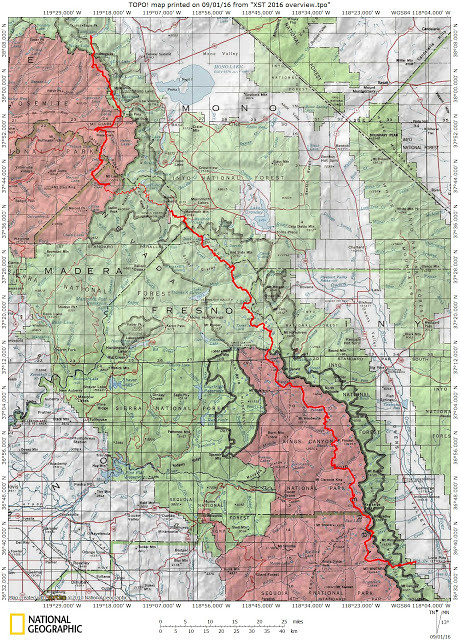
xst 2016 overview jpeg

Sunset after a storm on Mt. Ansel Adams near camp in the Lyell Fork:
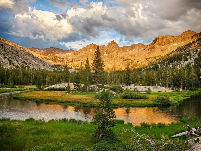
25

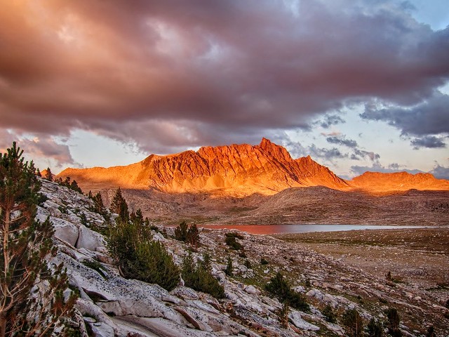
Alpenglow from camp on Lower Mills Creek Lake:
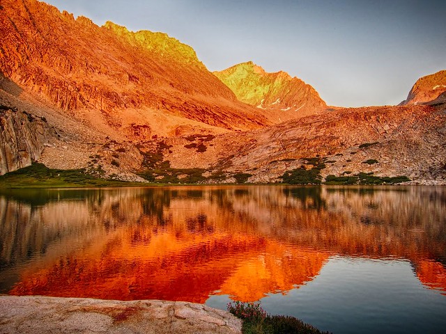
73

Storms passing during a climb up Puppet Pass:
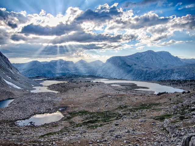
98

Humphrey’s Basin:

99

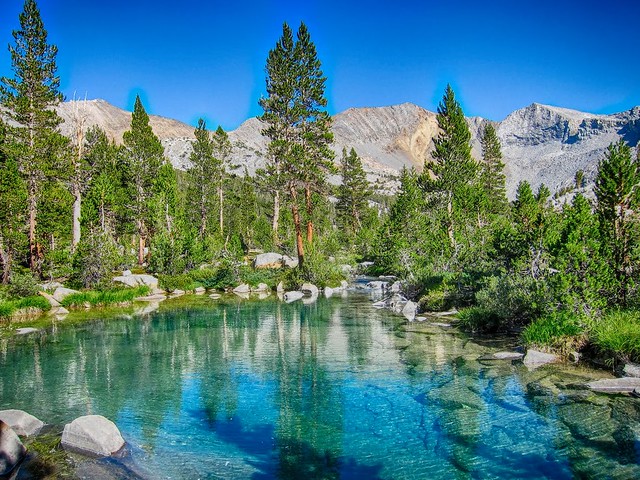
Mysterious emerald pools:

178

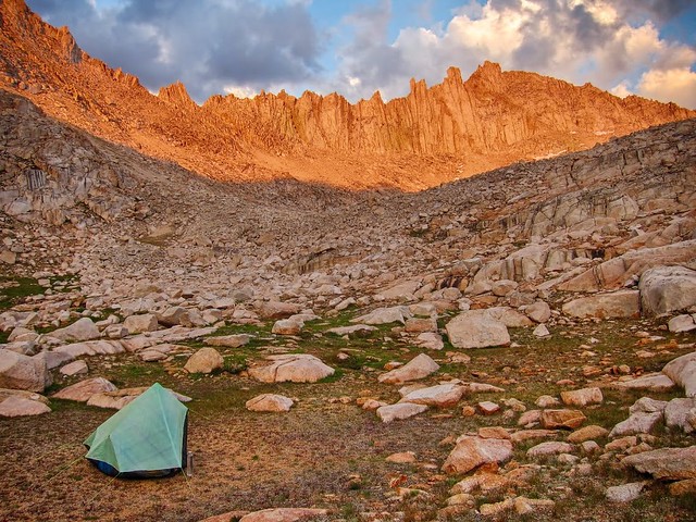
Old school Hexamid below Feather Pass:
90

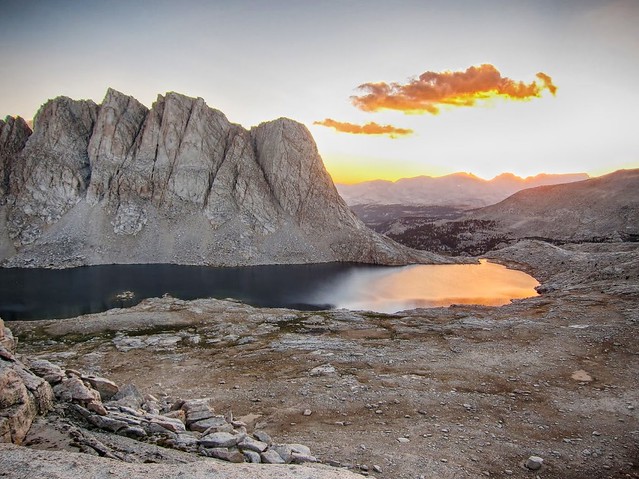
A final sunset on Wales Lake:

216

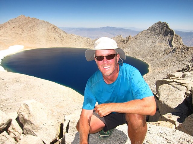
Dreaming of a cheeseburger from Russell-Carillon Col, the final pass:
222

PostedSep 6, 2016 at 2:30 pm

I almost missed this one due to being out for a much shorter, humbler hike.  Words escape me Andy, so I just leave it at this:  I have never come across a more magnificent trip!  Thank you for sharing it.

Andy Duncan BPL Member
PostedSep 6, 2016 at 7:24 pm

Many thanks for your feedback Tom! It was hard to condense into a read-able format, thanks for taking the time to check it out:)

jscott Blocked
PostedSep 6, 2016 at 7:51 pm

Fantastic report Andy; a pleasure to follow your trek. Impressive and one you’ll always remember I’m sure. Your photos are amazing!

I was evacuated from that fire area near Mammoth that you mentioned, on the evening of the fire, as it approached Reds Meadows. Good thing too!

David T BPL Member
PostedSep 6, 2016 at 8:50 pm

What a grand trip in the mountains. Great route and nice work making that happen!

PostedSep 7, 2016 at 12:10 am

Thanks for the report, very nice! 96 degrees at 11,000 ft is hard to believe.

Just an Opsack for that entire route?

PostedSep 7, 2016 at 7:12 pm

This is a seriously impressive route Andy, really inspiring.  Thanks for posting.

Andy Duncan BPL Member
PostedSep 8, 2016 at 11:57 am

Thanks for your comments everyone!


@Jeffrey
, I’m glad you made it out safely from the Mammoth fire.


@Cameron
, I used a canister throughout Yosemite and the other areas where it was required, but the Opsack was fine otherwise (especially above tree line in the remote basins).

PostedSep 8, 2016 at 6:07 pm

Andy, I have been looking over maps of much of the same route, and wondering about the canister logistics. This is what I understand: You use a canister to start and go through Yosemite, unload it in Reds, skirt the Bishop Pass required area by staying on the JMT, camp at Woods Creek and then at Vidette Meadow where both have bear lockers, and then on the rest of your route you are home free? Any other areas I am missing? Sounds easy.

Beyond that, if I kept going on the SoSHR where you exited, anyone have any insight on avoiding a canister along the path of Miter Basin- New Army Pass- Cottonwood lakes?

Andy Duncan BPL Member
PostedSep 8, 2016 at 11:26 pm

One thing I considered, but ended up running out of time to do (and it is not legal), was to cache a Bearikade Weekender in 60 Lakes Basin via Baxter Pass with enough food to finish. I was running out of steam by that time in the trip, but it’s reasonable to make it from Arrow Basin to 60 Lakes Basin in a day, especially if carrying a lighter pack with very little food, and avoid those bear sensitive areas.

Like you mentioned you could mail home a smaller canister from Mammoth (I was using a Bear Boxer on that section, it had plenty of room for the 3-4 day sections between resupply points at the north end of the route). Then go without a canister in the middle section where they are not required, and finally resupply via a horse packer in Dusy Basin (or pick up the cache in the Weekender) and have plenty of food to finish the trip and be legal in that last section.

If I could do it again I would try not to go more than a week before resupplying. It changes everything because I could have used a lighter homemade frameless pack etc.

I avoided the JMT from Deer Meadow to Woods Creek by staying in the adjacent high remote basins, and didn’t see a ranger (and only one other person) for those few days. Im not sure how to avoid the canister requirement in the Whitney/Rock Creek area. . .although part of my original route stayed very close to the Sierra Crest (Dragon Pass/Mt. Gould ridge/University Shoulder/Junction Pass/Williamson Bowl/Mt. Bernard to Russel-Carillon) where the chance of seeing anyone else, much less a bear, would be unlikely.

Are you going this summer?


PostedSep 9, 2016 at 1:14 am

Thanks for the info! My original goal this summer was several weeks Sierra high-routing, but my project-based work kept me home in July and August. With luck I will be able to get out in the next two weeks and I think I will first do the SoSHR Kearsarge to New Army Pass, and then I might get a second shot at another 7-10 days before mid-October clamps down, possibly doing a more northern section of the SHR. Six days provisions and no canister would be a luxury, but if I have to pack a Weekender it won’t be terrible. At least we can all live vicariously reading your epic trip report.

Manfred BPL Member
PostedSep 9, 2016 at 3:02 pm

Andy,

Thanks for the great trip report with the fantastic photos. Now I feel like i should have gone into the Sierra over Labor Day weekend instead of hiking all over Henry Coe SP.


Andy Duncan BPL Member
PostedSep 9, 2016 at 5:24 pm

Have a great time Cameron! I usually do a few 10 day trips in the summer and it usually feels like just the right amount of time (and easy to schedule with the week sandwiched by two weekends).

Thanks for your feedback Manfred! I have enjoyed reading your detailed trip reports here and your SHR “Trip of a Lifetime” really provided some inspiration for this one.

Jacob D BPL Member
PostedSep 11, 2016 at 12:03 am

Andy, Congrats on getting out for such an amazing trip. My mind is blown. So many great places, so many high passes. Good stuff and great photos!


Russ W BPL Member
PostedSep 11, 2016 at 10:48 am

Awesome trip and pictures. Makes my hike look like a loop around Central Park! Jealous you could grab a chunk of time like that…and you certainly made the most of it. Congrats!

John Kays BPL Member
PostedSep 12, 2016 at 1:52 pm

Great trip Andy! There was brief mention of “University Peak” and “U.P. Shoulder.” Did you happen to enter Center Basin from Kearsarge Lakes over University Peak Shoulder? That would seem to be time saving route?

Andy Duncan BPL Member
PostedSep 13, 2016 at 12:44 am

Thanks for your comments!

@ John, I originally planned on going over University Shoulder as a x/c alternative into Center Basin, but by then I settled for the trailed route. At that point it felt like I was running at 50% due to calorie deficiency.

BTW, University Shoulder/Center Basin was part of the ‘true’ x/c route I had planned from Rae Lakes. To avoid the JMT and Glen Pass etc I considered going via Dragon Pass/Gould Ridge/Kearsarge Lakes/University Shoulder/Center Basin/Junction Pass/Shepherd Pass. Then Williamson Bowl and over Mt. Bernard ridge to Wallace Lake Basin and back to the SoSHR. Maybe next summer. . .

Andy Duncan BPL Member
PostedOct 10, 2016 at 9:21 am

Jason, it was unusually warm and I never used my insulation layers (Montbell EX Anorack, Smarwool merino headband/buff and silk sleeves) so I mailed them home from Mammoth after the first week. For the next two weeks+ the Houdini, Montbell nylon wind pants and light synthetic hat were enough except on a few nights when I used my hiking shorts as a hat at night for added warmth.

Ben C BPL Member
PostedOct 10, 2016 at 12:31 pm

Great report and spectacular photos.  Those emerald pools look amazing.  I also loved seeing your walk around Tulainyo; we did that area last summer and really loved it.

Andy Duncan BPL Member
PostedOct 11, 2016 at 7:25 pm

Thanks Ben! Those Emerald Polls and Tulainyo were some of my favorite parts of the trip.

Viewing 23 posts - 1 through 23 (of 23 total)
Loading...