I may not be able to make my usual journey to see family on the east coast this Christmas, so I’m working on a plan b. I’m willing to drive up to ~15 hrs from Corvallis, OR, to hike or preferably backpack in mild-ish conditions (ideally ~30+ nighttime lows, 50+ daytime highs). Got any recommendations? If there’s a not-to-miss option, I might drive further…Thanks!
Topic
Where to hike in the west in December?
Become a member to post in the forums.
- This topic has 10 replies, 8 voices, and was last updated 5 years, 8 months ago by
 .
.
Viewing 11 posts - 1 through 11 (of 11 total)
Hi Lisa,
Check out Escalante National Monument, Bears Ears, or Canyonlands National Park in SW Utah, or Colorado National Monument/Black Ridge Canyons Wilderness in CO, but keep an eye on the temperatures. I’ve had below zero F nights there in Jan/Feb, but Nov/Dec have generally been in the 20s or higher. Colder down in the canyons where the Colorado River flows.
For mountains: the Pecos Wilderness E of Santa Fe and Great Sand Dunes National Park in CO can get some lucky seasons (little early winter snowfall) where trails even up to 9k+ can be done w/o snowshoes in December.
Rocky Mountain National Park trails are also usually quite compacted (hikers, snowshoes, and skiers keep them pretty spikeable) within a long days’ walk of the trailhead, but you’ll have to contend with some wind there. Bitter cold doesn’t *usually* arrive in the Rockies until January, but fall/early winter wind chill temps there are the real deal. The scenery might be worth it!
And don’t overlook the Oregon Desert Trail or Oregon Coast Trail or Lost Trail (CA) or the wilderness beaches in WA. I’ve been on all of these during the winter and while the storms can be totally outrageous (watch the weather forecast), it’s something special to be in those places during the winter months.
Mojave and Death Valley are phenomenal places to hike in the winter. Both can experience serious winter winds, but they’re usually easy to forecast with weather apps like Windy.com or Meteoblue.
If you’re good with snowshoes, your options open up: the central-to-southern PCT in the Sierras (CA) are pretty warm in December, as are the southern Cascades in WA and OR (although higher chance of rain/wet snow).
The Wyoming, Colorado, and northern NM Rockies get some killer winds that time of year. NoCA, NoWA, the central OR Cascades, and MT/ID get quite a lot of snow. WY, MT and ID Rockies can be incredibly cold if an Arctic front is coming down…
Normally I’d recommend a bunch of places on the Central California coast or just inland, but they’ve all had major wildfires this year, and many haven’t re-opened :-( Some still haven’t received significant rainfall!
— Rex
Go now, before everything is burned over. Sad commentary but global warming is increasing much more rapidly than was ever forecast 15 – 20 years ago when I was teaching Environmental Studies. Twenty years ago where we are now was not forecast to happen until 2050!
All rainfall nationwide is being diverted to Washington State Eric. Sorry about that guys
Death Valley will have the best weather. I like staying at Furnace Creek. You do need shade. Car camping in remote locations is possible if you have 4wd. I think, still…
Backpacking is possible if you stash water. Somewhere on BPL is a trip report by someone who backpacked Death Valley.
Go now, before everything is burned over
Many southwestern routes have been burnt to a crisp, though they’ll regrow eventually. Right now looking at the Arizona Trail Facebook pages for reroutes as it seems Superstitions, Four Pks, and Mazatzal all sustained serious burns.
It regrows but then there’s potential thorn bushes growing to head (and eye) level that can provide another layer of labor to the hike (carrying gardening shears). Wonder if overlaying burn perimeters on a map would help?
Gaia GPS has wildfire overlays (current and historical). Example, current (recent) fires in the Superstition Wilderness:
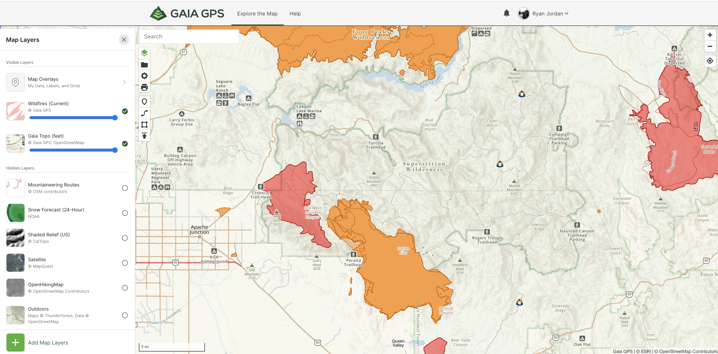
Definitely a nice graphical tool. Just saw an Arizona PBS program on forests (and campgrounds) affected by recent Arizona wildfires and regrowth is still “up in the air”. Conifers still regrow but they look physically stressed as it’s been drier – the wetter future wet seasons are, the better.
More towards summertime, but Arizona has some strong sun. Most people prefer to sit under a tree for shade (higher elevations generally) vs a bush. Maybe a good way to plan?
Rogue River. Either west from Graves Creek, out and back, or you could through hike but it would be tricky getting a car shuttle.
I do that at least once a year. Say hi if you see me. Otherwise it’s pretty lonely, maybe a few fishermen.
https://www.oregonhikers.org/field_guide/Rogue_River_Hike
The beach of the Olympic Peninsula. For example Toleak Point from Third Beach. It rains a lot but there are occasional windows of good weather.
Again, say hi if you see me, not too many other people out there. Maybe Daryl. I’ve been using that alternate trailhead. You have to get a permit on recreation.gov because of covid, otherwise you could self issue permit at trailhead in the winter.
https://www.oregonhikers.org/field_guide/Toleak_Point_Hike
Just for your information, if you get tired of the gloom and mold on the west side, and you can get over Santiam Pass, the Metolius or Deschutes Rivers can be good. Much drier. Lower elevation so usually snow free. Not really epic backpacks though. I like that eastern Oregon scenery.
Thanks for the brainstorming assist. I’m not exactly hoping to cancel my annual Christmas visit to NJ but the scenery at any of these places would sure be an improvement…
Viewing 11 posts - 1 through 11 (of 11 total)
Become a member to post in the forums.
advertisementYour privacy is protected: We do not transmit your user data to third-party ad platforms or advertisers, and we do not host third-party tracking pixels. Backpacking Light serves ads on its own custom, native, and internal platform.
 New Ultralight GearSee the latest releases in ultralight cottage-brand gear from small makers.