Starting to plan my summer. I’m thinking about the Tahoe Rim Trail, and wondering if anyone has itinerary suggestions or specific campsites not to miss. I’m hoping to do about 10-12 mile days, with a zero somewhere in there. I’ve read a few threads here at BPL and elsewhere, and looking at possibilities. I have no desire to do a guided trek. I’ll either be with a friend or two or solo, depending on how it all shakes out. I’m randomly tossing in a photo of our camp at Lake Marjorie last summer, just for fun.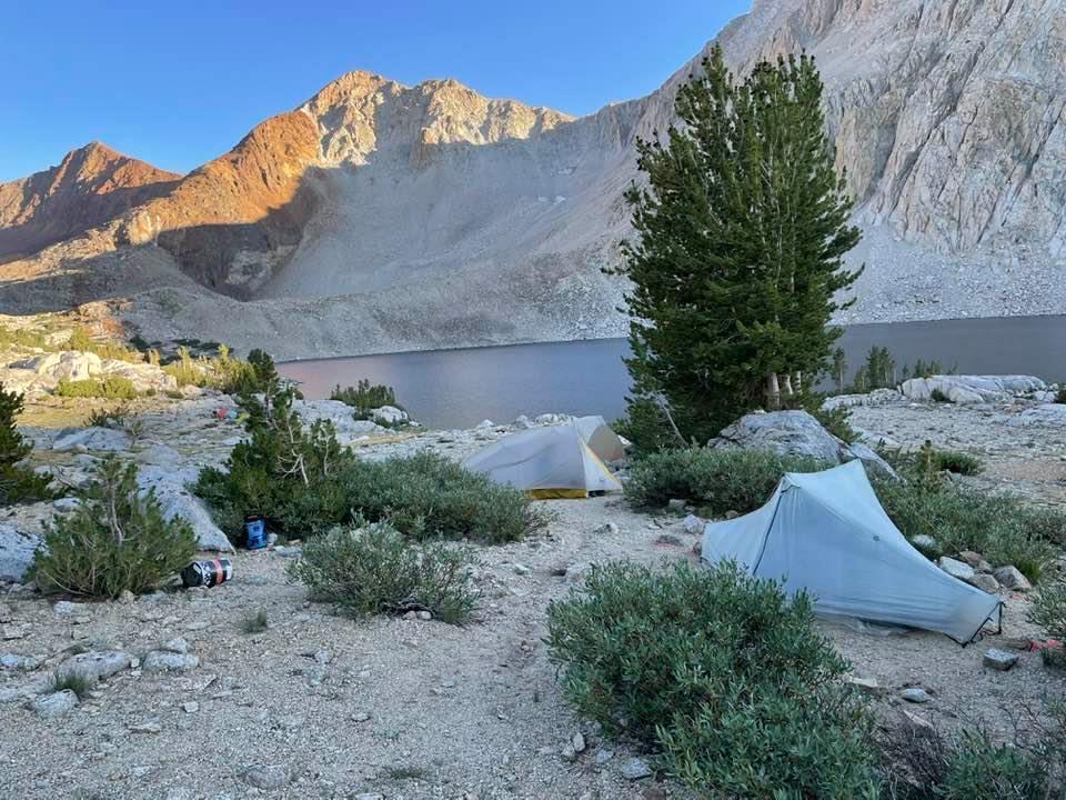
Topic
Tahoe Rim Trail – itinerary and campsite recommendations
Become a member to post in the forums.
- This topic has 10 replies, 9 voices, and was last updated 4 years ago by
 .
.
Viewing 11 posts - 1 through 11 (of 11 total)
I’ve done the TRT a couple times and spend lots of time in those mountains.
Don’t rush through Desolation as it’s the best part of the hike. The section from Echo Lake to the start of Granite Chief Wilderness is the best.
There are amazing spots on the backside (northwest) of Aloha under Mosquito Pass that are wonderful.
Half Moon Lake about 1.5 miles off the trail and under Dicks Pass and Peak is stunning.
The western side of Middle Velma is wonderful with lots of good swimming island to island.
The north side of the lake can be very dry later in the summer. I had a section of about 17 dry miles one year between Kings Beach and Mt. Rose. Plan and research well!
Karen – as a FL resident I am super envious of your upcoming trip. A couple years ago I was lucky enough to visit Yosemite, and also spent a few days around Tahoe. Gorgeous…bofuvum. If you are so inclined, let us know how the trip goes.
Adam – you are a lucky dude.
Haven’t done it, but have put in some time researching the idea and I will say that from what I have learned, think very thoroughly about water sources in the eastern half of the trail unless you are going early enough in the summer to expect plenty of snow patches.
Adam, do you recommend going clockwise or anti clockwise? I was thinking if I started at Echo Lakes and went anti clockwise that I’d be saving the best for last. Thoughts?
I agree that Desolation is prolly the best part of the TRT. That said…if you’re going solo, this is a good trail in the sense that there’s a lot of people around (not that it’s a mob by any means!) and there’s easy access to roads and a town in an emergency. I love this area in winter especially, or in Spring for an accessible pack in (Desolation from Echo.) Water issues on the East side are a real concern, and so factoring in that water weight is important. Traversing the east side with a lighter pack, food wise, is recommended.
To be honest, in summer there are many other areas that I prefer to hike, because the scenery is better. But that may be because I’ve spent so much time in winter around the lake that it’s magic is somewhat worn off.
https://backpackers-review.com/trip-reports/benson-lake-yosemite/
I’d rather hike nearby out of Bridgeport and do some variation of the above. That loop is shorter than you want but it’s possible to add on, including some very easy off trail canyons.
The Desolation Wilderness is a highlight but requires permits. I’d do that first going clockwise using South Lk Tahoe as a start and end (AMTRAK thru way bus goes there). Can hitch to Echo Lk as it’ll be thru hiker season or hit up Mountain Mellow hostel for a list of willing drivers.
Another idea from east South Lake Tahoe (again near Mountain Mellow) is take the shuttle bus between Tahoe and Gardenerville part way on Kingsbury Rd .. and start there (think it’s the Van Sickle TH). Should be other hikers too.
Just calculate your mileage with a little slack to get into the Desolation Wilderness on time, and don’t worry about food as you hike near a decent grocer at Tahoe City a bit after the Desolation. Good news is to make complete footprints you don’t have to worry about a ride to/fro Echo Lk if the roads are packed with drivers. It’s an option.
Add going past Tahoe City can get dry plus need to watch for mountain bikers potentially.
I last did that trail in late June of 2014 (photo album of trip) which was a low snow year. I think it took me 9 to 9.5 days with my biggest mileage on the east side near the end (was pretty flat). I started at the SE corner and went clockwise. The east side is definitely dry compared to the west side so less mosquitos but you need to carry more water or cache some. I never planned my campsites. I would hike until 7:30pm and start looking for something acceptable, and usually found something in 15-20 minutes. I don’t require water or scenery at my camps as I spend long breaks at such places during the day and only want to sleep.
We started at Kingsbury South to have a re-supply in Tahoe City right in the middle of our trek. We went clockwise so we could get some goodies at the Echo Lake Chalet store after the first quarter. Stashing water at Brockway summit was crucial to our success. We didn’t stash water at Hwy 50 and detoured a little to Spooner Lk for a nice swim and some water.
Howdy! I’m a local (north shore) and I’ve done the TRT 3 times. Agreeing with everyone here about water on the east side. The app formerly known as Guthook is usually frequently updated with regards to that. It’s worth it for current water availability even if you choose not to use it for other things. Campsites not to miss – well, this trail is pretty great for just hiking until you feel done and than finding a good spot off the trail. But if you want to DM me I’ll share one of my favs with ya :-)
Also, don’t know when you are coming, but we’ve had a low snow year, which means 1) you can get over the passes snow-free pretty early in the summer and 2) if you wait until late summer / early fall you are going to be in increased danger of canceling your trip because of fires or smoke. Just an FYI.
Viewing 11 posts - 1 through 11 (of 11 total)
Become a member to post in the forums.
advertisementYour privacy is protected: We do not transmit your user data to third-party ad platforms or advertisers, and we do not host third-party tracking pixels. Backpacking Light serves ads on its own custom, native, and internal platform.
 Pro-Grade Water RepellencyPolypropylene face fabrics: see the future of raingear.