Topic

Sierra High Route 2017


Forum Posting

A Membership is required to post in the forums. Login or become a member to post in the member forums!

Home Forums Campfire Member Trip Reports Sierra High Route 2017

Viewing 19 posts - 1 through 19 (of 19 total)
  • Author
    Posts
  • #3503622
    Cameron M
    BPL Member

    @cameronm-aka-backstroke

    Locale: Los Angeles

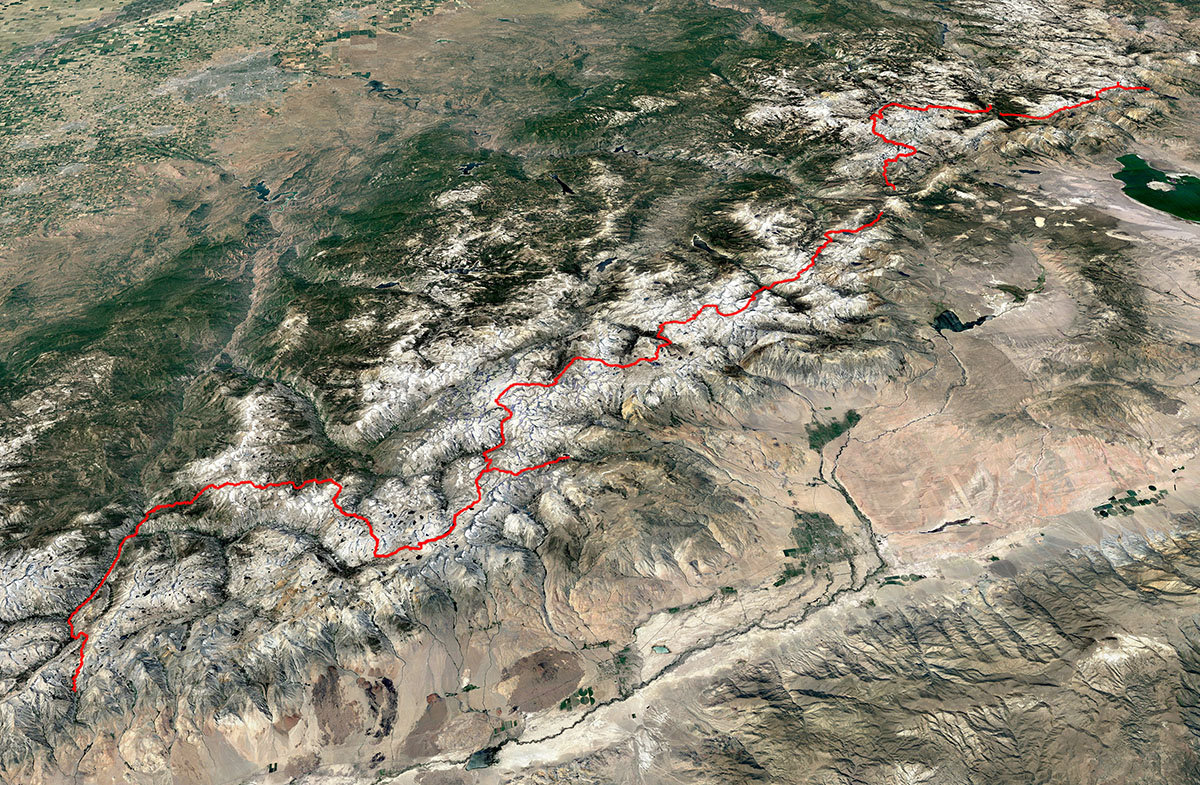
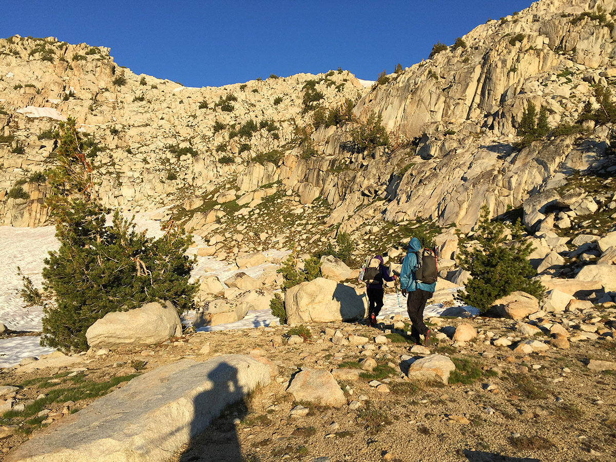
    The Sierra High Route (SHR) is a largely off-trail exploration devised by Steve Roper in the 70’s that runs down the center of the Sierra Nevada. It runs at high elevations of between 9,000 to 11,500 feet and only occasionally connects with the John Muir Trail. It is physically demanding and requires wilderness navigation skills and non-technical climbing skills. Few people attempt the route which enhances its wonderful sense of solitude. This summer I completed the route in four sections, walking a total of 20 days, 214 miles and 62,000 feet of elevation gain, including 33 high passes. Because of the massive snow this year, many decided to avoid the Sierra Nevada this year, but for me the snow was an incentive, at least for the snowy first half of the trip, as walking over snow is less onerous than negotiating the many tedious talus (rock) fields. During the course of my journey I meet only five other people walking the entire route.

    NOTE: This Trip Report is a summary of a much longer report with altogether too many photos and movies at https://www.trailnamebackstroke.com/sierra-high-route-2017/

    Section 1- July 12-15, 3 1/2 days. Twin Lakes to Tuolumne Meadows, SOBO.
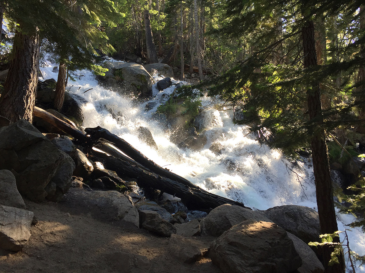
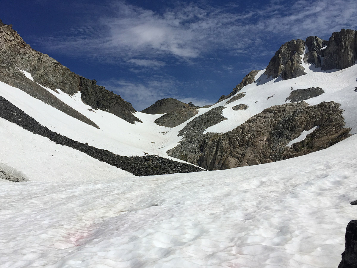
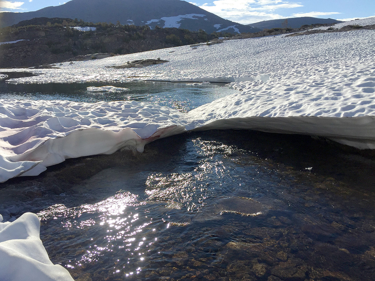
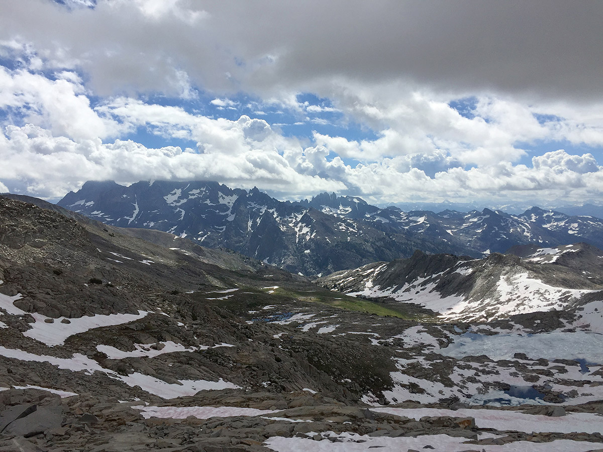
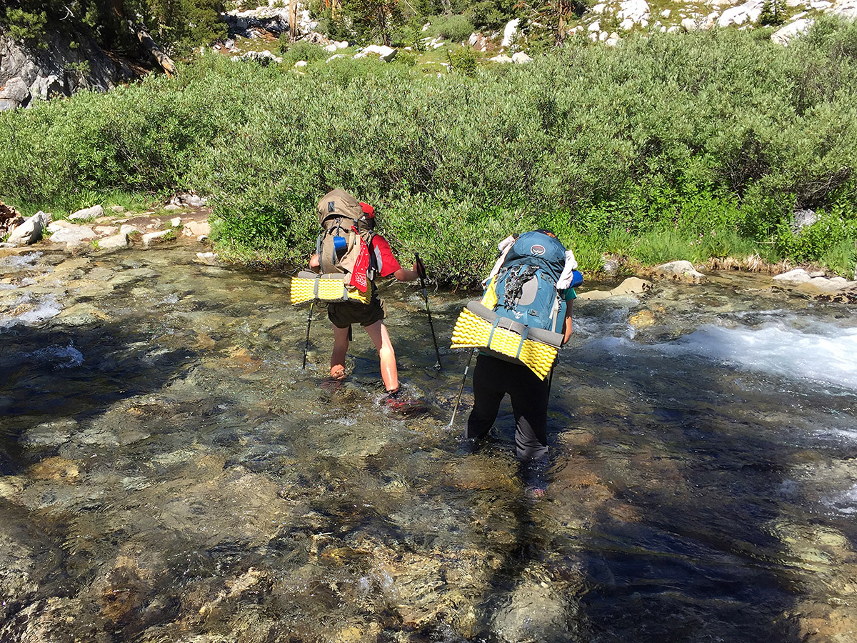
    I pick up my permit in Bridgeport to begin my hike on July 12. Most people take the route going NOBO (north-bound); I decide to go SOBO (south-bound) instead. As a first indication of the unusual snow year, the ranger tells me that she has so far issued only one similar permit this summer. As I climb the trail from Twin Lakes the water is absolutely raging down Horse Creek, hinting at the ongoing snow melt above. I bagged Matterhorn Peak (12,279 feet) on the first day which was a mistake as I was not yet acclimated to altitude nor in top hiking shape. The theme for this section was very much snow and water.

    Section 2- July 23-27, 4 1/2 days. Tuolumne Meadows to Mammoth, SOBO.
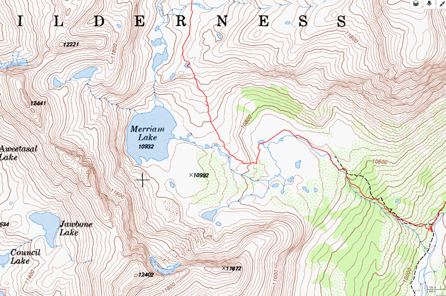
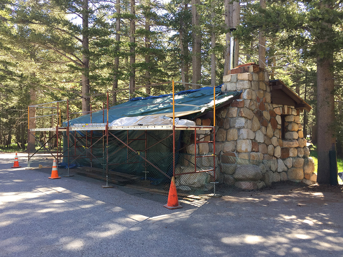
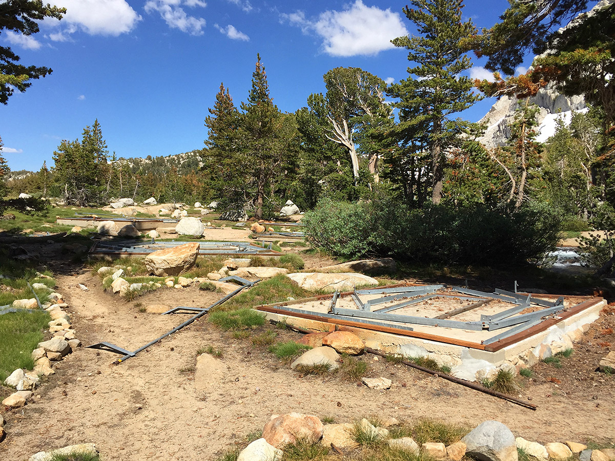
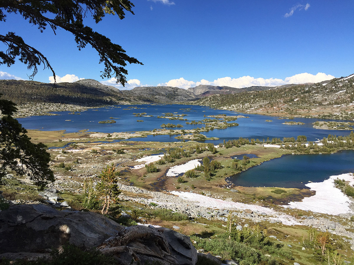
    I spend the night at the hikers hostel in Lone Pine, depart early and drive to leave my car at Mammoth, and take the 8 AM bus to Tuolumne Meadows. When I arrive I can’t believe it- the place is totally deserted, and most structures are closed and/or under repair. In some years the Tuolumne is sold out in early June and PCT hikers clog the area in front of the store. It obviously got whacked hard this year by the heavy snowfall. The permit office is open however. I go in to find three rangers staring intently at their monitors. One asks me where I want to go. When I say “High Route” it gets their attention and they all look up. One guy says “cool”. I get the usual question if I know what I am in for, and am told that I am the first person this season to ask for such a permit. Hard to believe; it just does not seem to me that the people who are qualified to hike this hike would be put off by some snow. The Vogelsang camp was not assembled this year, and Lyell Creek was a challenge to cross. Thousand Island Lake was deserted, and the trip felt a lot like a spring trip with a lot of melting snow.

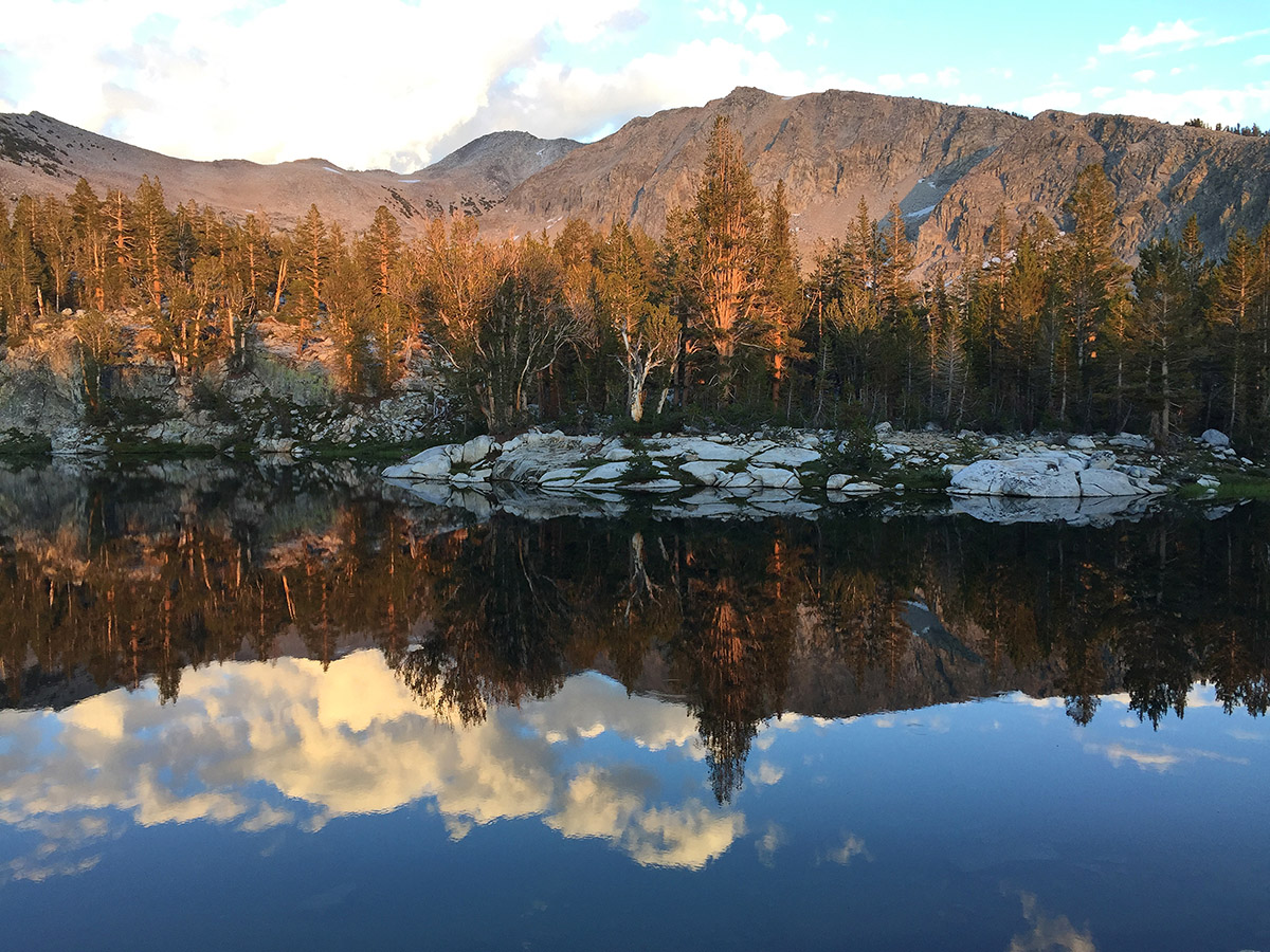
    Section 3- August 9-15, 7 days. South Lake to Tuolumne Meadows, NOBO.
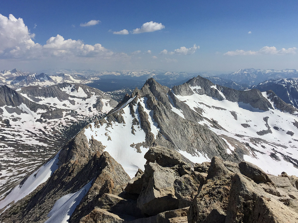
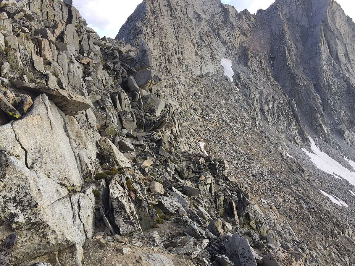
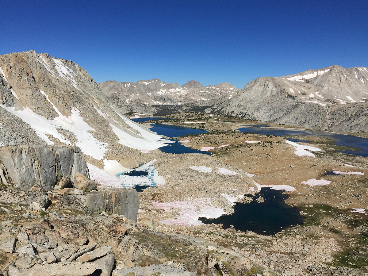
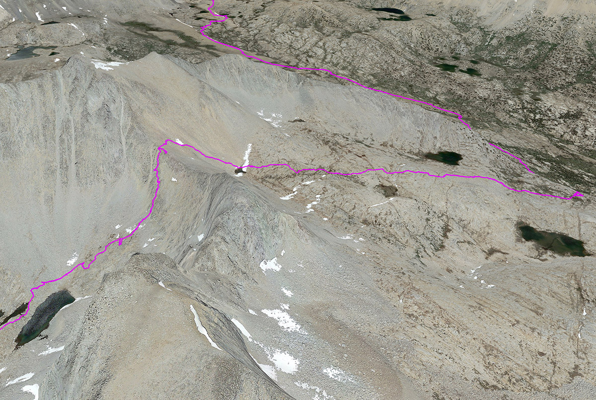
    I enter at South Lake and join the JMT for a day. Now there is less snow but the sound and presence of water are everywhere. I walk through water three times a day. After the second day I leave the JMT and encounter the notorious Snow Tongue Pass, cross Humphreys Basin, and enjoy many high alpine moments.

    Section 4- August 23-27, 4.5 days. South Lake to Roads End, SOBO, then August 28-29 to Onion Valley.
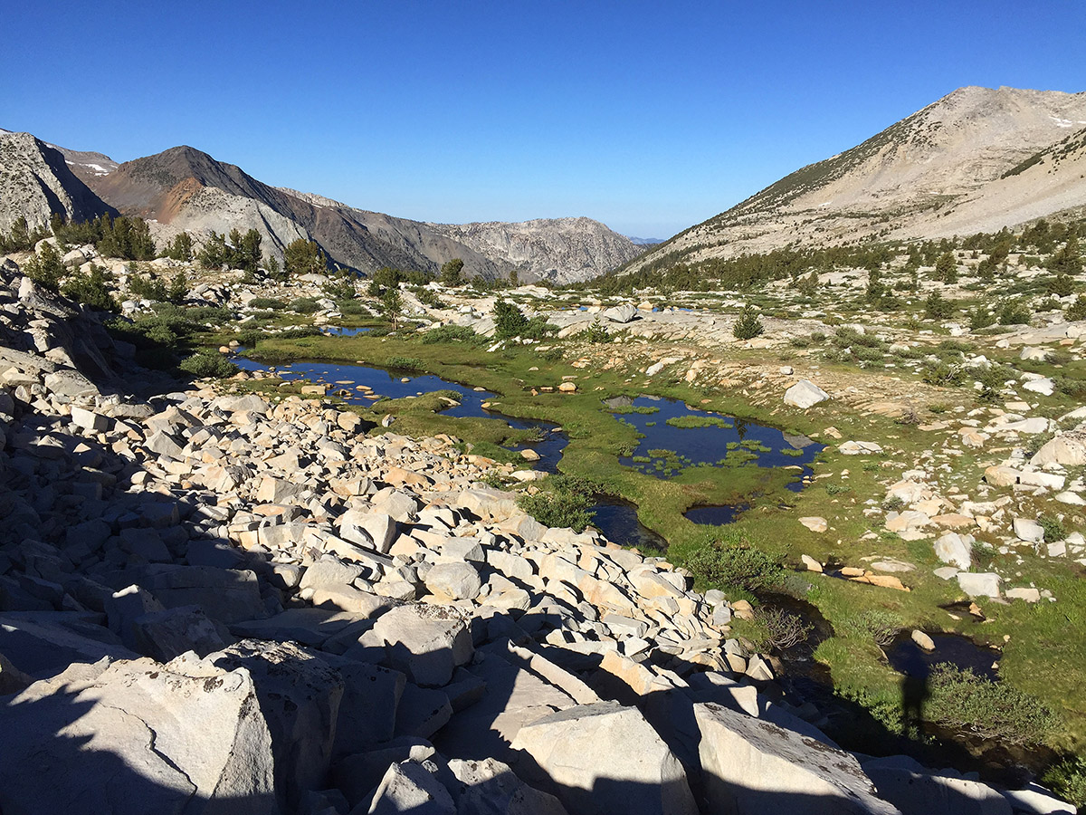
    By the fourth section everywhere is drier, so it feels more like a June trip. As the route drifts west the vegetation becomes richer. Of the many passes on this section, Vennacher was the most challenging, but not terrible. The lake Basin is amongst the nicest, most verdant stretches of the route.The stop at Roads End is a welcome respite with showers and food. I then hiked across the Sierra back to my car at Onion Valley rather than take a whole day to drive around.

    This is the most enjoyable long trip I have experienced. I am grateful that I have the health and means to undertake it.

    A note about safety: Events can turn seriously bad in the off-trail wilderness very fast. The majority of people die because of uniformed decisions. The many hazards include river crossings, bad falls and hypothermia. At a minimum, you should carry printed maps and know how to use them; have extensive knowledge of backcountry safety and best practices; and leave a trip plan with others in case you go missing. I also think that a personal locater beacon is important. Read, take classes, and take smaller experience trips first. BE SAFE !!!

    #3505022
    Alex Wallace
    BPL Member

    @feetfirst

    Locale: Sierra Nevada North

    Wonderful report, Cameron. Thank you.


    #3507402
    Matthew / BPL
    Moderator

    @matthewkphx

    Thank you for sharing this trip report. I’ve got the long version open on your site and I’m looking forward to reading it this weekend.

    #3507406
    Brad Rogers
    BPL Member

    @mocs123

    Locale: Southeast Tennessee

    Great Trip report!  Thank you for sharing!!!

    #3507436
    Erica R
    BPL Member

    @erica_rcharter-net

    Excellent Journey. Wonderful!

    #3512188
    Matthew / BPL
    Moderator

    @matthewkphx

    Wow this is a great trail report. I’m very curious where this photo is taken. You talk about French Canyon a couple of photos above it. Scenery like this gets me all hot and bothered. I hope to hike out of North Lake this summer…

    #3512409
    Cameron M
    BPL Member

    @cameronm-aka-backstroke

    Locale: Los Angeles

    Hi Matthew

    Looking at the map and chronology, I think that this must the wet area below (east) of Merriam Lake. The trail turns into a use trail somewhere beyond here. This is fairly deep in the Sierra and it would take a few days to get there, out of Pine Creek from the East or Florence Lake from the west. Or go over Piute Pass, and then go off-trail following the Roper High Route starting around Mesa Lake and down through the Puppet Lakes to get to French Canyon.

    #3512487
    Matthew / BPL
    Moderator

    @matthewkphx

    Excellent. Got it! Thank you for helping ID the area. Our plan is to hike over Piute Pass this summer and find our way through Humphreys and Puppet Pass and down French Canyon. We had planned to continue over to the JMT and complete the North Lake / South Lake Loop but your TR has us interested in the SHR. I’ve not read Ropers but it arrives on Tuesday.

    Thanks for posting this report (and the long format version on your blog).

    :)

    #3512489
    Cameron M
    BPL Member

    @cameronm-aka-backstroke

    Locale: Los Angeles

    Well you might want to have both Roper and Secor on your smartphone instead!

    I’ve been thinking about your photo request and trip. I ID’d the photo and area you like, but I would say that Merriam lake and that upper area is conceptually sort of off to one side from the action. I highly recommend going over Piute, and exploring both Humphreys and Puppet Lakes, which is a lot of territory, and skipping that trip up the hill to Merriam. It’s a very vertical trip up from French Canyon, and something of a dead-end unless you are continuing on the SHR. Just take care, Humphreys can be a wet area and you will want to time your trip before or after mosquito season.

    #3512575
    Tom K
    BPL Member

    @tom-kirchneraol-com-2

    Is the steep, rocky ramp in the picture just below your route diagram Vennacher Pass?

    #3512604
    Cameron M
    BPL Member

    @cameronm-aka-backstroke

    Locale: Los Angeles

    Hi Tom. If I understand the question correctly, yes the five photos that follow under the map/diagram are the ascent east side of Vennacher Col, one that I really enjoyed; big stable rocks; a nice meadow plateau respite in the middle; long walkable slabs. Only that last bit at the top was larger scree/talusy.

    By talusy I don’t mean the small town Talusy in Poland, 8 kilometres west of Ełk and 116 km east of the regional capital Olsztyn. Instead talus-y. You heard it here first. Or not.


    #3512621
    Tom K
    BPL Member

    @tom-kirchneraol-com-2

    You understood perfectly.  Thanks, Cameron.

    #3513440
    jscott
    BPL Member

    @book

    Locale: Northern California

    The Sierra from Bridgeport to Bishop is where I’ve done most of my hikes–but mostly on trail! Still, I can recognize a lot of areas that you show. Which just makes scrolling through your long report that much better! Thanks for this; and yes I’ve done enough off trail to understand that it’s a different beast altogether. Kudos.

    #3513447
    Cameron M
    BPL Member

    @cameronm-aka-backstroke

    Locale: Los Angeles

    Thanks for the comment Jeffrey. I have found that the combination of off-trail travel and peak-bagging has given me a very different understanding of areas I thought I knew well, and of terrain in general. The HSR drops in and out, crosses and runs parallel to the JMT, and the peaks give the meta view.

    #3513451
    Tom K
    BPL Member

    @tom-kirchneraol-com-2

    “yes the five photos that follow under the map/diagram are the ascent east side of Vennacher Col, one that I really enjoyed; big stable rocks; a nice meadow plateau respite in the middle; long walkable slabs. Only that last bit at the top was larger scree/talusy.”

    Oops, I missed the east part.  What was the west side like?

    #3513468
    Cameron M
    BPL Member

    @cameronm-aka-backstroke

    Locale: Los Angeles

    Oops, I missed the east part.  What was the west side like?

    The west side is steep Class 3 at the top, perhaps 40 feet of it, and then less steep, easier Class 3 for a bit, but all stable. From the info I can find online it appears to be the most difficult of the three passes in the area. I gather that the main concerns about nearby Frozen lake Pass are late season snow, and then the vertical scree. I actually prefer stable Class 3 to very vertical Class 2 scree.

    #3513476
    Tom K
    BPL Member

    @tom-kirchneraol-com-2

    Thanks , Cameron.  That has been my impression as well.  Cartridge Pass is steep, but all trail;  Frozen Lake Pass was really steep scree when we went over it in August, 2012, but we avoided most of it by staying on talus to the right all the way up, and most of the way down into Lake Basin.  That made it a much easier passage.  Dumbbell Lakes Pass has a lot of unpleasant talus on the north side, which there is no avoiding, but the Lake Basin side is an easy stroll down.  I haven’t been in over Red, White, and Gray Passes, but they sound pretty straightforward.

    #3513486
    Cameron M
    BPL Member

    @cameronm-aka-backstroke

    Locale: Los Angeles

    Tom, I attach a picture of Cartridge Pass, taken from the north looking south. One can see a few ways up, and yes it looks steep. Red, White and Gray are straightforward and easy. I am looking at doing a customized version of Skurka’s Kings Canyon High Basin Route next summer and I might route through Dumbbell and Cartridge Passes next year, I can’t wait.

    #3513521
    Tom K
    BPL Member

    @tom-kirchneraol-com-2

    “One can see a few ways up, and yes it looks steep.”

    Just east of the last lake in the basin at the SE corner, there is a very clear, steep trail that leads up to the pass.  There is also a faint boot track that skirts the lakes leading up to that trail.  It’s the remnant of the original JMT.

Viewing 19 posts - 1 through 19 (of 19 total)
  • You must be logged in to reply to this topic.
Forum Posting

A Membership is required to post in the forums. Login or become a member to post in the member forums!

Get the Newsletter

Get our free Handbook and Receive our weekly newsletter to see what's new at Backpacking Light!

Gear Research & Discovery Tools


Loading...