


This is happening about an hour down the road from me.
Topic
Become a member to post in the forums.
 .
.
This is happening about an hour down the road from me.
I found a safe spot off of Highway 97 to take pictures of it. I’m trying to get down there once per week until it finally goes. Last report I read suggested that they weren’t too worried about it damming the Yakima River, but we’ll see.
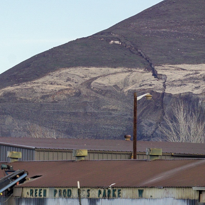

Just a BIG example of the opening lecture in Intro to Geology back at college, “Geology is basically simple if you remember that erosion always wins”. Weak rock to begin with; but did the quarry undercut the rock or does the quarry just happen to sit at the toe of the movement with 4 million cubic yards headed its way?
Either way Ian, just stay clear until the dust settles.
To look at it, it’s hard to believe the quarry didn’t cause this, or at least speed up the process.
My red mark here may not be super precise, and is from memory, but it definitely is connected with the quarry 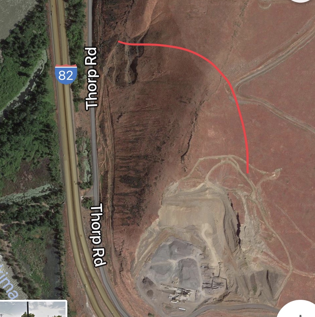
The interstate is still open but I give it a wide berth. It’s pretty easy to on Highway 97 or 24.
My lens was 350mm equivalent and I still cropped in a fair amount
Are they mining sand there? It’s hard to tell but I don’t see rock. If it’s sand then the area would be unstable to begin with.
I’m not sure Kat. I drive past it 100+ times per year but never really paid any attention to it until now.
Looks like sand to me. A long time ago I spent a few months working in a mariposite quarry ( blasting dynamite and all) and recently I have spent time at a limestone quarry. Anyway…I am no geologist but what little I know and generically speaking areas that can be mined for sand are very unstable. I have seen some massive slides after the fact . Being able to watch the progress like you might be able to do is fascinating, and scary.
Great picture btw.
It really is fascinating to me. I’ve always wanted to chase and watch avalanches from a safe distance, but to do so is a considerable drive and a lot of waiting with no guarantee of success.
I don’t think there’s a very good chance of witnessing the landslide when it happens but it’s been wild to watch this happen in slow motion.
Thanks for the picture compliment.
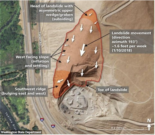
Removing a buttress that was supporting “… planes of weakness inside the mountain. In the case of Rattlesnake Ridge silty layers located between thick layers of fractured basalt, a volcanic rock … the Rattlesnake Ridge landslide appears to be moving 1.6 feet per week …”
What Could Go Wrong?

C’mon Ian, if it’s still there on Saturday, I’ll meet you there, and we can jump up and down on it for a bit to see if we can move it….
Thanks for adding the image Greg.
Doug, I’ll pass.
Here’s another one that shows the proximity of the Yakima River to the future landslide
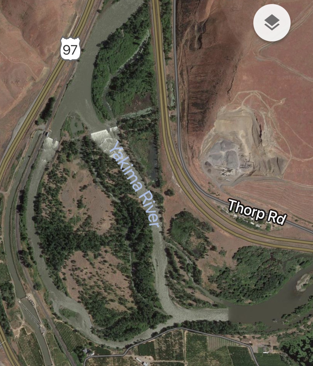
It looks sort of like there was a landslide previously that rerouted the river? and then the river eventually moved back?
is that a quarry? so they removed material that was buttressing the hill, now removed, so it’s sliding?
they keep talking about it on Portland news. There were a bunch of people that were living below it. It was cheap land close to freeway. Now evacuated.
Become a member to post in the forums.
 Tactical Wool Thermo ShirtSuperfine merino wool-blend mesh baselayer with a slim unisex fit and densely knitted shoulder panels for pack-carrying comfort. Weighs 4.9oz | 140g
 © Beartooth Media Group Inc.
 Loading...