Due to a West Coast business trip in April, 2016, I had the good fortune to solo backpack for 3 days at relatively low altitudes in Sequoia National Park on the High Sierra Trail and a few offshoots. Prior to this hike, several of you in the BPL Community thankfully and properly warned me about the snow dangers at elevation and recommended that I return during the summer months. Good advice indeed!
After contacting the ranger station and talking to some really nice folks (Bill and Anna Lisa), they helped me map out a loop-hike that began at the Roads End Ranger Station, taking the Copper Creek Trail and going clockwise, exiting through the Bubb’s Creek Trial. Then, low and behold, I get a recommendation from Amy Lauterbach, recommending the “Big SEKI Loop as an alternative to the JMT”. My ranger friends were happy to accommodate a permit for two, and I and a buddy hiked up Copper Creek and back out through Colby Pass, for a 10-day, 135 mile trek, August 18-27.
Tuesday, August 16: Both of us flew to Fresno, Ca, and reveled a bit at the Buffalo Wild Wings that evening. We completely ignored the advice of Eric Chan for altitude preparation but we felt the need to get our pre-hike grease on!
Wednesday, August 17: We picked up fuel, better maps, and a few other necessities at the REI in Fresno. This is one of the larger stores and we really lacked for nothing. We then drove to Road’s End Ranger Station to pick up our permits so we could get an early start the next day. According to the website, the station closed at 3 pm, and we had plenty of time, except the park service is removing dead beetle -infested trees along the road, so we were delayed about 30 minutes. We reached the permitting office 2:52 pm, and the ranger actually slammed the window in my face. Talk about PO’ed! Fortunately the office was open until 3:30pm and the ranger was simply taking a break. We got our permits.
What Amy and the rest said about getting an early start up Copper Creek is correct. The temperature that afternoon must have been around 90 degrees…..Don’t want to hike in that! Of note: There is a lodge, small store and a grill at Cedar Grove, about 5 miles before Road’s End. They do a competent burger and sell more beer than milk.
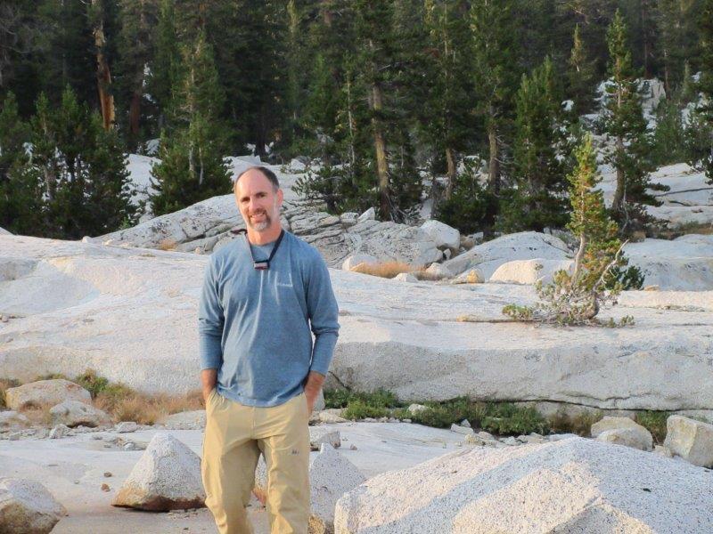
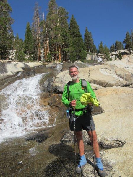
Thursday, August 18: I messed up with my watch and given that I’m already programmed for Eastern Time, got up about 4 am. We were on the trail before the sun came up. I had already told myself that the initial entry and accent was going to be tough but we got through it unscathed and on top of the 10K elevation before 11 am. We made our way to Granite Lake, meeting two additional backpackers coming down, and a 3-person horse team coming down. Granite Lake is basically dried up with a small pond and a good stream/water source. A very good first day. And that was it for other people for 2.5 days.
Granite “Lake”:

Friday, August 18: Up and down very pretty mountains, never much above 10K feet, and down again via the Simpson Meadow Trail to Simpson Meadows. My friend Jason experienced a light ankle sprain but we kept moving and through drugs and motion he worked it out. There was an overused campsite at the trail intersection, so we opted to continue for another mile or two and were able to find a splendid and little used campsite along the river. Good for washing and sitting around. During the entire day we didn’t encounter a single person.
Trail descending down to Simpson Meadows:

Jason Day 2:
Russ at campsite on the Middle Fork Kings River:

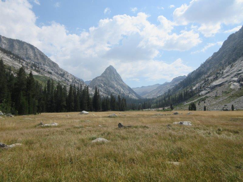
Saturday, August 19: Moving north up a beautiful gorge and river, lots of up and down, mostly up. The gorge was beautiful and we thoroughly enjoyed the view. It was like a river gorge on steroids and proved to be one of the scenic highlights of the trip. We continued until we reached the JMT, and what do you know, we began seeing lots of people. In an attempt to keep our mileage on track, we decided to head for Palisades Lakes. Going up the pass was difficult because of the acclimation and end-of-day miles, but the lakes and views were spectacular. We was whipped by end of day!
Middle Fork Kings River, a gorge on steroids:

Palisade Lakes; our first 11K pass at the end of the day….we was whipped!:
Sunday, August 20: Up and over Mather Pass (we decided that maybe these folks did something wrong and they named passes after them for punishment). Beautiful mountains, scenery, chipmunks, deer, marmots. Our trail legs were coming in strong and we made it to Lake Marjorie….just in time for pitching the tent and jumping in as it started steadily raining for most of the night. The TT SS2 fly performed flawlessly. We didn’t prepare a hot dinner.
Lake Marjorie on Monday Morning:

Monday, August 21: Here’s where it gets weird. The rain is gone, the sun it up, the birds are chirping. We’re camped on a beautiful lake, surrounded by beautiful mountains. I’m just about expecting Julie Andrews to belt out “The Hills Are Alive”, and from above the lake north of us, we hear, and I quote, “F*** you B****!!”. “I’m going to F*** you up!!” “I hate your F***ing guts!” “I’m going to smash your F***ing Face in!!”. “Kiss my A** B****!!”. A male and female were in concert, giving and getting, lots of screaming at the top of their lungs, echoing across several square miles, and variations and combinations of the same words over and over, plus just plain primal screaming. Imagine the echo and reverberation. I kid you not. This went on for about 30 minutes as we ate cereal and sipped coffee. Murder on the JMT? Will there be blood? We don’t know for sure, but about 45 minutes later a younger couple that didn’t look happy, passed our camp, followed by an older and much more cheerful couple. We didn’t find blood or body parts but if by chance someone is missing in the general area about this time frame, give me a call. Just saying.
From there, up and over Pinchot Pass, and on to Rae Lakes, and it began raining in the afternoon. With the rain jacket and Chrome Dome, I felt like a duck outside playing. The umbrella seemed to be an oddity and I got a lot of comments. Glad to provide humor, but let me tell you…it continues to be my favorite piece of rain gear.
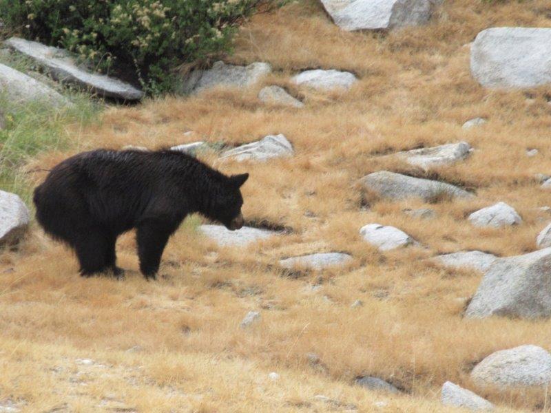
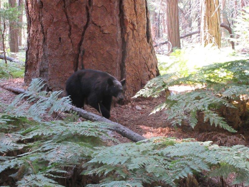
Buddy Bear at Rae Lakes – I barely missed the shot but the shutter noise scared the poor boy, and I can undoubtedly confirm that a bear does in fact S*** in the woods. Projectile!
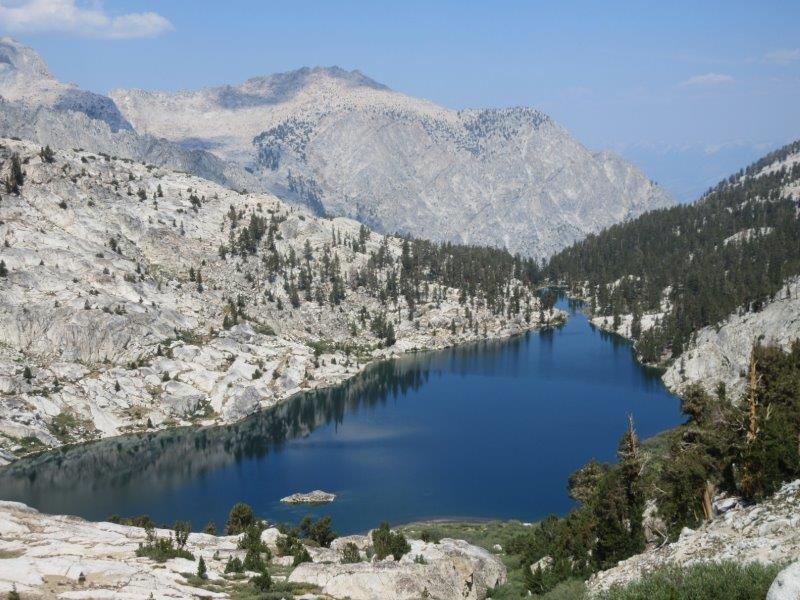
Rae Lakes, or is this “Fantasy Island”? This is where I want to be:
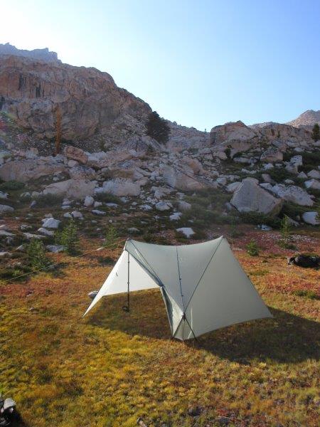
Tuesday, August 22: Rae Lakes – Over Glen Pass, and we camped before major ascent to Forrester Pass. There were some campsites available that were already crowded, not very pretty. We continued about another ½ mile and camped in a meadow beside Bubb’s creek….awesome decision. Interesting that rain kept threatening, but the mountain passes continued to block the clouds. Cold evening, about 30 degrees, frost on tent and major condensation inside….I just don’t have this Western thing figured out yet. Easy dry out though.
TT SS2 Fly below Forester Pass and campsite in meadow before Forester Pass:


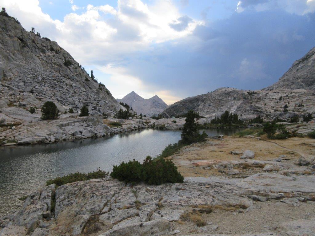
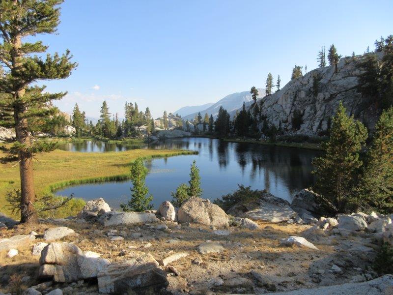
Wednesday, August 23: Over Forrester Pass (about 15 or so people on top). Again, top of the world, 360 degree views, cloudless skies. Beautiful. Once down the other side it seemed like we were hiking in the desert for 5 or 6 miles. Anxious to be shed of so many folks on the JMT, we departed right on a series of trails leading to the Colby Pass Trail. At a trail junction, there was an idyllic lake where we skipped pitching the tent fly and simply slept under the stars. Great viewing.
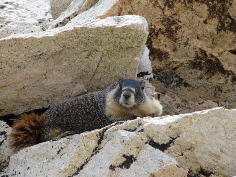
My Buddy the Marmot…Cute and cuddly…I’ll bet he would gnaw off a finger if given the opportunity!:
Russ and Jason on Forester Pass:

Beautiful lake about 4 miles on side trail off the JMT – We had it all to ourselves:
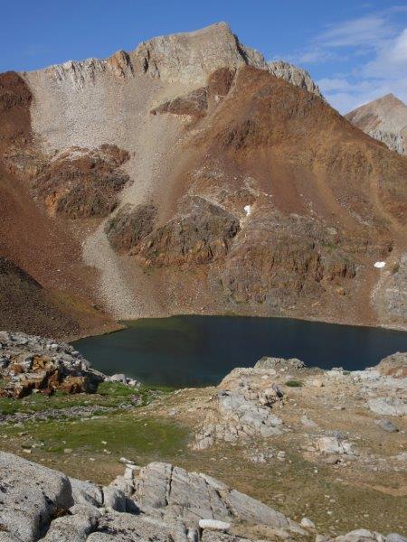
Thursday, August 24: It was pretty obvious that the trails in this area were almost primitive and not anywhere near the maintained quality of the JMT. That said, they were very rugged, remote, and the scenery was still very pretty. Best of all, we encountered exactly 1 person in the 3 days when we detoured from the JMT. We climbed and scrambled up a canyon for 6 or 7 miles; I guess we’ll never know exactly because the signs, maps, common sense and mileage did not add up or sync. We thought we were going to camp by Gallot’s Lake, but either we missed it or it’s dried up, so we hiked past something called “Big Wet Meadows” to the meadow right before Colby Pass where we pitched our tent. Once again, beautiful, breathtaking views:
Big Wet Meadow:
Meadow right before Colby Pass:
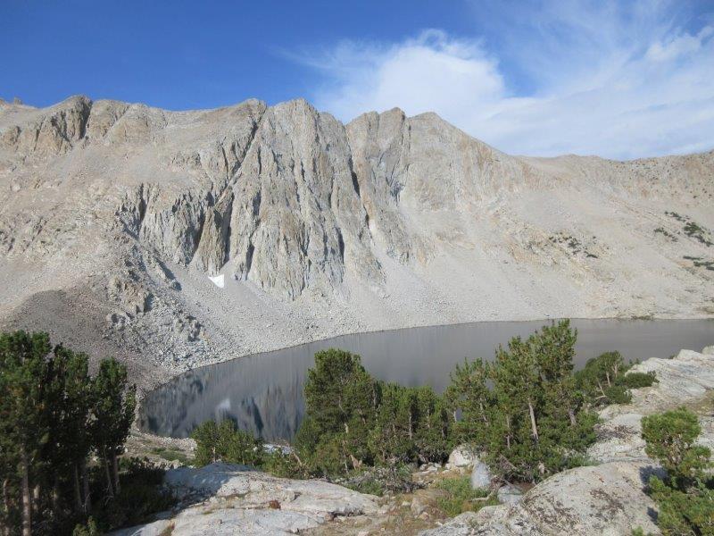
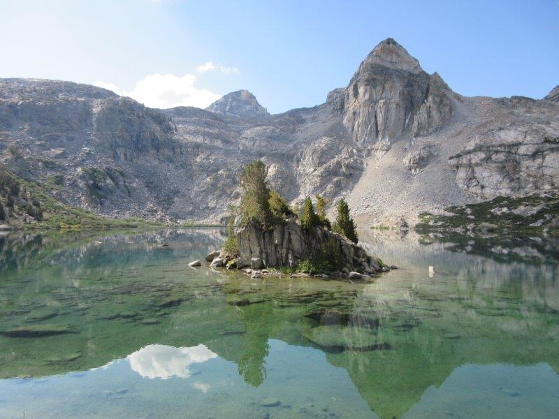
Friday, August 25: We climbed over Colby Pass and had it all to ourselves. At the bottom of the pass was the beautiful Colby Lake, which we agreed was single prettiest lake and environment that either one of us had ever seen….and we had it all to ourselves. After the lake, the trail was largely unspectacular and downhill. The mileage signs and map mileage were not in sync and completely off. We camped in kind of a burn area about 2 miles past the Roaring River Ranger Station. Not an ideal campsite, but it was getting late, dark, and we had water.
The most beautiful Colby Lake:
Saturday, August 26: Up and over Avalanche Pass, and then a major descent of roughly 5,000 feet. Some of the most spectacular trail engineering I have ever seen. All in all, just beautiful mountains and streams. About 2 miles from the trailhead on the Bubb’s Creek Trail, we entered what I like to call, “The Flip-Flop Zone”. Here is where you see the day hikers dressed like flannel-covered lumberjacks in the 85 degree heat. Here is where you smell 10,000 varieties of perfume instead of your own hiker funk. And here is where we ran into bear number 2….a curious fellow and we got some pictures. Shortly after, we passed an Asian couple and Jason told them about the bear. The girl’s eyes were as big as saucers and exclaimed, “What did you do?”. We told her we backed up and gave him the right of way. We now wish we had said, “We took his picture….and then we ATE HIM!!!”. All in good humor of course.
Buddy the Bear 2 – I really wouldn’t eat you…promise! Look at that tree!:
Russ and Jason after 10 days and 135 miles. Look out Fresno and Buffalo Wild Wings!!:

After we popped out, we headed back to Cedar Grove for more burgers, and then back to Fresno for showers and a planned terrorizing of Buffalo Wild Wings…I guess it didn’t make the news but it was not for a lack of trying.
Of Note:
Lightweight Backpacking – I had a preconceived notion that everyone on the west coast practiced light or ultra-light weight backpacking. Comparative viewing on the JMT suggested that I had one of, if not the lightest pack, even with a 10-day supply of food. My base weight was 17 lbs. with bear can, Delorme, Battery, Camera. Food weight was about 15 lbs. I kept checking my pack after day 6 to make sure I wasn’t forgetting something. I was greatly surprised in a good way.
My friend is really not a backpacker and relied on me for planning and equipment guidance. After the experience, I asked him if there was anything he felt like we were missing, or something that caused us suffering by going without or lightweight. We could think of nothing. BPL is the way to go!
We met a guy with a Seek Outside Pack, maybe 6,000 CI, and he seemed extremely proud that he could haul 70 pounds with no problem. Included was something that looked like a small fire extinguisher, but it was simply a huge fuel container. I tried on the pack out of curiosity but I concluded that those heavy hauling days are over forever. Good grief!
Desert – My preconception of the Sierra Nevada mountains looks like the label on a bottle of a Sierra Nevada Pale Ale. I was surprised that many of the areas we crossed through more resembled desert, which was not bad, just a bit unexpected. Speaking of which, a Sierra Nevada Pale Ale in the desert would have been really great!
Cooking: I used the Zelph cooking combo including the Toaks 550 ML pot, Ti Caldera Cone, BGET for Esbit, all for about 4.5 ounces. I was able to achieve 2 cups boil for freezer bag dinner, and have relatively warm coffee in the morning for 10 days, using a total of 12 tabs of the 14 gram Esbit over 10 days. Jason used a BRS 3000 and two 110 gram canisters of fuel. Both systems worked flawlessly, with the weight winner going to Esbit, and the convenience factor going to the BRS. I remain convinced it’s good to play around with different things and be comfortable with multiple options.
Tent – We used the fly from my TarpTent SS2 (27 ounces) instead of a pure tarp. I’m sure both would have worked but the fly provided more security in a storm situation. I do have a newly purchased Borah Gear 8 x 10 tarp but I didn’t think my skill set was quite ready yet, so maybe next year.
Rain Gear – We both used Frogg Toggs, Chrome Dome Umbrellas, no pants. We had one day of rain on the JMT and the system worked perfectly. I saw a lot of umbrella envy!
Temperature – The morning below Colby Pass, our water bottles had plenty of slush in them, suggesting that at 11k feet, the temps were around 25 degrees. Upper elevations 65-70 degrees but felt hotter due to the sun, or colder because of wind and sweat. Some of the lower elevations with sun felt like 85 degrees. Not sure. I had a Borah puffy sweater and puffy pants, EE Hoodlum and Booties. I almost left all of this at home but I’m glad I didn’t. Cozy the whole trip.
Sun – I used an OR long-sleeved top (about 4 ounces), Nike running shorts, and an OR Sun hat of some sort. No sunscreen. My biggest regret was that I didn’t protect the tops of my hands and they were relatively fried by the end of the trip.
Naproxin, Tylenol – Don’t ever leave home for a trip like this without plenty. Saved my friend’s ankle.
Energy Bars – I will never, ever take another on a backpacking trip. They always come back as the least favorite thing in my food bag.
Bear Canister – Each of us had a BV500 to manage a 7-day supply of food once we hit the JMT. The lid became ornery when the temperature dropped and we had to use rocks or sticks to make it work. I sure hope on my next return that the Ursack is ultimately approved. The BV is 2.5 lbs. I’ll never get back. Yuck!
Shoes/Boots – I used Selewa Firetail MS 3 Approach shoes. I had never used low-cut shoes before and for 135 miles my feet have never been more comfortable, ever. Roger Caffin was right that if you beat your feet up before the trip and make sure your hiking footware remains comfortable for all other purposes during the trip, that is the way to go. I don’t know if I have his troll feet, but I think I came close! My buddy used La Sportiva Core High GTX and experienced blisters and his boots were falling apart by the end of the hike. For what he paid I’m surprised. I intend to continue pursuing lighter shoes as long as I can maintain the comfort. I also used Dirty Girl Gaiters – They look silly but work fantastically.
Solitude – Hiking from Road’s End up the Copper Creek Trail, we saw about 4 people on day one, and on day two, nobody. Once on the PCT/JMT, we encountered maybe 175+. Once we diverged from the PCT on the Colby Creek option, we saw exactly one person until about 2 miles from Roads End. Amy Lauterbach is 100000% right about this trip.
The non-PCT/JMT trails were much less maintained, but every bit as spectacular. Our favorite landmark for the entire 10 days was Colby Lake. It was absolutely stunning and we had it all to ourselves.
Talking to a few folks, somewhere between the Colby Pass Trail and the JMT, there are plenty of off-trail opportunities similar to the Wind Rivers….. the mind boggles.
Food – We both used prepackaged food because we’re lazy. Highlights for me were the brand “Good To Go”, and I had Thai Curry, Pad Thai, and Indian Korma. They take a bit longer to dehydrate than Mountain House but were extremely tasty and generously filling for one person. I also experimented with something called “Moon Cheese” which was dehydrated cheddar and pepper jack cheese. It was great with lots of calories per ounce. My friend brought some Buffalo Chicken Jerky that he purchased at Kroger that was simply outstanding. He wound up giving it to me and I didn’t get sick or die….really good stuff.
Water – We used my Steri-Pen Ultra, recharged a total of 3 times, and it worked flawlessly. After all of the pumping, squeezing, gravity filters, etc., I have a new favorite.
Packs – Both of us used Elemental Horizons Aquilo packs, which handled the bear cans and the 32 lb. starting weights with no problems. Of note, I had been training with my pack and it was dirty and salty, so I contacted the owner, Matthew Lagas-Rivera, about cleaning the pack. Using a sports wash and gentle cycle on a front-load machine, the cleaning magically reduced the weight of the pack by about 3 ounces. Who knew?
Food & Lodging – is a store/lodge (Cedar Grove Village) about 5 miles before Roads End that has just about anything you want from a food and beverage standpoint. In the word of the cashier, they have more beer than milk. The hamburgers we had the night before departure were very good. The hamburgers we had on day 10 when we came out were the best hamburgers I’ve ever eaten. Not sure what the difference was.
Eastern Notches vs. Western Passes – Interesting dichotomy of terms.
Elevation Gains – Eastern elevation gains tend to be 1,000 to 2,000 total, and older trails may gain 1,500 or more per mile in some locations. These trails were extremely well switch-backed with well-planned grades, however, the climbs and descents continued for miles and miles….never-ending.
Thanks for the recommendation Amy. I had a blast and look forward to returning.

