Topic
Memorable Memorial Day Weekend in Desolation Wilderness
Forum Posting
A Membership is required to post in the forums. Login or become a member to post in the member forums!
Home › Forums › Campfire › Member Trip Reports › Memorable Memorial Day Weekend in Desolation Wilderness
- This topic has 5 replies, 5 voices, and was last updated 3 years, 11 months ago by
 Alex Wallace.
-
AuthorPosts
-
May 26, 2020 at 10:30 pm #3649458
COVID-19 has made backpacking in our area impossible for quite some time as our county’s health order restricted travel for recreation at first to 5 miles and then to 10 miles distance from our residences. A day after that 10 mile radius was lifted on May 15, El Dorado National Forest made camping permits for Desolation Wilderness available again – starting on May 22.
You can bet that my girlfriend Gela and I were out there right on Friday May 22. The following 20 pictures can give you only a small glimpse into our fantastic experience in Desolation Wilderness, but be assured it was blissful!
Before we started our loop at the Glen Alpine Trailhead, we first went up Mt. Tallac with our day-packs to enjoy the fantastic view of Mt. Tallac and Fallen Leaf Lake.

We had the top of Mt. Tallac all to ourselves and wondered all weekend where all the other people are.
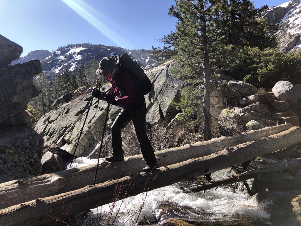
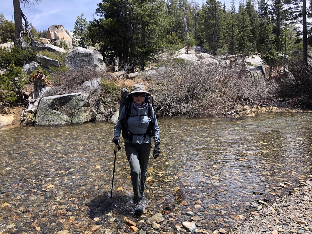
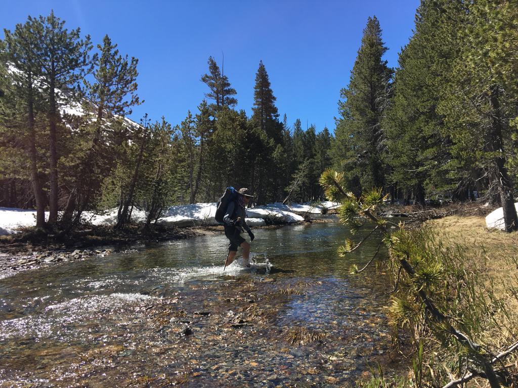
Once back at the car we donned our ‘real’ backpacks and went across Glen Alpine Creek
to Grass Lake for the first night.
Crossing back across Glen Alpine Creek the next morning
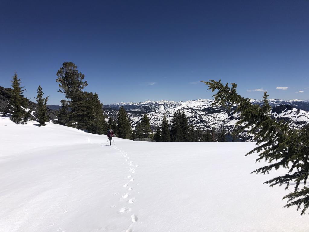
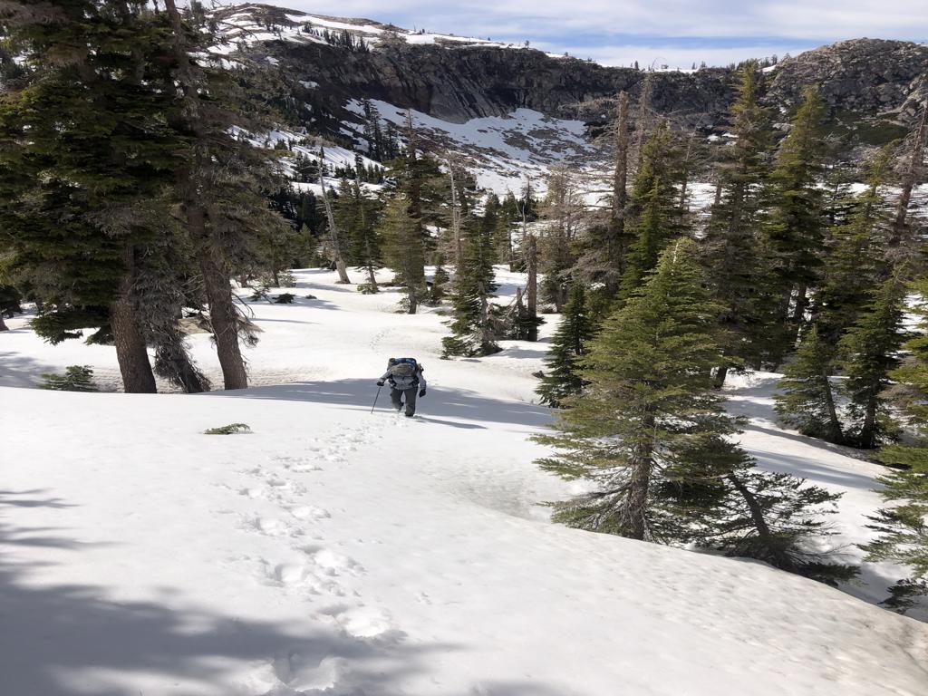
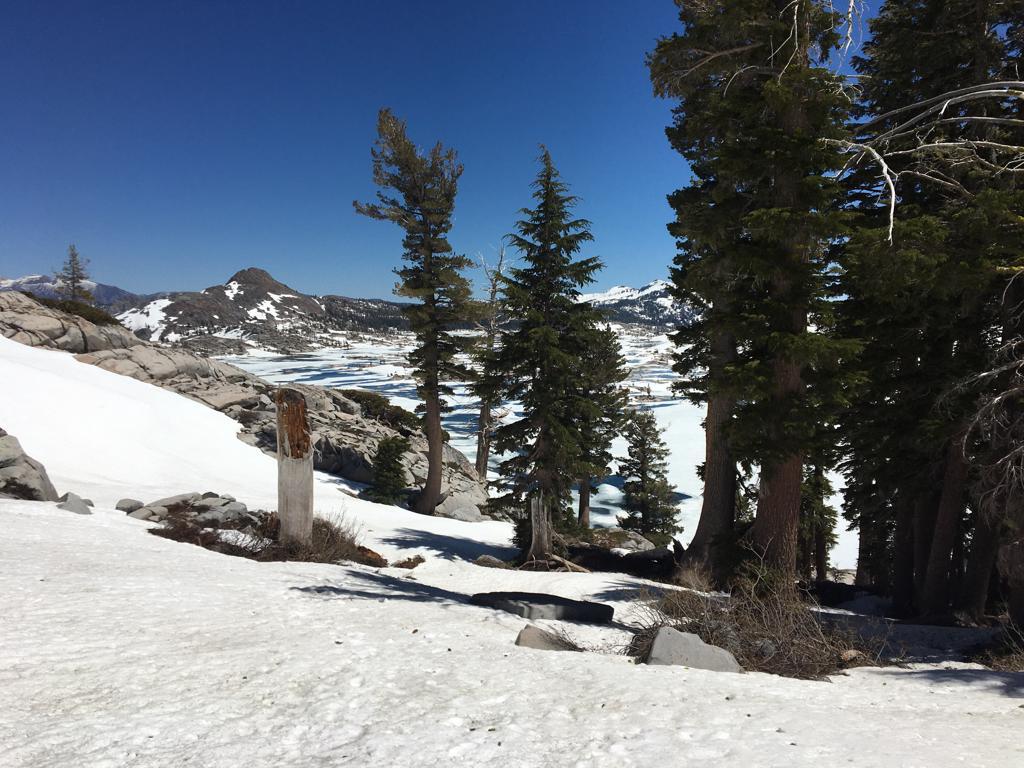
we made it to Gilmore Lake and started to trek through the snow
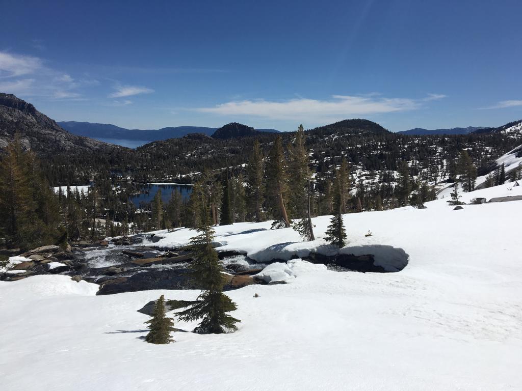
up to Dicks Pass while constantly enjoying wonderful views of the Sierra. Do you notice how many footprint there are in the photo? We basically had the whole place to ourselves.
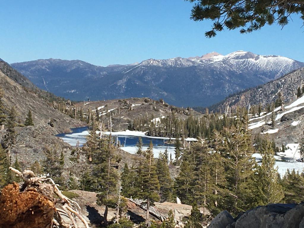
Once on top of Dicks Pass we found a snow-free spot for the night with excellent views of of frozen Dicks Lake and Fontanellis Laks on one side
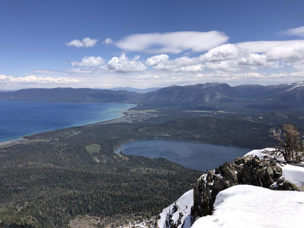
and views of Velma Lakes and Lake Tahoe on the other side
When going down to Velma Lakes the next morning we could see Emerald Bay in the distance.
After making it through the snow all the way down to Camper Flat we enjoyed a little rest and took off our shows and socks to dry them a littlebefore crossing the Rubicon River again :)
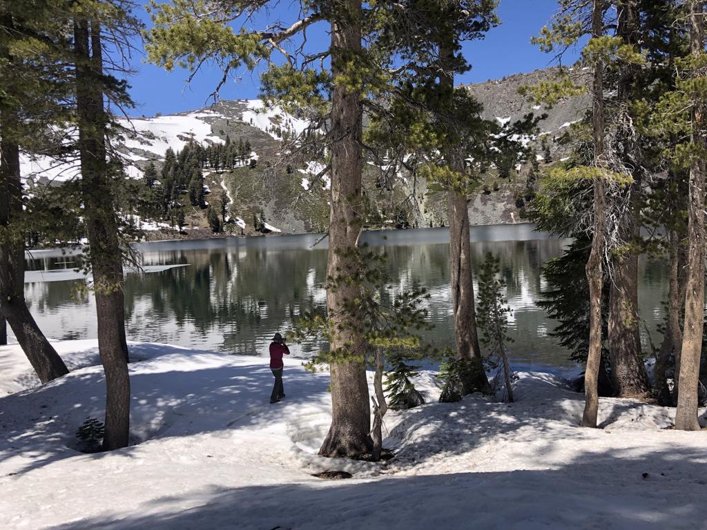
Going back up into the snow we made it first to Lake Schmidell
before our final push up
to Lake Lois where we camped on Sunday.
On Memorial Day we crossed the Rubicon River once again near China Flat
and were now committed (Remember Julius Caesar saying ‘Alea iacta est! when he crossed the Rubicon’?) to make it with no visible trail over Mosquito Pass to enjoy the view of Lake Aloha
From there it was a short stretch past Heather Lake
to Susie Lake. Once at our wonderful campsite we realized that we had all of Susie Lake to ourselves – on Memorial Day – and felt very grateful for this weekend and this trek.
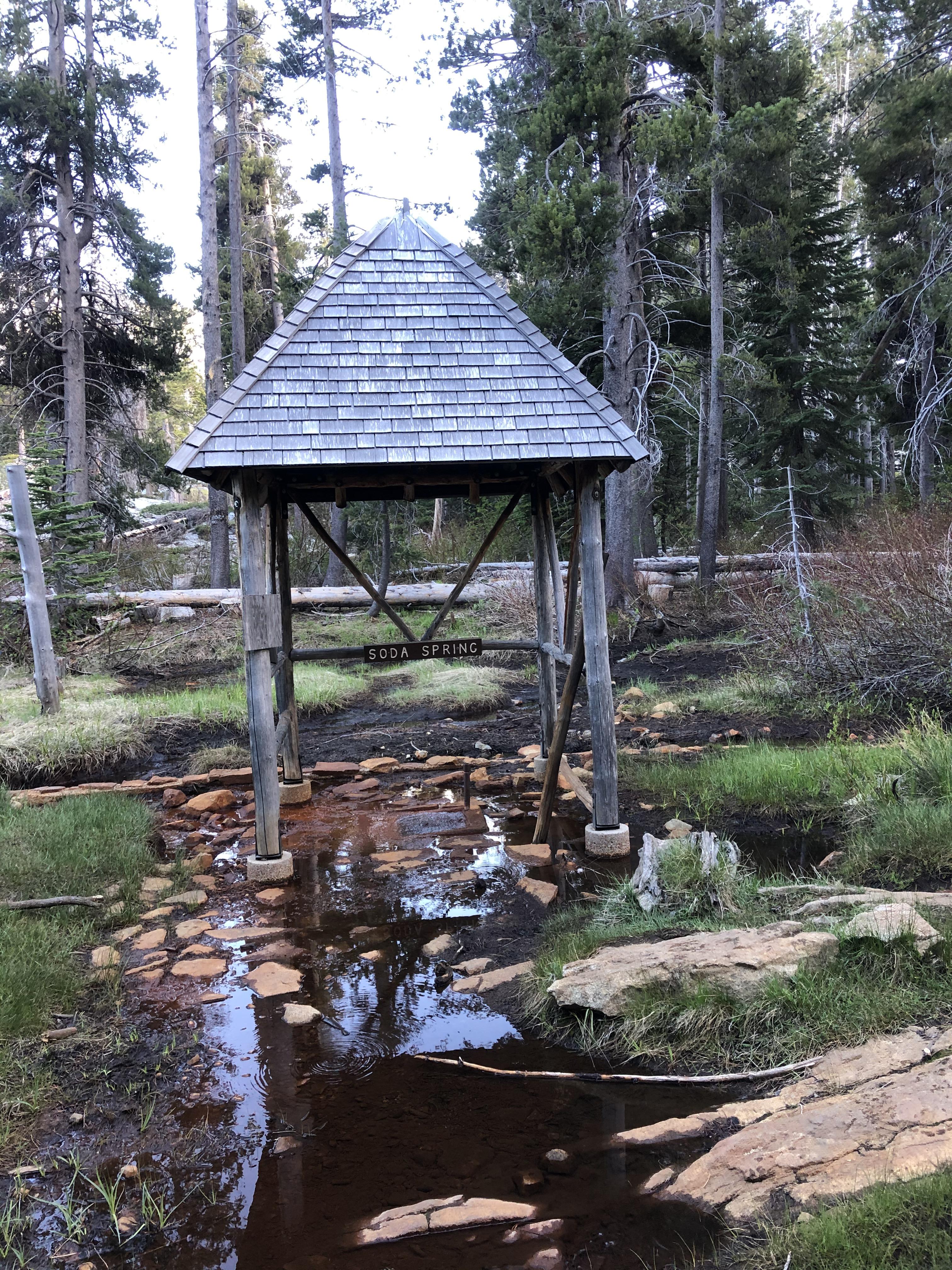
This morning we hiked four easy miles downhill past historic Glen Alpine Spring resort, which was established in 1878, as the first family resort in the Lake Tahoe Basin, back to our car at Glen Alpine Trailhead.
This was clearly a memorable Memorial Day for us and we are thankful that El Dorado National Forest reopened right in time for the weekend and made online reservations and printing your permit and parking pass possible as the ranger stations are all closed.
Hopefully more and more backpacking will become available in California in the coming weeks as Gela and I can’t wait to get out again.
May 27, 2020 at 4:29 am #3649477Beautiful photos and it looks like a great trip for the two of you – thanks for posting.
May 27, 2020 at 8:09 am #3649486Awesome!!! Thanks for sharing. I’m ready for my trip to the Sierras the first week of August. Hopefully we’re able to do it.
May 27, 2020 at 3:00 pm #3649581Cool trip photos! Where would you say snow line was?
May 27, 2020 at 3:58 pm #3649588Hi Drew,
that depends very much whether you are on a south facing or north facing slope.
– We hiked up to the top of Mt. Tallac (9,734 ft) on the southern route with barely any snow
– The route to the top from the west had snow starting roughly from Lake Gilmore (8,200 ft)
-Lake Schmiddell at 7,900 ft was completely frozen, while Middle Velma Lake at the same elevation was ice free
– The Velma Lakes Trail over to Camper Flat had snow down to roughly 7,500 ft
Thus 7,500 ft is a good bet, if you would like to get a single answer. On south facing mountain sides its easily 1,000 ft higher. Take this photo from Lake Schmidell as an example. We are standing on one side of the lake in snow at 7,900 ft and the other side of lake is free of snow all the way up – which is 8,600 ft.
Given the current heat wave this will most likely all change very rapidly.
Best Regards,
Manfred
May 27, 2020 at 5:18 pm #3649604Outstanding early season trip especially during these unprecedented times. Thanks for sharing.
-
AuthorPosts


- You must be logged in to reply to this topic.
Forum Posting
A Membership is required to post in the forums. Login or become a member to post in the member forums!
Our Community Posts are Moderated
Backpacking Light community posts are moderated and here to foster helpful and positive discussions about lightweight backpacking. Please be mindful of our values and boundaries and review our Community Guidelines prior to posting.
Get the Newsletter
Gear Research & Discovery Tools
- Browse our curated Gear Shop
- See the latest Gear Deals and Sales
- Our Recommendations
- Search for Gear on Sale with the Gear Finder
- Used Gear Swap
- Member Gear Reviews and BPL Gear Review Articles
- Browse by Gear Type or Brand.
