My son and I will be flying into NM in about a month to spend 5 days in the Pecos Wilderness (June 17th-21st). I’d love to tackle the entire Skyline Trail (#251) with him. But I’m preparing for there to be too much snow at the higher elevations. If necessary, we can string together some lower elevation trails elsewhere in the Pecos. Does anybody have any insight regarding how the snow is doing up there this year? Thanks.
Topic
Looking for some early snow-reports for the Pecos Wilderness this year.
Become a member to post in the forums.
- This topic has 12 replies, 4 voices, and was last updated 10 years, 3 months ago by .
I’ve been monitoring this site:
http://www.wcc.nrcs.usda.gov/ftpref/data/water/wcs/gis/maps/nm_swepctnormal_update.pdf
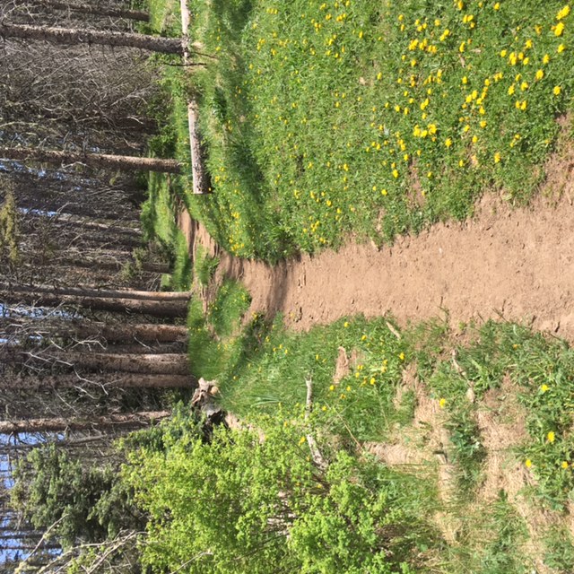
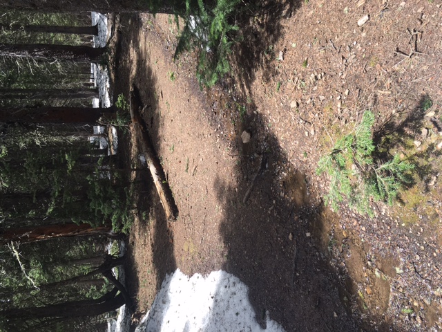
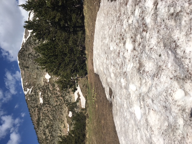
In the Pecos, I found that the snow is the most issue in the trees as opposed to above tree line.
Thanks Paul. I’ve been using the snotel data on the caltopo site. But your link is helpful to show that it seems like there is more snow this year, than on average. Can I ask you to explain a little further what you mean in your final comment about snow being an issue in the trees? Are you saying that you’ve found that the snow melts above treeline before it melts below treeline?
Thanks!
Right now several inches in some places (maybe more) as the higher elevations north of Santa Fe have got moisture (rain ->snow) even yesterday. Should be ok by mid-June though there’s always the possibility of a flurry/hail/thunderstorm. Sometimes there’s lingering snow even while the rest of the Pecos is baking hot … traversed a pile of south facing snow on one steep exposure once in late June (I just kicked footholds).
Can I ask you to explain a little further what you mean in your final comment about snow being an issue in the trees?
I’ll let the photos explain. :) But yes, the trees tend to retain snow more than above treeline. I suspect by mid-June you’ll be fine, however.
From five years ago.during heavy (but not as heavy as this year) snow year:
In the trees

Above treeline:

Thanks guys. Paul, thanks for the pictures. Both of you guys are giving me hope that by the middle of June a Skyline trail hike might be doable.
Fingers crossed.
Have fun. I love the Pecos and northern New Mexico in general. Stop in Eskes Brewery in Taos after for some good New Mexico influenced pub-grub and yummy beer. Sitting under a large cottonwood tree, relaxing and sipping a good beer is one of my favorite memories from New Mexico. :)
I live in Santa Fe and am planning on doing a shortish trip over the Memorial Day weekend with my boyfriend and the dogs. I will update this thread after that. But really, by mid June, snow should not be a problem. Though the portion of the skyline between horsethief meadow and the flanks of pecos baldy is badly burned out. I have hiked through there a coupe times last season, and couldn’t stay on the trail. Fortunately it is easy to follow sight lines to where the trail goes up a saddle on pecos baldy. You just need to be comfortable with off-trail scrambling over lots and lots of downed trees. The rest of the skyline trail on the west side of the wilderness is easy to follow. I haven’t travelled on the east side yet though it’s on my agenda soon.
Thanks Heather! Appreciate the information, especially the part about the burned out area. Will look forward to an update after your trip. Have fun!
I actually went for a scouting hike in the pecos yesterday. Some patchy snow starts showing up around 10000 feet on north facing slopes, which was as high as I got for the day. There are probably larger drifts and patches of snow up around 11,000 feet and above, but I am very sure it will be all be pretty much gone by mid June. So no worries there.
One other note on the pecos. Like I said previously, I haven’t done the skyline trail on the east side of the wilderness. There’s a reason for that. All the big mountains and most of the alpine lakes are on the west side. I used to want do hike the whole skyline trail, but my new notion of a big trip in the pecos is to take the skyline from the ski area to where it intersects trail 24 (middle fork trail) then keep to the ridge line and follow it north toward Jicarita peak, then exit the wilderness at Santa Barbara campground. This would give you about 30 continuous miles of above tree-line hiking. IMHO, that would showcase the best of what the pecos has to offer.
Thanks for the update. I keep monitoring caltopo aerial pics for decreasing snow totals. :-)
Hope you had a nice time this weekend!
Just returned from a cpl nights in the middle of the wilderness playing around with some snow gear. Drier lower .. this is usually a little muddy..

But starting to get muddy with snow patches. The trail is actually the stream but going off-trail will require post-holing as seen in Pic #1 below. Pic #2 more snow approaching the lake


Post holing approaching Trailriders (of course with everyone post-holing maybe they’ll clear the way. Also those going from the Meadows to Jacks Ck report post-holing, plus select north facing slopes. Melting fast, and current muddy areas had other hikers wanting real gaiters.
Precip: some storms and winds going through camp
Temp: didn’t get below freezing.
Thanks for the update HK (and the pictures. Looking good. We will be in the Pecos/SF NF in a week, making a go at the entire 70ish mile Skyline Trail. Starting at the lower elevation SE terminus and making our way counter-clockwise. Hopefully by the time we enter these areas (about 10/11 days from now) it will be much drier.
Thanks!
Become a member to post in the forums.