Topic
KCHBR- Kings Canyon High Basin Route, 2018
Forum Posting
A Membership is required to post in the forums. Login or become a member to post in the member forums!
Home › Forums › Campfire › Member Trip Reports › KCHBR- Kings Canyon High Basin Route, 2018
- This topic has 12 replies, 8 voices, and was last updated 5 years, 2 months ago by
 Cameron M.
-
AuthorPosts
-
Feb 10, 2019 at 11:57 pm #3577826
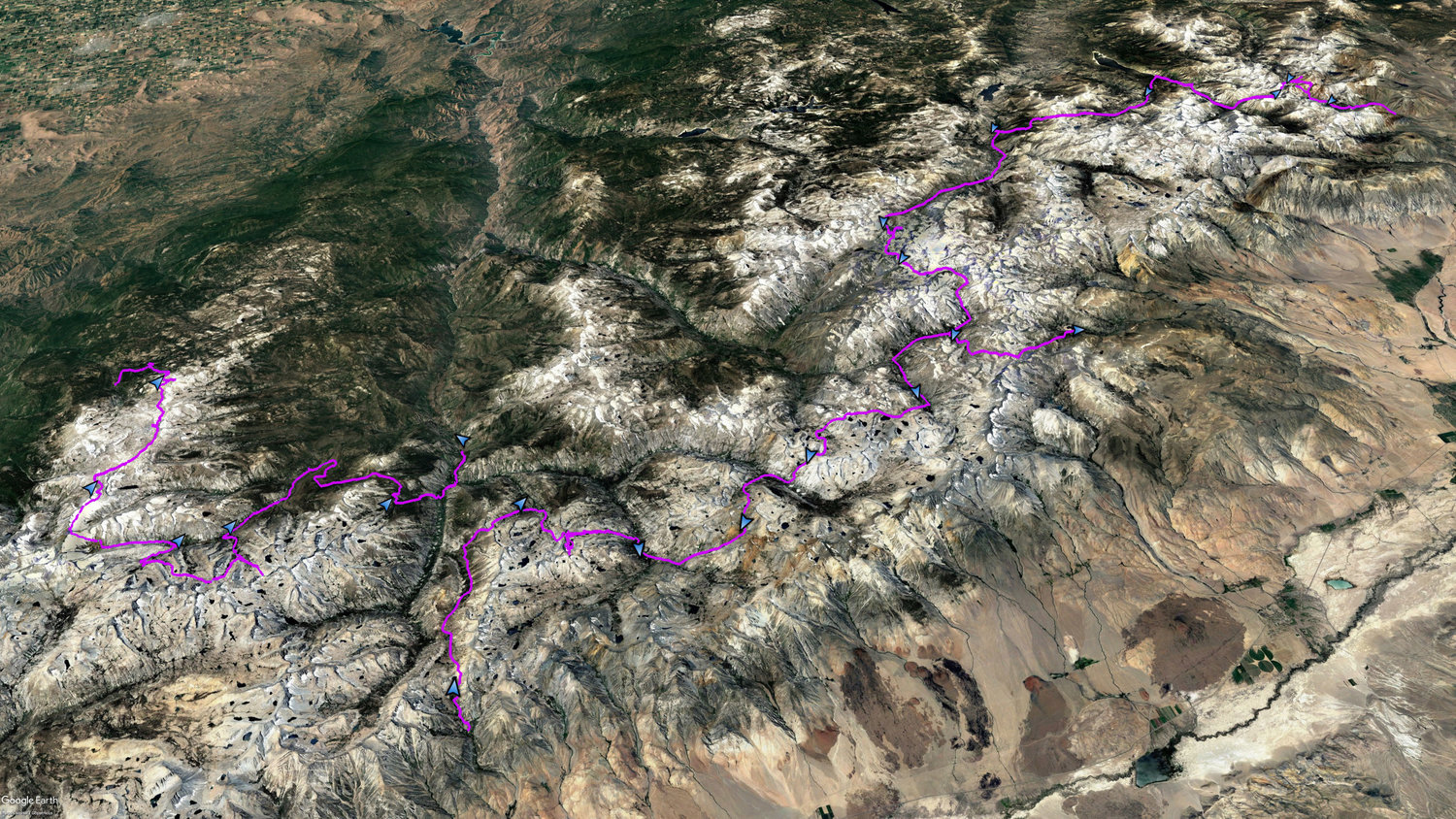
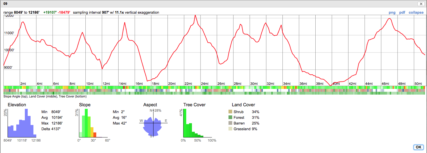
KCHBR- Kings Canyon High Basin Route, 2018. 22 days, 186 miles, 58,000’ ascent.
The Kings Canyon High Basin Route (KCHBR) was conceived by Andrew Skurka. In the summer of 2018 I walked my version of the KCHBR, broken up into three sections, in June, July and August. For my version I added extra mileage to include a more northern destination, the annual meet-up of the HighSierraTopix.com website, and I did not walk the last leg of Skurka’s route as it nearly duplicates what I walked the previous summer when I completed the Sierra High Route (SHR). My trip took a total of 22 days, where I traveled 186 miles and climbed 58′,000’. I trained reasonably hard for several months in advance, including climbing over 22,000’ of local peaks, running up 1,600 steps every day for months, and completing a quick 67 mile hike in March. I post a summary here but invite you to visit my website to see the complete report:
http://www.trailnamebackstroke.com

For the first section in June I chose a loop to depart from Lodgepole and end up at the Cedar Grove/Road’s End trailhead. This meant I had to first drive to Lodgepole to get my permit, then drive to and leave my car at the Road’s End trailhead, and then hitchhike back to Lodgepole to start my trek.
I reached the top of Longley Pass to find a massive overhanging snow cornice. No way I am dropping over it, and there is no acceptable way to climb around it. Yes, if I had a super-compelling reason and absolutely had to descend here, I could have done it, but I preferred to live to tell about it, and decided to change my route by backtracking back down the hill.
Dramatic evidence of a hungry bear at the Roaring River ranger station.
For the second section in July I entered at McGee Pass so I could spend some time up north and to visit the Highsierratopix meet-up. Along the way I attempted the Red and White and Red Slate mountains. At the top of the first ridge for Red and White I discovered a nasty bit of steep snow along the ridge to the peak. I did not bring traction and was unprepared for this final surprise. With this warm weather I could have probably kick stepped into the snow along the ridge, but it was still too funky for me, and I elected to quit.
The Highsierratopix group assembles for a photo. From left, Rockyroad, Cameronm, Robert, Gazelle, Dave_Ayers, RichLong8, SekiHiker (all listed by website monikers). Photo credit: Michael Yee. Michael’s website: MyTrailMixx.com.
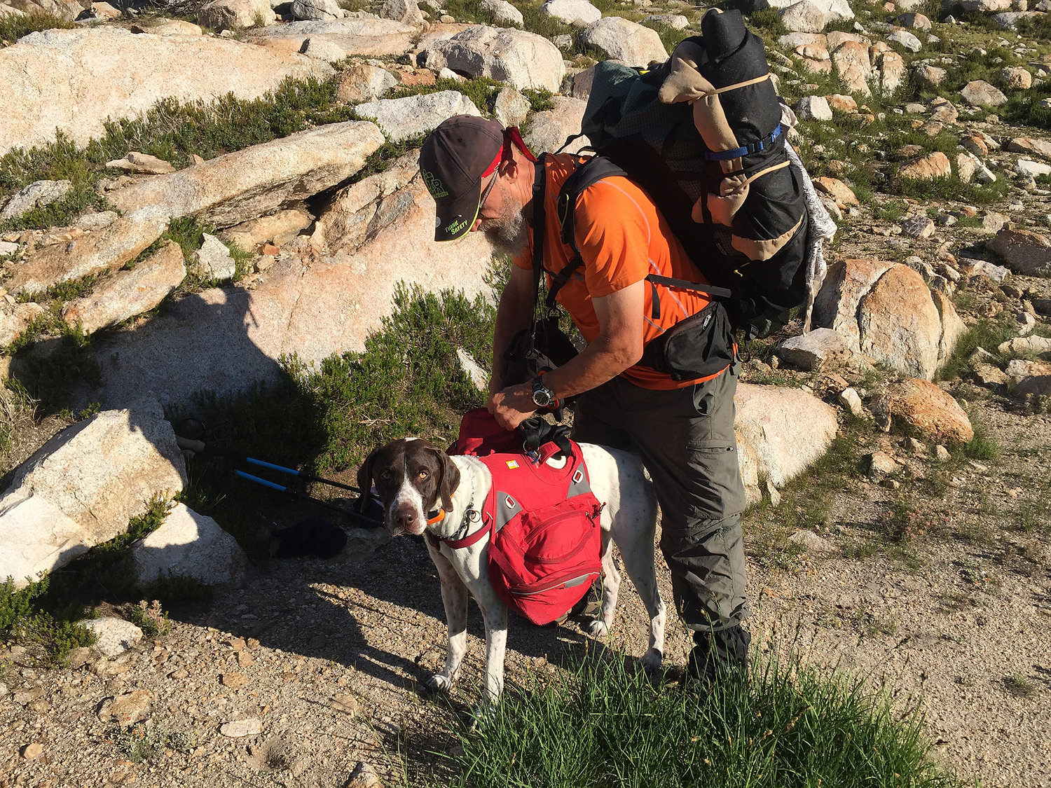
The next morning after the meet-up, Rich, his dog Beau and I departed south off-trail to seek the Laurel Creek trail. It was fun to see Beau negotiate some difficult terrain.
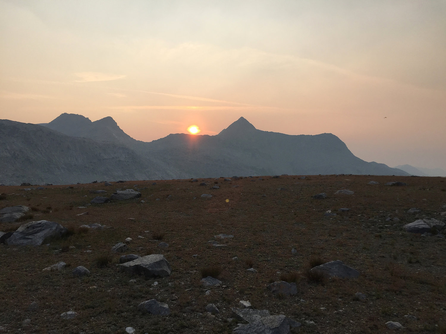
I continued south up Goddard Canyon and reached Martha Lake. At 11,000’ the terrain became a moonscape.
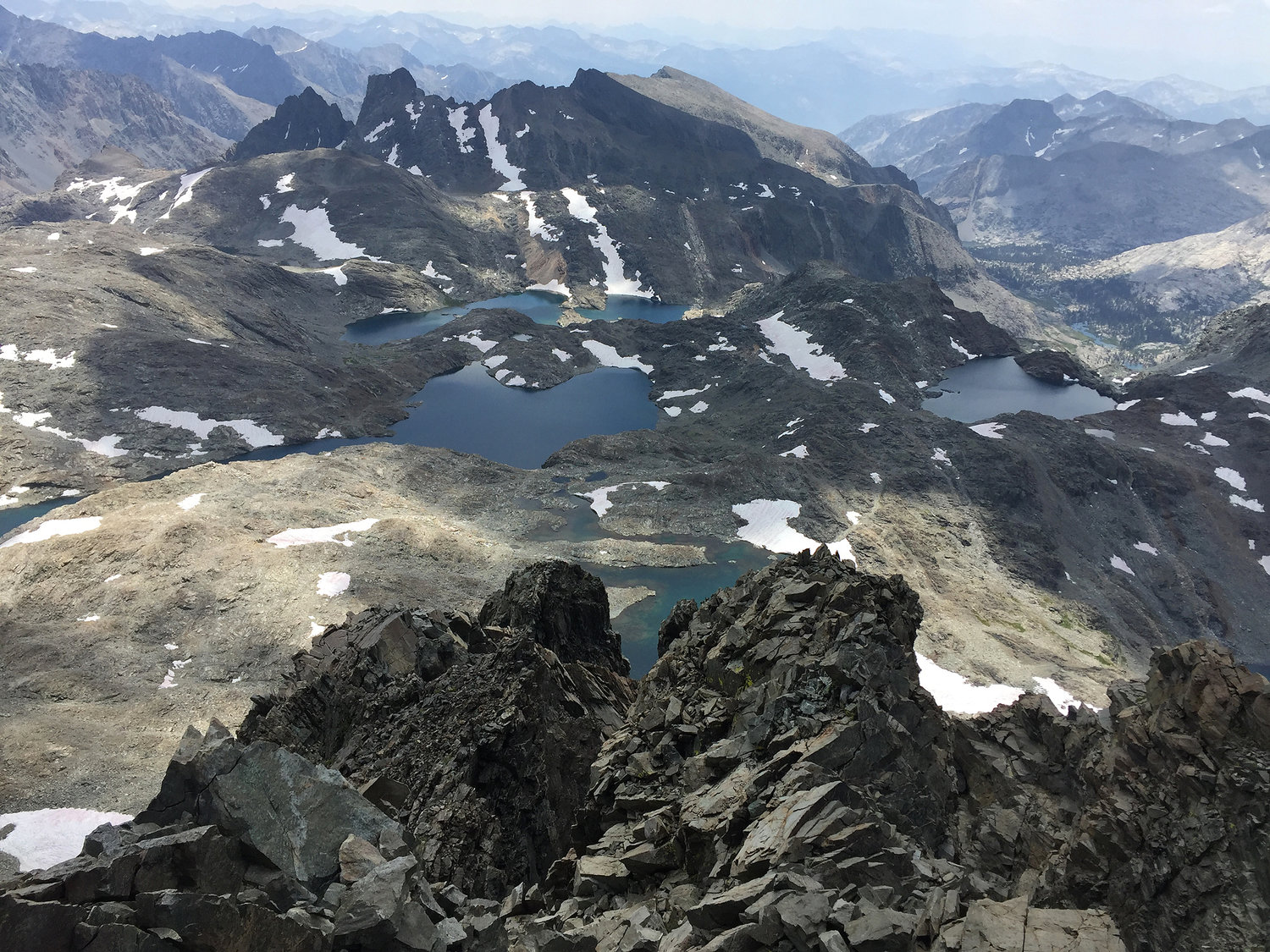
The view from Mount Goddard of the Ionian Basin.
There is something special and “prehistoric” about this place. I particularly enjoyed all the small ponds of captured water.
In August I completed the third section of the route, traveling north from Onion Valley to South Lake. This section is the most similar to the SHR in that it features many high passes.
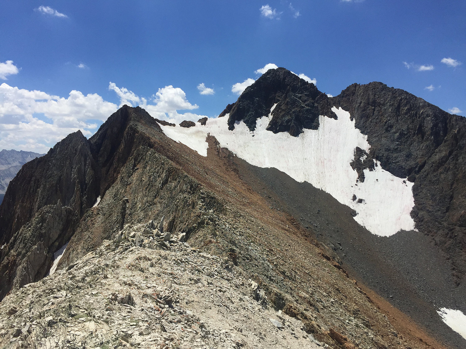
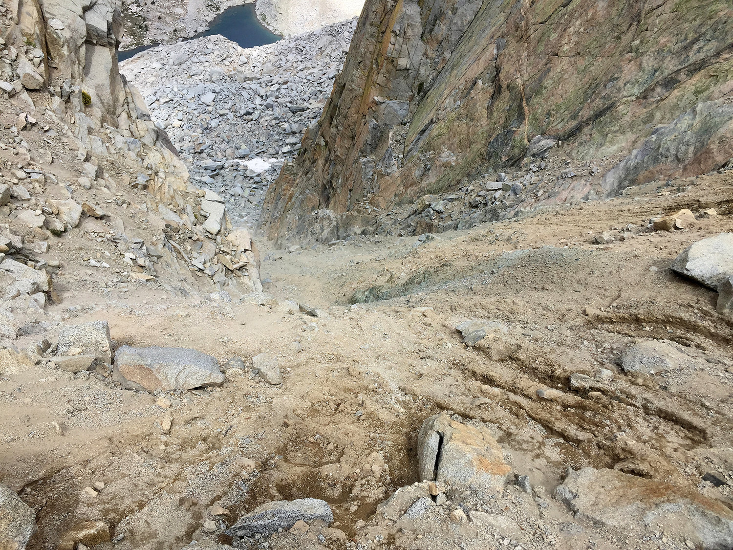
I arrived at King Col, which seemed fairly standard on the approach. However the descent is nasty where there are very few dependable stable rocks. My usual method in these cases is to make to one side and do my best to have a controlled climb down. This one is more difficult than most.
I arrived at Whitefork Pass, and Sector’s description of where to find the pass is not very clear, so I just started climbing and figured it out.
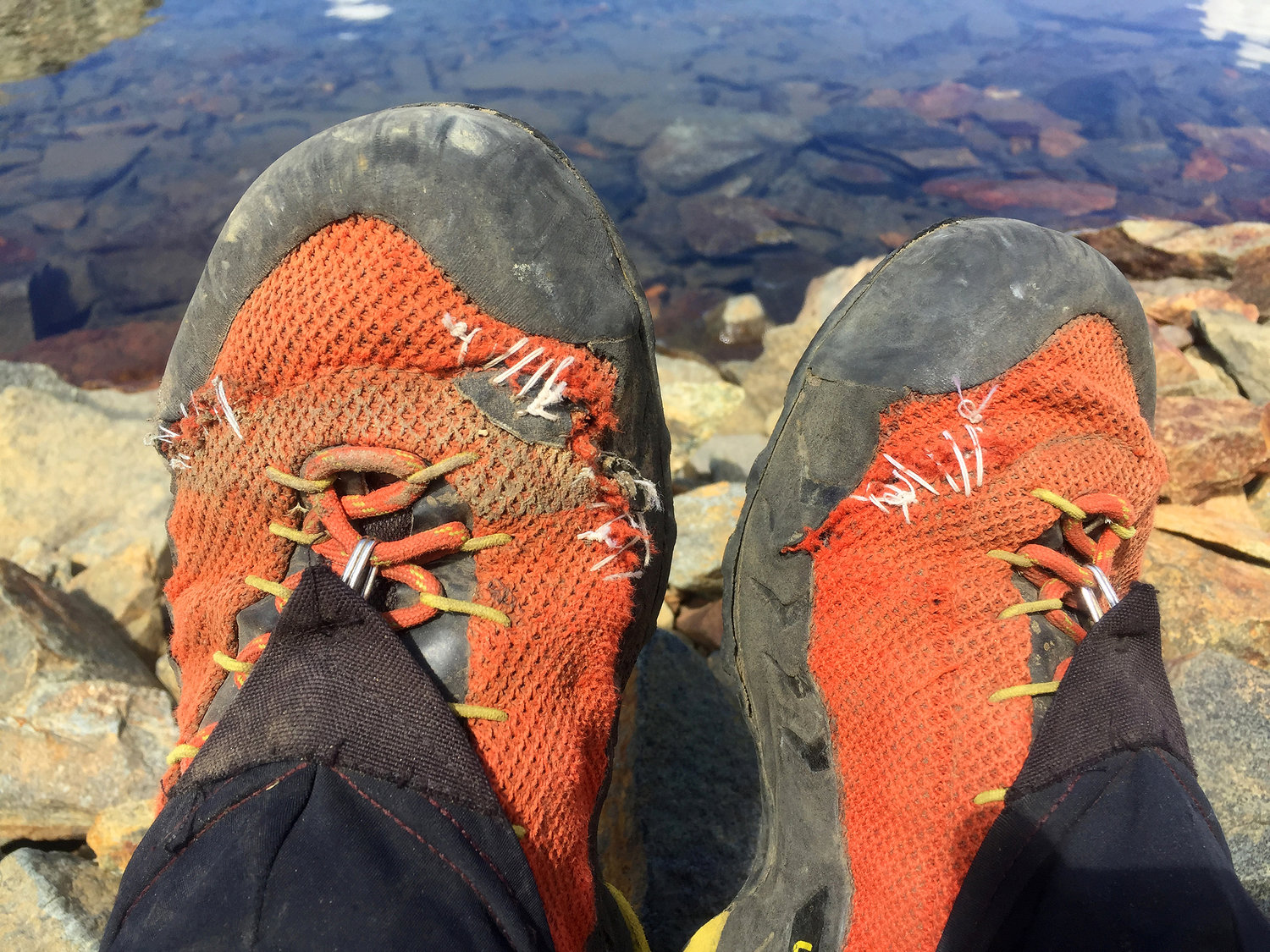
My La Sportiva TX3’s rapidly disintegrated, and contrary to urban legend, duck tape is not good enough, I needed to do some sewing. I made it down to Palisade Creek and the JMT to exit once again at South Lake. The trip was everything I had hoped for, and I became more familiar with Kings Canyon. There were a few times where it went from “challenging” to downright “hard”. No doubt, it is a tough route. All in all, a memorable summer.
Feb 11, 2019 at 12:29 am #3577831What a great adventure. Thanks for sharing!
Feb 11, 2019 at 3:24 pm #3577899Cool trip Cameron. I checked out your website last night…great photos.
Feb 11, 2019 at 4:52 pm #3577903Great read and pictures.
Feb 12, 2019 at 12:26 pm #3578035Wow! Thanks for sharing your TR. I always get excited when I see you have posted one.
Feb 12, 2019 at 1:34 pm #3578044Nice report and quite a trip. I was amazed that your TX3’s started coming apart, how old were they?
Feb 12, 2019 at 3:50 pm #3578060Thanks for the nice comments.
I don’t want to scare anyone away from the TX3’s, quite the contrary! A rough estimate is that they delivered at least 500 miles with about 150,000′ elevation gain. I have walked as far as 27 miles a day in them in total comfort, and they are unparalleled for walking/climbing. Obviously they are are cooler than the TX4’s, which have leather uppers, but I still switch to a lighter and more airy Wildcat or Cascadia for pure trail walking. I was surprised on my last section how they rapidly tore apart, but I guess they had just reached the end of their useful life. I run into many people out in the field wearing them, they have many adherents. I just bought two new pairs to squirrel away in case La Sportiva stops making them.
Feb 12, 2019 at 8:28 pm #3578116I too am a fan of the TX3’s for off trail hard rocky conditions and currently use Terraventures for more tame trail stuff. Just was curious how much use they had been put through, lots.
Feb 16, 2019 at 1:33 am #3578748@cameron-m
All I can say is you had one helluva an epic season. I followed your journey with an interest based on having visited all but two of the basins at least once down through the years. One of those two, White Fork, I intend to pass through this September. Your description of White Fork Pass intrigues me. As near as I can tell, based on your following route over Cartidge Pass, it lies on the ridge of Mt. Ickes, either to the west or the east. I suspect it is the west. Would you be willing to provide the GPS coordinates for it, as I am unable to find them elsewhere? Beyond that, I can agree with your feelings about Gardiner Pass. I went over it in 2016 for the second time, and agree that it is all too often underestimated. It’s a challenge.
Great trip(s) report. Thank you!
Feb 18, 2019 at 6:55 pm #3579205Hi Tom, good to hear that you plan on getting out there. The pass is actually south-west of Mt. Ickes. Those two ridges on either side of Ickes look difficult or impossible on the north faces. I will communicate via PM to get you the GPX, which I am happy to share with anyone who PMs me.
Feb 19, 2019 at 1:33 am #3579257Many thanks, Cameron. The map above, alone, is solid gold, but the GPS coordinates will nail it down. I really appreciate the beta.
Feb 21, 2019 at 6:53 am #3579703Epic trip(s)! Thanks for sharing!
Mount Goddard and the Ionian Basin have been beckoning for quite some time… Maybe 2019 is the year!
For what it’s worth, I was headed the opposite way over Cataract Creek Pass, and came in atypically high, well above the Amphitheater Lake. Thus, I was faced the same decision, as I headed towards the pass: stay high, or descend to the lake? We stayed high for a bit, but things got cliffy, and the risk of cliffing out grew. We backtracked and descended, then followed the lake shore. Not saying there’s no way, of course but… well, great minds, or something I suppose.
Whitefork Pass was part of a route I had planned this year. Didn’t make it (sprained an ankle in Paradise Valley, of all places). But thanks for the beta. I’ve been over Explorer Pass a few times now; White Fork has always looked like an interesting alternative.
I’ve seen a few of your past trip reports, and they’ve been great resources for my own planning. However, I’m worried about you–what are you going to do when you run out of places in the Sierra to explore?!? =D
Feb 22, 2019 at 12:18 am #3579830Thanks Adam. If you can come down/go up Goddard Canyon to the Ionian Basin, it is worth it, it is very colorful. I don’t think there is a pretty way to go past Amphitheater Lake, high or low. I am currently in a race between mortality and exploring all of the Sierra, and the Sierra will most certainly win!
-
AuthorPosts


- You must be logged in to reply to this topic.
Forum Posting
A Membership is required to post in the forums. Login or become a member to post in the member forums!
Our Community Posts are Moderated
Backpacking Light community posts are moderated and here to foster helpful and positive discussions about lightweight backpacking. Please be mindful of our values and boundaries and review our Community Guidelines prior to posting.
Get the Newsletter
Gear Research & Discovery Tools
- Browse our curated Gear Shop
- See the latest Gear Deals and Sales
- Our Recommendations
- Search for Gear on Sale with the Gear Finder
- Used Gear Swap
- Member Gear Reviews and BPL Gear Review Articles
- Browse by Gear Type or Brand.
