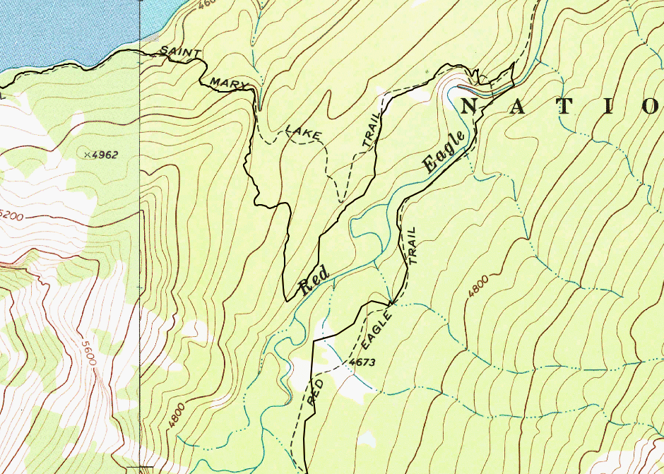
On September 8th, I’ll be hiking from Red Eagle Lake (head) campground to Reynolds Creek campground. Starting from Red Eagle Lake, I hike north on Red Eagle Creek trail towards the suspension bridge that connects to the St. Mary Lake Trail. If you look at the maps, this route makes a big loop, as seen in the top-right corner of the following caltopo snapshot:
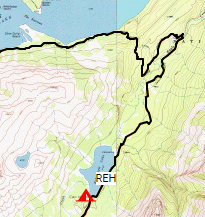
That loop is a bit more than 2 miles long. I was wondering if there’s a way to bypass that loop by cutting across Red Eagle Creek. I’ve never been to Glacier NP and am wondering if anyone familiar with this area can tell me if the creek crossing is manageable. From the satellite photos, it seems okay, but I wanted to see if anyone has on-the-ground information. Remember, I’ll be doing this part of the trail on September 8th, so I’m thinking the water level would be much lower than in spring.
Thanks in advance for any information!