A few years ago, I’d have pointed out that dedicated GPS units are more robust should they drop onto a rock or into a stream. Newer iPhones are now waterproof enough for me to not fret about water and I learned long ago to have a high-friction case on it so I don’t drop it nor does it slip out of my chest pocket.
The last dedicated units I’ve used had much smaller, more pixellated screens but maybe they’ve improved with time. Data entry and navigating their command menus was always very tedious.
The greater functionality of an app on a smart phone, would, by itself, decide it for me, but then there’s the weight savings and only have one instead of two devices to keep charged. Mostly, I don’t use anything, and leave my phone off altogether (certainly at night) or at least in airplane mode (for step-counting), only checking my position once every few hours.
I’ve resigned myself to bringing an extra battery since I keep my smart phones for so many years, the batteries get crappy. And, if I really need the nav function (get lost, need to divert, low cloud ceiling), I’d be running it for more hours than I’d planned.
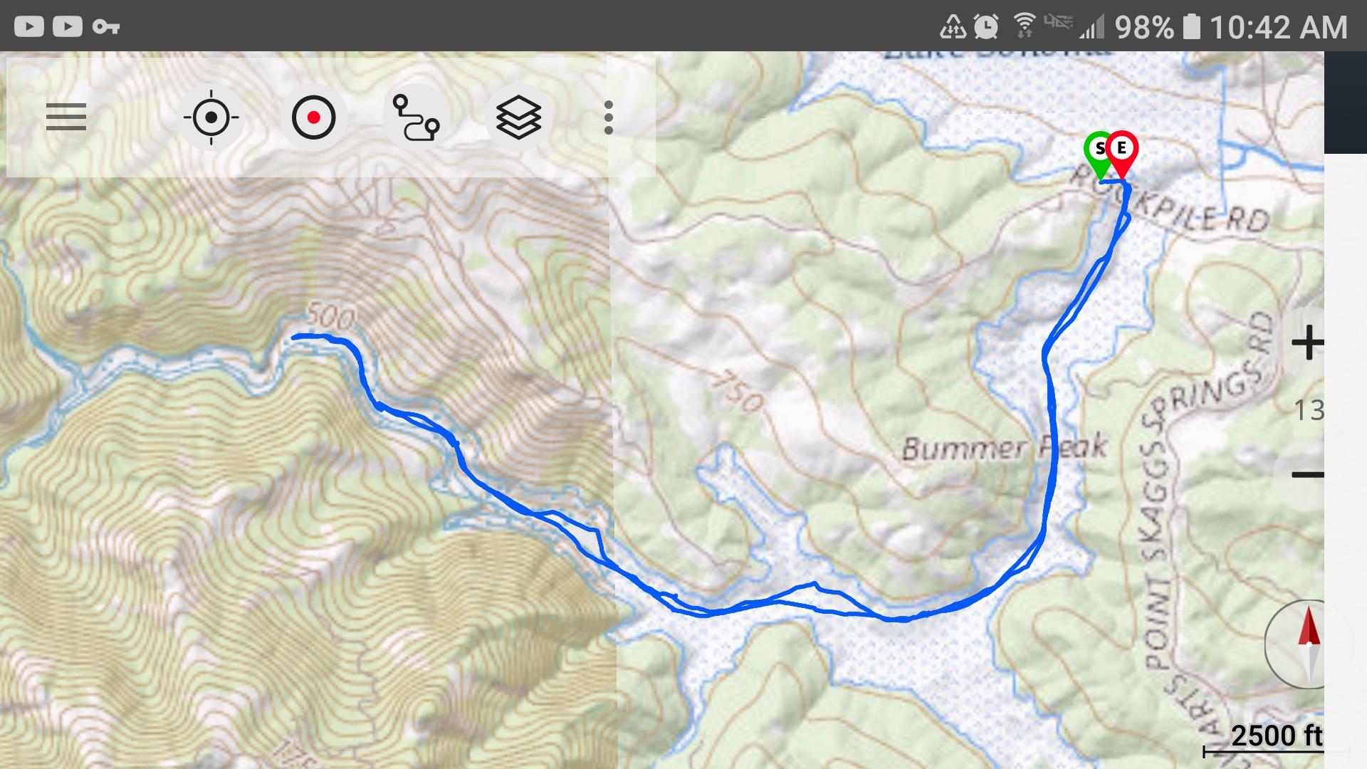
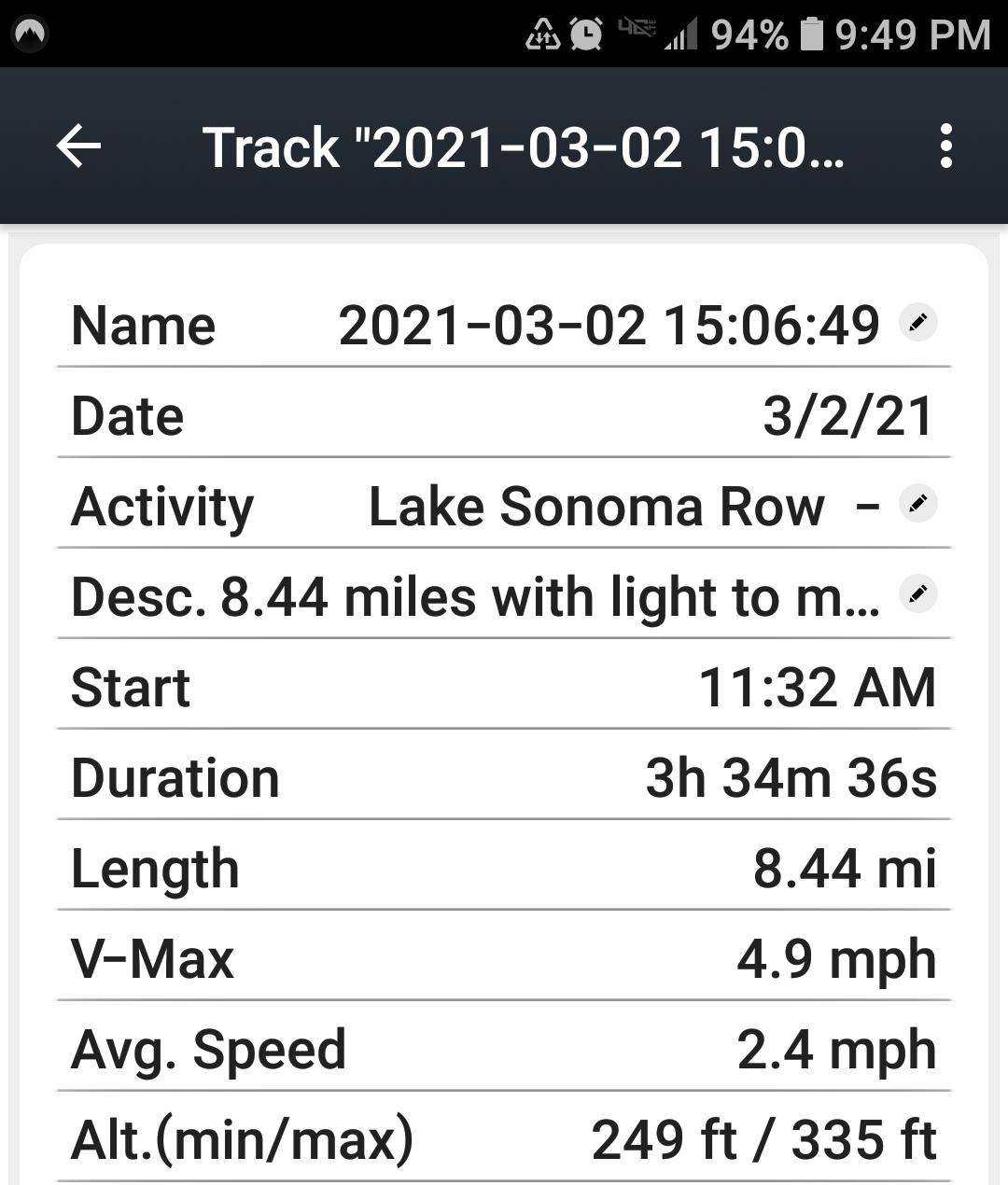
More than what device you use, is what base maps you can download in advance of the trip. I like having Gaia, USGS, NOAA, etc charts on my phone since many trips are Surf & Turf combos.

 in the salt water 7 miles past the the last native village.