Topic

Arctic Canyons of Tuktut Nogait – 11 Day Solo Packrafting Expedition

Viewing 6 posts - 1 through 6 (of 6 total)
Steven Evans BPL Member
PostedOct 23, 2023 at 9:07 am

Youtube video

Country Canada
Province Northwest Territories
Area Tuktut Nogait National Park – Hornaday River Canyons from Uyarsivik Lake to the Arctic Ocean
Trip Month (07) – July

Gear List

  • ULA EPIC DRY PACK (L) BLACK
  • Enlightened Equipment ENIGMA ELITE (-6*C)
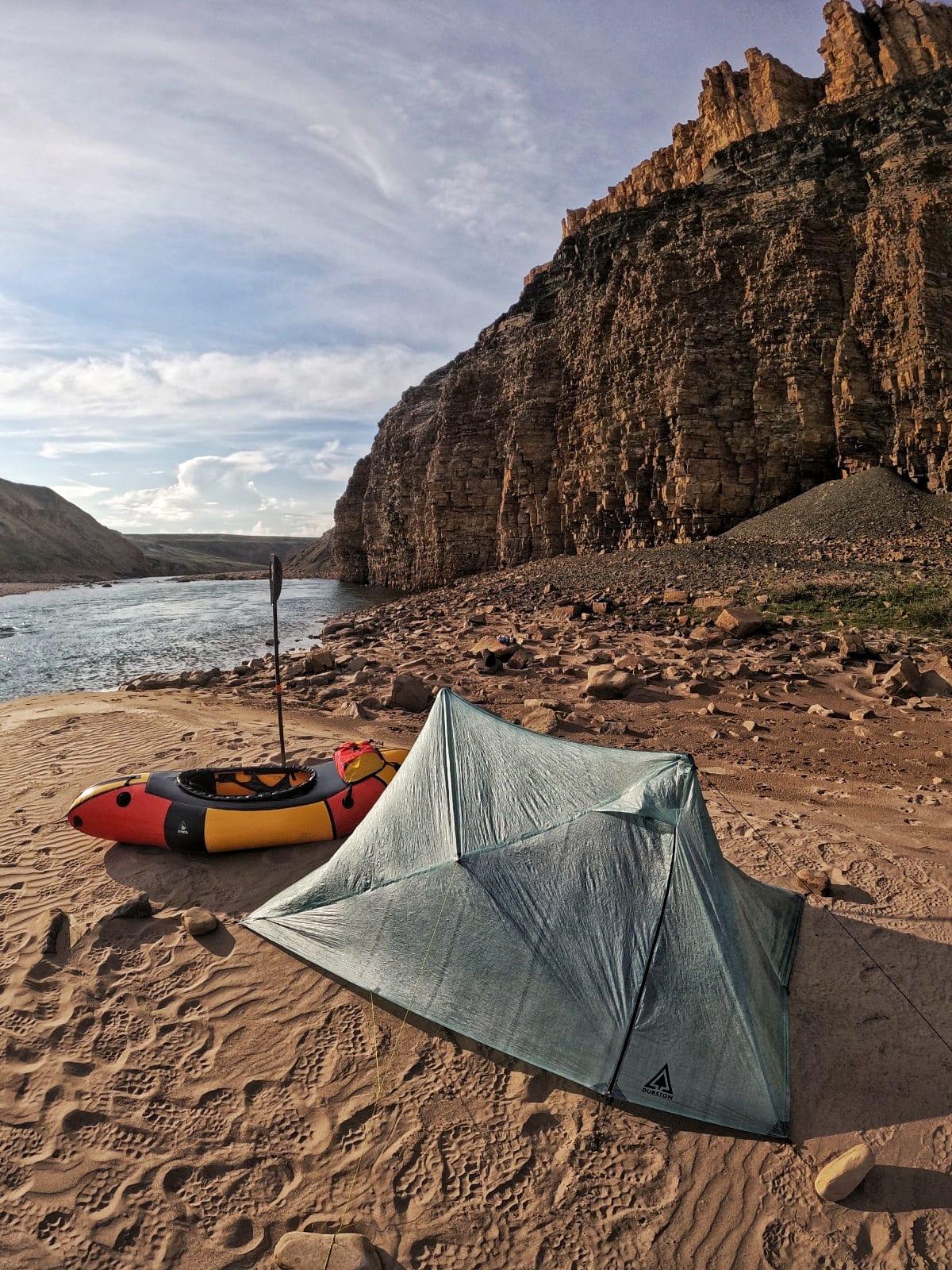
  • Durston Gear X-MID PRO 1
  • Aquabound WHISKEY CARBON 4-Piece STRAIGHT SHAFT PADDLE
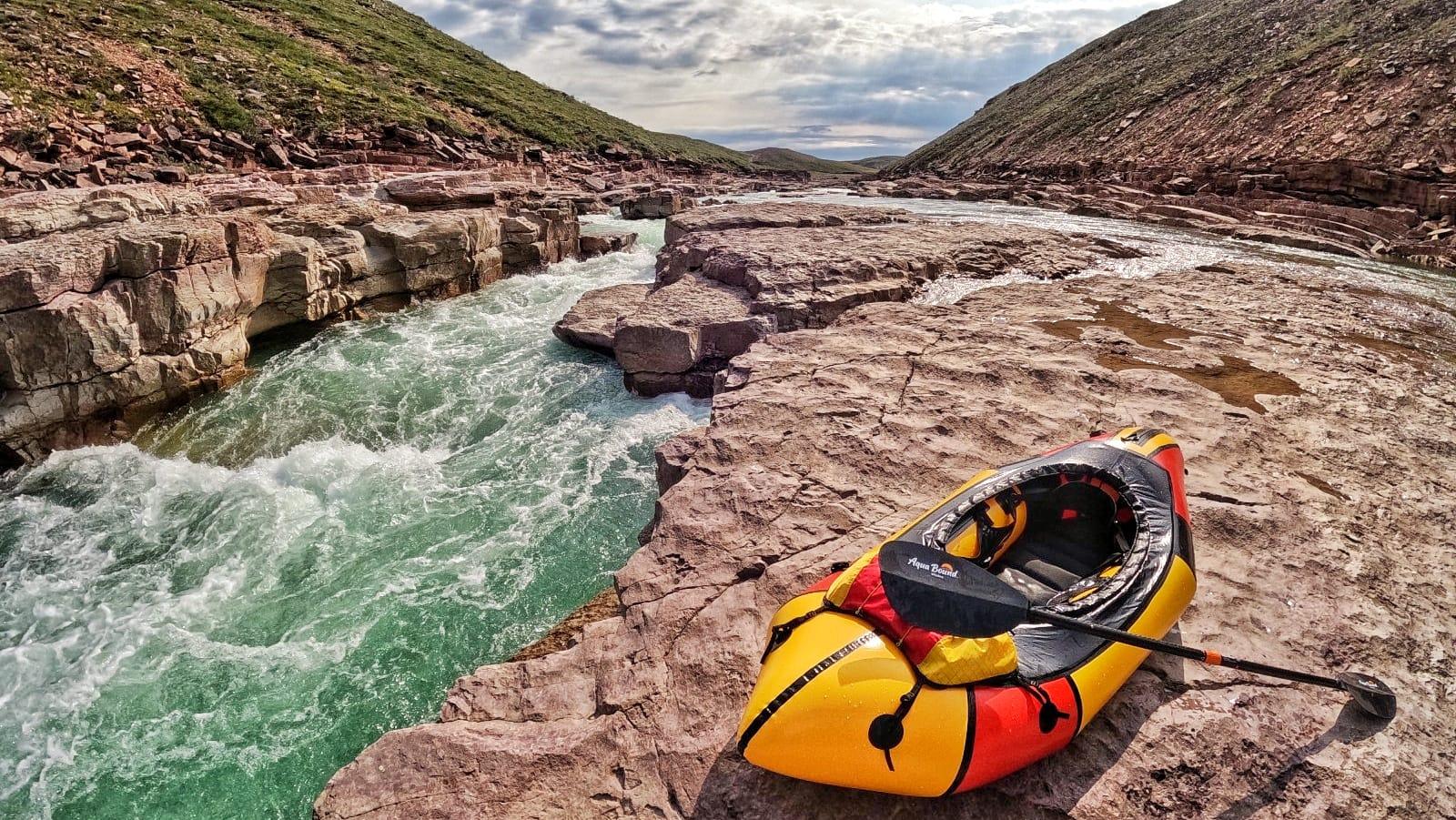
  • AlpackaRaft – GNARWHAL (L) w/ backband & thighstraps
  • Bern CARBON FIBER HENDRIX HELMET (L)Report / Notes
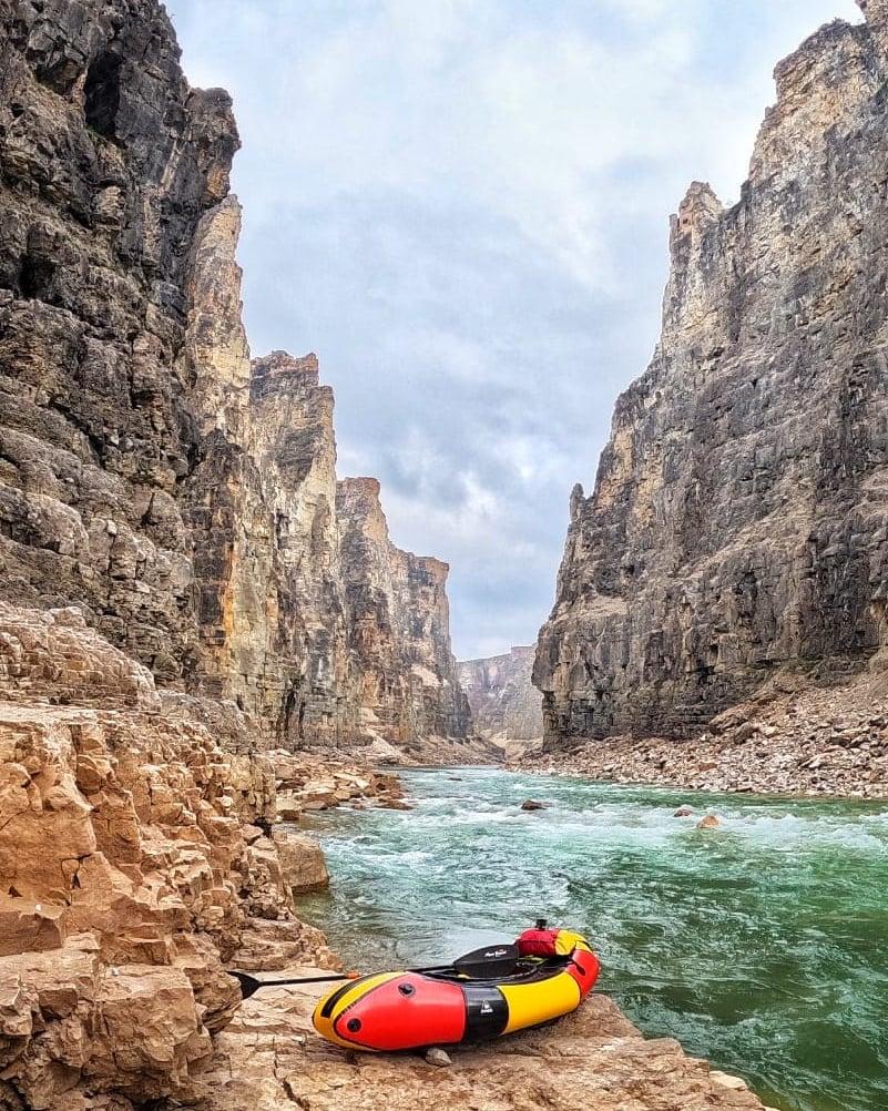
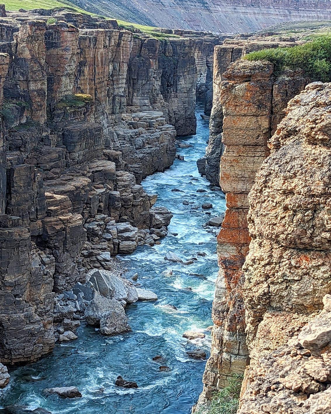
    I went on a very special trip this year, an 11 day, solo, Arctic Packrafting and Hiking Expedition in Tuktut Nogait National Park. Easily one of the most incredible places I have ever been to, it doesn’t even seem real when you are surrounded by the canyons. This is a very remote area, well over 200 km north of the Arctic Circle.  To give you an idea of how few visit, in 2023, a single visitor permit was issued, and it was me. I worked with the park and researched for over 2 years to put this trip together. My mandate: I would traverse, chart, and paddle the Hornaday River through the Canyons to the Arctic Ocean.

Link to the detailed river map/gearlist/trip information: https://suluk46.com/arctic-canyons

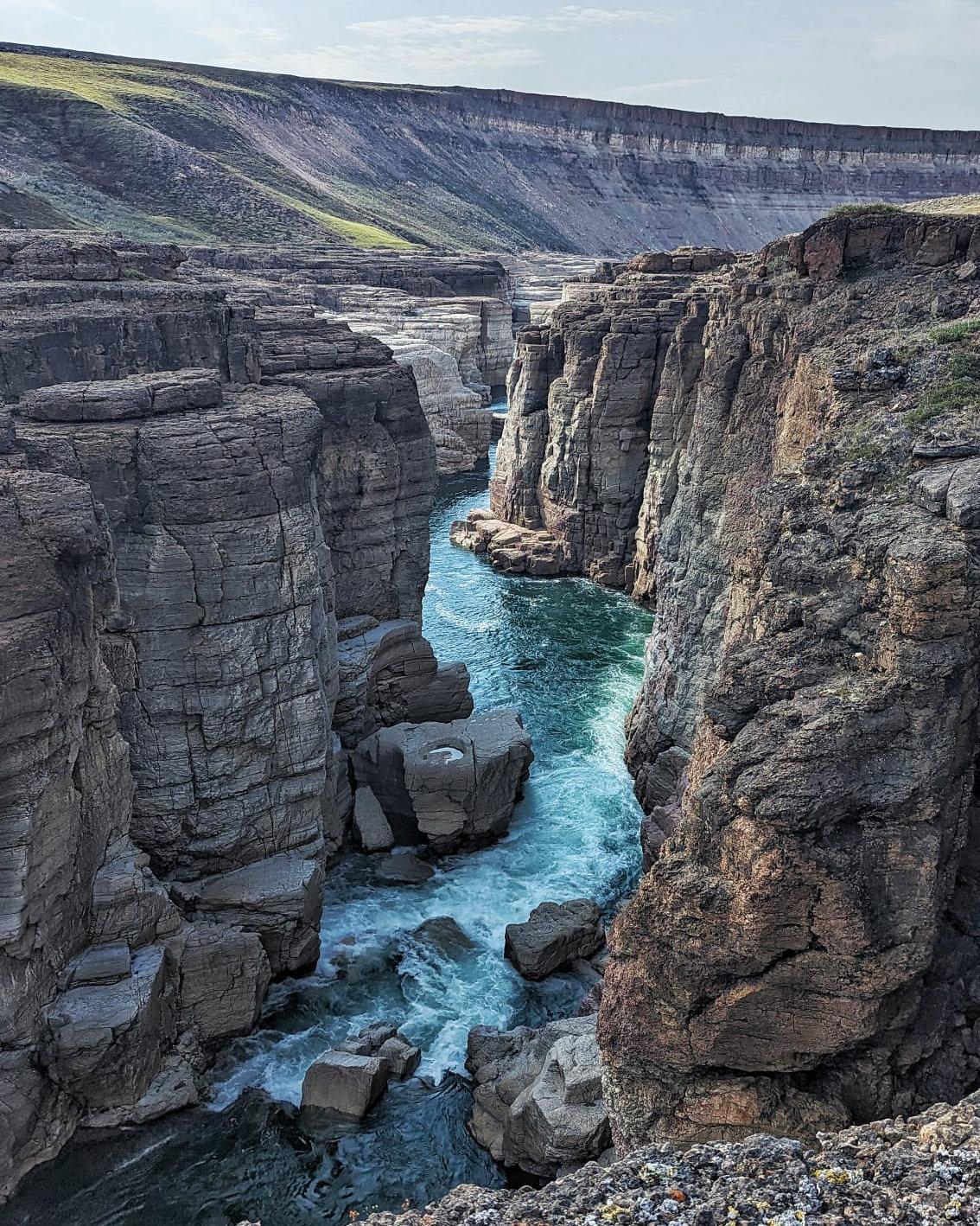
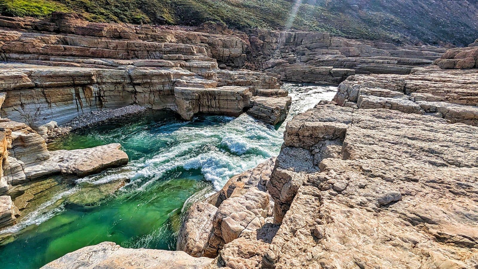
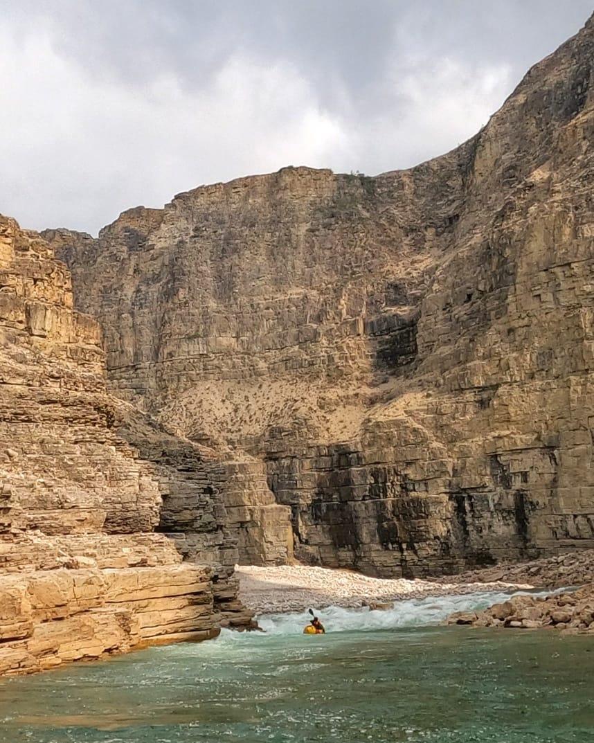
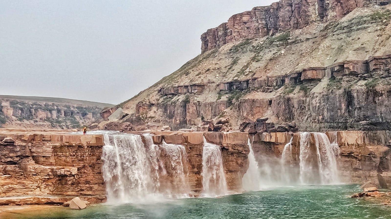
I was flown in from Paulatuk to Uyarsivik Lake, compliments of Parks Canada, and spent the first 2 days at an Inuvialuit Camp where youth was being taught skills and history by their Elders – it was a very humbling experience to see how one can live off the land. It then took me 10 days to get from Uyarsivik Lake to the Arctic Ocean. There are 3 very long white water canyons spanning this section of river. They are highly committing, with the longest being the 3rd canyon – I spent almost 4 days making my way through it. Lots of scouting, consistent back to back sections of rapids and portaging is very difficult on the rock walls.

It seems that the animals do not fear humans here at all. There was wildlife galore, every day in the valley had Caribou around me, a wolf in camp, and a grizzly at the side of the river while I paddled (very quickly) by. He came to the rivers edge to investigate, and lost interest and trotted up the river bank.

A little history of the trip, I was scanning for canyons in Northern Canada on google earth and came across this park. It was clear there was a very aggressive and long canyon section cut right in the arctic tundra. I spent months researching and found that this section of river was first attempted in 1977 by Larry Osgood and his team. They were successful in paddling a good portion of the canyons, portaging out of the canyons when needed. I acquired a copy of his journal (54 pages) of this trip, and I can’t even imagine the challenges of such a trip with the gear that was available and the lack of maps and information that there would have been at that time. Then, in July of 1999, the Beaudry Team, comprised of professional kayakers along with Parks Canada, became the first and only full descent of the Hornaday Canyons. They successfully ran the entire river and their report, albeit much shorter, had very good data in terms of the canyon descriptions. This section of river then lay dormant for nearly 25 years….

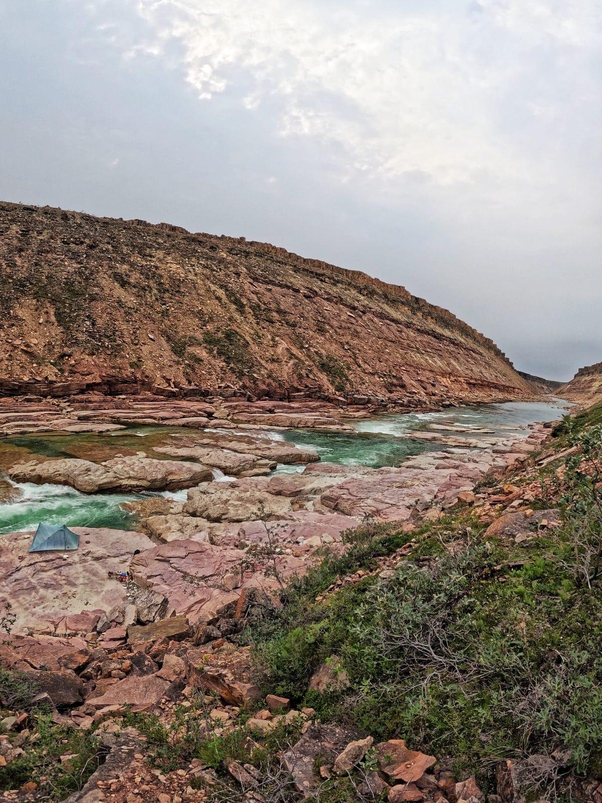
That is…until me and my packraft made our way up there! I filmed and documented every rapid, portage, campsite and point of interest along the canyons. I created a map (which is too large to upload here but will be hosted on my website) so that others can have the opportunity to safely run this incredible river.

The video linked is the trailer for the multi-part series that is starting November 1st. If you have seen any of my other trip videos, this one will be the same, basic documentary style go-pro footage stitched together with some music here and there. I’m not a super fancy editor, priority is always the trip itself. Enjoy!

Matthew / BPL Moderator
PostedOct 23, 2023 at 11:10 am

Can’t watch the video right now but the overall appearance in the photos reminds me of Arizona or Utah. I would not have guessed this was in the Arctic.

Steven Evans BPL Member
PostedOct 23, 2023 at 1:05 pm

It very much has that vibe – basically arctic tundra for as far as you can see, then a huge cut in the earth where the canyon runs out to the ocean. Having lived in Southern Ontario (Canada) my whole life, the first time I went hiking in Zion and the Grand Canyon was mind blowing. I thought I was on Mars.

peter v BPL Member
PostedNov 5, 2023 at 10:06 am

awesome trip. and lordy, the effort to film it (ohh, the pain), yikes !

.. and thank you.

went and looked at the map, i don’t know how deadly accurate the thing is, but ..(old man memory incoming Alert) if you go around the north side of Rat Lake , there’s a very sweet OHV track from the final bluff on the west bank all the way into town.

your trip reads waaay better than that painter guy who got up there and went all poetic woosy over it.

funniest thing about that area is, ranger and peter are reviewing the route and ranger points out an area that is “granite”. well … goodie goodie for me (thinks dumbo), imagining some arctic form of stunning rock slab, rife with small ponds, gentle ridgelines, and glacier polish .. and promptly routes himself directly at the now-unavoidable center of it. ya .. well … two days of rock hopping later, and foolish lad finally gets his butt out of the “granite”.

and yes .. “hunting caribou” equates roughly to “shooting cows”. i will not begin to properly spell this very gracious man’s name, but i watched George Kanuktechuk of Paulatuk,  down and dress and entire animal, in about 20 minutes, and not get blood past the second knuckle of either hand.

then, he wrapped in a garbage bag and after finding a cardboard box (this, an UN-negotiable necessity according to wife Moriya (spelled correctly, mind you)) , he brings it home, and his lovely lady whacks it apart on the kitchen floor (hence, the box) with an axe. ya kind’a had to be there.

then Moriya boiled it, and many folks from town just walk in an fed themselves out of the pot. rather much later on (like, a couple of years), and fully 300 miles to the east, peter is a lunch guest at a duck hunting camp, and while praising a plate of the most Ambrosial tasting caribou ever created on earth, is relating his experiences of meeting the Kanuctechuks. the matron of the camp, who is know far and wide as really the alpha female of Kugluktuk, is honestly praising the character of George and Moriya. and then, being the leading female that she is, and knowing that i had eaten with them, asks in that knowingly sad motherly tone that Women Who Rule occasionally use asks .. “does she still … just .. Boil it ??”

great trip. and thank you for the little jog down memory lane .. eh?

v.


Steven Evans BPL Member
PostedNov 6, 2023 at 2:19 pm

Hi Peter,
No too many people have made it up there, sounds like you may have spent a decent amount of time in the area. That OHV trail north of Rat Lake you speak of is the one I took back into town from the mouth of the Hornaday River as it met the Arctic Ocean.  I think it’s about 15 miles long so took most of the day. The artist that painted up in the area was Cory TrĂ©panier, sadly he passed away a while back. Watching the videos I took up there already brings back great memories and I am always interested to hear others story of their trip up to the area, so feel free to share.

Viewing 6 posts - 1 through 6 (of 6 total)
Loading...