You didn’t think I was that confident, did you? Next post…
:)
Topic
Become a member to post in the forums.
You didn’t think I was that confident, did you? Next post…
:)
This trip report summarizes a day hike that I crammed in during a family trip to Lake Tahoe, in August 2018.
The primary purpose of our long weekend in South Lake Tahoe was to spend time with family—family that was visiting from out of town, for a wedding. But we weren’t obliged to attend the wedding, and there’s all that granite looming above—how could I not go visit it?
My original plan was to do a short hike on Thursday, then a longer hike on Friday. For reasons that become obvious later in this post, Thursday’s hike was the only that would materialize.
It was noon on Thursday when a temporary waning occurred in the hurricane of familial obligations; in this calm, it became clear that I’d have the chance to escape for an afternoon. My wife offered to drop me off “somewhere”–and I’ll pause to appreciate the fact that dropping me off “somewhere” on the side of a highway in the mountains only so I can appear “somewhere else” hours later is a totally normal thing in our family–she offered and I took her up on the offer. I decided that Hwy 50 near Strawberry was the “somewhere” for today. The route I had picked out began with an ascent of Pyramid Peak via Rocky Canyon, then continued off-trail over the summits of Agassiz and Price before a final off-trail descent that would leave me on the PCT at Mosquito Pass. From there, it would be straightforward trail miles—along the PCT, then to Gilbert Lake, then over and up Mount Tallac, and down to the Mount Tallac Trailhead, near the shores of Lake Tahoe. Essentially, I’d traverse the Desolation Wilderness from south to north, summiting four of the seven major summits in Desolation.
The only downside to this magnificent opportunity was that by the time it evolved to this level of maturity, it was already 1:00 PM.
__________
I gather my hiking gear quickly, doing bare-bones functional checks of things like DeLormes and headlamps, and then we are out the door.
As my wife drives south on Hwy 50, I hesitate. My hesitation is borne out of the amount of daylight left: It’s getting late in the day. Should I attempt this? How long will it take to slog 4,000 feet up Pyramid? How long for the subsequent 3-4 mile off-trail section, along the ridge, with the rocky summits and jagged ridge lines and skunky chutes and whatnot?I don’t really mind finishing by headlamp, but I don’t want to be off-trail when darkness settles in.
Eventually, I decide that I’ll just see what happens. My wife drops me off near a pull-out that seems like it’s in about the right location to start the climb up Rocky Canyon. I glance at my watch—it’s 1:33 PM.
I step out of the car, wave and blow her a kiss, then devote my attention to the task at hand. I examine the wooded hillside in front of me. I do not see any signs of a marked trail, but there are footprints in the loamy dirt. Footprints mean I’m in maybe the right place, and that’s good enough for me.
I enter the woods, and almost immediately, I find myself bushwhacking up steep wooded slopes. As I whack, I decide that I’m probably not in exactly the right place (what with the bushwhacking), but after a few hundred feet of climbing through a discordant labyrinth of white PVC water piping intertwined with pine branches, I find what is definitely a trail. Once on the trail, the ascent is straightforward and pleasant: first climbing creekside, then meandering across lightly wooded slopes, eventually leaving the woods, at which point the views—and the granite—expose themselves.
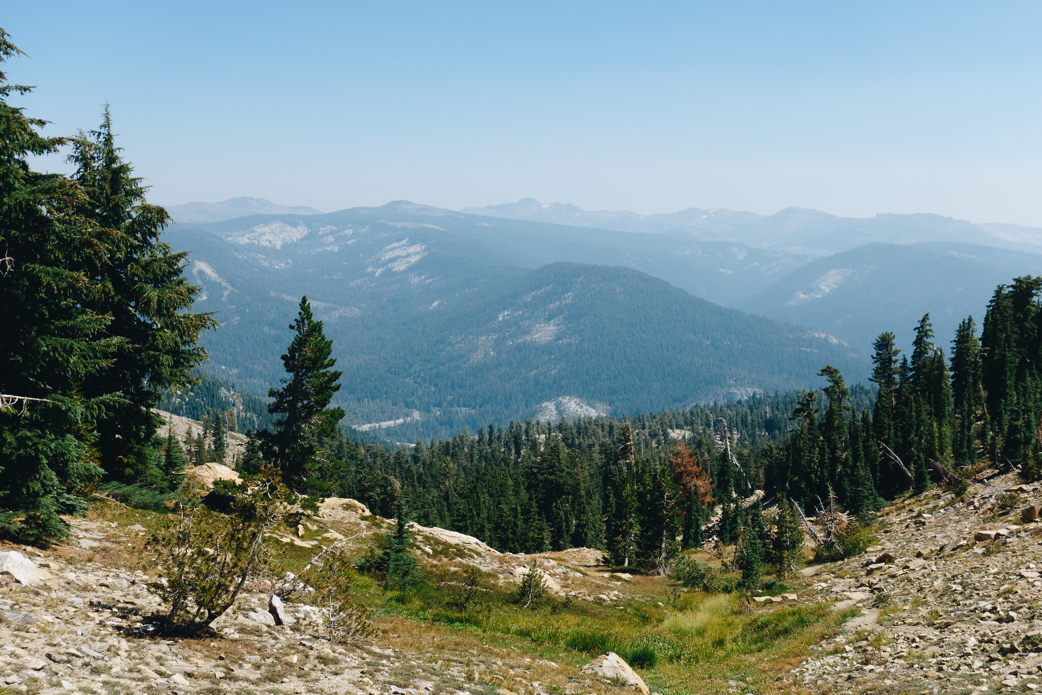 The view back down Rocky Canyon, towards Hwy 50
I pass a few hikers on the ascent; one hiker says he’s hiked this trail 100 times. I ask him about the traverse to Agassiz and Price, because I didn’t do much research, and I’m not sure it’ll go.
“No… I’ve never tried that.”
The way he has chosen to word his sentence does little to instill confidence in me.
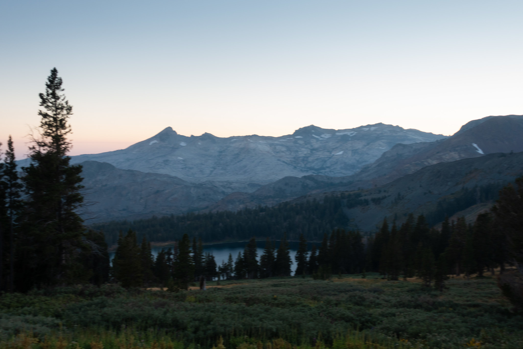
Soon the trail dissolves into a field of mellow talus. I hop hither and thither, and then I’m on top. The vista across the barren expanse of Lake Aloha unfurls beneath me. I look north to Agassiz and Price, and peer at the ridge line between me and them. It is not appealing, and I begin to understand why one might turn around 100 times when confronted with this view. However, I’ve never been one to limit myself to appealing things; I continue to scrutinize the ridge, and eventually spy a slabtastic route that is a few hundred feet below; it should offer easy walking, if only I can get down to it.
 The view across Lake Aloha, towards Lake Tahoe. Mount Tallac is the massif to the left.
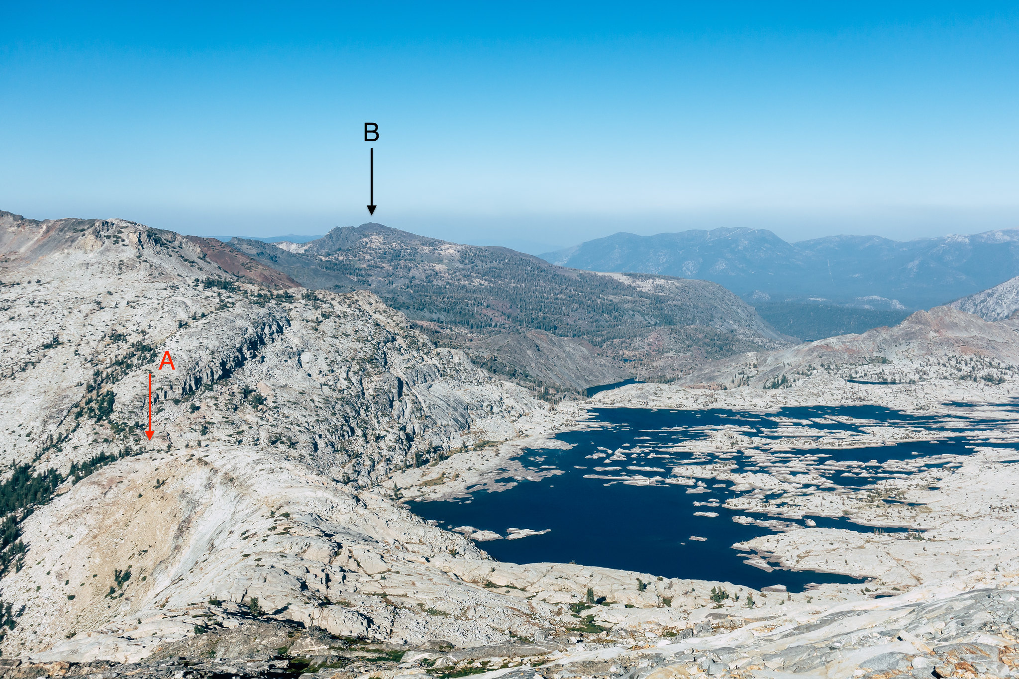
 Agassiz (A) and Price (B) from Pyramid Peak’s summit
I pause my route finding reconnoitering to page through the summit register. I glance at my watch; it’s now 3:24 PM. I’ve made ok time so far, and as long as the subsequent traverse isn’t too time consuming, I should be okay—I still have about 4.5 hours of daylight.
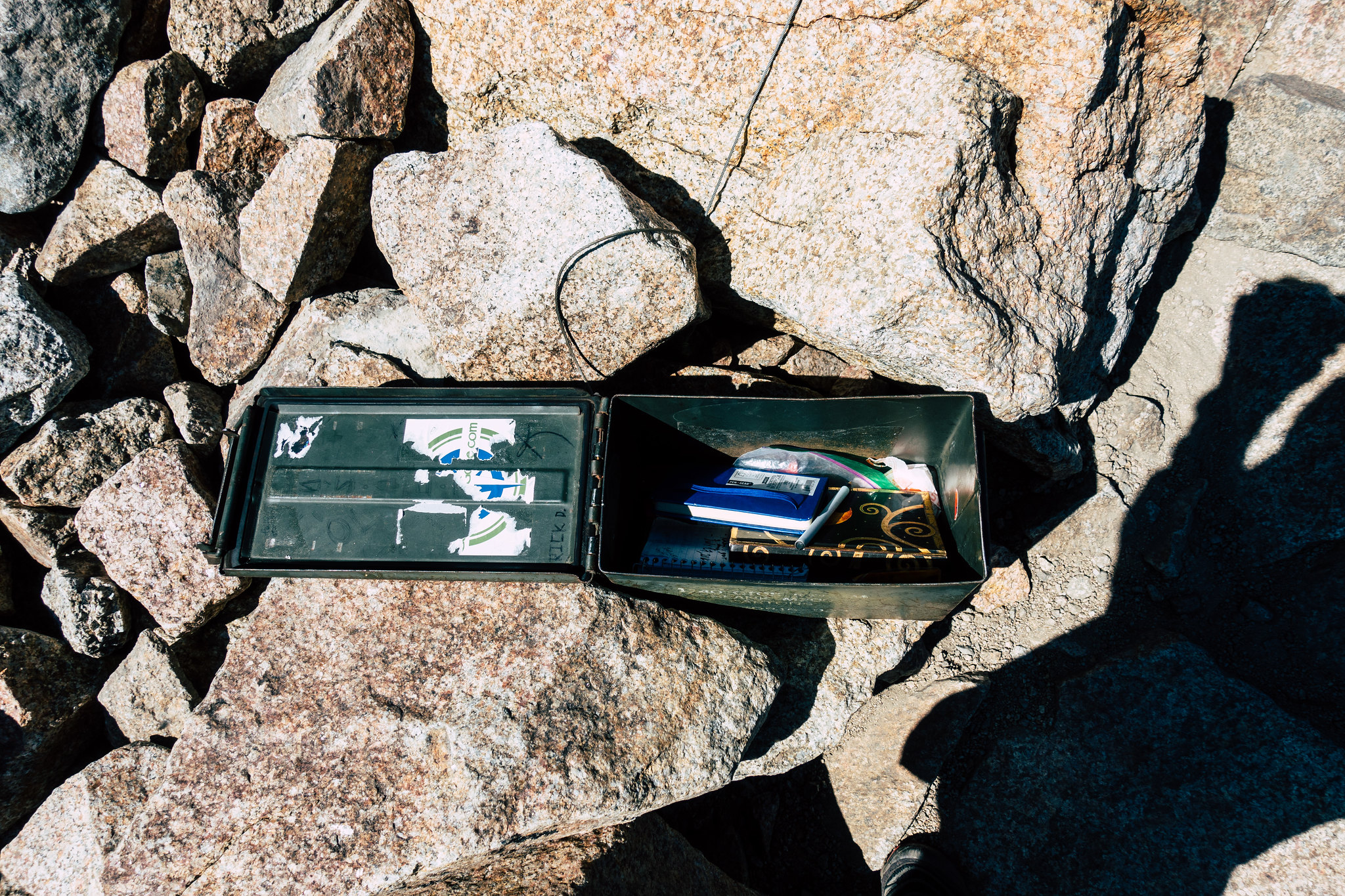 Summit paraphernalia
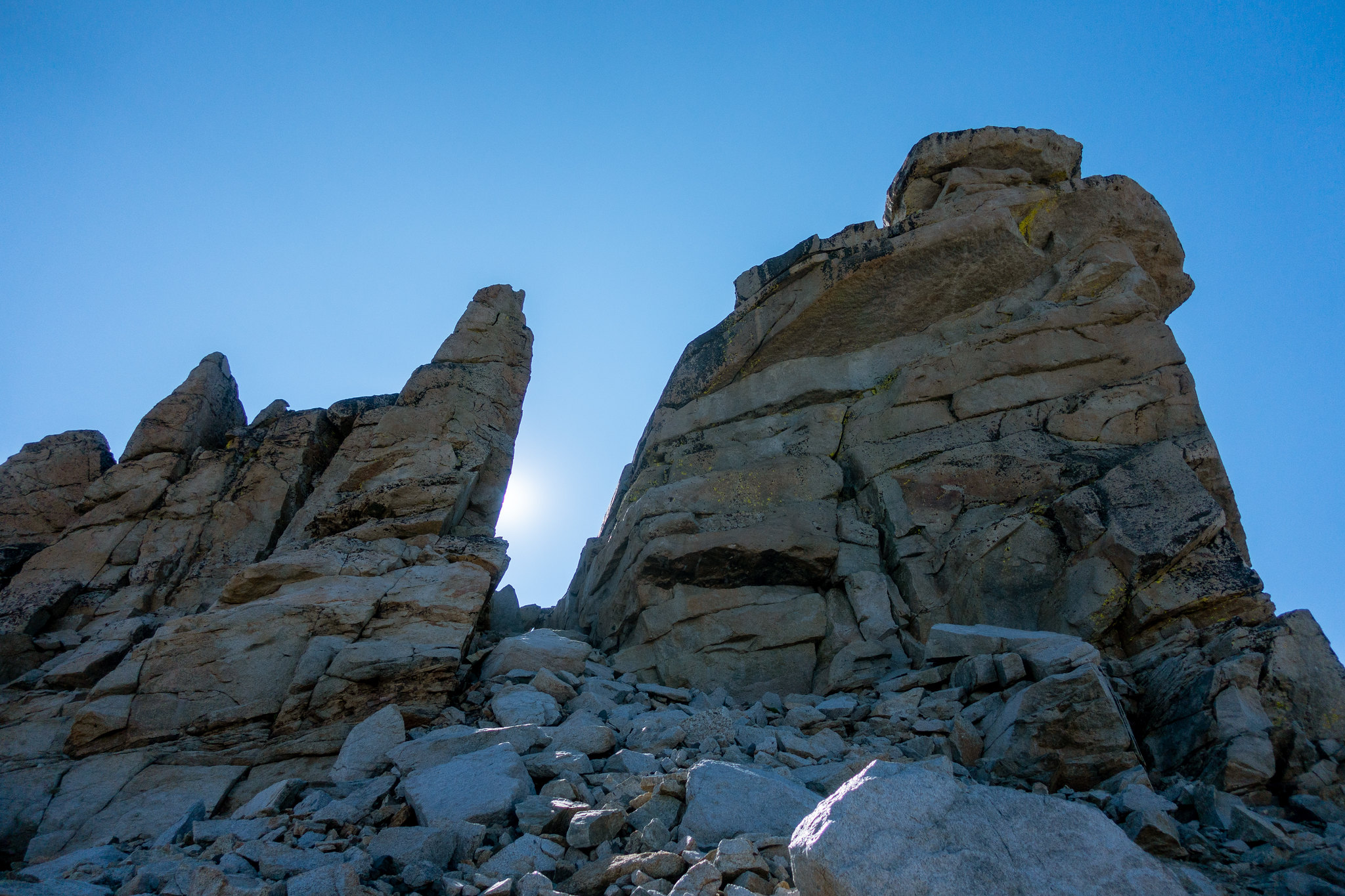
But, daylight is burning—with that realization, I get a move-on. I begin descending the northern aspect of the peak. It is immediately steep—much steeper than on the shallow southern face. Progress is slow, as I meander to and fro, trying to decide how to best reach the lazy slabs that are a few hundred feet below. Eventually I discover a notch and a chute which will take me just where I need to go. I look down the chute with a scowl—it is a steep, loose death chute. But I do what I always do in these situations, and stare at it until it seems like it’s neither too steep nor too loose. This trick works, and soon I skid and clamber my way down the chute, then hop across a short talus field, whereupon I find myself on the slabs, and walking is just walking again.
 On the slabs between Pyramid and Agassiz, looking down the western slope of the Sierra Nevada
I traverse along easy slabs for several hundred feet. The joy of off-trail walking in the subalpine Sierra! Then it is steep again, but the climbing is easy, and soon I find myself staring at the summit block of Agassiz from below. From this angle, it is imposing. I climb around the base of the summit, hoping to find an amenable route to the top. I discover one option that looks like easy climbing, but unfortunately, it has infinite exposure. I hesitate briefly, but no amount of internal cajoling will make the fall non-fatal, so I resume my scouting. Eventually, I find an easy way up, and then I am on top.
 Agassiz’ imposing summit block
I repeat my summit-process—I gaze at the view, and snap photos. I page through and sign the summit register. I glance at my watch—it’s 4:35 PM. I’m still doing fine time wise, even with my indecisive meandering down Pyramid; my confidence is bolstered that I’ll make the trail before sunset.
 Pyramid Peak, from Agassiz
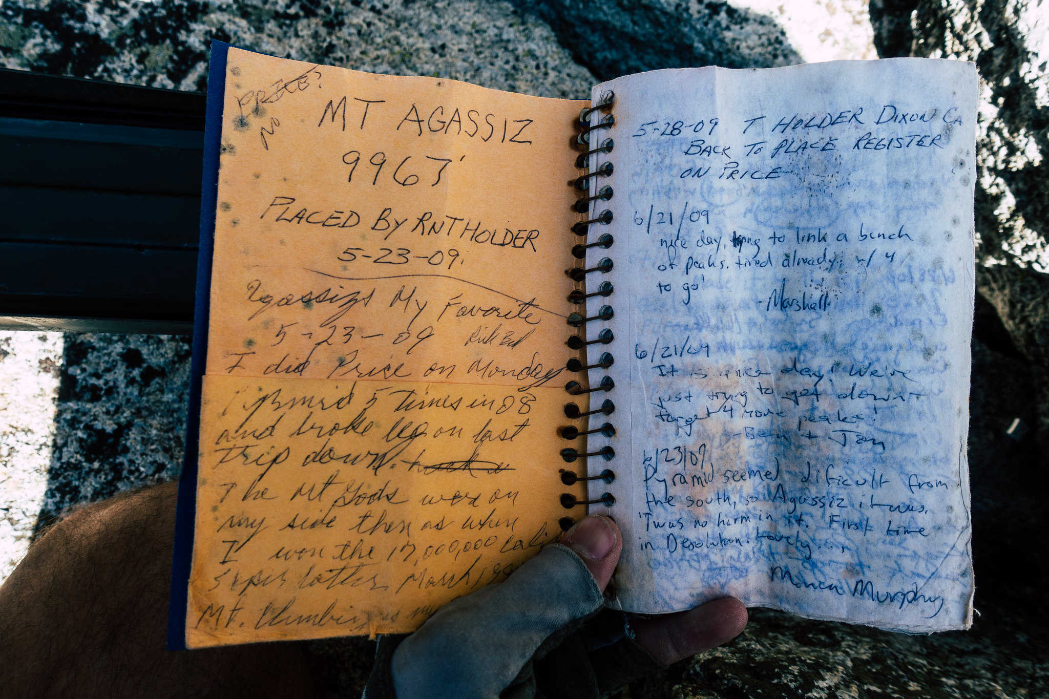 The good book
I look off to the north, towards Tallac. It still seems too far away for a thing that I’m hoping to be on top of before the end of this hike.
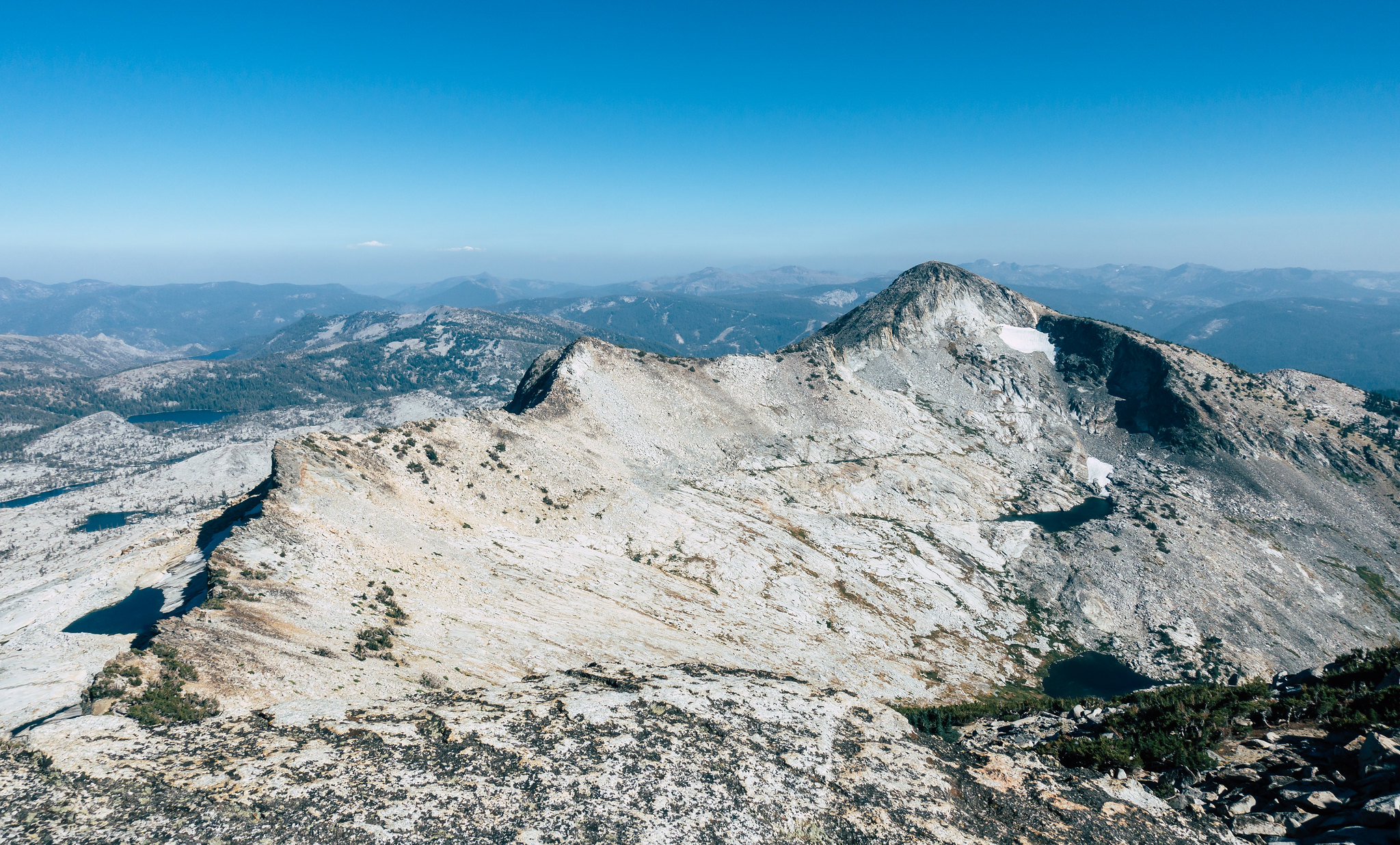
I descend the summit block, and work my way towards Price on easy talus. The going is easy, and within 30 minutes, I’m atop Price. More photos, more registers, more gazing towards Tallac.
 Agassiz and Pyramid from Price
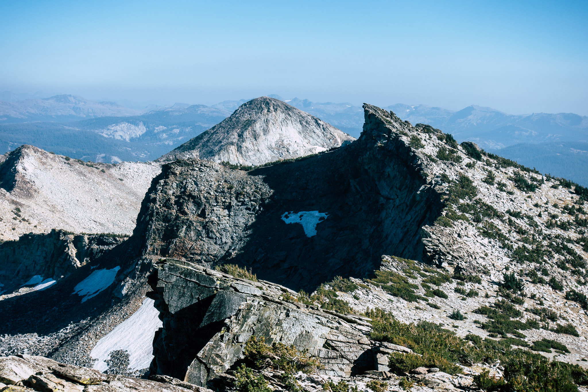
Between me and Tallac, of course, is the descent to Mosquito Pass. I know people have done this, but again, my lack of research means I need to assess in realtime the feasibility of me making the descent. Unfortunately, my initial impression is demoralizing. I need to drop to the east, but everything is very precipitous in that direction. Dropping to the west will do me no good; I’ll be stuck on the wrong side of the ridge. I have to go east. I work my way north along the ridgeline, sometimes meandering to the west temporarily when the ridgeline gets tricky, but always returning to the east. In a few places, I begin to work my way down promising ledge systems, but those systems always terminate in “you fall, you die” hands-and-feet moves on narrow ledges. When that happens, I backtrack towards the ridge, being relatively uninterested in either falling or dying, today.
Soon, an opportunity to descend to the eastern face presents itself. It requires a unique momentary move wherein I must stand atop a tree. I am not a particularly seasoned Sierra climber, but this is the first time I’ve stood on top of a tree.
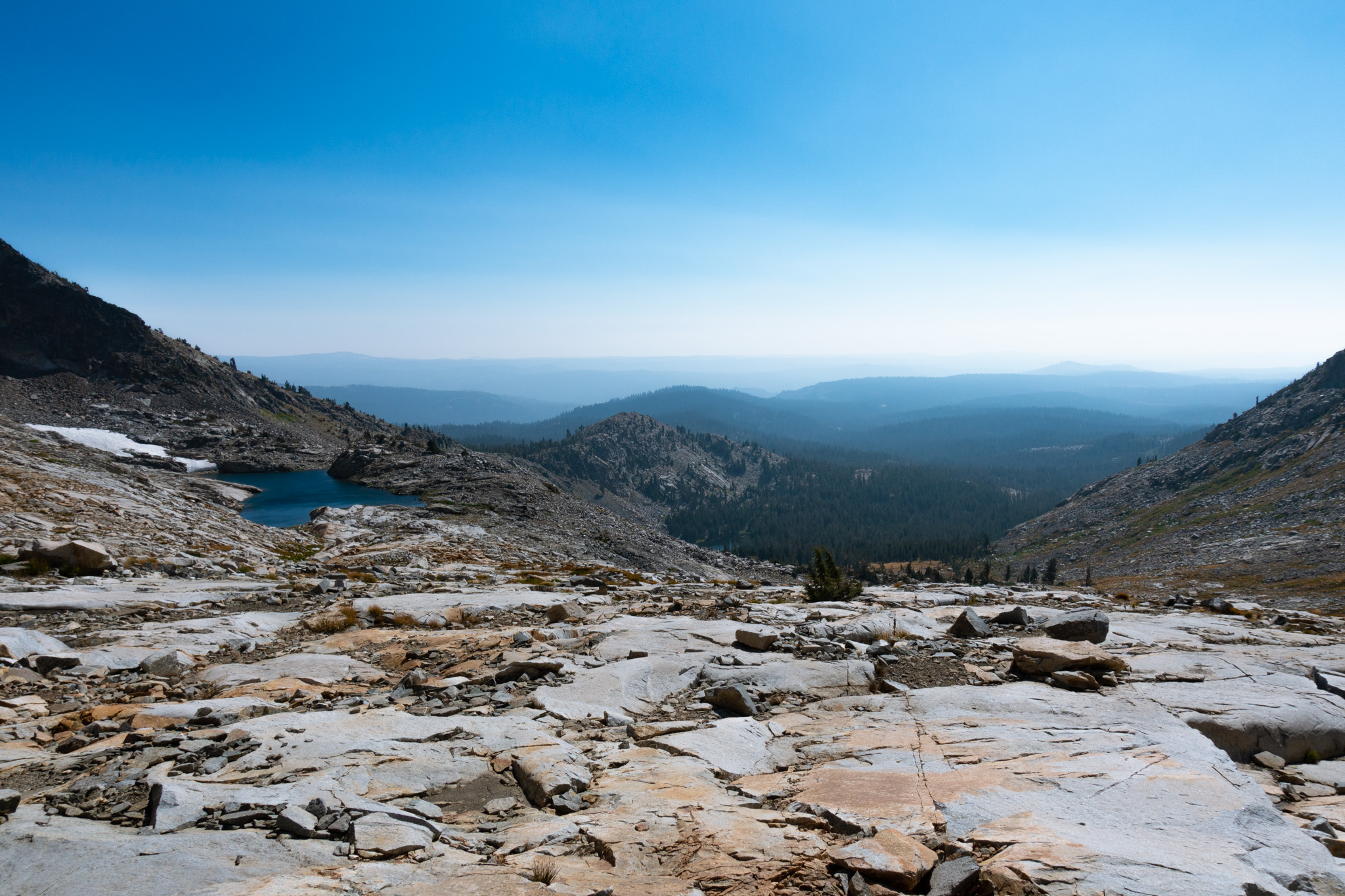
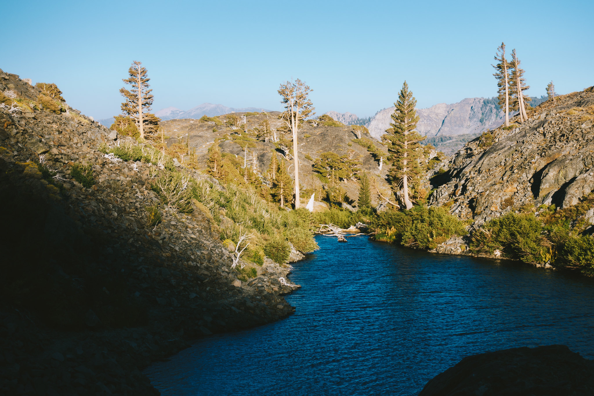
Then I’m descending scree—it’s steep, but nothing that I’m afraid to glissade down—and soon I arrive at a sea of ramps. They are gentle and meandering and all of them go; it’s fun and mild, and I can see almost all the way to Mosquito Pass, and it all looks benign. I continue, cheerful that I will almost certainly land on the trail well before dusk.
 Descending towards Mosquito Pass (A). Tallac (B) seems a touch too far away.
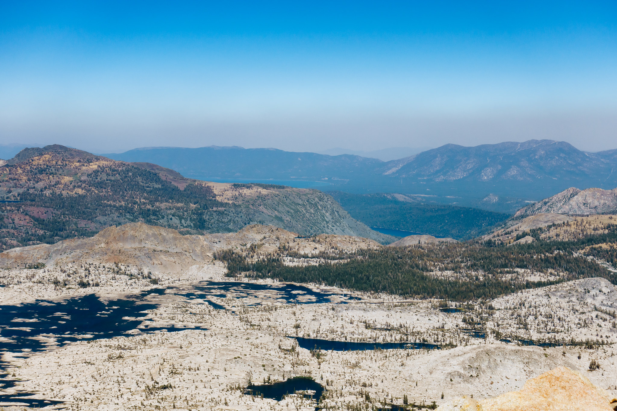
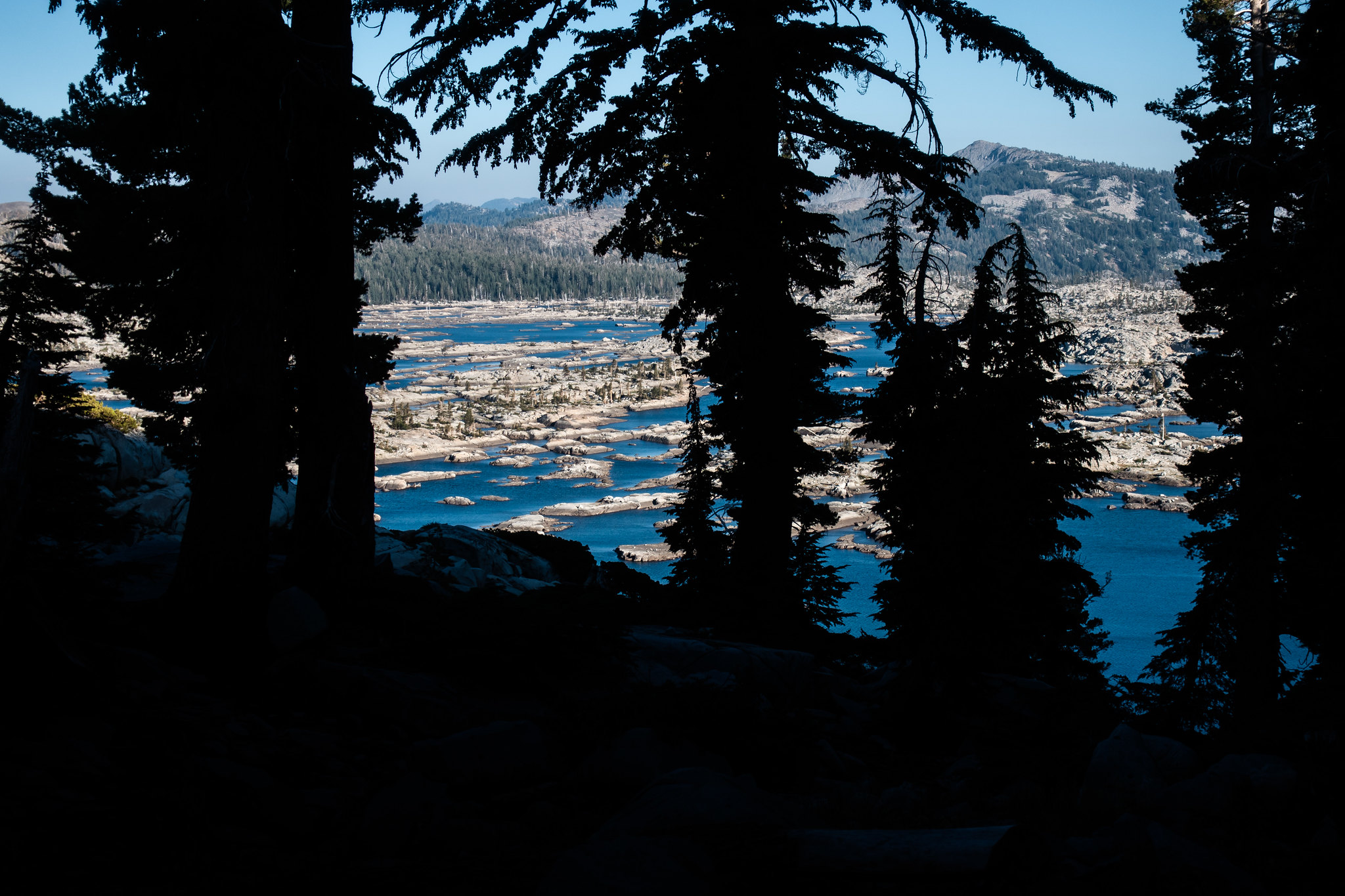
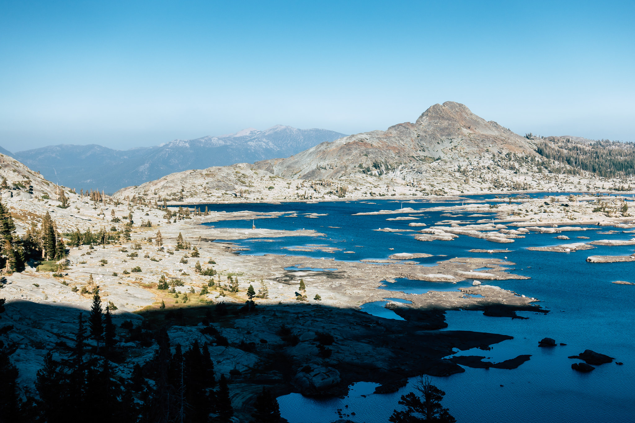
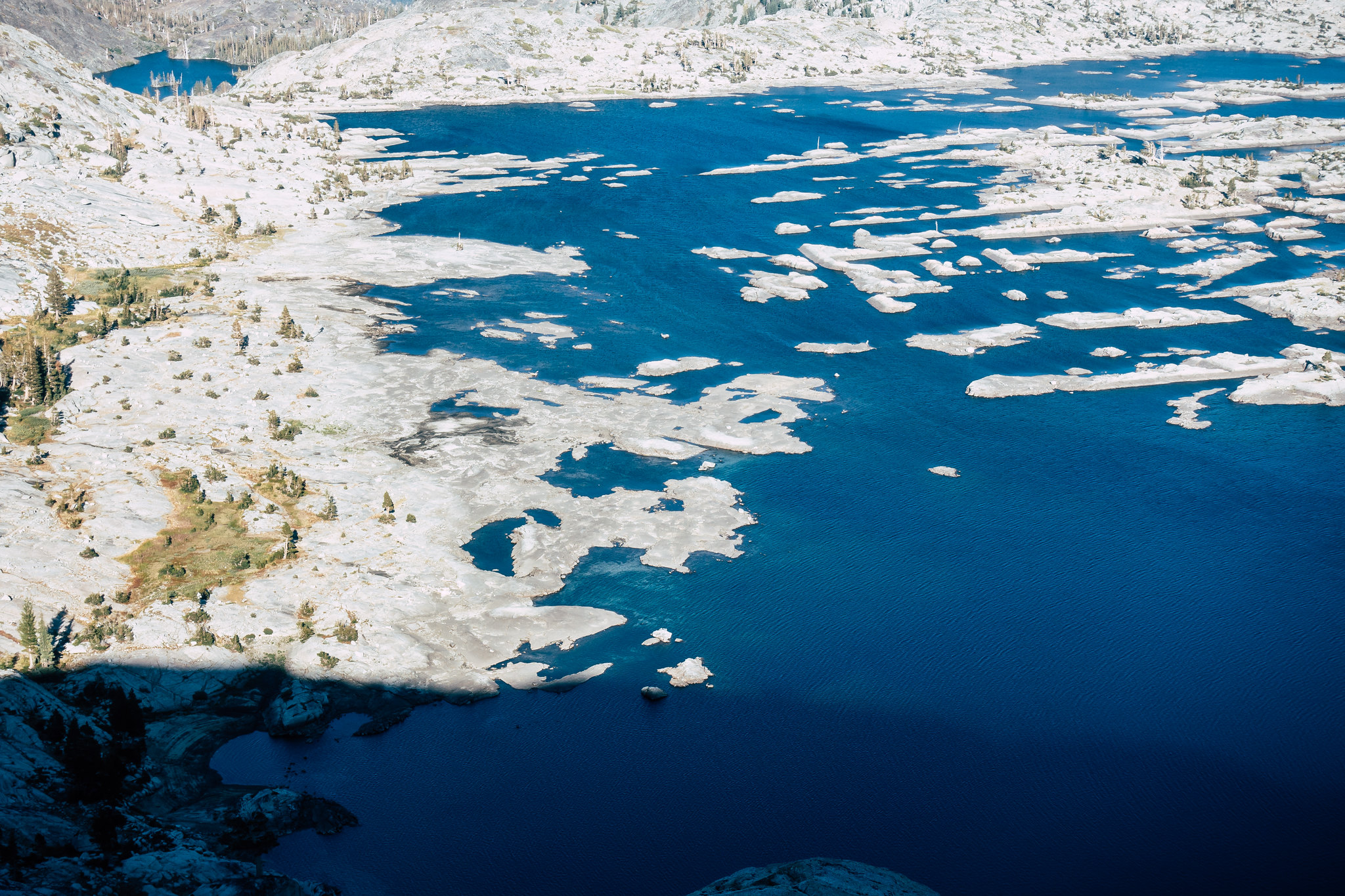 Lake Aloha’s complex shoreline
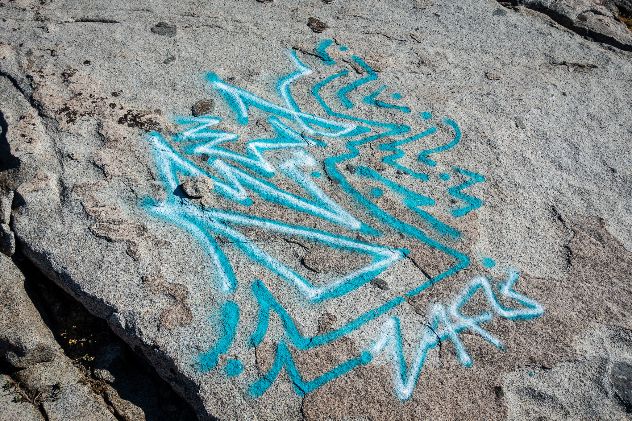 Graffiti in the wilderness. Admittedly, Desolation “Wilderness” doesn’t have the “wilderness” vibe of its peers a few hundred miles to the south
I reach the trail at 6:10 PM, and begin the carefree ambling that is on-trail hiking. The hard part is done and I’m relaxed; warm, slanted sun-rays bring contrast to the never-ending views across Lake Aloha, and the rocky peaks that rim the Desolation Wilderness. Soon I pass other lakes: first Heather Lake, then Susie Lake, then Gilmore Lake. At Gilmore Lake, the trail explodes into an infinite number of use trails. But there are many campers here—I ask two of them where the main trail goes.
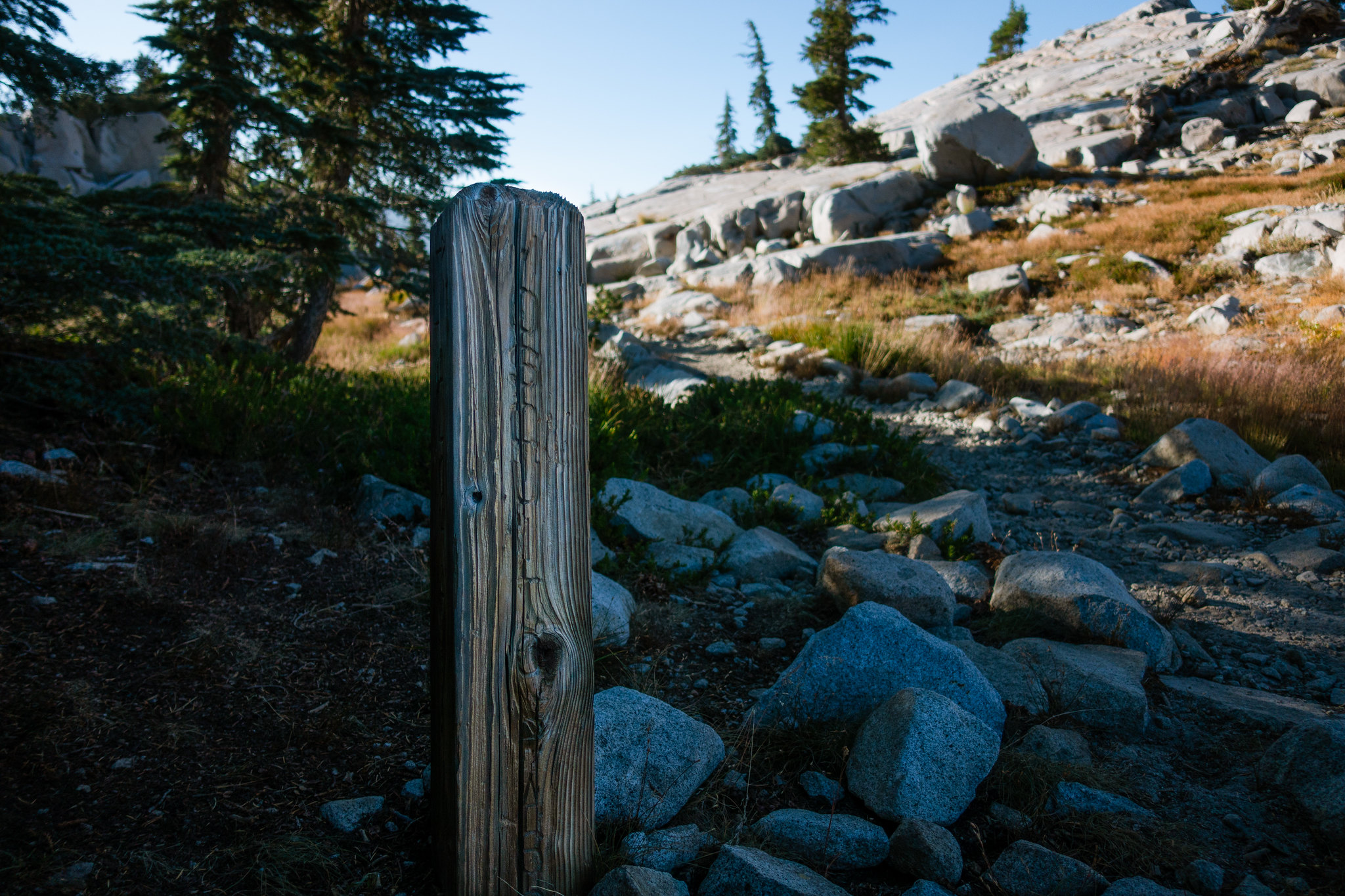 On the trail at Mosquito Pass
 Lake Aloha through the trees
 Approaching Lake Aloha
 Dusky duskness at Heather Lake
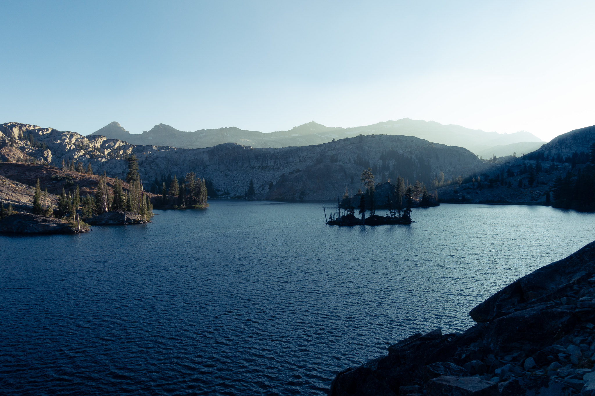
 Susie Lake, named after who knows who
“Where are you trying to go?” they ask. They are lounging in down jackets and camp shoes; they have arrived and their day is over.
“Tallac.”
They nod.
“Keep going—there’s a sign up ahead that says Tallac.”
I thank them, and proceed.
The climb to Tallac is gentle, through open grassland most of the way. The trail is smooth and the walking is easy. Soon I am on rock again, and then there’s a trail junction, and I’m almost there. It’s headlamp-dark now, but the moon is nearly full, so I forego the headlamp.
 Looking back from whence I came: Pyramid (left), Agassiz (center-right), Price (right)
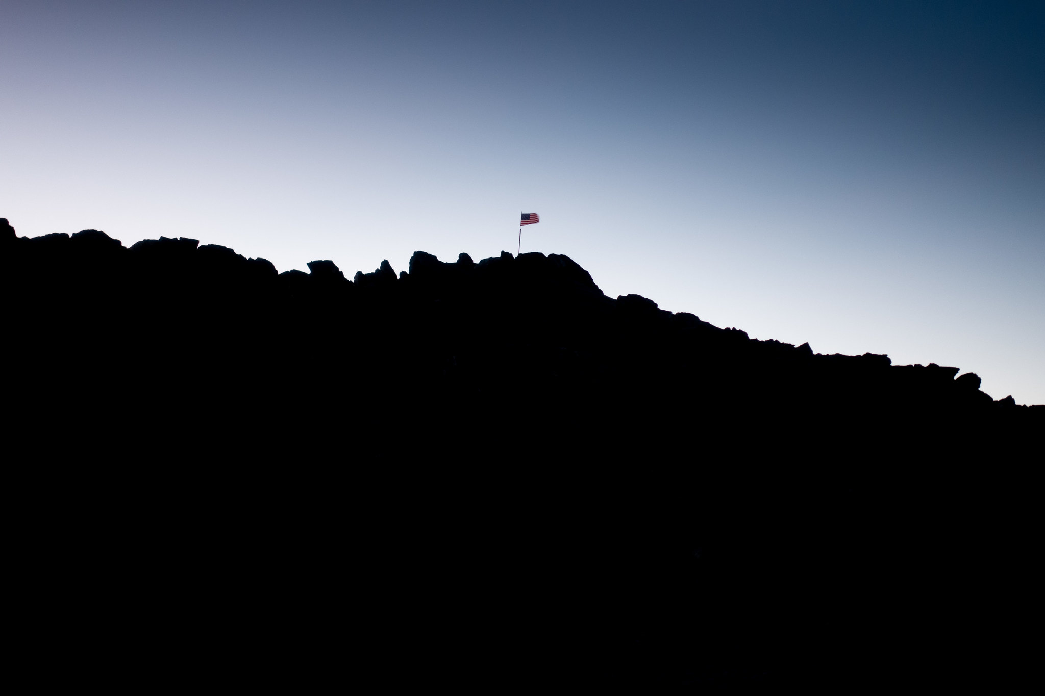 Tallac’s patriotic summit.
At Tallac’s summit, I look briefly for the register, but give up nearly immediately. I need to get down—I wasn’t perfectly clear with my wife about when exactly I’d be done with this hike, and although I mumbled something about several summits and a headlamp, I’m not sure my message was adequately conveyed. I call her, and briefly explain that I’m on my way down, an hour or so from the trailhead.
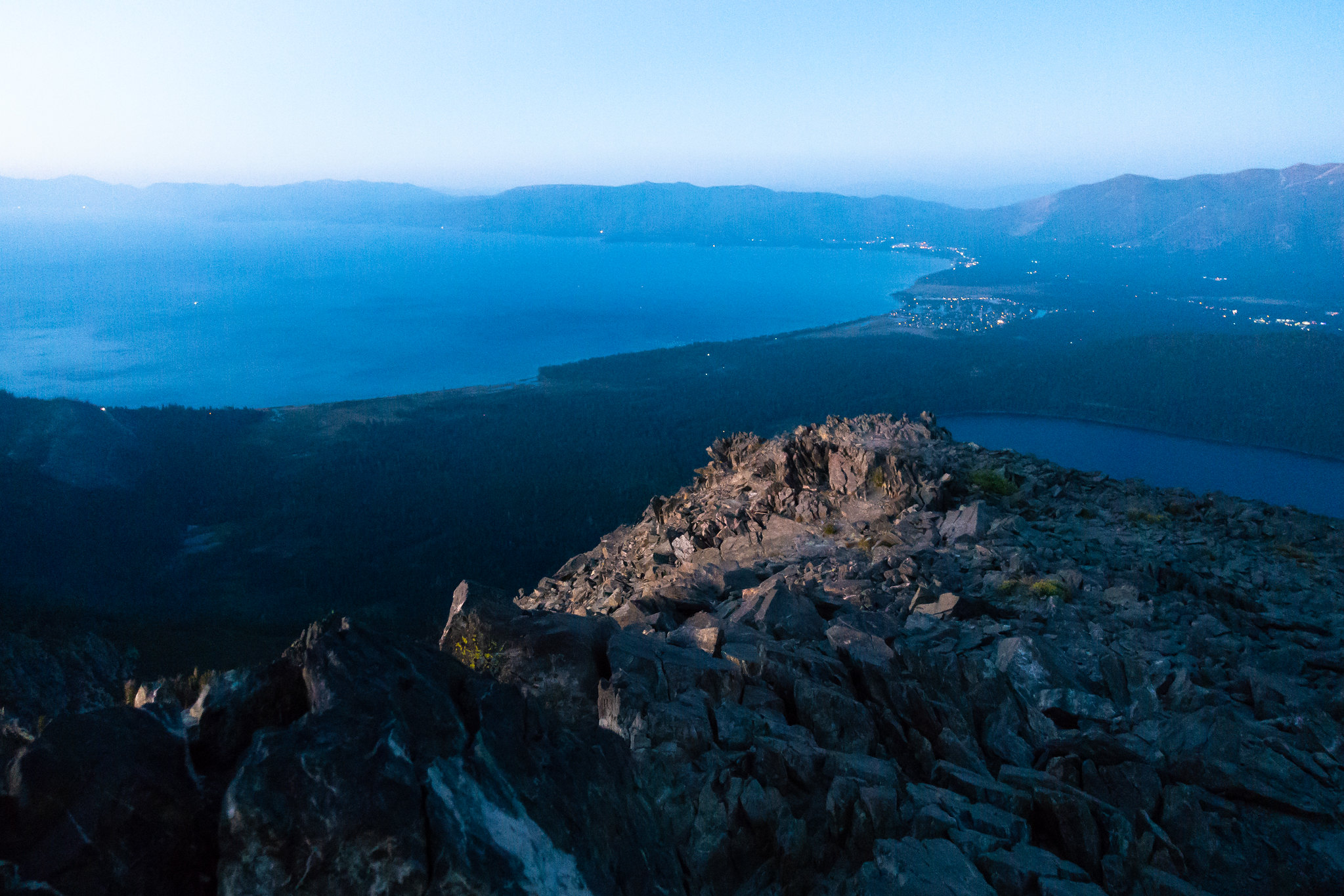 South Lake from Tallac’s summit
The headlamp comes out, and I descend. I climbed Tallac in 2010 from this side, but the trail is rockier than I remember it being. My progress slows as my ability to discern “trail” from “not trail” decreases under my pale headlamp.
Down, down, down. Soon I am at the trailhead. My cell signal is intermittent here, and I can’t complete a call to my wife. I continue walking north, along the road, all the way to Hwy 89 before we eventually meet. It is not hard for her to find me, because I am the only guy walking along the side of the highway.
“There is more than one trailhead for Mount Tallac,” she says with a frown.
Then, there are more frowns—once in the car, I am informed that a minor kerfuffle has occurred, owed to my tardy arrival; in-laws had to stay late to watch our kids while I was out scrambling down dark mountains, and nobody is really happy about it.
My reparations for this will be Responsible Parenting tomorrow, so that’s that—a Friday hike is not in the cards.
This will have to do it—but it was not a bad way to get it done.
That was quite a ramble, Adam. Very well done indeed. I’m guessing your hip isn’t giving you too much grief lately, which I’m really glad to hear.
That graffiti, or is it graffitus, was really disheartening; a sign of the times I fear.
Thanks for posting. I enjoy your trip reports very much!
Tom,
I’m guessing your hip isn’t giving you too much grief lately, which I’m really glad to hear.
Well, unfortunately, it’s a mixed bag and an ongoing saga. I took six weeks off of running and cycling, doing just stretching and strengthening exercises, but it’s come back. It seems to be one of those injuries that’s not so crippling that I can’t do some things (hiking seems okay!), but completely limiting in others (running).
I’m not sure what I’ll do. Arthroscopy is the recommended next step. But if I can hike just fine, perhaps I should hang up my running shoes for a bit? I’m wary of the risk of surgery. Of course, without surgery, it could continue to degrade, to the point of necessitating hip replacement…
That graffiti, or is it graffitus, was really disheartening; a sign of the times I fear.
One curious aspect about it was that is was pretty far off the trail (on the slabs above Mosquito Pass). A surprising level of ambition for a vandal!
Thanks for the kind words, A D!
Gotta give us the mileage/time/splits/mph spreadsheet to really pile on us less capable members;) Reads like a grand afternoon/evening adventure! Pack weight?
Gotta give us the mileage/time/splits/mph spreadsheet to really pile on us less capable members;) Reads like a grand afternoon/evening adventure! Pack weight?
Ha! You know, none of those really matter, right? ;)
Okay, to step down from my ivory tower of Appreciating All The Right Things, for just a moment:
Pack weight was pretty close to zero–clothes in case of unplanned bivouac (fleece hat and gloves, rain shell, wind pants), DeLorme, BeFree, headlamp, mini bic, sunblock, chapstick, cell phone, Sony RX-100, FAK, and perhaps 1,500 calories? Forecast was great, so no real need to be too cautious (although I am the cautious sort).
Of the data, my watch says: 19.91 miles, 7,516 feet of ascent, 8h 42m total time, 5h 57m time spent moving, 14m time spent thinking this wasn’t a good idea, and a total of 38 smiles and 2 scowls*.
Bah, there I am in my ivory tower again :)
* graffiti and death chute
your many great reports speak volumes,
but what I really want to know is how you developed the skill of hiking in the future, and if you are willing to give lessons … :)
your many great reports speak volumes,
but what I really want to know is how you developed the skill of hiking in the future, and if you are willing to give lessons … :)
The continual dosing of sunlight reflecting off granite must be cooking my brain… thanks for the catch!
And that is why you never ever write a trip report in the first post. :)
Become a member to post in the forums.
advertisement
Discover under-the-radar ultralight gear from small brands.

 Loading...