Topic
Planning a Grand Canyon trip, looking for a little advice
Forum Posting
A Membership is required to post in the forums. Login or become a member to post in the member forums!
Home › Forums › Campfire › Trip Planning › Planning a Grand Canyon trip, looking for a little advice
- This topic has 20 replies, 9 voices, and was last updated 7 years, 11 months ago by Chris A.
-
AuthorPosts
-
Feb 5, 2015 at 5:16 pm #1325415
Hello everyone,
I am hoping to plan a trip to the grand canyon for my upcoming spring break (~March 15), and I have a few questions. I am a fairly strong hiker (This previous summer I was averaging 20+ mile days on weeklong trips through the Sierras) and am comfortable with basic map and compass skills (did a bit of off trail travel in the Sierras and recently did a 50 mile cross country trek through Joshua Tree). I don't mind a bit of scrambling but have absolutely no climbing experience; anything with ropes is unfortunately un-doable for me at this point.
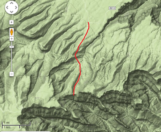
I am hoping to do something well off the beaten path; I backpack to get solitude. Something maybe 50-60 miles or maybe 2 separate ~ 30 mile trips is what I am hoping to put together ( I have about a week off including driving time from the Los Angeles area).
I am hoping to get some advice on a good book or two. Everything I look at has mixed reviews so I wanted to know if anyone with some experience here could recommend a good book for the type of trip I am trying to plan. Here are a few that I am considering:
1) Grand Canyon Treks, Butchart – http://www.amazon.com/Grand-Canyon-Treks-Harvey-Butchart/dp/0964753022/ref=pd_sim_b_1?ie=UTF8&refRID=16J8J8CC9M8V6YX7Q713
2) Hiking the Grand Canyon: A Sierra Club Totebook, Annerino. http://www.amazon.com/Hiking-Grand-Canyon-Sierra-Totebook/dp/1578051509/ref=pd_sim_b_3?ie=UTF8&refRID=0TF0S935YBKDQTVQZQRF
3) Hiking Grand Canyon Loops, Steck. http://www.amazon.com/Hiking-Grand-Canyon-Regional-Series/dp/0762712082
If you have any recommendations on areas I may want to check out, that would be appreciated as well.
I have read that getting permits can be a nightmare and must be done many months in advance. I assume this applies for the more popular areas and it would not be a problem getting a permit at this point for something more out of the way. I can't imagine such a large park being fully booked up… Thoughts?
Thanks in advance for any input you may have, I appreciate it!
Feb 5, 2015 at 6:47 pm #2171780I will be there at the same time you're planning to go. Mid-March is a great time to go for weather and water, and permits will indeed be difficult. Once you've figured out a few general ideas for itinerary, your best bet is to phone them and just have them hunt for something that's available. You'll have to try many times before you get through, but they are pretty helpful when you do.
But be advised that if you have no GC experience, the rangers will be extremely reluctant (for good reason) to issue permits for anything that you sound like you want to do. Do you have any experience at all in the GC? The Steck and Butchart books are classics. But both are only suitable once you have extensive GC experience. Even with the strong skills you evidently have elsewhere, it takes time and experience to learn how to move through the Canyon safely. This is not the Sierras – when you're cross-country in the GC you're mostly either climbing or traversing dangerous, crumbling cliffs or you're canyoneering.
I can suggest a couple of routes that are way more adventurous than usual for a first trip to the GC, but sound like maybe what you are looking for.
(1) Go down Tanner Trail. Option to first go east along the Beamer Trail to the Little Colorado confluence. Then back, and follow the Escalante Route west. Dayhike up 75-mile canyon. Exit via New Hance trail. Don't underestimate the climb out on New Hance, it's rough going.
You will struggle to get permits for this. I think you will not get permits for BB9 Tanner, but you could spend the first two nights in BA9 Palisades. Then it's possible (but unlikely) that there might be a couple of nights open in BC9 Cardenas, BD9 Red Canyon.(2) Phantom Creek. Starting from the S Rim, you first need to head down one of the corridor trails (Bright Angel or S Kaibab) to cross the river to Phantom Ranch. Abandon the crowds up a steep semi-trail and then cross-country onto Utah Flats. You could spend 2-3 nights exploring Phantom Creek. It's gorgeous, you won't see a soul. Then maybe head cross-country over the Isis-Cheops saddle and and spend a couple of nights exploring Trinity. This might be too daunting, but it's out-and-back, so you can turn around. Return same way into Phantom Creek, but instead of going back via Utah Flats, you can return to Phantom Ranch down the Creek itself. There's nothing technical or dangerous, but it's awesome fun – you will be sliding down rocks into pools in a few places, and "swimming" – really just doggy-paddling a few yards to get through a few of the deep pools. This will be your last day – you'll hike straight out up the S Kaibab trail afterwards – so it doesn't matter if things get a bit wet.
Permits – you will definitely not get permits at Bright Angel campground, so you need to plan to travel from the South Rim into and out of Phantom Creek on your first and last days. Phantom Creek (AP9) permits – I don't know, but it's possible. Trinity (AQ9) permits won't be a problem.Both of these areas have the solitude that you're looking for, are somewhat adventurous without being crazy dangerous, and may just conceivably have permits. I can give you much more detailed information if you get permits, feel free to PM.
all the best
Feb 6, 2015 at 8:00 am #2171903Wow Ralph, thanks a lot for such an in depth response! I do not have any experience at all in the grand canyon and I imagine it would be different and steeper than what I am used to. That is why I mentioned my total lack of experience with any sort of climbing/ canyoneering techniques. The Phantom creek option sounds wonderful. I am looking over the maps and will let you know if I have more questions. Hopefully the permit works out.
I will probably pick up the Steck and Butchart books eventually, but is there a book you could recommend geared more towards people without much experience in the Canyon? I am eager to learn about anything special I should know for this area. For example, I am used to just filtering water through a Sawyer mini without any pre filtering. I realize this won't work in GC and I'll be needing to bring alum and allow plenty of time waiting for sediment to settle. I am trying to figure out what other similar aspects will make this trip unique. I'll probably be reading a lot of trip reports here in the upcoming days.
Feb 6, 2015 at 10:18 am #2171943For a guide to the trail system, with some nice geologial context, I quite like the Falcon Guide book by Ron Adkison – just called "Hiking Grand Canyon National Park". And I see it's on Kindle, which is great, because you can load it onto your phone and have it with you.
You can also just invest in Butchart right away. He's such a legendary figure, and that book does describe all the major trails, and give some great background & color. Just be cautious about his descriptions of off-trail stuff. Butchart would do some crazy dangerous things, usually alone, often unroped even on Class 4 or beyond. So when he says "there's a route" – you cannot rely on this like you can for (say) Roper or Skurka's description of the Sierra High Route. With Butchart, it may turn out to be anything from easy Class 2 to beyond Class 4 – all you know for sure is that a mountain goat or a team of roped-up Swiss guides could (probably) make it. You must rely entirely on your own route-finding and scrambling/climbing skills to assess whether you can safely go.
Online stuff:
NPS has pdf guides for all the trails, including the Escalante Route, go here and scroll down:
http://www.nps.gov/grca/planyourvisit/campsite-information.htm
They also have one for Utah Flats (the semi-trail route that I described to get you from Phantom Ranch up and NW across into Phantom Creek), but for some reason it's not on that page. Possibly because they want to assess you in person before handing it out. I can send it to you if you need.You can also find a bunch of other stuff online. Try the Yahoo Group for Grand Canyon. They have an annoying policy of putting new members in moderation for several months, so your posts will vanish for hours to days before showing up. But it's a great resource just to search. Bear in mind that conversations on there vary widely – from beginners asking "how do I get a permit for Indian Garden" to guys who've been hiking off-trail there for 30 years discussing Class3 / 4 semi-mountaineering routes, so just make sure you have context.
If you can't get a Phantom Creek permit, one other option:
The Boucher trail is one of my favorites, and it's probably the toughest trail on the S Rim. A couple of spots are almost Class 3, hands on rock. But that's a good thing – it keeps 99% of backpackers away. It's a spectacular and beautiful route into the Canyon. If you approach it in a similar way to cross-country in the Sierras, it should be within your abilities – preferably pack weight no more than 25lb. You will be lucky to get a permit for Boucher itself (BN9) and it will be even harder to get permits for anywhere east of Boucher (Hermit, Monument Creek, and everywhere east of there is popular). However, the Tonto Trail west of Boucher is much less traveled. You may well be able to get permits for the Slate (BO9) area. And you can reach BO9 in a day from the trailhead if you're in good shape and leave early. Just make sure that you DO have plenty of time – this is not a place you want to be rushing. You'd fill up with water in Boucher Creek, then you'd need to travel at least 2 miles west onto the Tonto platform to reach the BN9/BO9 boundary. You will find plenty of water in Slate, Sapphire and Turquoise canyons in March. And these are all awesome side canyons to explore – you could easily entertain yourself with 4-5 days in this area, spending a day exploring down each of these side canyons. You will have complete solitude, and by exploring these canyons as dayhikes you can just scramble as far as you feel comfortable. Slate goes to the Colorade with a difficult (but non-technical) scramble. Sapphire I haven't explored, but looks like a fun winding slot. Turqoise is gorgeous, there's a creek, a grotto, hummingbirds… If you can't get a Boucher (BN9) permit on the way out either, you'll have a long tough day hiking back to Boucher up and out, but you'll be light at that stage. Just leave at dawn, if you're fit and agile you'll be fine
Ralph
Feb 6, 2015 at 10:42 am #2171951GREAT advice from Ralph!
A couple of additional points — Firstly, Harvey Butchart and George Steck were legendary canyoneers who often pioneered very difficult and dangerous routes. (One even involved the death of Butchart's hiking companion.) Their guidebooks are not very detailed as far as route-finding goes, and you would need to be very proficient with map & compass, as well as have an understanding of how to travel off-trail in crumbly sandstone and prickly cactus. That takes practice.
Secondly, one of the greatest challenges of GC travel is the lack of water. While carrying 1L or less in the Sierras is perfectly feasible (there will soon be another creek!), you may have to carry 6-8L or more in GC. That's a lot of weight. And even in March, it can be very hot near the river (requiring plenty of water). Basically, plan your route with water in mind.
Feb 6, 2015 at 12:59 pm #2171999I understand what others are saying about being careful if you aren't experienced in GC navigation, but on the other hand if you're an experienced backpacker in general and capable of 20-mile days then hiking Kaibab or Bright Angel will just frustrate the hell out of you. Too many tourists. Lots of traffic. (Though maybe not so much in March.)
You can find more remote trails than the Corridor System, which are still easy to follow and have predictable water sources. Tanner Trail is one- there is no water on the trail but you can do the whole thing in a day either way, and water is available from the Colorado River at Tanner Beach. Then do trips from the Tanner Beach campsite, perhaps one along Beamer Trail to the LCR and back. I would almost say that a GC neophyte could do the Escalante Route to Hance Creek and Horseshoe Mesa, then up Grandview. Yeah, now that I think of it the NPS just needs to bite that bullet and renamed it the Escalante Trail. A neophyte could do it, if instilled with appropriate water paranoia. Here's a trip report:
But would 75-Mile Creek be flowing in March? That'd make things more exciting.
Frankly, just going down Grandview to Horseshoe Mesa and hiking in that area would be great, too, especially in mid-March. It would be pretty straightforward to just spend a day to circumnavigate the mesa.
If you want to feel remote go to the North Rim. (I think it might not be open in March, though. You'd have to hike in.) I would recommend Nankoweap trail- it is exposed but you aren't bushwhacking off-trail, and I only saw one other group in two days. It's not that hard for someone inexperienced in the canyon to follow- not like the Horsethief Bypass or other craziness you'll find in Steck's book. (Steck's book is absolutely for experienced GC hikers- it's basically a series of anecdotes and funny stories that occasionally mentions something about water sources.) It would be an out-and-back trip though. Here's my trip report which includes it:
The seep at Marion Point is very slow. You can't tank up there, but you can leave a trap to pick up on your way out. (If you're a trusting soul…) But Nankoweap is lovely if you break it up. Camp at either Marion Point or Tilted Mesa. The former is more impressive. Camp again at Nankoweap Creek, and make a day hike to the Colorado River and the pueblo ruins. Then camp again at Marion Point or Tilted Mesa on the Way out.
You could easily combine Nankoweap with the Ken Patrick Trail to lengthen it.
Feb 6, 2015 at 9:34 pm #2172166You guys are unbelievable; thanks so much! That is a lot of information to digest. I'll be looking at all the options you have suggested and hopefully applying for a permit in the next couple of days. I'll let you know how it goes.
Ralph, If you wouldn't mind sending me the Utah Flats pdf that would be great!
Feb 11, 2015 at 12:14 am #2173342Be careful with Steck and Butchart. Their route descriptions are deliberately vague, in that "if you don't know what I mean, you don't belong there" way. They assume that you know and can recognize GC rock layers as well as landmarks and named formations. If you don't, the directions will often not make any sense to you.
March permits aren't that hard to get once you're off the corridor. Accessing remote trailheads in March will be more of a problem, especially when you're talking about Steck. Most of the North Rim will be inaccessible.
Call the Backcountry Office and see if they can clobber a permit together for you. Ask about New Hance or maybe Tanner. Forget any ideas about averaging 20 mile days. The GC doesn't work like that. Think more like 7-8 mile days; camps near side canyons that can be explored once you get there. The GC is much more about nooks-and-cranies. Outside of the corridor, you're really not going to be bothered with crowds in March.
Feb 16, 2015 at 6:50 pm #2174847In March, with the North Rim still closed, the reasonably remote treks will be along the Tonto Trail. At ~60 miles you are looking at Tanner to S. Kaibab (or Bright Angel) or reverse, or the South Bass to Bright Angel (or S. Kaibab) or reverse.
The first 1/2 of mention routes, Escalante (Tanner entry) and "Gems" (South Bass entry) are remote seldom traveled routes. Annerino's book on the Grand Canyon has good info on both.
As mentioned in an earlier post a Backcountry Office ranger will most likely contact you and ask for a backpacking resume'. This to give them some confidence that they aren't permitting a search and rescue operation.
Steve
Feb 17, 2015 at 1:19 pm #2175082But even if the North Rim is closed you can park in the national forest and hike to the lower Nankoweap trailhead. It's about 3.5 miles. My second link above covers it. From there you can out-and-back both Nankoweap and Ken Patrick.
Feb 17, 2015 at 3:53 pm #2175132Dean – I think you need to be cautious about that drive. So far as I'm aware, there's no road within 20 miles of the Nankoweap trailhead that gets plowed. So if you use the FS dirt roads to reach the trailhead in winter or early spring, you need to be confident about the weather forecast, or your car may be parked there longer than you anticipated. (As in, several months longer than you anticipated.)
Feb 18, 2015 at 7:10 am #2175323Granted, when I did it it was a very low snow year, and I have 4WD. (What's the snow like this year?) And, while dirt, the roads were quite good. I think you're wrong on the "no roads within 20 miles of the Nankoweap Trailhead" part. Seriously, it's 3.5 miles to Lower Nankoweap Trailhead from FR8910. I've hiked it. (Lower, not Upper Nankoweap.) Here's my 60-seconds-on-GoogleMaps visual aid:
So, I mean LOWER Nankoweap. Maybe I'm mis-using that trailhead name? But nonetheless, one can get to Nankoweap Trail from FR 8910, on a reasonably established trail. Not established enough that doing it in the snow wouldn't require some navigation skills, though. But you can SEE the notch you're aiming from from the road, so as long as you hike toward it you'll find it. (FWIW Even Upper Nankoweap looks like it might be at most 8 miles.)
EDIT– And, mind you, I'm not saying to neglect the weather forecast… Thus far SNOTEL says there is no accumulation at GRCA:
Is that ground truth? And when does GRCA get most of its snow? March? Hmm…
EDIT AGAIN– The Yavapai Point webcam doesn't show any snow, but that's South Rim, of course. The San Francisco Peaks look like they have a pretty high snow line right now, too. As long as that holds I'd say one would be pretty set to drive in, pending the forecast, of course.
(This is all apropos for me, because I have plans for a grand loop through GRCA some day similar to the map on this link above, and I would plan to do it in February or March. I have to scout the Horsethief bypass, but if it goes I think it's doable for me.)
EDIT AGAIN AGAIN– Wait, you specified a road "that gets plowed." My bad. In that case you're right, and it may be farther than 20 miles, frankly. But of course if there's no snow then there's no snow.
Feb 19, 2015 at 7:27 pm #2175921It's not just about whether the roads are plowed or have snow. Some will have downed trees from winter that will not have been cleared yet. There's also the chance of getting snowed in while you're below the rim.
Feb 20, 2015 at 6:43 am #2175990We are blessed nowadays in having access to very accurate weather forecasting, which you will note I said not to neglect. Granted, this doesn't help much when you have to apply for permits months in advance, but this is well within the range of do-able. The need to apply for permits so far in advance may indeed make this impractical for someone who doesn't have some flexibility in their schedule, but far from impossible in general.
Likewise, blowdowns in that part of Kaibab National Forest is also far from a dealbreaker, but might require a strap to pull them off the road. They aren't so much trees as prodigious big shrubs (IIRC almost all juniper?). One thing that I did just think of is that there are a few creek beds to cross, and that time of year they may well be actual creeks rather than beds. So a vehicle with good clearance would be helpful. (FWIW when I did it in early April there were no blowdowns and the creeks were dry.)
But, bottom line, yes, I guess you all are right. (Not surprising, since I'm at best a moderately experienced GRCA hiker.) Without flexibility it's hard to do without risk of getting snowbound. You have to have a low snow year and a helpful forecast, which is hard to predict months in advance. That said it looks like this year may be a low snow year, so we're halfway there…
Feb 20, 2015 at 2:09 pm #2176145Dude that's crazy awesome good advice! Can't wait to explore your suggested routes. Relocating to Flagstaff soon!
DanaFeb 20, 2015 at 2:28 pm #2176160The Round Valley access to the Nanokoweep Dean highlights is a different ballgame from the roads up on the plateau. These days it's probably useable almost year round. I'd actually be far more worried about mud in the wake of a storm or melting snow than anything else, the potential for gumbo at that elevation is pretty huge. Same deal on the winter detour to the Indian Hollow and Bill Hall THs.
I've been out to the north rim in early April before with no problem. A 6 mile dirt detour will take you around the gate on highway 69, and that road usually melts out very fast. A saw and strap are a good idea for any dirt roads up on the Kaibab.
Mar 6, 2015 at 7:16 am #2180489Dean – last week was a timely example of what I was warning about, if driving to N Rim trailheads at this time of year. When I hiked into the Canyon on 2/19, conditions were balmy, more like late April. Completely free of snow and ice on the S Rim trails, and I'm sure the N Rim roads and trails were similar. Then between 2/28-3/3 there was a huge dump – the N Rim got 27" of snow.
Mar 11, 2015 at 8:22 pm #2181871Indeed, don't neglect the forecast. However:
Note that while the park has some snow residual up there on the plateau, there is still none in the part of the Kaibab National Forest that I'm talking about. I understand that this is not uncommon in the spring.
And even immediately after the dumping that Ralph describes there was still no snow where you would park in Kaibab National Forest (which is discrete from the Kaibab Plateau):
You would have had to hike through a bit of snow to get to the Lower Nankoweap trailhead (up to a foot?) but your truck wouldn't have snow, nor would the drive out. The first bit of the trail to Marion Point might be a bit exciting, too. (Spikes!)
So, it can be done. You just need to watch the weather, which I have admitted is a pain because you need to get permits WAY in advance and then chance having to cancel. You need a backup in case it doesn't pan out. OTOH I find it hard to believe that permits for Nankoweap are all taken at this time of year, so a last-minute walk-in is probably viable.
And I wouldn't do it without a 4WD, and I'd have extra supplies in it. Winter camping in Kaibab National Forest! Woop!
P.S.- Don't leave us in suspense, Alex! What are you doing?
May 27, 2016 at 4:12 pm #3405093I found myself in a very similar position as the OP about a year after this thread started, but found it very useful and wanted to give a shout out to Ralph Burgess for his insights (see first reply in the thread). It was late February and I hadn’t made any reservations for The Grand Canyon. All of the conventional spots were booked up. I found this thread from 2015 and ended up PMing Ralph to talk about the Phantom Creek route.
Ralph gave us detail that we wouldn’t have been able to do the trip without. Thanks, Ralph!
Here is a summary of our trip:
Day 1: Arrive at The Grand Canyon in the evening — car camp at the rim
Day 2: Hike down to the bottom, pass Bright Angel campground, up to Utah Flats, across and down to Phantom Creek.
Day 3: Rest and play around in Phantom Creek area; we were concerned about hiking all the way out of the canyon, so we hiked part way back and camped in Utah Flats.
Day 4: Hike out of the canyon.
We had never been to The Grand Canyon and found this to be a stretch of our abilities, but rewarding. It’s a good intro to scrambling and route-finding on less maintained trails. We lost the trail for a few minutes with only about an hour left of sunlight on climb down to Phantom Creek, but we kept a cool head and found it again and successfully made our way down. I would recommend this route to others and would recommend talking to Ralph if you have questions about it. I would also be willing to chat about it, but Ralph can give you way more information.
May 27, 2016 at 4:29 pm #3405096We lost the trail for a few minutes with only about an hour left of sunlight on climb down to Phantom Creek, but we kept a cool head and found it again and successfully made our way down.
Oops – I realized when I was there myself in March that I had misremembered where the trail comes down, I think I told you to go downstream a little way to the campsite? Â But the trail comes out right opposite the campsite – pretty obvious in daylight, but I hope that didn’t send you the wrong way at dusk.
May 27, 2016 at 4:34 pm #3405097Not a problem! Just some fatigue and one of the cairns tries to hide around a bend combined for us to attempt going down a little early on a false trail.
-
AuthorPosts
- You must be logged in to reply to this topic.
Forum Posting
A Membership is required to post in the forums. Login or become a member to post in the member forums!
Our Community Posts are Moderated
Backpacking Light community posts are moderated and here to foster helpful and positive discussions about lightweight backpacking. Please be mindful of our values and boundaries and review our Community Guidelines prior to posting.
Get the Newsletter
Gear Research & Discovery Tools
- Browse our curated Gear Shop
- See the latest Gear Deals and Sales
- Our Recommendations
- Search for Gear on Sale with the Gear Finder
- Used Gear Swap
- Member Gear Reviews and BPL Gear Review Articles
- Browse by Gear Type or Brand.