A friend and I did the Cone Peak Loop in the Ventana Wilderness last weekend. We left San Diego at 8:30am on Friday and after a stop at PizzaRev in Camarillo and Shine Café in Morro Bay we were hitting the Kirk Creek/Vicente Flat trail around 5:30. It took us about 2.5hrs in the dark to get to Vicente Flat. We got down there along with about 5 other groups who had already set up and were enjoying campfires.
The next day we set off up through the redwood lined canyon to Cone Peak Road. There were a couple downed trees, but overall the trail was in great shape.


Cone Peak
View East from Cone Peak Road

We made it to Cone Peak around lunch time along with a large group we saw at Vicente Flat the night before. I had a good time using the PeakFinder Earth app on my phone to figure out the names of the surrounding and distant peaks.
On top

Fun fact: ignoring atmospheric refraction, one can see about 87.5 mi of ocean from the top of Cone Peak
West toward Twin Peak
North to Junipero Serra Peak
Northwest
East
We couldn’t have asked for better weather. It was warm, clear, and no haze until later in the afternoon. We could even see some snow capped peaks of the Sierra, although they don’t show up in the photo.
Thanks to Jack Glendening for putting together an excellent online map Big Sur Trail Map
of the Big Sur area with printing capabilities. We took a chance and decided to head back down Cone Peak about .75mi to pick up a use trail over to Twin Peak, bypassing the Gamboa trail. The beginning of the use trail was not obvious, but we left the trail right where Mr. Glendening’s map shows to and the use trail became clear about 15 yards in.
On to Twin Peak

South from Twin Peak
From Twin Peak one can follow the ridge all the way down to the highway or take another use trail over to Ojito Saddle. This section seemed not as well traveled and required a bit of bushwacking, but overall was easy as the saddle is basically visible the whole way… along with stellar views of the ocean.
Over to Ojito Saddle


At Ojito Saddle we followed the now excellent Stone Ridge Trail down to Goat Camp.
Goat Camp is a small, but great campsite with ocean views framed in by two ridges. There was water flowing about 50 yards further down the trail. My friend had a good time using his folding saw to cut fire wood. He got so excited, he decided to cowboy camp right next to the fire.
Goat Camp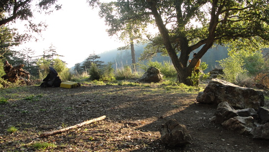


The next day we hiked back down the Stone Ridge Trail to Vicente Flat and back out to where we parked next to the Kirk Creek Campground.
Nice switchbacks from Ojito Saddle to Goat Camp

Route up from Hwy 1 to Cone Peak


I had tried to do this loop with someone else in March 2008 going clockwise from Vicente Flat. It was my first backpacking trip: no maps except the tiny ones in the guide book, no experience, and no idea how faint trails in Big Sur could be. We didn’t even make it to Goat Camp on that trip due to all the downed trees, brush, slides, and game trails that looked like it just might be the real trail. Thank you to Mike Heard and the Ventana Wilderness Alliance for making this trip a walk in the park.
Then


Now


