Topic

southern Wind River Range – Texas Pass on August 11th?

  • This topic is empty.
Viewing 11 posts - 1 through 11 (of 11 total)
PostedDec 31, 2014 at 1:27 pm

In late August of 2013 I attempted to hike in the Cirque of the Towers area. We had to pull out on the 2nd day because one member had a bad sinus infection, and another got AMS. The rest of us salvaged the trip by spending 4 days in the Tetons.

I'm headed back in 2015, but have to go about 2 weeks earlier due to work vacation scheduling.

Should I expect a problem crossing over Texas Pass on August 11th? I realize conditions may depend on the amount of snow this year, etc. But is it generally a dangerous pass if there's some snow up there?

Would anyone recommend taking microspikes as a precaution? Ice axes?

I read Andrew Skurka's 2014 blog about attempting a Wind River Range high route. He had to turn back from Bonney Pass on the north end of Titcomb Basin because the pass was icy and they didn't bring microspikes or crampons. I'd hate to find myself in a similar situation. He was in the Winds on the FIRST week of August.

However, he did write about Texas Pass:

the consensus southern entrance/exit over Texas Pass near Big Sandy is underwhelming, lacking technical challenge, novelty, or a climatic view that offers inspiration to northbounders or a sense of accomplishment for southbounders.

Thanks for thoughts. My plan is to cross Texas Pass southbound.

Brad Rogers BPL Member
PostedDec 31, 2014 at 4:54 pm

I went over Illinois Pass on 8/30 and there was no snow on Texas Pass. It looked like a pass full of loose scree. That is such a beautiful area, you will have a blast.

Brad Rogers BPL Member
PostedDec 31, 2014 at 4:58 pm

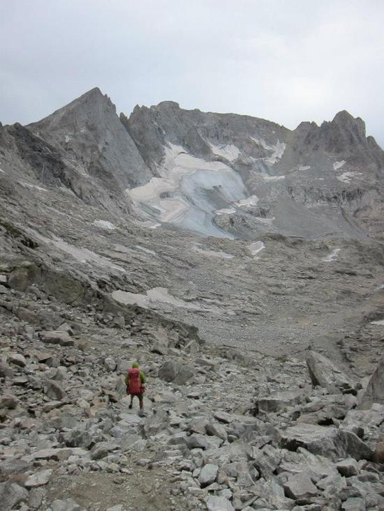
Here is a picture of Texas Pass that I took on the accent up Illinois Pass. Texas Lake is in the foreground.

tx

PostedJan 2, 2015 at 4:38 pm

Thanks, Bradford. Nice photo!

I ready about Illinois Pass in the Pallister book. How was it? I don't think it's something my whole group could do, but a few of us could probably tackle it.

Brad Rogers BPL Member
PostedJan 2, 2015 at 7:33 pm

We did the route Pallister described going up the right hand side of the pass and it wasn't that bad. I did Knapsack Col in 2012 and thought Illinois Pass was slightly easier. She mentioned some sections where you have to remove your pack and hoist it above your head, which we didn't encounter. I guess either we took a slightly different route or with a lighter pack it wasn't necessary. There were a few spots we needed to use our hands. The toughest sections were some areas where we were in basketball size talus.

Looking at Texas Pass I am not sure if it wouldn't be more difficult than Illinois Pass. It looked like a lot of loose scree from my perspective, of course there could have been a clear route once you got closer. I didn't get any closer than the shore of Texas Lake.

I am sure you will have a great time, I love the Winds, and that is such a beautiful area. You will have a blast.

PostedJan 4, 2015 at 11:19 am

When you did knapsack col, was there a cornice to deal with? It's YET ANOTHER area of the Winds that interests me – going over Knapsack Col east bound and down into Titcomb Basin.

The Winds certainly offers a multitude of opportunities!

John Vance BPL Member
PostedJan 4, 2015 at 12:39 pm

Terrain and trail conditions really vary from year to year and July to August. I have been over all the routes you are describing some years with no snow and others with significant snow. All have been passable just a bit more sketchy at times. Specifically concerning Knapsack Col going east bound, the cornice, if it exists, can typically be skirted to the north on rocks but if there is enough snow to run out on can be fun by taking it head on and glissading down. This is very dependent on soft snow conditions or it may become much more exciting than you bargained for.

I have typically passed on the north side and then glissaded down if conditions permitted "safe" sliding. Some snow makes all of these routes a bit more enjoyable and easier provided you are on snow and not ice…particularly the east side of Knapsack. As winter progresses into spring the should be a better idea of general snowpack in the Winds going into summer. Until then, I too dream of the high places.

PostedJan 4, 2015 at 1:54 pm

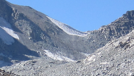
It's a little hard to tell for certain but it appears that there was a cornice in mid-September, 2012 on the Titcomb Basin side. The photo is grainy due to zooming in to capture the area of interest.

Knapsack Col

Brad Rogers BPL Member
PostedJan 4, 2015 at 3:29 pm

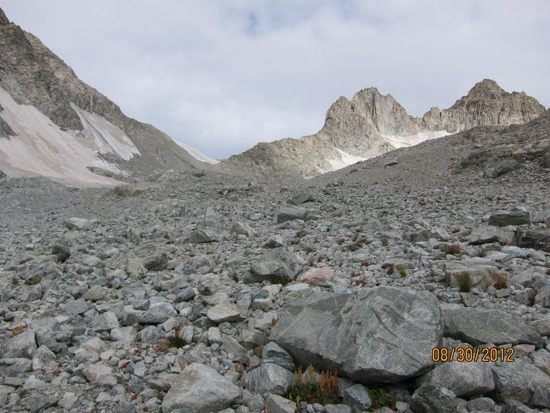
When I was there at the end of August 2012 we didn't have any problems going over the pass and barely had to cross any snow at all. I went from Titcomb Basin to Peak Lake and the Titcomb Basin side was mostly talus with no defined trail after I left Titcomb lakes. On the west side, it was lose scree near the top but a clearly defined trail on most of that side.

Here is a picture of the pass (from Titcomb Basin)knapsack col

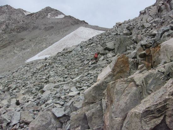
Here is a picture of the climb up (notice Brain Camprini in front of me)knapsack col climb

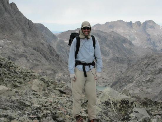
And of course, a picture from the top of the pass:summit

Decending down to Peak Lake:knapsack col west

Brad Rogers BPL Member
PostedJan 4, 2015 at 3:38 pm

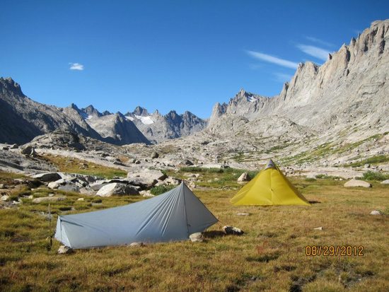
Also, speaking of Titcomb Basin, I camped in the basin in 2012, and though it would have been a terrible camp in poor weather (It was windy even in good conditions), it was the most beautiful camp I have ever had.

Our Camp:
Camp

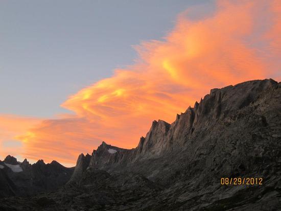
Sunset reflecting off clouds:
sunset

Viewing 11 posts - 1 through 11 (of 11 total)
Loading...