Topic

Mapping Software for a Mac ?

  • This topic is empty.
Viewing 23 posts - 1 through 23 (of 23 total)
PostedDec 30, 2014 at 10:43 am

I'm moving from (the discontinued) National Geographic's Topo State Series on an XP machine to something on a Mac. I use Topo for route planning, specifically distances and profiles. Being able to select Print Area, beyond standardize paper sizes, is crucial.

CalTopo looks like a candidate. What else is out there that is comparable to Topo? It will get a lot of use, so I don't mind paying for a good product that can get the job done at least as well as Topo.

Thanks.

Richard May BPL Member
PostedDec 30, 2014 at 12:42 pm

I’d be curious about software for the Mac too. It seems everyone is jumping on the mobile bandwagon.

It’s kind of a PIA for making printable maps but I’ve been using this tool http://www.mappingsupport.com/p/gmap4.php.

I make screen captures of segments and stitch them together in Photoshop (Gimp would work too). This results in a large map image that I segment into page size pieces for printing.

Doing that is OK for 6 or 8 segments but beyond that it becomes more of a chore. I find the ESRI basemaps to be better than the USGS topo. Also, if you use the MyTopo basemap it will give you a link to order a print, or send it to your phone.

Ian BPL Member
PostedDec 30, 2014 at 1:13 pm

Caltopo has worked well enough for me on the Mac and GPS that I haven't really looked for anything else. I *believe* there's a way to measure distance on there but I've never explored that option; I just use a piece of string or 3×5 after printing the map. They have a few YouTube videos and a blog that may be worth checking out to see if it offers that feature.

Lori P BPL Member
PostedDec 30, 2014 at 1:22 pm

The software is 70 or $80 and then you buy the maps that that you want. They have a lot of different sets. I own the USGS topos for California plus the USFS topos.

you search for and bring up the different quads by name. It was extremely useful to find the California map with all the quads named on it. once I know which quads I want for the hike I'm planning, I just open them up on the screen, scroll around and print the maps in ratios that I wish to use for the trip. The software also interfaces with a wide variety of GPS units, I have used garmin and Magellan on mine

PostedDec 30, 2014 at 4:21 pm

Mike W –

The core is a free download but as far as I can tell I have to by map sets to do anything in the woods. About $390 + S&H to get the western US on DVD.

Or am I missing something?

PostedDec 30, 2014 at 4:33 pm

John –

ArcGIS – It looks like a full blown GIS app. At $2500 to start, per year.

I live at the end of a crappy two-wire 64K land line. Cloud apps are painful.

I see a bunch of general maps, but nothing like a topi.

What have you done in it? Routes, Distances and Profiles?
Give me a pointer on where to get started.

Thanks.

John S. BPL Member
PostedDec 30, 2014 at 4:43 pm

lol. ArcGIS online thingy is slower to load but is interesting and free. For a slower connection I'd think caltopo would be the way to go. It's actually what I have used the most. Here is a Pecos map I made.

http://caltopo.com/map?id=7M2R

PostedDec 30, 2014 at 4:48 pm

I've managed to create a simple route, but the profile is very specific.

Is there a way to force the distance and elevation axis into something meaningful, and that could be compared against a different rout?

Bill Law BPL Member
PostedDec 31, 2014 at 12:21 pm

When I converted to a Mac, giving up the Topo app was the hardest thing.

I continued to use it for a while by using VirtualBox and running Windows XP in that.

Eventually I switched over to Caltopo.com.

PostedDec 31, 2014 at 12:28 pm

Bill,
In my quick glance at CalTopo I found the 'Profile" lacking –
– Elevation Bars not there etc
– distance scale rudimentary
– no way to get rid of rise&run

Are those user configurable, and I just need to dig a bit?

(I suspect I'll keep the XP machine in the corner, running as long as possible.)

Thanks

Bill Law BPL Member
PostedJan 2, 2015 at 10:45 am

I'm noT sure of what those are, so I reckon I am not missing them. Configurability isn't one of caltopo's best virtues. The UI leaves much to be desired. Aside from running Topo in a virtual machine, it is still the best option out there, in my experience.

Nick Gatel BPL Member
PostedJan 3, 2015 at 9:40 pm

I bought a MacBook Pro last year. But I needed to use Excel for Windows (I build Excel for Windows VBA applications and the object model is a little different than Excel for Mac), and Quicken for Windows.

Since the newer Macs use Intel processors they can run Windows.

I use Parallels to launch Windows (not a dual boot setup). The Windows apps run faster on the Mac than my old Windows 7 PC.

And I use Topo! too.

For me the setup is awesome.

PostedJan 4, 2015 at 7:06 am

"I use Parallels to launch Windows (not a dual boot setup)."

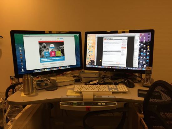
I'm partial to VMWare Fusion, but they do both work well. Loved using it with two monitors, the Fusion program on one monitor and the regular Mac desktop on the other. The setup was basically as you see in the pic, though now I'm running two Mac Minis side by side, each with its own monitor. I use a program called Synergy to share a keyboard and mouse between the two, works very well. The Mac Minis are pretty cheap, so this is a low-cost (other than the monitors) dual-computer system.

desk

Nick Gatel BPL Member
PostedJan 4, 2015 at 2:30 pm

I am using two Thunder Bolt monitors with my MB Pro. This allows for many desktops on each monitor whether they be Windows or Mac or both. To switch desktops I just swipe with my Magic Mouse or Track Pad. Nothing has ever crashed and everything is blazing fast… well the exception was the Yosemite upgrade that tried to kill the speed, but I finally fixed that. Also, I was able to keep Adobe Creative Suite for Windows without buying a very expensive Mac version.

More and more I am using mostly Mac software, but there are some exceptions where there is not a suitable replacement for some of my Windows programs.

I highly recommend the Parallels solution. I would not have switched to a Mac if I couldn't do this. Seeing that I have the most expensive MB Pro 15" with a retina screen and the dual Thunderbolt monitors, it was a sizable investment that wouldn't have worked out had I not been able to keep the few necessary Windows program.

Nick Gatel BPL Member
PostedJan 4, 2015 at 2:38 pm

National Geographic also has the Mac version on the CD, but I installed the Windows version since I was familiar with it. I may go back and install the Mac version to see if it is any better or worse. assuming it will run on OS 10.10

Nick Gatel BPL Member
PostedJan 4, 2015 at 3:00 pm

Forget that thought. I just tried and it doesn't support the Mac version of Topo! on newer Macs.

PostedJan 4, 2015 at 3:21 pm

Thanks Nick.
I know nothing about Macs. You just saved me from massive heartburn.

Viewing 23 posts - 1 through 23 (of 23 total)
Loading...