Topic

Falls of High Creek

  • This topic is empty.
Viewing 3 posts - 1 through 3 (of 3 total)
Hikin’ Jim BPL Member
PostedOct 6, 2014 at 3:39 pm

I did a little cross country travelling this past weekend up in the San Gorgonio Wilderness in Southern California. One of the routes I did was a route up high Creek from the Halfway Camp area. Here is my GPS track showing the route I took from Halfway Camp to High Creek Camp.

There was some pretty heavy brush between Halfway Camp and the drop in at High Creek.

However, once in the drainage, the brush generally wasn’t bad.

It was a nice route with plenty of water.
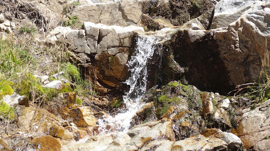
Of interest to me were the three water falls between the drop in point and High Creek Falls. I’ve known about High Creek Falls for a number of years (it’s visible from the Vivian Creek Trail), but I wasn’t sure what I would find below High Creek Falls. I found another three falls.

A word of warning to anyone who might be interested in ascending High Creek: Each of the falls requires a certain degree of rock climbing skill (this is not hiking). The falls generally require class three moves to surmount. See backcountry travel classes for definitions.

First falls (really more of a steep cascade):

Looking down from first falls:

Yes, you need to scale straight up the face.

Second falls:

I thought the second falls was really interesting. It had these beautiful fluted grooves worn into the rock by the water.

Looking down the second falls.

Third falls:

Looking down the third falls:

Above the third falls there were some unpleasant willow thickets, but nothing horrible.
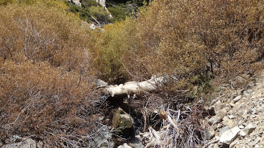
And finally, one comes to High Creek Falls, which is just below High Creek Camp. I’ve always thought this was one of the most attractive falls in the San Gorgonio Wilderness.

A very interesting trip, but again one would be well advised to consider what rock climbing skills are involved before embarking on the journey.

Regards,
HJ
Adventures In Stoving
Hikin’ Jim’s Blog

PostedOct 21, 2014 at 7:29 am

Jim,
this is a cool route! I havent found mention of these falls anywhere else so you must have touched on something pretty rarely visited on this one. When you exited, did you end up back on the trail above high creek falls or below it? I wonder if this route could then be continued up the ridge east of high creek camp. I did not get a good look at this area since it was dark when I passed through. I was also wondering, down in the drainage, east of halfway camp, was there any areas clear enough to hang out down there? I probably should go look for myself, but still, cool report!!

Hikin’ Jim BPL Member
PostedOct 21, 2014 at 11:41 am

this is a cool route! I havent found mention of these falls anywhere else so you must have touched on something pretty rarely visited on this one.

I got the sense that no one had been there for a long time. There’s dense brush and 4 water falls that have to be negotiated. There was a little bit of trash, but I think that probably washed down from High Creek Camp which is upstream.

When you exited, did you end up back on the trail above high creek falls or below it?

I exited just above High Creek Falls via the little use trail that connects to the Vivian Creek Trail.

I wonder if this route could then be continued up the ridge east of high creek camp. I did not get a good look at this area since it was dark when I passed through.

Definitely it could be continued up on to the ridge that leads to San Gorgonio (the ridge east of High Creek Camp) or the ridge that leads to E Dobbs Peak (the ridge west of camp).

I was also wondering, down in the drainage, east of halfway camp, was there any areas clear enough to hang out down there? I probably should go look for myself, but still, cool report!!

There were a few spots where one could bivy, but nothing major. But, boy, you’d sure have the place to your self. Water doesn’t start for maybe 0.2 miles upstream though.

HJ
Adventures In Stoving
Hikin’ Jim’s Blog

Viewing 3 posts - 1 through 3 (of 3 total)
Loading...
