Day 1:
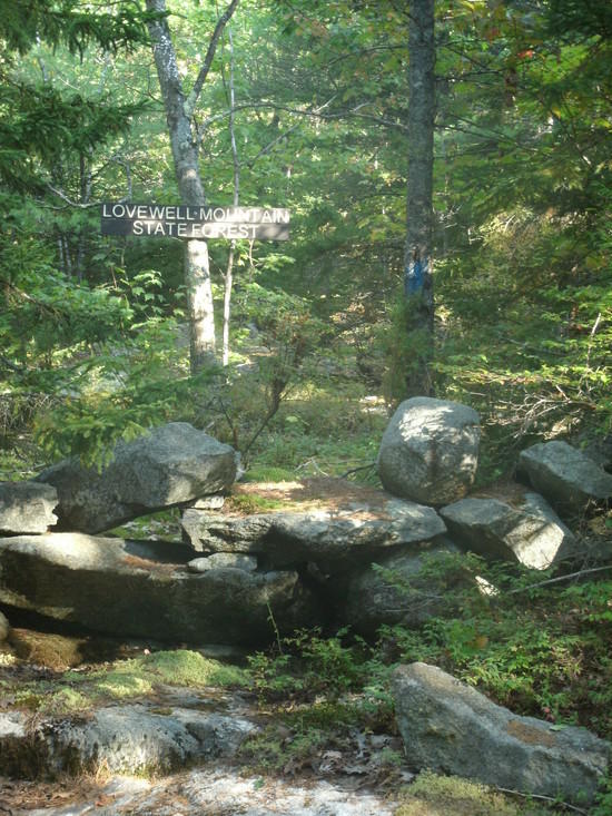
The local forecast was saying thunderstorms on my departure date so I skipped the Mt Monadnock section of this trail. I endured a thunderstorm on this treeless summit several years ago… never again. I began instead on the Dublin Trail at the Old Troy Road parking lot. Having chopping four miles from my original itinerary by skipping Monadnock I decided to camp at the site adjacent to the Childs Bog dam which is about three miles beyond my original destination, the Spiltior Shelter. Dont be fooled by the name. Childs Bog is actually a small lake created by the dam next to the camp site. It was a great place to spend the night.
Childs Bog Site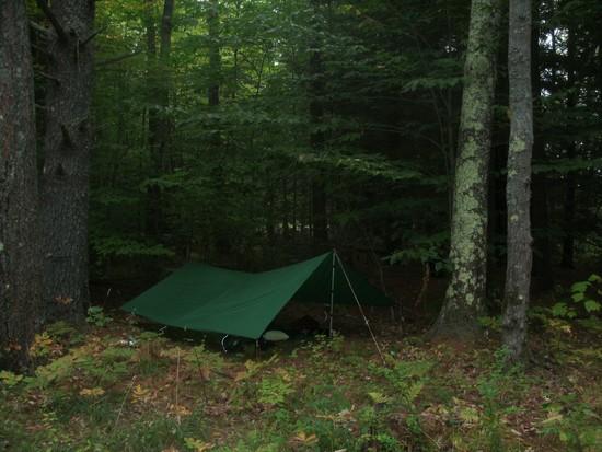
Day 2:
From Childs bog I continued north towards Nelson NH. The trail along this section was easy and included a short stretch of gravel road that passed by some pasture land and unique road signs the area is known for.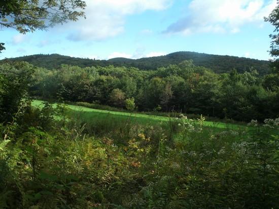

After this a very short stretch on a desolate paved road brings you to Nelson Center. There are no stores or public facilities here but there are some good photo opportunities.
All Nelson residents get their mail here. And you thought you lived in a small town.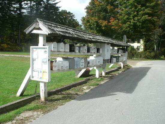
Nelsons Church.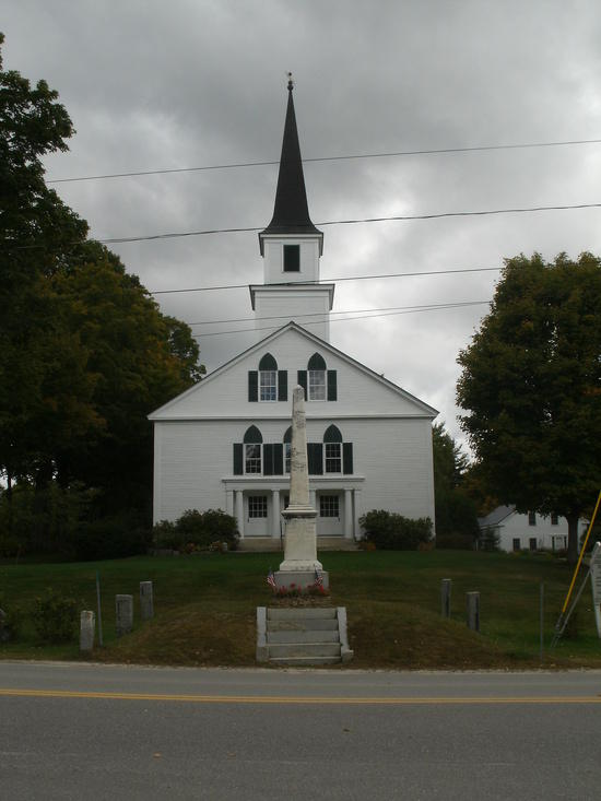
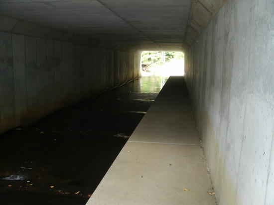
From Nelson the trail cuts through easy terrain. Im used to the White Mountains where near vertical ascents over seemingly endless boulder fields pass as trails. I made much better time on MSGT than I thought I would. This section alternates from hardwood to softwood forests, fields and beaver ponds. On the MSGT even the road crossings are interesting. Pictured below is a stream crossing that runs under Rte 9.
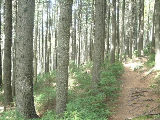
Beyond Rte 9 the MSGT is mostly on NH Audubon land. Easy terrain all the way to Crider Shelter. Four of the five shelters on the MSGT are constructed just like this one. My night at Crider was a cold one. Overnight temps dipped lower than expected, I was glad to be up and moving in the morning. 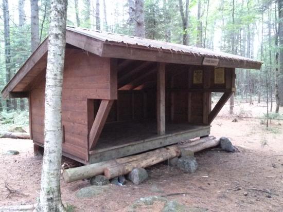
Day 3:
A short distance from Crider the trail passes Center Pond. Here I met a man from Vermont happily running extention cords and setting up tools to work on his waterfront yurt.

After passing Center Pond the trail enters the Andorra Forest and leads quickly to Robinson Brook Cascades. Water is low this year so the cascades were not dramatic but were a convenient place to stock up on cold, clear running water. This forest is beautiful and its thick blanket of pine and fir needles made for very comfortable walking. The highlight of my 3rd day though was Pitcher Mountain. A short steep climb to this summit offers great views in all directions. Though not exactly strenuous, Pitcher Mountain does mark the end of the easy terrain. From here there are three more sizable hills to climb before reaching the General Washington Shelter. These range from 1900 to 2000 feet. After Hubbard hill is the Fox Brook tent site. Last chance to get water until Washington. I had lunch here before pushing on. Its roughly 13 mils from Crider to Washington and I made it with about an hour to spare before nightfall. There was some obvious beaver activity near the water source at Washington so I walked the short distance to Washington General Store to buy water and snacks. Fires are not officially allowed anywhere on the MSGT and the trail association regularly dismantles fire rings at the other shelters. At Washington however there is fire ring in place that has clearly been in use for years. The landowner lives in the house to the right of the trail and provides water for hikers. They might grant you permission to have a fire if you ask. 
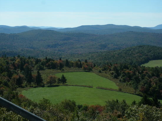
View from Pitcher Mountain
Day 4:
Ham and cheese ommelette with homefries at Washington General Store. YUM! Very nice people here and worth a stop. Day 4 started with a road walk through Washingtons center then along Half Moon Pond Road before entering Pillsbury State Park and crossing the Summit of 2400 ft. Lovewell Mountain. From here the Max Israel Shelter is only a short distance and makes for a convenient stopping point. After Max Israel a fairly steep ascent leads to a ridge where the summits are not high but are numerous. This series of short ups and downs continues all the way to the Steve Galpin Shelter.
Washington Center
Pillsbury State Park
Firs in Max Israel Forest
Steve Galpin Shelter
Day 5:
Most of this section follows the Sunapee Ridge. More short ups and downs. The trail is more rough here than in other sections though. Twisted root masses and ledgy stretches are much more common. I was forced to slow down a bit through much of this area. On the other hand the best views of the entire hike are to be found here.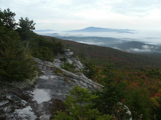
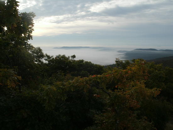
The view of Lake Solitude from White Ledges is impressive and my photo doesnt do it justice but I had to snap at least one shot while I was up there.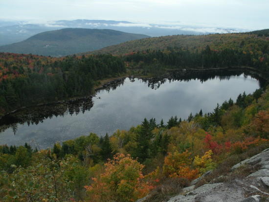
The Official MSGT terminus is at the summit of Mt Sunapee. (Strange tradition here of beginning and ending trails on the tops of mountains) From here you can descend on the 2.1 mile Summit Trail or via one of the many ski trails.
This was a great hike!
For more info: http://www.msgtc.org/

