McGee Lakes Basin via Lamarck Col 9/6-11
McGee Lakes Basin had been on my list of special places for over 30 years, so when a more ambitious trip going in over Lamarck Col fell thru, it was an easy decision to substitute a shorter trip to McGee Lakes using the same entry point. As is frequently the case when altering plans on the fly, we did not regret the decision. The trip proved to be a fitting finale to a very rewarding season.
Day 1
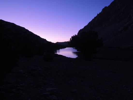
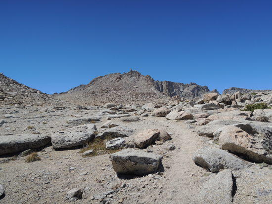
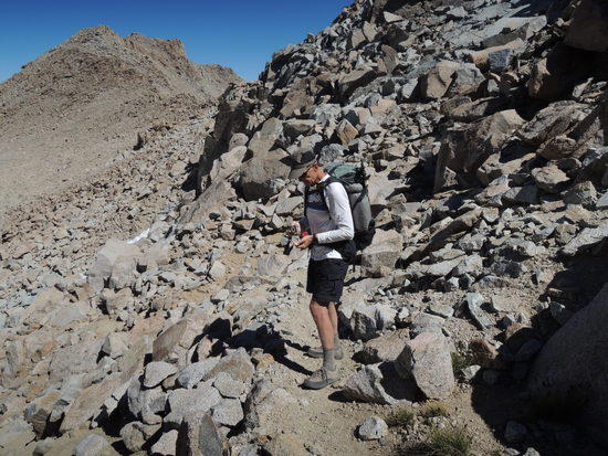
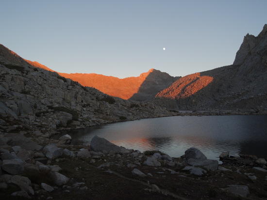
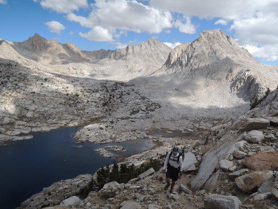
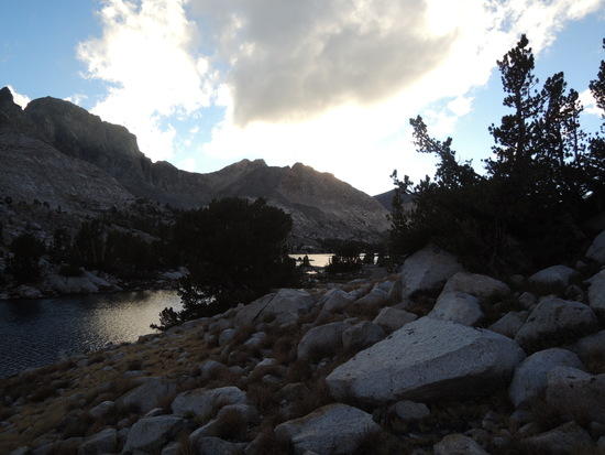
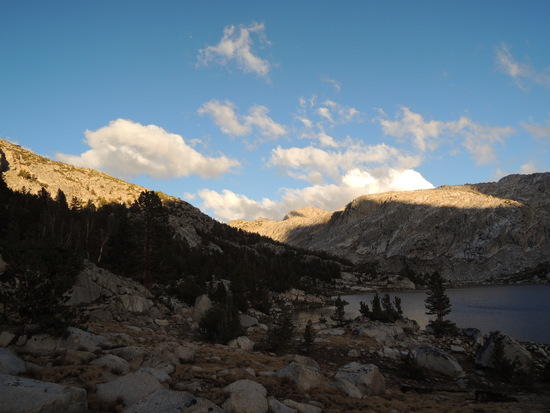
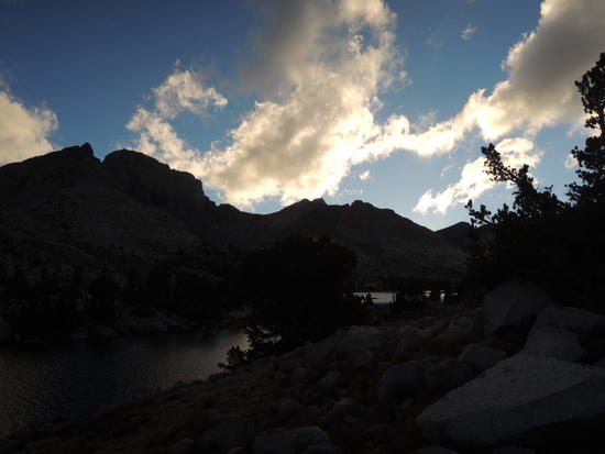
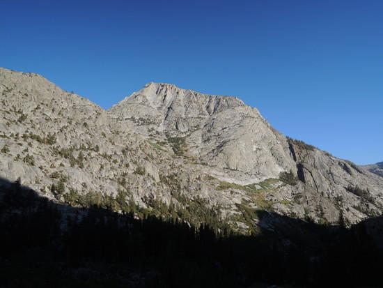
We decided to go over Lamarck Col the first day, since it is only 5 miles from the trail head, and get down to at least the upper lake in Darwin Canyon. This made for a much easier second day hike to McGee Lakes Basin than stopping at Upper Lamarck Lake to acclimatize and then having a much longer, harder hike the following day. The problem with going over Lamarck Col on day 1 is the rapid ascent from Bishop, where we spent the night at 4000', to the Lamarck Lakes trail head at 9400' by car in 1/2 hour, and then hiking another 3500' up to the col at 12,960'. For us it required a very slow pace, frequent stops, and proper attention to hydration and carb intake. This approach worked out well, and we found ourselves at the col around 2 PM, with plenty of time to make our way down to the lakes before sunset. Due to three years of low snowfall in the Sierra, the normal final approach to the Col, a low angle snowfield, has melted back to form a much steeper wall of rotten ice. Ascending it without crampons and an ice axe is out of the question, and so the new normal is an initially steep, slightly unstable, slope of talus and glacial till to the left of the ice wall. It lays back slightly after 60-70' and a use trail of sorts appears. From there on things get much easier. The descent is no longer really off trail due to the increasing number of hikers, but it is sufficiently strenuous and rugged nonetheless, so we took our time. We were surprised at the number of people we encountered, and were not able to find a campsite until we were well down the shore of the second lake in Darwin Canyon. Our campsite had two excellent pads plus one that was marginal, so we naturally took the best two. We had no sooner settled in for the evening than an older couple came trudging along the lake, headed in the direction of the col. They were both carrying huge packs and were clearly ready to be done for the day. We knew there were no campsites available further up the lake, so after a quick consultation Fred and I called them over, filled them in on the campsite situation, and volunteered to let them use my pad. I had decided not to set up my tent because the sky was clear, so it was an easy matter to drag my sleeping bag over to the smaller pad. Clearly relieved, they accepted without hesitation. As the evening wore on we got to talking. The woman, Barbara, was perhaps 5' 2", aged 66, and as nimble and fit a 66 year old woman as I have ever come across. She had hauled a 40 pound pack over many an off trail route down thru the years and was preparing to haul it thru/over/under some very large talus the next day en route to the col. Her husband, Mike, 68, was carrying around 70 pounds. Given that they had appeared exhausted when we first saw them, I gently inquired if they would be interested in lightening up a bit. Barbara, by far the more gregarious of the two, was mildly interested, but not if it was going to cost very much. Mike expressed no interest whatsoever. So I let it drop. They were perfectly content with their approach to backpacking, and were clearly having the time of their lives. Luke Cobrae's heavyweight trip from Horseshoe Meadow to Whitney, with all the attendant flack he took in his TR thread, came to mind, and I thought to myself once again that it really is the backpacking part that comes first, not the light. Eventually the conversation died out and we all settled in for a beautiful sunset, followed by a moonrise just two days away from being full. The effect on Mounts Darwin, and Mendel was nothing short of surreal, silver-green moonlight on granite limned by inky black recesses; I stayed awake far longer than I should have, unable to close my eyes to the wonder of it all.
Day 2
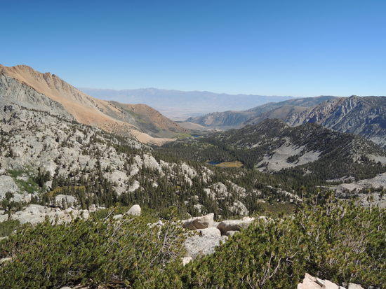
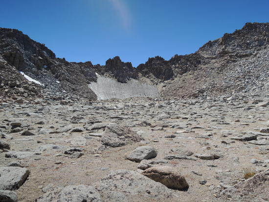
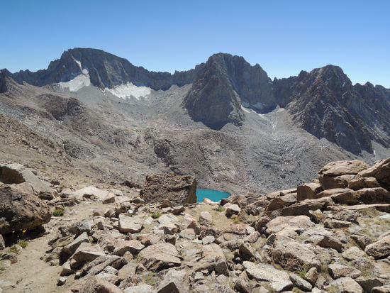
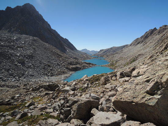
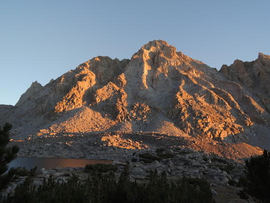
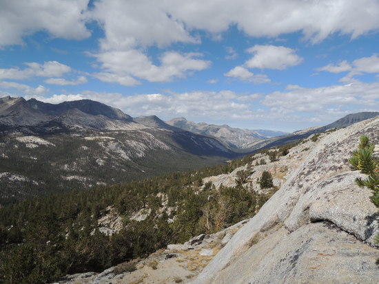
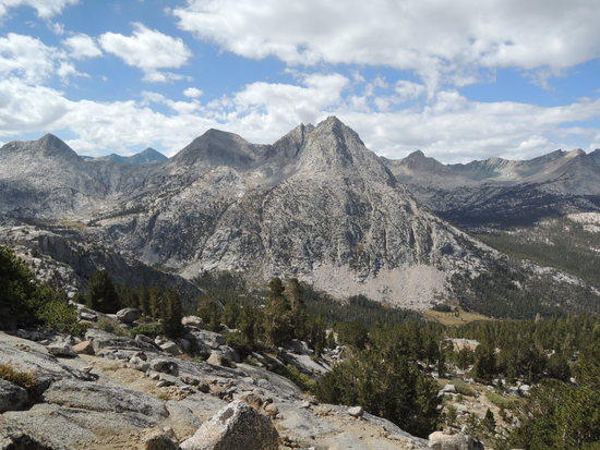
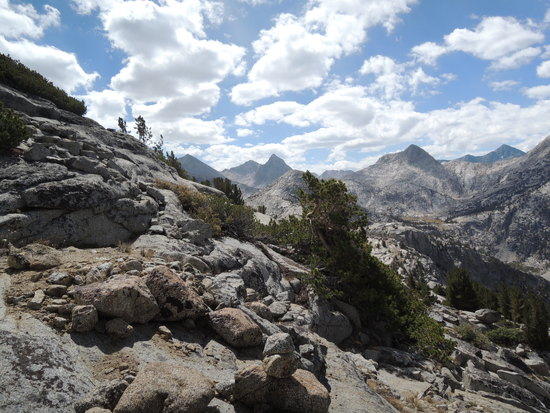
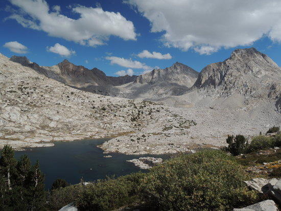
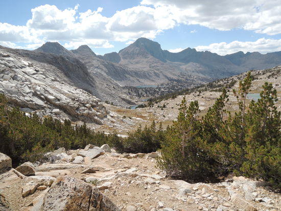
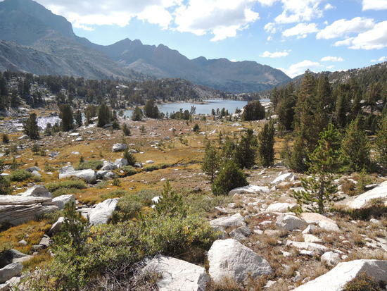
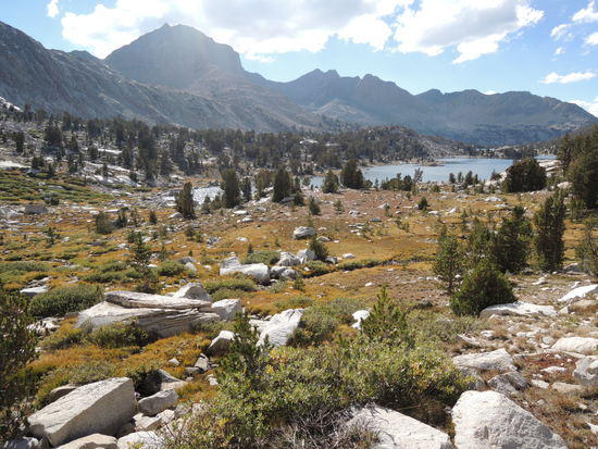
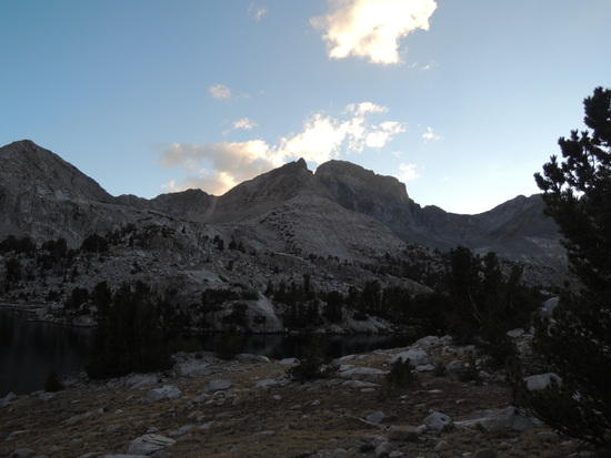
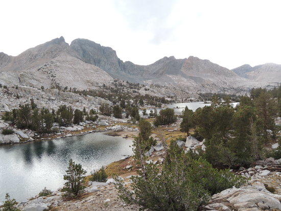
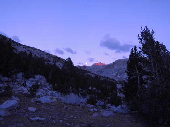
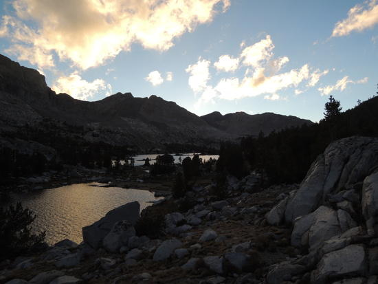
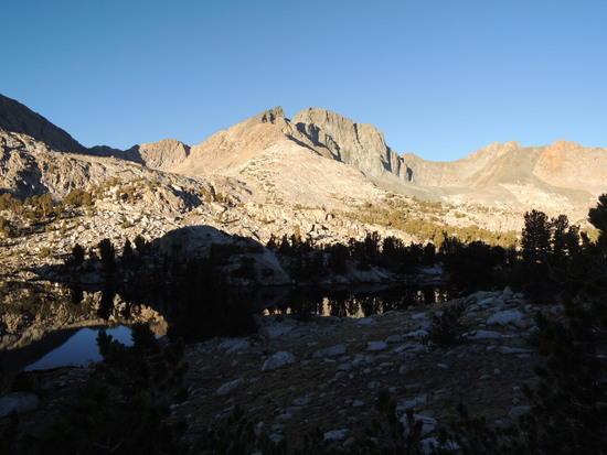
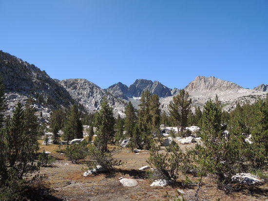
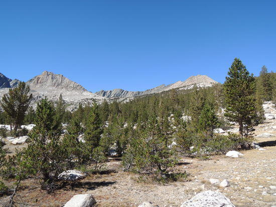
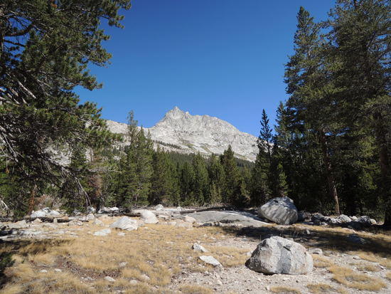
We awoke to another beautiful day, with nary a cloud in sight. We only had about 7 miles to go, so we treated ourselves to our usual leisurely breakfast without the slightest trace of guilt and got underway around 10 AM. The walk down Darwin Bench to the JMT is one of the Sierra's finest, IMO, with spectacular scenery everywhere one looks and a classic Sierra panorama opening up to the west. Once on the JMT we ambled along easily, sort of hands in pocket if you will, pausing only for a short lunch break before arriving at the south end of Sapphire Lake. The route up to the saddle which provides entry into McGee Lakes Basin is pretty obvious, and it only remained to select the best tactical line up the slope. We chose a rising northwest traverse up the steep slope, which gains about 600' in a half mile, and picked up a series of cairns about 100' vertical below the saddle. From there the way was straightforward until we crossed the saddle and lost the "trail". The lakes were tantalizingly close, perhaps a mile and a half or so in the distance, nestled in a gorgeous basin. But the way down to them was not exactly a straight line. Straight ahead were cliff bands, so we had a choice of moving left or right; we chose left and slowly worked our way down thru thickets of gnarly, wind sculpted Whitebark Pine, a bit of class 2 talus, and sandy scree. Once down the initial section, it was an easy stroll down to the lakes. Looking back up the slope, we concluded that it would probably have been easier to go right, confirming once again that hindsight is invariably 20/20. We eventually found an excellent, unobtrusive campsite on a sandy bench a ways back up from the first large lake and settled in for the evening, well satisfied with another stellar day in the Sierra. We were treated to another beautiful sunset followed by a nearly full moonrise that made me wish I knew more about photography, and had the equipment to take longer exposures successfully. The sight of Mt McGee and Peter Peak, and their subsidiary ridges, bathed in warm silvery moonlight accented by pitch black recesses was mesmerizing, and I was not even aware of when I drifted off to sleep.

Day 3
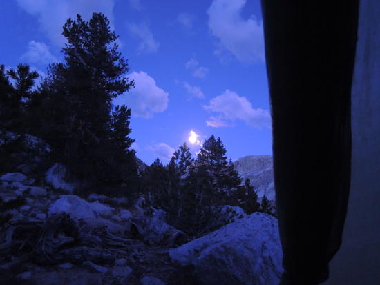
When we awoke it was clear that our good fortune with the weather had come to an end. The skies were a heavy, leaden gray and there had been a drastic increase in humidity overnight. It didn't take a meteorologist to figure out that we were in for inclement weather in the near future, so we decided to take advantage of whatever dry weather remained to scout out the beginning of the unmaintained trail that leads from McGee Lakes down McGee Canyon to Evolution Valley. It has been my experience down thru the years that such trails can be difficult to locate; we did not wish to waste time the next day doing this, since we had a relatively long hike to get far enough up into Piute Canyon to find a campsite. It was a pleasant hike down to the outlet stream of the lower lake, but it did take a bit of poking around to locate the trail in somewhat complex terrain that offered several possibilities. We placed a few cairns to mark a critical section and then turned and hightailed it back to camp, hoping to beat the rain. Unfortunately, our luck ran out. It began to rain, initially just a few drops, then with increasing intensity, and by the time we got back to our tents we were well and truly soaked. We ended up spending the rest of the day in our tents while the rain came down in sheets. At one point it turned into hail for about an hour, the heaviest I have ever experienced in the Sierra, and I truly feared for my Skyscape-X. I was much relieved when the hail turned back to rain and my shelter was still intact. I'll give credit to Ron Moak, he designed a much stronger tent that I could have imagined from a very lightweight Cuben fabric. Finally, around sunset, the storm tailed off and we had another crystal clear evening for a magnificent full moon. Our only regret was spending a layover day in our tents, instead of exploring the smaller lakes tucked away in hanging basins above the main chain of lakes. Even so, we felt fortunate to be able to spend time in this seldom visited gem. People do come here, but not many, and they tread lightly. The only sign of visitors was a faint intermittent path along the lake and a few stones unnaturally close together at our campsite, indicating their probable use as reinforcement for tent stakes by some long ago visitor. There was no evidence of fire rings or other "improvements", or litter. We did see one other party, an older couple, on our trail reconnaissance hike, but they maintained their distance and disappeared from sight quickly. I suspect they were as surprised as we were, and probably, like us, a bit disappointed at having their solitude compromised.
Day 4
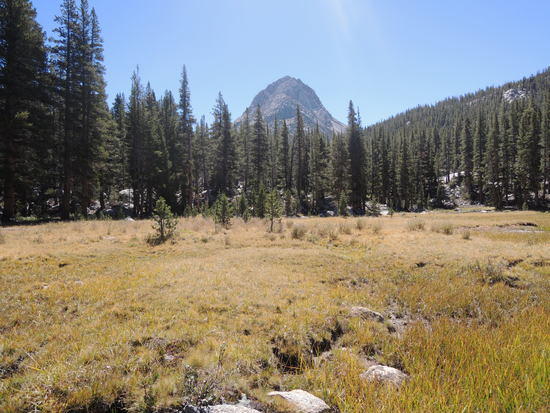
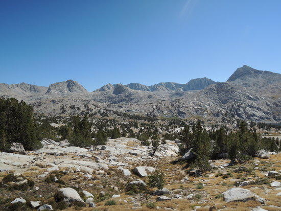
With dawn came the promise of a bluebird day, perfect weather for what was to be our longest day. We would be hiking approximately 14 miles from McGee Lakes to a point in Piute Canyon, where the narrow defile carved by Piute Creek as it tumbles steeply down to join the South Fork San Joaquin River starts to lay back and widen. There are numerous excellent campsites strung out along Piute Creek from that point on, and there is little chance of bear trouble in the area. We were not carrying bear canisters and therefore did not want to spend a night along the JMT anywhere in the Evolution Valley/Muir Trail Ranch section, even though we were set up to hang our food and there were ample trees to do so. Evasion has long been the foundation of my approach to avoiding bear trouble. The hike down McGee Canyon to Evolution Valley was sheer delight. The trail was easy, the scenery gorgeous, and our spirits were high with the return of classic, crisp, clear, September Sierra weather. We emerged from McGee Canyon somewhere between Colby and McClure Meadows, crossed Evolution Creek at a wide spot in ankle deep water, and settled in for the long downhill stretch of the JMT to its junction with the Piute Creek trail. Our mood changed subtly at this point, as we were now on a main trail. It was a bit of a letdown, expected but a letdown nonetheless, to encounter streams of hikers, and everything else that goes with walking a heavily traveled trail. That soon faded, however, as the miles went by and our focus gradually shifted to the prospect of slogging up the Piute Creek trail from the JMT. It is about 3 miles to the first campsites up a rugged, at times steep, section of trail that gains about 1200'. This is not a lot of elevation gain, but the ruggedness of the tread and steep step ups at the end of a long day(at least for a couple of over-the-hillers) had us ready to call it a day about a mile before the first campsite came into view. We set up our tents, ate, cleaned up, and crawled into our bags with little of the usual good natured banter that usually accompanies our evening routine, and were soon lulled into a deep sleep by the soft murmuring of nearby Piute Creek
Day 5
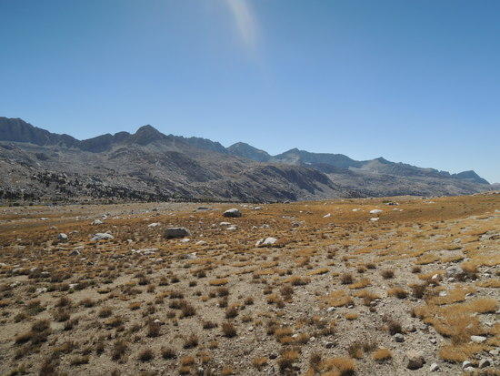
We started out planning to hike about 8 miles and camp at one of my favorite sites between Upper Golden Trout Lake and Muriel Lake, leaving an easy 6 mile hike for our last day. As the miles went by, however, we found ourselves at a point on the Piute Pass trail about 1/2 mile from our intended campsite and also Piute Pass, at 3 PM. So, we decided to take an hour to eat dinner, rest, and then hike until dusk, with the goal of camping a couple miles or so farther down the trail on the Owens Valley side of the pass. We found a really nice spot to dine just off the trail, beneath a stand of unusually robust Whitebark Pines that provided both shade and a panoramic view of Glacier Divide, including a now snowless Snow Finger Col. Much refreshed, we continued on and ended up stopping at Loch Leven, which left us with a scant 3 miles to hike the next day. It was at that point that we broke trip discipline and allowed ourselves to broach the subject of cool pints of Stone IPA at the Black Sheep Café in Bishop, a most pleasant prospect to entertain as we drifted off to sleep.
Day 6
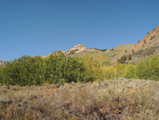
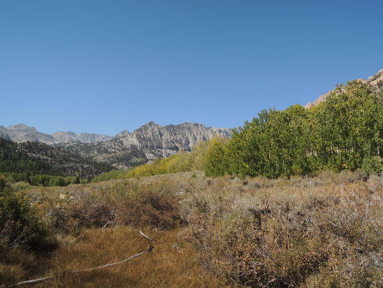
With only 3 miles to go and our ride not due to show up until noon, we lingered over a second cup of coffee. Even then, we arrived around 10 AM, ensconced ourselves in a shady nook along the north shore of North Lake, and relaxed while awaiting our ride. The views up toward Piute Pass and Lamarck Lakes are truly magnificent, even from a front country vantage point like North Lake, and we contemplated them in silence while savoring the warm afterglow of another deeply satisfying sojourn in the High Sierra. For me, as is always the case, a subtle feeling of melancholy intruded at the prospect of returning to the craziness of life in a fast paced, hyper competitive, high tech society from which I find myself increasingly alienated. Of late, something new has insinuated itself into my post trip introspection, an elegiac awareness that at this point in my life there are far more trips in my past than in my future. The resulting mood is one of exquisite bittersweet gratitude for all that the Sierra has given me down thru the years, amplified by the related insight that each trip, each day hike, each day, is a gift to be treasured as if it were the last. There is nothing new here in terms of human experience, for it has always been so, and some future trip will inevitably be my last. What is new is my own awakening to this basic truth, which has considerably deepened my appreciation of the opportunity I have had to weave the majestic High Sierra into the fabric of my life for some forty years now, and counting.