Background
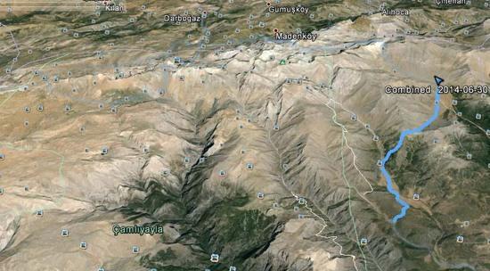
The Bolkar mountains are located in the central Taurus Mountain chain, in southern Turkey. On the north, they descend to the Anatolian Plateau; on the south, deep valleys run down to the plains around the Mediterranean sea. Towards the east end of the Bolkars, there is a kind of broken plateau surrounded by ridges and peaks. The highest peak is Medetsiz, at 3,524 m and the plateau itself rises from about 2,600 m in the east to about 3,100 m in the west.
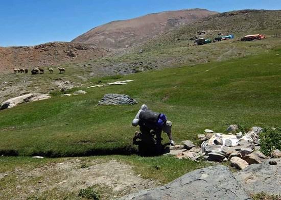
Although the Bolkars are mentioned briefly in the long out of print Lonely Planet Trekking in Turkey and Cicerone's Mountains of Turkey, few trekkers venture into the mountains, except to climb Medetsiz, usually from Karagol in the west. In fact, in 35 days of hiking in the Bolkar over the past three years, we've yet to come across another hiker. There is, however, a large amount of sheep and goat herding activity during the summer, so you don't exactly have the mountains to yourself.
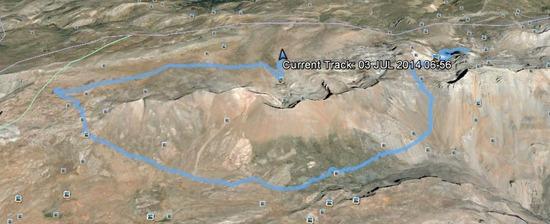
This trip took place at the end of June/beginning of July and the aim was to link up some walks we'd done previously.
Day One
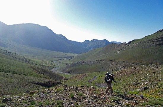
We'd planned to spend the first couple of days walking up via the southern valleys, in order to regain a bit of fitness after a couple of months of inactivity. This turned out to be a mistake as we coincided with a heat wave and we encountered temperatures of about 37 degrees centigrade.
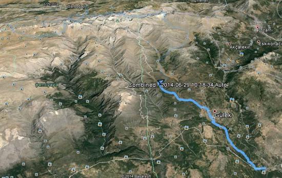
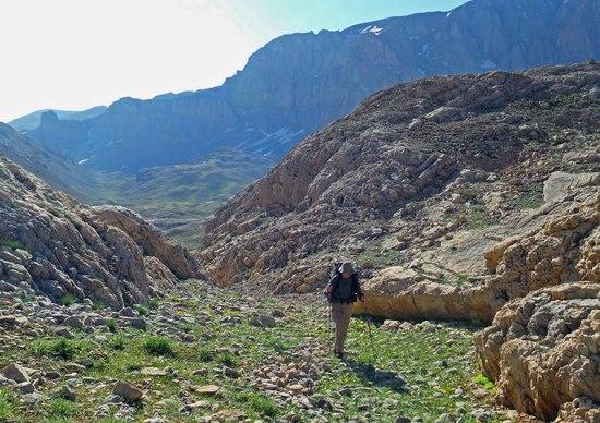
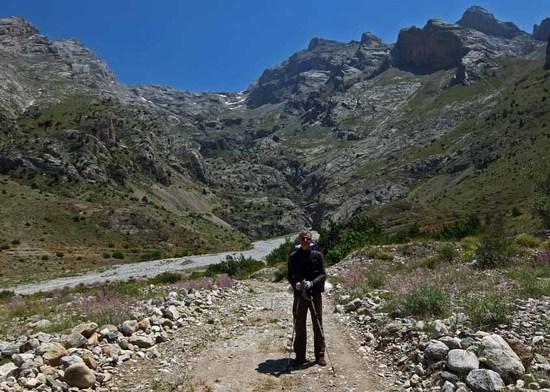
The route first followed a pleasant valley from Camalani (740 m) to Gulek (1,062 m), then continued on goat tracks to Yilan Ovasi (1,170 m).
From there, we turned up a tributary to the main valley, towards the valley below Ağaçkese Bal Ormanı (1,377 m), which we have renamed Kurtlar Vadisi (Valley of Wolves), after a night spent there last November listening to the nearby wolves howling at the full moon. The wolves are all high in the mountains at this time of year.
Day Two
The next morning we crossed a low shoulder over to the beautiful Karbogaz (pronounced Karbowaz) valley. A ski resort is planned for this valley and a survey was completed a few years ago. Fortunately, nothing has happened since and I hope it will stay like that.
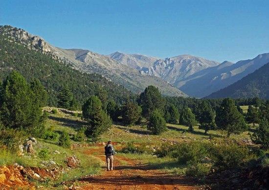
From there, we crossed the much higher shoulder (about 2,100 m) separating Karbogaz from Elmali valley. Good views but hot going.
We camped in the river bed to shelter us from the stiff breeze that usually blows down this valley.
Day Three
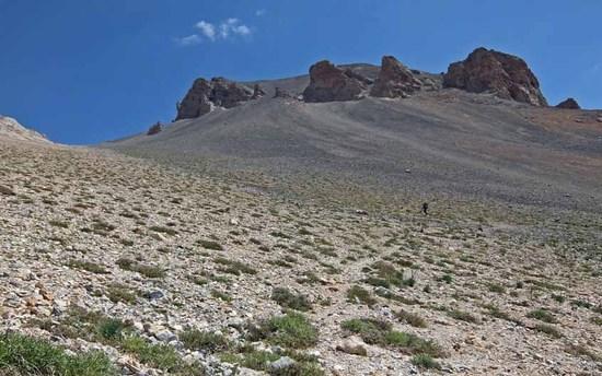
A road runs up the valley past some shepherds' camps to a pass that runs over the eastern end of the mountains from the head of Elmali valley. Trekking in Turkey calls it Kocagedik (pronounced Kojagedik = Large/Great Pass), but from the name of the shepherds' camp half way up it's more likely to be Kosan (pronounced Koshan) Gedik, Running Pass.
The road continues up to the highest shepherds' camp, but it runs on very wide switchbacks, so we took a more direct line.
The last 400 m of ascent are up scree, which I suspect gives the pass it's name since it's easy to run down. (Very useful if you find you've left your gps at the bottom and have to go back!)
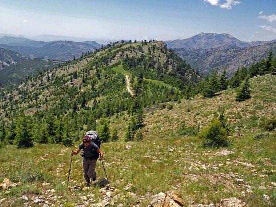
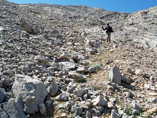
At first a decent path rises on switchbacks…
…but it gets more indistinct as the scree gets steeper.
The pass tops out at just over 3,000 m, then descends towards the plateau, past a seasonal tarn.

As the pass approaches the plateau, an indistinct (often non-existent) path…

…heads over a pass running along the north side of the southern ridge…
…and brings you to Karagol (Black Lake). Karagol is a very common name in Turkey and there are at least three of them in the Bolkars. The two on this walk are among our favourite parts of the Bolkar.
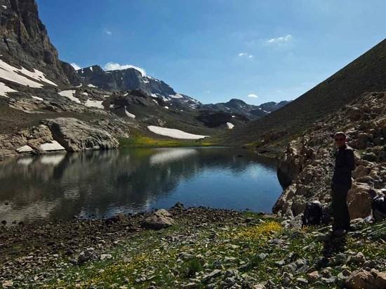
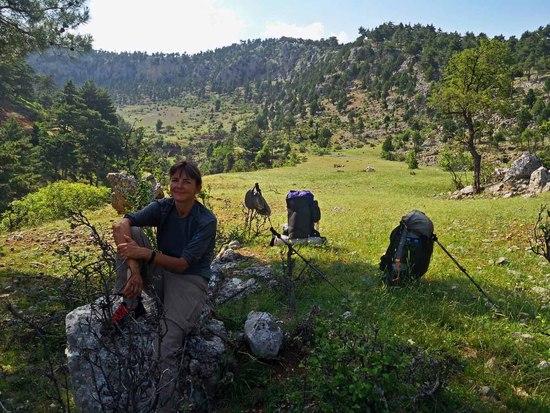
A short walk brought us to Hasan Cayiri (2,800 m), where a snowmelt stream provides water.
A shepherd sets up camp here later in the summer, but we had the place to ourselves to spend a windy night.
Day Four
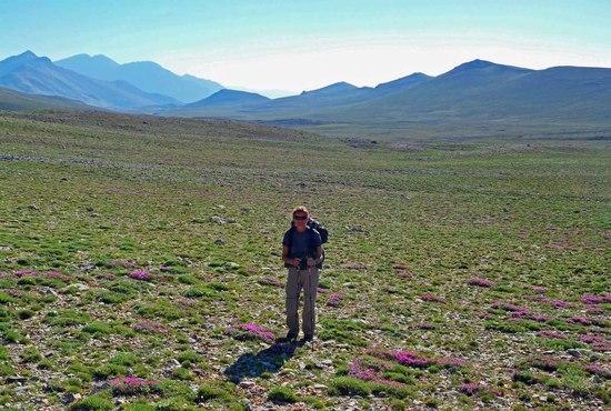
A pass leads over to the western part of the plateau…
…and the Alisah (pronounced Ali Shah) basin. There is a shepherds' camp here somewhere, though we haven't seen it in two visits.
We were here to attempt a pass described in Trekking in Turkey. We looked for it from below, but the route had looked impassable. However, last year we found a path leading toward the top of it and a local had told us it was doable.
A decent path leads down to the start of the pass proper. The Anatolian Plateau is visible in the background.
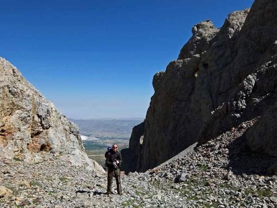
According to Trekking in Turkey, this was once a camel route; now the path is often non-existent, or washed out.
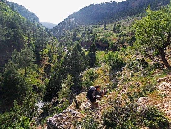
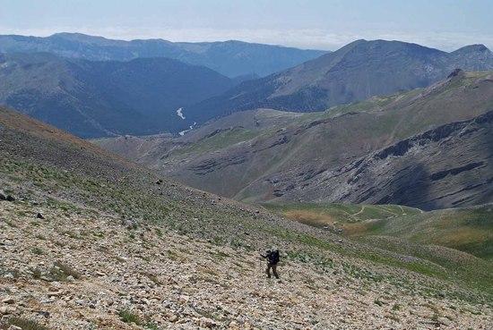
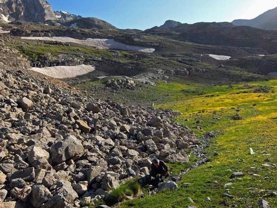
A very rocky scramble brings you out 1,300 m lower at Arpalik Deresi, a short way upstream from the small village of Maden, literally Mineral, named for the extensive mining in these mountains.
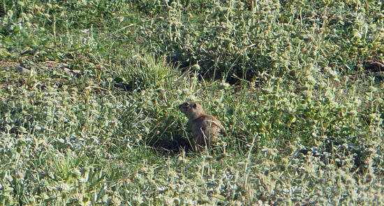
We followed the Arpalik Deresi up to a large cirque called Meydan, home to many souslik, a type of ground squirrel.
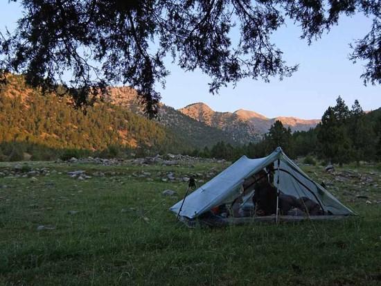
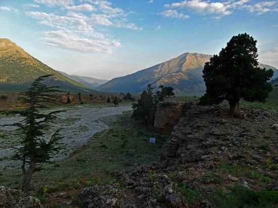
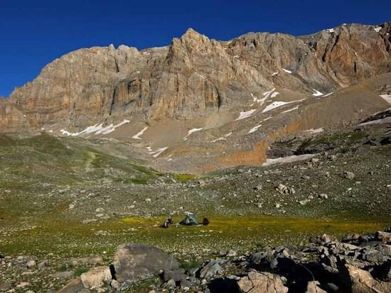
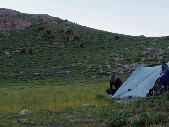
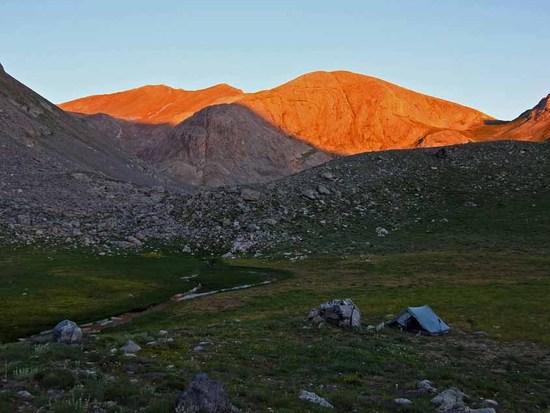
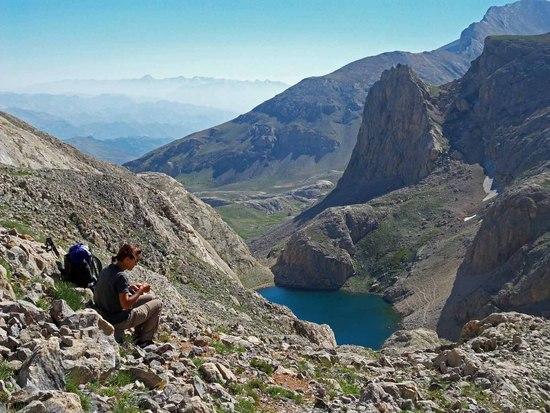
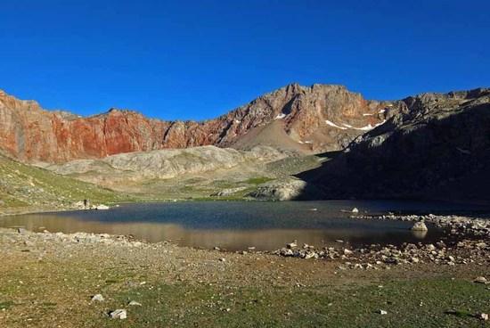
A steep path continued up to our second Karagol. Here we decided to camp just below the tarn and set up camp watched by feral horses.
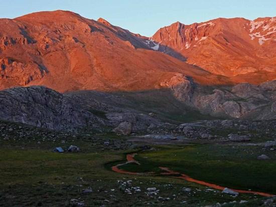
We were treated to a fine evening alpenglow.
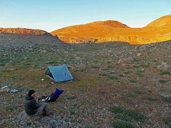
Day Five
And another the next morning. Karagol is just over the rise behind.
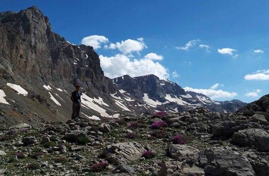
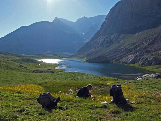
Our aim was to cross the Karakapani Pass, which crosses over to the south side of the mountains from the tarn. We'd been here twice before but had been turned back, once by fog and once by snow. The start of the pass is visible in the photo below. This year was a very low snow year.
But first we had to fill up with water at a spring.
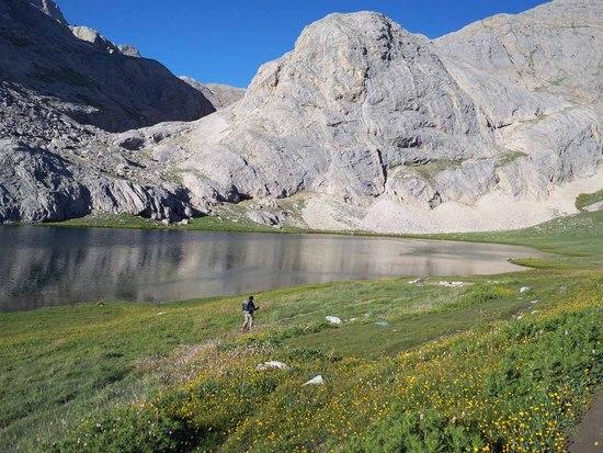
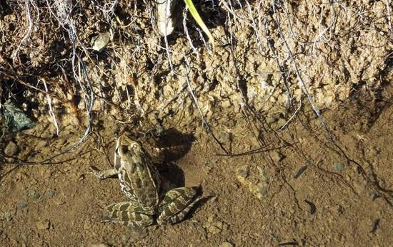
Karagol is home to an indigenous frog, the Taurus Frog or rana holtzi, which is only found in a few tarns in this area. This one was hiding out in the spring.
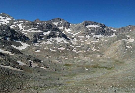
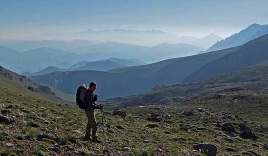
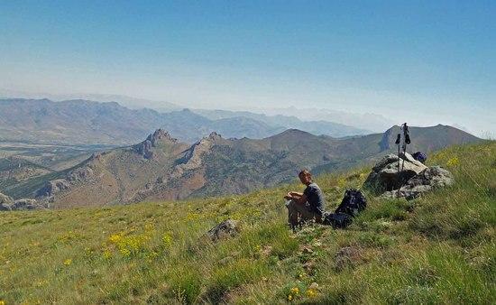
The pass rises past a second tarn, Cinigol (pronounced Chinnygirl), or tile lake, named for its colour. The pass has fine views east to the Aladaglar Mountains.
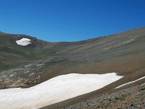
The pass reaches its summit at about 3,000 m, with the rounded hillsides more typical of the mountains farther to the west.
The south side of the pass runs down scree towards Kadincik Vadisi, which runs down to the Mediterranean plains.
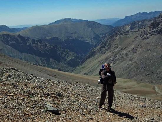
But at the base of the pass, we turned west to climb to the extensive shepherds' camps at Gogeri (pronunciation impossible to write with the Roman alphabet, but something like Guhuhri). The shepherds' were good enough to hold back their dogs while we filled up with water.
They sent over a little boy to warn us about a couple of dogs on the route ahead. The flocks are invariably guarded by dogs, of varying aggressiveness, similar to the Akbash mentioned in a recent thread. It's best to stay clear of grazing flocks, in which case the dogs will usually content themselves with barking from a distance. We assumed that the boy meant that the dogs were out with grazing flocks, but it turned out that the flocks were penned next to the track just up ahead and the two dogs hurtled towards us howling. They pulled up when we confronted them with our poles, and at this stage you can usually reach a standoff where the dogs will let you move off. This time though, they seemed determined to find away to get at us and we were relieved when their owner came and sent them packing.
The upside for us was that the owner was able to point out a short cut to us which took us the open plain where a pass crosses to the north side of the mountains.
Our original plan had been to descend from the mountains via the beautiful Zindan Vadisi (Dungeon Valley), which heads down from the northwest side of the plain. This would have given the route a nice logic, starting in the southeast of the Bolkars, crisscrossing them several times as we headed generally west, then ending in the northwest. We'd visited this valley a couple of times before, though, and transport home from the end of it can be somewhat difficult, so while a couple of days earlier we'd decided to turn back east towards Alagol (2,900 m), a tarn where we'd camped a couple of years before.
Unfortunately, we'd just arrived when a couple of shepherds turned up to water a large flock of goats at the lake. We would have to wait for them to leave before we could set up the tent and cook, probably after dark, so after sharing some of one of the shepherd's butter, we decided to continue a little way and camp at the first available spot.
Day Six
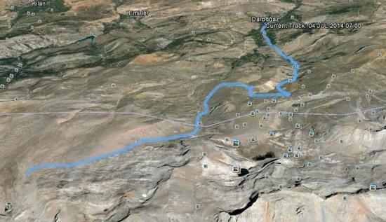
The plan for the day was to follow one a wide valley that runs off the north side of the mountains to Darbogaz, where we could find transport. From this valley, there are beautiful views east over to the Aladaglar range.
At the mouth of the valley, we said goodbye to the Bolkars…

…and contoured a headland round to a drainage valley that led us down to the cherry orchards surrounding Darbogaz.
We cleaned up as best we could in the mosque toilets and waited for the minibus that would start our journey home.

