


Planning my trip leaving the 29th of August….finishing the 5th Sept. Any trip reports with conditions or recommendations would be welcome.
Topic
Become a member to post in the forums.
Planning my trip leaving the 29th of August….finishing the 5th Sept. Any trip reports with conditions or recommendations would be welcome.


I just did the Seattle/Spray park to Isput Pass/Mowich Lake loop. We walked across some snowfields but nothing you'd need to worry about. Mosquitos are doing what they do in August; hopefully that'll improve in the next couple weeks. I'll probably post a more thorough TR next week.
Can't speak for the other 70ish miles but I think Anish posted something on her blog the other day where the water levels were high where she was hiking. I think she did the Northern Loop so it might not have been on the Wonderland proper depending on where she was. I'd post the link but I'm too tired/lazy to do that right now.
There was a fire somewhere between White River and Sunrise last week but they were patrolling for hot spots the last I heard so that shouldn't be a concern.
We're looking at starting the 3rd or so. Maybe we'll cross paths.
I'm planning on going counterclockwise from Sunrise and I shipped my two food drops to Longmire & Mowich Lake. I'm crossing my fingers that I'll manage to get a pass that allows me to pick them up!
If all goes as planned… on the 3rd I'll be at Nickel Creek on my way North to Indian Bar – Summerland.
My wife and I recently car camped at White River Campground–WT passes through here and some hikers also camp. Lots of bear activity observed–a small black bear roaming through unattended campsites. One startled camper asked us "have you seen a ranger, a bear is eating our Nutella!"
PS The Nutella bear was finally scared off by the camper holding up his sleeping pad (to look larger) and shouting at the bear.
The rangers like to hold on to the food caches at Carbon River Ranger Station until the last minute before moving them up to Mowich Lake. Make sure you a) call Carbon River once you get your itinerary, and b) ask the rangers who issue you your permit to do the same. If you get delayed for any reason, contact them ASAP. They're quick to bring it back to Carbon River if they think you're going to be a no-show as the food box is pretty small.
I just did the WT at the beginning of August, with the spray park alternate route. The trail is in excellent condition, with the exception of the Mowich river crossing- the bridge is out. It was pretty easy to cross, so no worries there. Bugs were pretty bad anywhere you find meadows, and dayhikers abound in the summerland and spray park areas ( you can smell them a mile away!) There was a bear in camp at Summerland on 8/9, thanks to some great dayhikers who thought it would be fun to feed him.
There is only one dry stretch to speak of, between Nickel Creek and Indian Bar. If you plan to stay at Golden Lakes or Klapatche park you may want to bring a filter system, the water is pretty gross to just use drops or a steripen (a nice gentleman let me use his filter system at Golden to prevent floaties!) Also, if you stop at Longmire, make sure to buy your beer in the gift shop, not the restaurant. $6.75 vs $1.50. Have fun!!
Thanks for the heads-up Ian. I'll make sure to touch base with the Rangers. I left pretty explicit instructions on the container but since I'd rather not go without food I'll do my due diligence.
Thanks Christy… cheap beer always taste best. We must be old neighbors because I lived in PA for 10-years, just about four miles up Mt. Pleasant. It was awesome because I could hike right into/out of the park. My training route was the gravel road up to the summit to enjoy the cellular tower. Just moved over to the dark side two years ago.
Bump… in case someone has updates. Leaving on Friday morning and I'm having a hard time concentrating at work.
We're going clockwise from Longmire starting Sunday 9/7 and finishing 9-12 or 9-13 depending on how we feel on the last day. For anyone else doing it, or anyone in the know, I have a couple of questions:
1. Are there links to good weather stations in the area? The forest service page has some great links to stations that aren't reporting anything. Most of our camp sites are 5,000+ plus, and I'm having trouble finding forecasts at or above that elevation.
2. How much insulation are you guys bringing for the next couple of weeks? I just did the Timerbline trail last weekend sleeping in a mid-weight down puffy, down booties, microweight base layer, and a 40* quilt at about 7,000 ft. Do you think that system is appropriate for the coming two weeks on the WT?
3. Any recent bug reports?
Hope everyone has great trips. Maybe we'll cross paths.
I know most of the people on this thread are either just finishing or are still on the trail but here's an update for those who've yet to go.
Snow through Panhandle Gap was much smaller than what I expected and a fraction of what it was last year when I crossed mid September.
Mosquitoes are 99% gone although biting flies persist in some areas; not a big deal as all the bugs seem to disappear around 8pm or so. Only wore my head net less than an hour in six days.
Blueberries are near perfect near Golden Lakes and decent for about 1/2 of the west side.
Plenty of bear activity, especially where the berries are thick.
No sketchy stream crossings.
I brought zero insulation. Never felt cold and never wore more than a wind shirt or rain jacket. 30* sleeping bag was plenty warm. YMMV
Become a member to post in the forums.
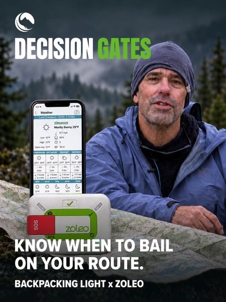 How to Plan with Decision GatesKeep going, change your route, or turn back? Watch how decision gates help structure these choices in our YouTube video.
 © Beartooth Media Group Inc.
 Loading...