Kearsarge Pass, Glen Pass, and Baxter Pass are all close to the Sierra Nevada crest. The original plan was that it would take me about five days, so I packed food for six days and got my wilderness permit for six days. However, I had never been over Baxter Pass before, so I really didn't know what I was getting in for. I assumed optimistically that there might actually be bighorn sheep up there, in which case I could easily spend an extra day.
I left home very early on Wednesday and got to Onion Valley by mid-morning. I got started in earnest on Thursday morning at 6 a.m. while it was cool. I got over Kearsarge Pass in three hours, then down to the John Muir Trail in another two hours. Turning north, I got over Glen Pass at 1 p.m. with a rain shower threatening. Instead of taking the shortcut over Rae Col into the Sixty Lakes Basin, I went the long way, going down to Rae Lakes and then on the official trail to Sixty Lakes. I saw no bighorn sheep at the place where I have seen them twice previously. So, I camped in the middle of Sixty Lakes by 5 p.m., pretty much dead on my feet. I had covered two days worth of trail in one day.
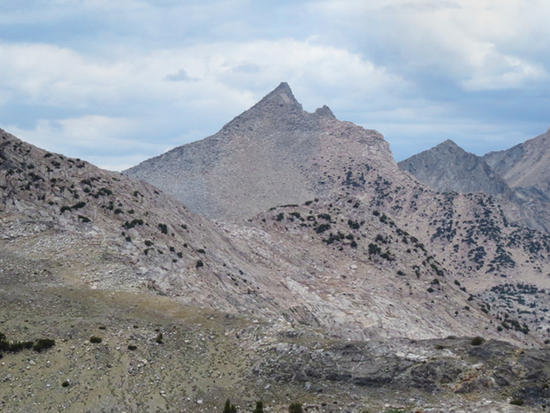
On Friday, I got started early for Mount Cotter. The approach routefinding was non-trivial, but I made it up the Class 3 ridgeline. I haven't had to do any climbing like that in eight years. I took the summit photo from a place about ten feet lower than the true summit block, then left my camera and pack there for the last scramble. I was feeling a little vertigo. I descended to the southwest and the largest lake of the Gardiner Basin, and went back around to Sixty Lakes Col, which is the base of the ridgeline. Then I made it back to camp by 4 p.m., pretty much dead again.
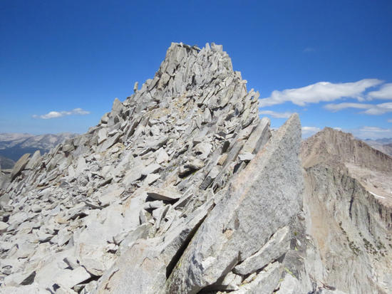
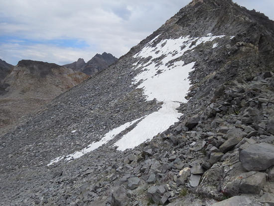
Notice how loose the rock is on the right side. I felt dizzy just watching it.
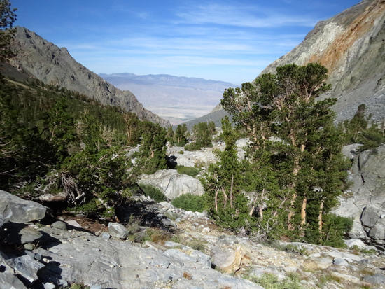
On Saturday, I broke camp early to exit the Sixty Lakes Basin, but I wanted to take a shortcut back out to the JMT. So, I ducked through a notch that is unofficially called Arrowhead Col above Arrowhead Lake. I got through there and descended to the lake, then turned northbound on the JMT down to Dollar Lake. That is where it got interesting. At the north end of the lake, I saw the Baxter Pass Trail sign, with "Trail Not Maintained." I was following a series of rock ducks, but they disappeared after only a couple of hundred yards. So, I knew where the trail was supposed to go across a talus hillside, and that is where I went. After a couple of miles, I intercepted the trail again. Following it around through the woods to the Baxter Lakes wasn't easy. The ducks would disappear, and then I would start zigzagging until I found a trail again. Trees down across the trail were not removed. There were no step rocks for crossing streams, and it was just a generally visually crappy trail. The highest of the Baxter Lakes is 11,400' and then the talus began. I made it to the pass at 3 p.m. and there was a slight snow cornice remaining as I started the descent. The trail was terrible. The upper part of it was very steep and loose. The only way to walk it is to point your toes straight down the fall line. So, basically you have to go on your tippy toes down the trail. My boots were chosen to be lightweight and comfortable, not to be stiff and supportive. As a result, the front and underside of my toes took the brunt of the pressure, so they got sore and swollen. I had descended over 2300 feet that afternoon before I camped overnight. Now I knew why the trail is called Not Maintained.
On Sunday morning, I had to get all the way down and all the way back to my car twenty-odd miles away. The trail changed a lot. It remained steep, but it was loose and overgrown with sticker bushes. I got down to the oak and cactus country and the trail started to improve. I made it to the 6000-foot trailhead around 9:20 a.m. My rush to get there was because of heat. I knew that the Owens Valley gets hot, so I wanted to get back to my car early before it got incredibly hot. I had hoped that there might be somebody with a car at the trailhead and I could hitch a ride down to Independence. No such luck, so I had to walk, and I still had one remaining quart of water. Leaving the trailhead on a dirt road, I started taking shortcuts down across the desert scrub brush. After I had walked four miles or so, I hitched a ride to Independence at 11 a.m., so that helped. I was getting dehydrated, but I didn't really realize how badly. Upon reaching Independence, I had to hitch another ride 15 miles uphill to get back to my car at Onion Valley, so I stood out on the right street corner with a sign: RIDE. I drank my remaining water and purchased a Coke to gulp as well. It was after 2 p.m. when I finally got a ride that got me back uphill to my car. I drove my car back down to Independence to get on the highway to home, and then I saw the air temperature in Independence. It was 105F. Yikes! No wonder I was dehydrated. I purchased another tall Coke to sip on for the long drive home, about six hours. By the time I got home at 10 p.m., I still did not need to visit the restroom, so that says something about my state of dehydration. My body weight was down eight pounds over five days. That's probably half just in water weight alone.
When I started, my pack weighed about 28.5 pounds, but when I finished I still had over half of my food left. Of that, the base weight was about ten pounds. Add camera gear and some other goodies. Plus, I tried to carry two quarts of water whenever I had the chance.
–B.G.–