Topic

CalTopo adds SNOTEL layer!!

  • This topic is empty.
Viewing 5 posts - 1 through 5 (of 5 total)
Amy Lauterbach BPL Member
PostedFeb 6, 2014 at 10:37 am

CalTopo just introduced a SNOTEL layer.

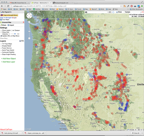
This is an easy way to see the SNOTEL data and I’m excited. As Matt says in his blog post about it, the data was available before, but not so easy to access, and not accessible in the context of good maps that include your route plan. Here’s the CalTopo map of the west showing all the sensor locations.

Matt’s doing great work on CalTopo, and we use it a lot. It’s a terrific tool. He built it for SAR teams, and if you use it and like it he suggests making a donation to the Bay Area Mountain Rescue SAR oraganization. We donated, and you should too. Done preaching.
PostedFeb 6, 2014 at 1:11 pm

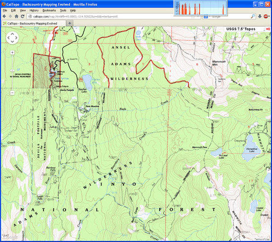
This is what I see …

CaSnoTel

I don't seem to see any SnoTel sites. Am I looking in the wrong places, or in the wrong way?

thanks.

Bob Gross BPL Member
PostedFeb 6, 2014 at 1:25 pm

If you zoom out to a high-elevation view, you should see red or blue circles in various areas of the West. Then, if you click inside a circle, you will see additional data about snow.

–B.G.–

Amy Lauterbach BPL Member
PostedFeb 6, 2014 at 1:25 pm

Greg – you need to zoom out from that view you show in your image. There are not SNOTEL sites at EVERY place you might be interested. And also, make sure you've got the SNOTEL layer turned on – it's in the list of added layers under the map-type drop-down in the upper right.

snotel

PostedFeb 6, 2014 at 1:47 pm

I did start at "global", and kept stepping down, but to no avail.

Now I am presented with what I expected to see, without intervention my part.

Must have been some browser voodoo going on….

Thanks.

Viewing 5 posts - 1 through 5 (of 5 total)
Loading...