My girlfriend and I were looking for a short two-day hike in NC, close to our home in Winston-Salem. We decided on something in the Mt. Mitchell area, because we had never been there and it is the tallest peak east of the Mississippi. We picked out the Black Mountain Crest Trail, an 11.3 mile trail that starts at Bolens Creek and ends at the summit of Mt. Mitchell. I bought a topo map of the area and planned the route, figuring that we would start first thing Saturday morning at Bolens Creek, hike to Mitchell, or at the very least a spot called Deep Gap about 3/4 of the way there with established campgrounds, then turn back and hike to the car along the same route. It is January, and the lows were supposed to be around 14, so we packed accordingly. I did a little internet research on the trail, and called the Mt. Mitchell State Park ranger office to make sure that it would be open in case we needed to get a shuttle back to our car for some reason. I got only a recorded message that assured me the park was open and campgrounds were open year round.
We both pack light, but with a borrowed tent (we usually use hammocks and tarps) plenty of calories, a Platypus bag full of wine and extra clothes to cover our dog with in the tent, our packs were around 25 lbs a piece. I have a company called Yadkin River Supply (yadkinsupply.com) which is right now making dry bags and waterproof phone bags, and I brought along a few of those to field test as well.
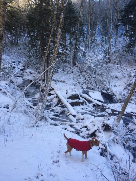
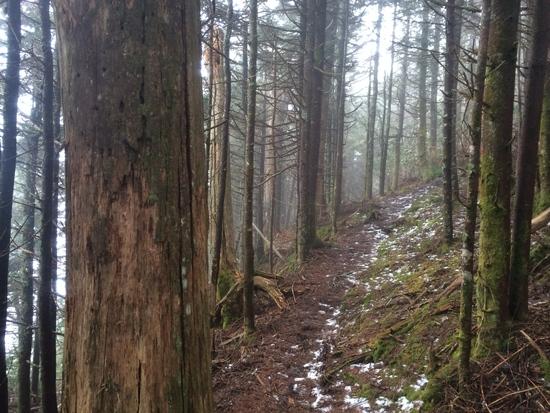
We had a little trouble finding the trailhead, which was about a hundred yards down a road that was marked private off of Bolens Creek Rd. There was space for two cars to park, and a small sign that said this was legitimate parking for the trail. We started up the trail at 11 am, and climbed 3,000 feet through a gorgeous, snow covered wonderland forest for about 4 hours, passing lots of great ice covered fishing holes along the way. There weren't any grand vistas along this part of the trail, but the forest itself was staggeringly beautiful, and the trail was intense enough to hold our attention. We had no problem following the trail, although there were no markers.
Tucker enjoying his first snow expedition.
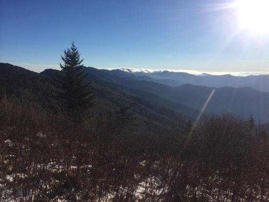
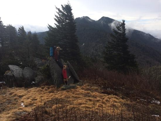
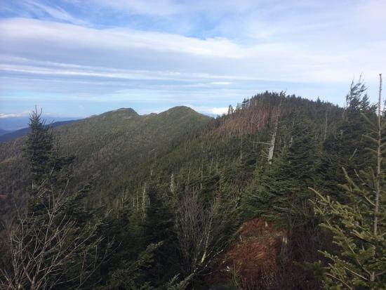
At about 3:30, we came out of the woods to the top of the ridge right below Celo Knob and one of the most beautiful views I have ever seen.
The view from the top of the ridge after a 3000' ascent. Mt Mitchell is in the background in clouds.
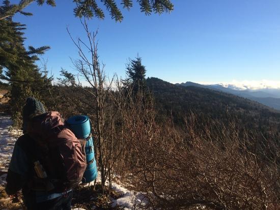
 A ranger later told me there is a great unmarked campsite on the other side of the knob, and we did see a trail we thought went to the summit, but we didn't spend the time exploring – we only had an hour and a half of light left, and our destination looked very far away from this vantage. We took a short break to refuel and consult the map, and decided we could definitely make Deep Gap, about 3 miles away. We could easily see our whole route along the ridge, and it looked like we could get there by dark.
Our path along the first part of the ridge.
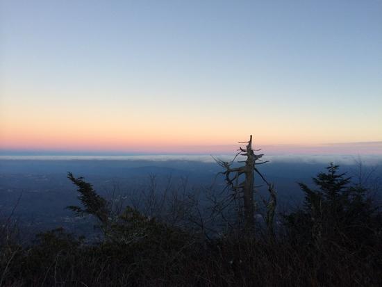
The trail was well established and flat as we walked briskly along this first part of the ridge, passing Horse Rock, Gibbs Mountain, and two or three other unnamed 6,000' + peaks; the sun setting behind Mt. Mitchell and the rest of the Black Mountain range was one of the most amazing sights I have ever seen. We kept up a brisk pace I thought was at least 3 mph (except for a minor lost glove incident) until the sun set in earnest. I had not looked at the map again since topping the ridge at Celo Knob, so I didn't know exactly where we were or how far we were from Deep Gap and the promise of a flat tent site, but I felt sure it was just over the next peak at the time the sun set. We fished out our headlamps, ate some gorp, and pressed onward.
The sun set, like it usually does. We kept going.
It was about this time that the trail started to get difficult. We hiked tirelessly for about two hours after dark, passing each peak thinking that the next valley was Deep Gap – but the trail became much harder as it scrambled up and down around the side of Burnt Mountain, through icy Rhododendron hells and along the steep sides of cliffs with stiff winds pushing us toward the pitch black 3000' precipice to either side. We would not have been able to keep the trail at all at this point if it wasn't for our fearless dog and the snowy footprints of a group of four that had apparently passed this way the same day. We would have stopped or turned back if that were even an option, but we didn't find anywhere flat enough to set up a tent, the air was getting much colder and the wind was reaching hurricane force (or it felt like it anyway). When we finally did stop and set up camp, it was 7:30 pm – two and a half hours after sunset – in a relatively flat spot directly on the trail that we later learned was the side of Winter Star Mountain, another HOUR hike to Deep Gap and the campsites there. We slept warmly and soundly in our tent, despite the bumpiness of our site and the wind threatening to tear apart the forest around us.
The next morning we had a decision; we thought that we had missed the Deep Gap campsites and trail intersection because of the dark and my failing headlamp the previous night, and we thought we were somewhere near Cattail Peak – only 2 miles or so from Mitchell. The morning was too foggy to see anything, so we couldn't orient ourselves or tell exactly where we were with the map. We could either turn back immediately, which would mean another full day of hiking to retrace our footsteps back to the car, or press on until we could at least see where we were, try to get to Mt. Mitchell and thumb a ride back to our car. We also had friends in the area who would happily give us a ride if push came to shove. We decided to keep moving forward toward Mt. Mitchell.
The trail up the side of Winter Star Mountain. It is too foggy to see off the side of the cliff.
Twenty minutes into our hike, we came to the summit of Winter Star Mountain, and a marker which gave us a definitive location. It was still too foggy to see anything as we stood on the peak, but as we watched, the clouds rose up with astonishing speed and the whole ridge and massive valleys on either side were revealed. Deep Gap was in fact the NEXT gap, and it was indeed deep. The trail led 500 feet down the steep, icy mountainside to what seemed to us at the time a garden of Eden – a half dozen or more beautiful campsites in a long, flat dale with very little wind, and a few marked water sources that weren't muddy trickles of snowmelt. The Colbert Ridge trail led off steeply to our left, as indicated by a very nice, clear Forest Service sign. We were half tempted to set up camp again just because the spots were so nice.
Descending into Deep Gap. Cattail Peak is ahead.
We pushed onward up, over and down three more massive peaks, the already very steep trails made even more difficult and treacherous by the fact that they were frozen solid and coated with ice. Cattail Peak was marked by an old wooden sign that told us it was three miles to Mt. Mitchell. It also sported one or two very nice campsites right around the summit. Big Tom was a real bear to climb; the top had very little view, but we were rewarded with a plaque telling our altitude and a short history of the mountains' namesake. Mt. Craig was last in line next to Mt. Mitchell itself, and only thirty-six feet shorter at 6,648'. There was a sign near the top asking hikers to stay off rocks to protect endangered plants – I haven't been able to determine what plants yet – and a walkway was constructed over the summit. The view was incredible, except in the direction of Mt. Mitchell. The parking lot, visitors center, museums, gift shop, bathroom and changing station, etc, were all very visible right on the mountain's face. The wind was the most intense I have ever experienced – enough to literally knock me over at times.
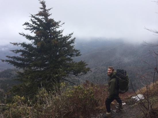
The views were amazing, the trails dangerous. This was my kind of hike.
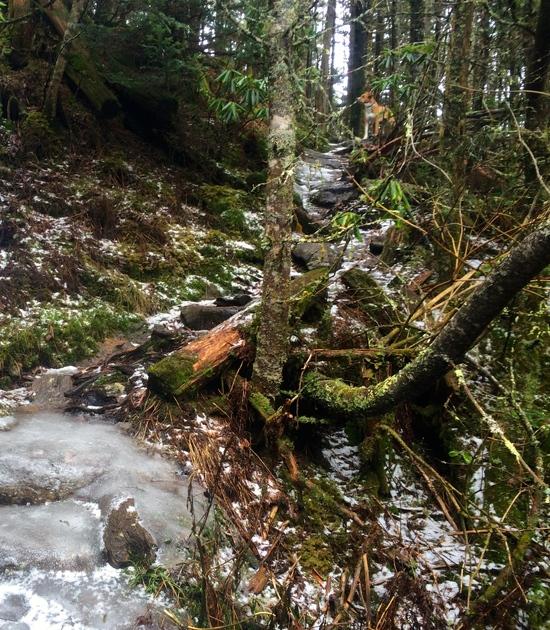
A typical trail, and our fearless guide leading the way.
Looking back over our route from the side of Mt. Craig.
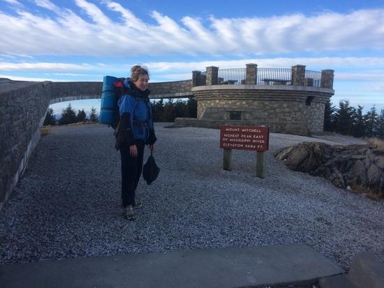
The climb down Craig and then up to the summit of Mitchell was just as arduous as the rest of the day had been – until we hit the parking lot. The last 300 vertical feet was accomplished by strolling through the empty parking lot, past the empty museum, around the empty and locked bathrooms and picnic areas, by the gift shop, away from the changing station and on up a sturdy stone ramp to an observation tower built up twenty feet above the peak. We took our pictures at the top of the world, then walked down… to where? The park was totally abandoned, it was an hour before sunset now, and our backup backup plan relied on us finding a ride here to get back to our car. We had gear for the cold, we had enough gorp and granola bars to make it maybe a couple more days in a pinch, but we had to work in the morning! Also, unbeknownst to us, there was a huge cold front moving in that night. The temperature would drop to well below 0 – which we weren't prepared for – and dump over a foot of snow. We were wearing tennis shoes with plastic bread bags over our socks.
Too tired to explore the gift shop.
Our options at this point were: go back the way we had come, and arrive at our car after dark the next night if we pushed it hard, or walk down the road towards the exit of the park, try to find a ranger and beg for help. We chose the latter. Also of note, we had given our location and route to my mom before setting off with instructions to call for help if we didn't contact her by dark on this day, and of course, there was no phone service anywhere we could find.
As the sun was going behind the distant peaks and the temperature was starting to make its rapid descent, we finally arrived at a seemingly abandoned Park Ranger station. We knocked on a door and hollered to no avail. Finally though, we did find two rangers loading up some wood and told them about our predicament. They told us about the storm moving in, and said that they weren't planning on going anywhere, and that the nearest open road was about 16 miles away – the nearest town about 30. However, breaking protocol, a member of the NC State Park service offered to take us on the one hour drive back to our car!
The moral of our story is this: be prepared for the worst but enjoy whatever comes at you. Even though this trip didn't go at all according to plan, we enjoyed every minute of it. I was a little anxious as we neared sunset both nights without knowing where we were sleeping, but we both just went with the flow and everything worked out – as it always does in the flow. This was one of the most beautiful and most exhilarating hikes I have ever been on, and I would highly recommend it as a two or three day hike – one way. The views were panoramic and constant, and the trail was enough to challenge the most seasoned hiker. The ranger we spoke with recommended hiking it the other way, from Mitchell to Bolens Creek, but I liked our way – ending at the top of the highest mountain on the East coast.