Haekel Col/Ampitheater and Dumbbell Lakes/Lake Basin/Sawmill Pass 9/16-9/24
My long time friend and hiking partner, Fred, and I were looking for a trip that would be at once challenging, scenic, and off the beaten track. We decided on a route that began with a crossing of Haekel Col and had us exiting over Sawmill Pass 9 days later. In between, we hiked the JMT from Sapphire Lake to Cataract Creek and then proceeded off trail to Ampitheater and Dumbbell Lakes before crossing over Dumbbell Lake Pass into Lake Basin. From there our route went over Cartridge Pass and picked up the JMT again enroute to Sawmill Pass. It was a physically and mentally demanding route that took us thru some of the least visited territory in KCNP, and more than fulfilled our expectations.
First off, I would like to thank Andy Duncan for his excellent trip report on crossing Haekel Col. It eliminated a considerable amount of the guesswork that is often involved in picking one's way thru difficult off trail terrain.
Day 1
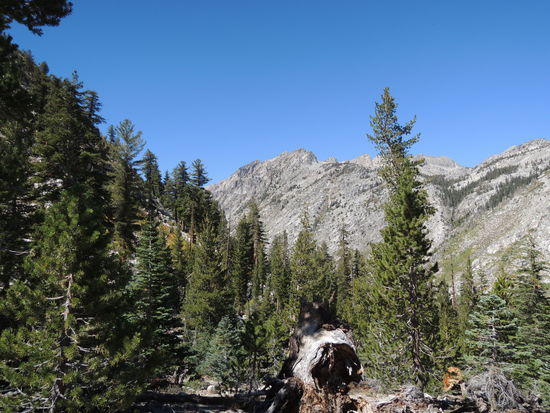
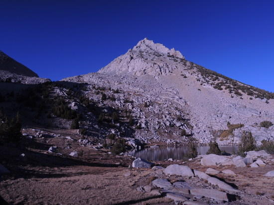
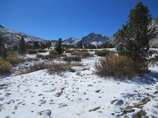
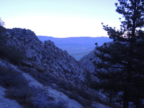
We started off from Sabrina Lake at around 7:30 AM, intending to stop at Midnight Lake for the day to acclimatize, but when we arrived, it was only 10:30 AM. Fred and I both handle altitude well, so we decided that, rather than hang around Midnight Lake, we would continue on up another 1000' or so to give ourselves a leg up on the strenuous day we knew was in store for us the following day. The route from Midnight Lake up onto and along the ridge that separated it from Hungry Packer Lake was relatively straightforward on easy terrain, and made for a most enjoyable afternoon. We dropped down to a tarn at ~11,600' overlooking Hungry Packer Lake in mid afternoon, and found a comfortable grassy area with magnificent views to camp. It had been an excellent first day, which boosted our morale considerably. Well satisfied with our effort, we enjoyed the first of many gorgeous sunsets and turned in early, well aware that progress tomorrow would exact a higher price.
Dingleberry Lake
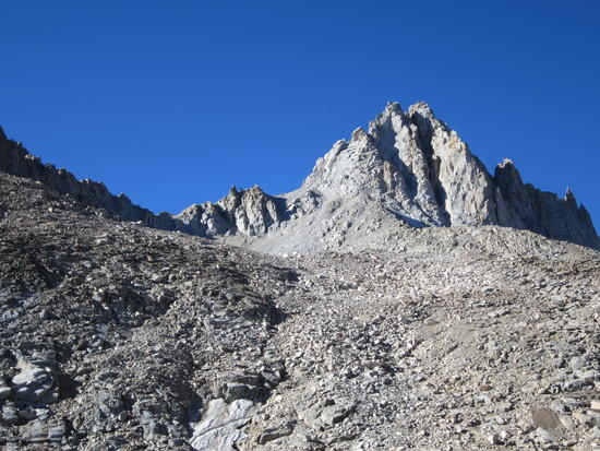
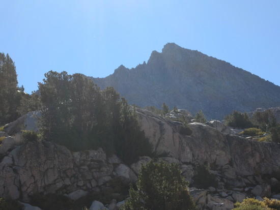
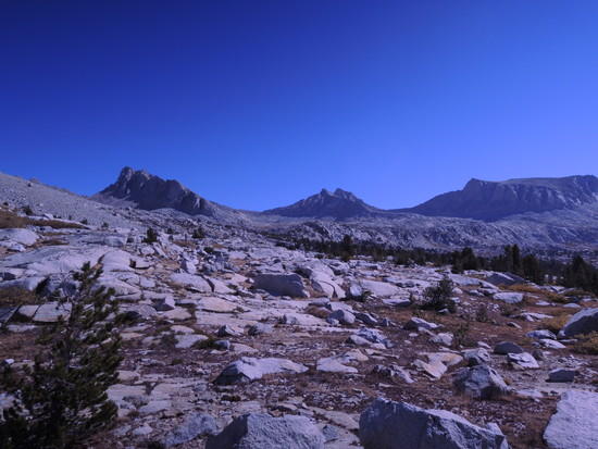
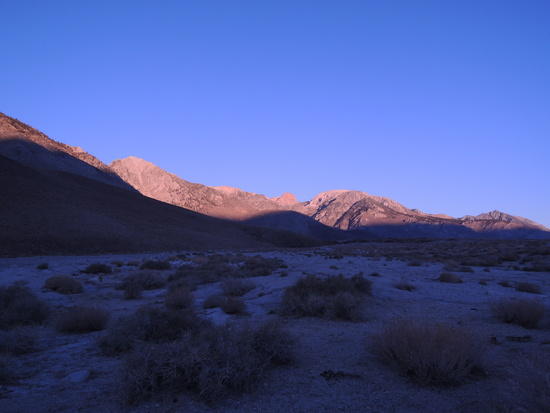
Mt Haekel from camp
Sunset over Hungry Packer Lake
Day 2
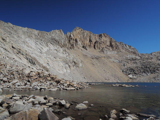
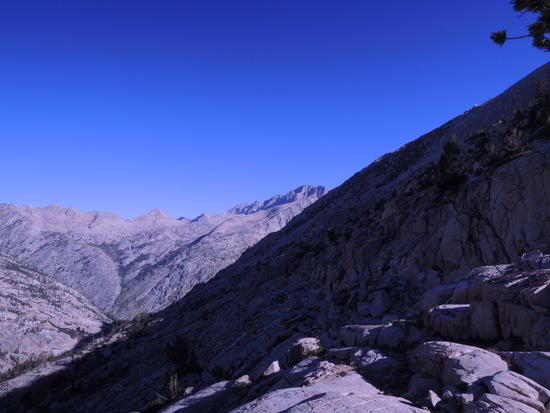
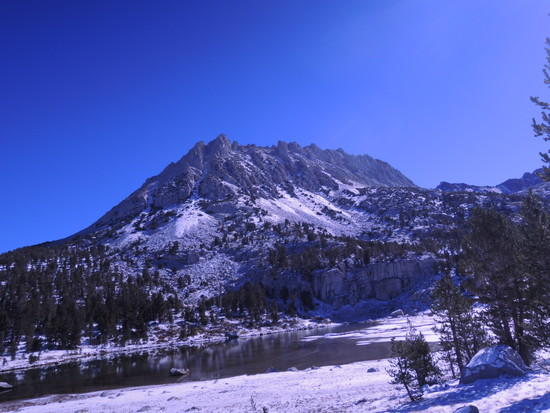
As expected, the hike over Haekel Col(12,680') to Sapphire Lake proved considerably more challenging than than yesterday's stroll up from Sabrina Lake. We proceeded slowly over mixed terrain, talus, granite outcroppings, sand, and scree. As we approached the col, the wind picked up, and by the time we wiggled thru thru the notch was gusting in the 35-40 mph range, and cold. This would prove problematic for me on the descent of the steep, medium sized talus field, thankfully mostly stable, that lay between us and Lake 11,808 far below. Fred is a much bigger guy, and had less trouble with it, due to greater body mass. My solution was to stay even lower to the rock than usual when descending serious talus. It worked out well, but slowed my progress a bit. The views from the col were stunning, though, and more than compensated for the effort required to obtain them. We worked our way down the slope methodically, following the general route laid out by Andy in his trip report, and eventually arrived at the narrow gully that provided a way down between the steep slab and rock faces that would otherwise have blocked further progress. The gully was filled with loose, unstable debris, which required very close attention to foot placement, hand holds, and balance. It was basically an accident waiting to happen and by far the least pleasant section of the entire trip. We were both glad to be done with it when the slope finally began to lay back and we could begin talus hopping our way around the lake. Once beyond the lake the route was an easy stroll, threading our way thru granite outcroppings on gentle, boulder strewn, grassy slopes as we made our way down to Sapphire Lake. We set up camp about 200 yards southeast of the lake and settled in for the evening, tired and relieved to have what would turn out to be the most difficult section of the trip behind us. The moon was 2 days shy of being full, and transformed what would otherwise have been mundane, nocturnal, bladder relief forays into near mystical experiences.
Approach to Haekel Col


East side of Haekel Col
West side of Haekel Col

Descent from Haekel Col


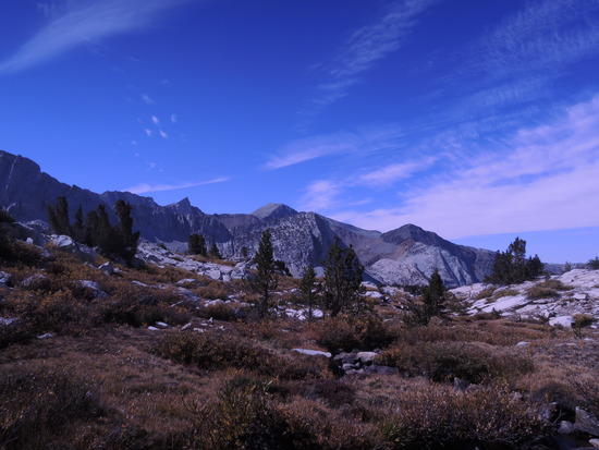
Evolution Basin and Mt Huxley from camp

Day 3
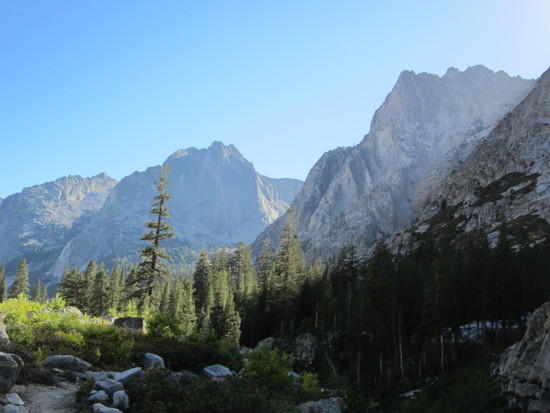
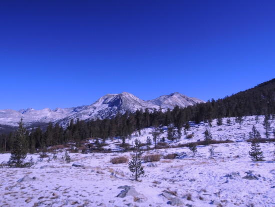
We treated ourselves to the luxury of a late start, as this was to be a transition day of trail hiking on the JMT that would put us in position for the off trail route leading up Cataract Creek to Ampitheater Lake and beyond. We figured it was better to sleep in an extra hour or two, rather than go off trail tired from the previous day's effort. The day proceeded uneventfully, as we maintained a relaxed pace and took ample time to enjoy the beautiful scenery along the way. We found the section down into and thru LeConte Canyon particularly attractive, which partially compensated for the rough trail below Muir Pass, one of my least favorite sections of trail in the Sierra. We were both glad when we turned the corner after about 14 miles and headed up Palisade Creek, finally setting up camp about 1 mile southeast of the JMT junction with the Middle Fork Kings River trail.
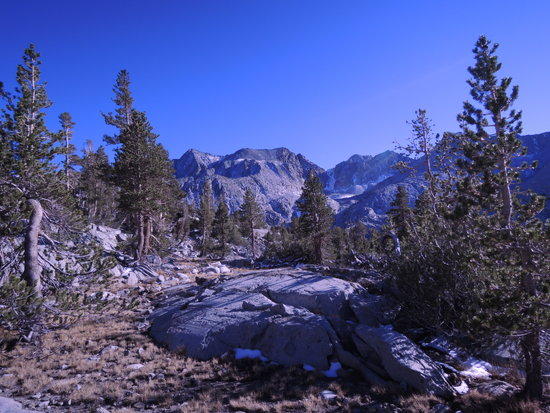
Leconte Canyon

Day 4
We woke up refreshed and excited at the prospect of making our way off trail up Cataract Creek to Ampitheater Lake, over Cataract Creek Pass, and onward to Dumbbell Lake Pass before entering Lake Basin. 2-3 days of mostly off trail hiking in a remote, seldom visited area would be a welcome change after a day on the heavily traveled JMT, beautiful though it was. After a brief 3 mile stretch on the JMT, we waded Palisade Creek and began to slog our way uphill thru Sagebrush and Manzanita scrub that was beginning to revegetate the burned over slope. There is supposed to be a faint trail angling diagonally up the slope from east to west before turning parallel to the creek, but we failed to pick it up. It really didn't matter, as the route finding was quite straightforward, with the only difficulty being to find a way over/around copious blowdown and brushy areas. Eventually, we reached the creek and soon picked up a faint trail, which promptly petered out. This became the pattern for the rest of the day, as we hiked upstream thru the gorgeous valley that led up to Ampitheater Lake. But the trail always seemed to reappear in places where it made a real difference. As the day wore on, the only real problem we encountered during the entire trip manifested itself. Fred's pace gradually slowed and eventually he ground to a complete halt, complaining of a lack of energy, nausea, and diarrhoea. Given our location this was a real concern, and after he relieved himself, we agreed to bivy as soon as we could find a flat spot large enough to throw down our sleeping bags. We trudged along for a short time and fortunately found a suitable location about 1/2 mile below Ampitheater Lake. The diarrhoea had subsided, thankfully, eliminating one potential source of concern, so after dinner we sat down and began to sort out the situation. I had noticed the previous evening that Fred's food bag was much lighter than mine, which I found puzzling since I carry a pretty light food bag and am a much smaller guy. It turned out that Fred had intended to depend mostly on body fat as his energy source, but when we analyzed what he was carrying it quickly became clear that he had underestimated the amount of carbs required to support fat metabolism. We made a decision to offload as much of my carbs as I thought I could reasonably give up without risking putting myself in the same condition, and also that he would cook his relatively carb rich dinner at lunch time to make the carbs available while he was on the move and the demand for them highest. It wasn't a perfect solution, but the effect was noticeable, and permitted us to move on at a reasonable, if reduced, pace for the remainder of the trip. Our campsite was ideally situated for sunset viewing, and we were treated to another beautiful sunset bathing the Palisade Crest, which dominated the skyline to the northeast, in gentle shades of red, gold, and purple. We took it as a good omen for what we knew would be another demanding day tomorrow.
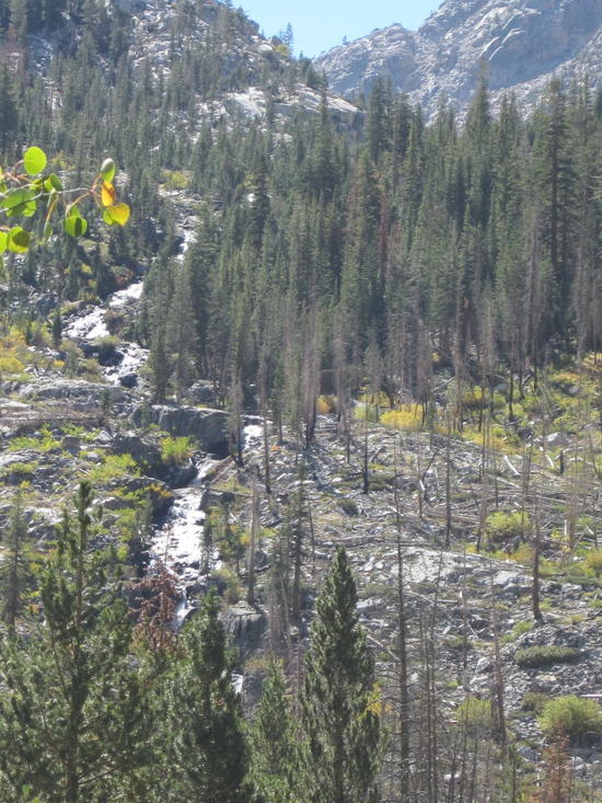
Cataract Creek at confluence with Palisade Creek
Hiking up Cataract Creek


Day 5
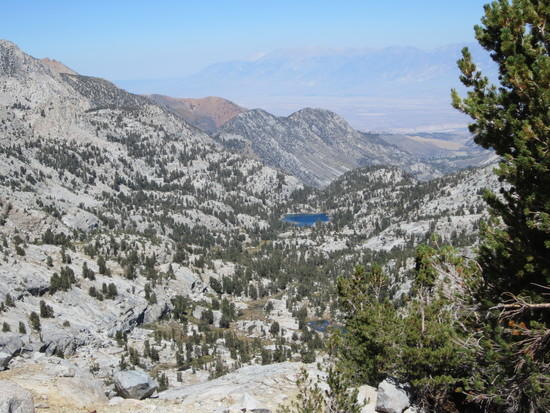
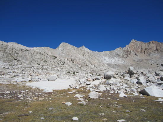
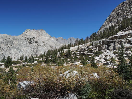
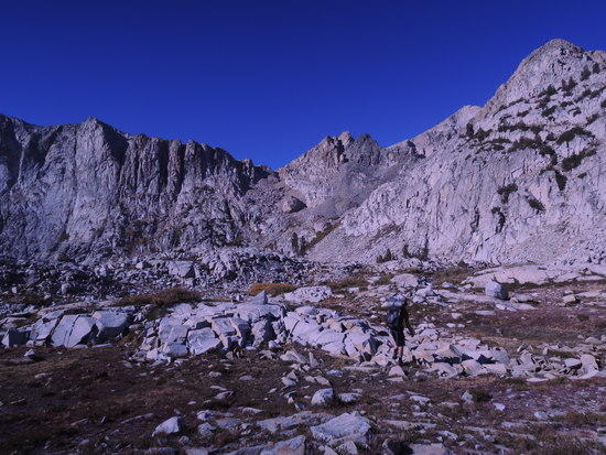
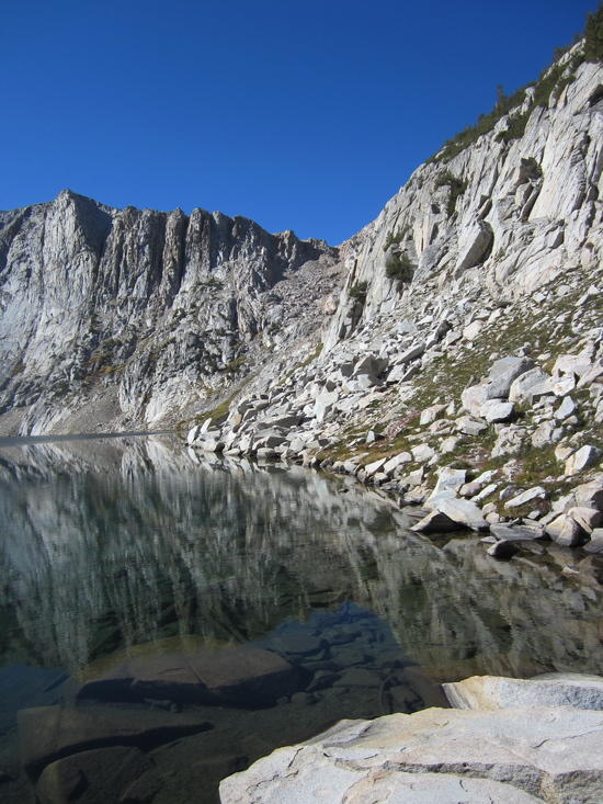
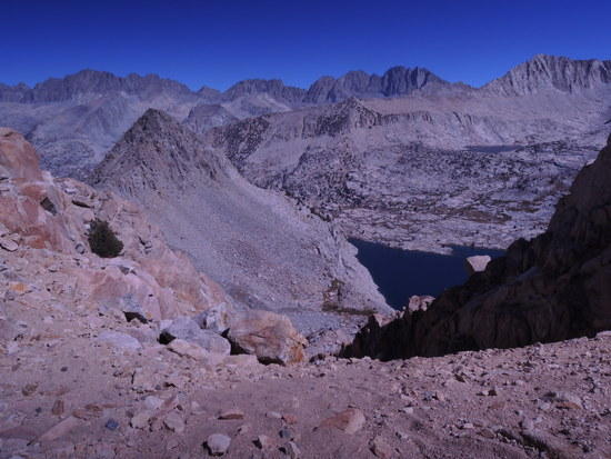
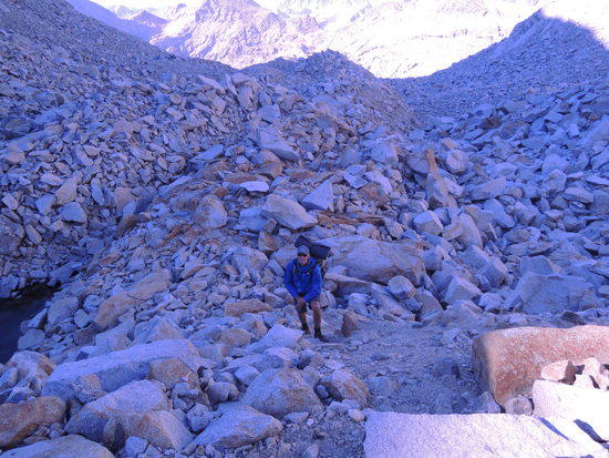
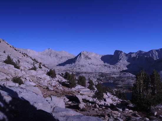
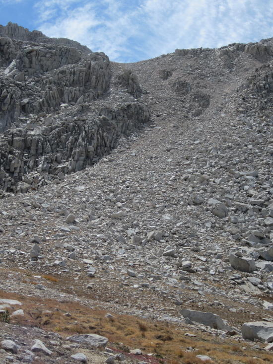
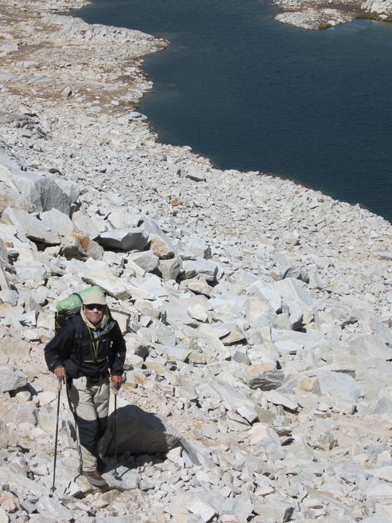
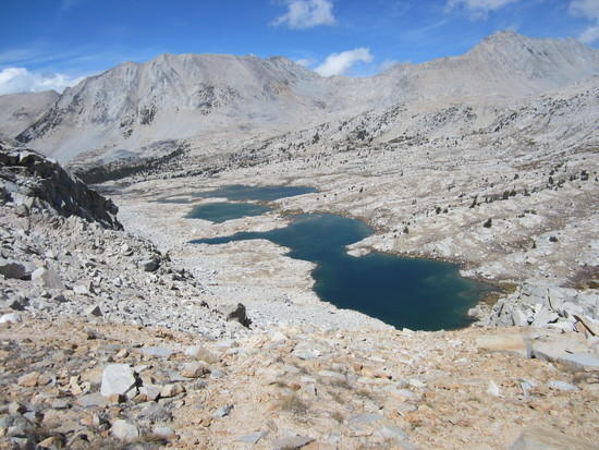
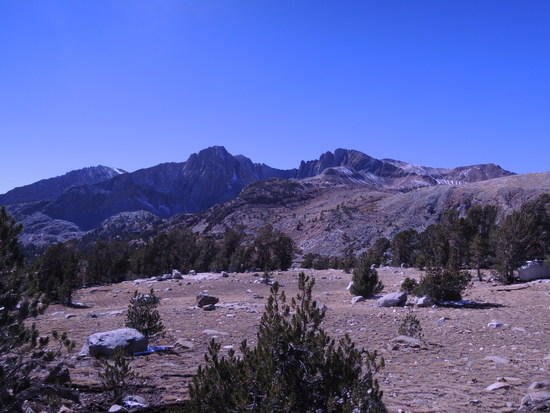
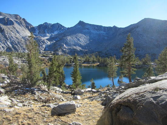
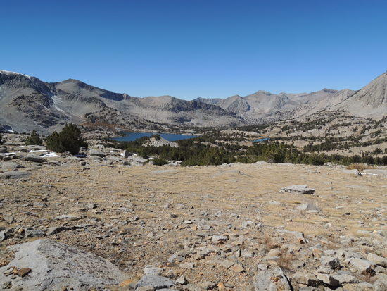
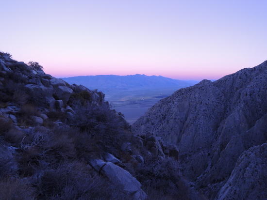
We both woke up in a much better frame of mind, with Fred noticeably improved and I was much relieved to see him more like his usual steady, unflappable self. We set out at a leisurely pace over easy slabs and ledges, and soon found ourselves at beautiful Ampitheater Lake. If one word comes to mind when describing Ampitheater Lake and its environs, it is "serene". The entire basin, with a series of satellite lakes situated in small pockets above and to the east of Ampitheater Lake is a place I could easily have spent a couple of days alone with my thoughts, far from the "madding crowd" in an oasis of exquisite beauty. But we had a good distance to go over terrain that would very likely be fairly rough in places, so we did not linger. After a short rest/hydration break, we talus danced around the west side of the lake and began our ascent of Cataract Creek Pass. It proved strenuous but straightforward, over mixed terrain of talus, loose debris, sand, and brush, and we were soon at the top overlooking a lake filled basin whose outlet stream flowed steeply downward into Cartridge Creek beneath an expansive vista that included the northern terminus of Windy Ridge and Windy Peak. We descended southwest over sandy slopes in the general direction of Dumbbell Lake and stopped for lunch in a sheltered location just below it. Thus restored, we made our way up to the southwest shore of Dumbbell Lake and reconnoitered the route up to Dumbbell Lakes Pass. Secor is often a man of few words when describing off trail routes, and in this case cryptic as well. We had expected to work our way around the south shore of the lake and enter the main talus chute directly, but it turned out to be a little more complicated than that. We were dismayed to see a cliff dropping off directly into the lake, blocking access to the main chute. At this point we reexamined Secor's route description, a bit more thoroughly. His directions describe the route from south to north, exactly the opposite of our direction, which is of critical importance. When we reversed the route description, things became as clear as Secor ever gets, and led us to ascend an accessible talus chute at the southwest end of the lake. We had initially ignored the chute because it dead ended at a steep headwall after about 500 vertical feet or so. About 150-200 vertical feet of easy class 2 up the chute we found a narrow bench that was plausibly the one that Secor mentioned, only it was not grassy, and followed it over to the main talus chute. We never did see any grass, but the route went, and that was all that mattered. We eased our way into the chute, and that is when the fun began. We only had to ascend another 300 vertical feet or so over 1/2-3/4 mile, but the talus was among the biggest and nastiest I have ever encountered. It was truly as Secor describes it: "Lots of terrible talus". It was slow, strenuous, edgy going, with 2 disheartening false saddles that lifted our spirits only to dash them when we topped out and encountered another bowl full of terrible talus. After what seemed like an interminable grind, we finally broke out onto a sandy saddle and found ourselves overlooking the wide open vistas of Lake Basin in all its glory, with Marion Peak and Red Point dominating the southern horizon. It was a welcome sight to two tired, slightly frazzled old goats, and we wasted no time descending to the nearest lake to set up camp. It was sunset, and the temperature was dropping rapidly. All we could think of was food, warmth, and sleep at that point. The nearest lake turned out to have excellent campsites, and we were soon in our bags with full bellies, well satisfied with the day's effort. The most difficult parts of our hike were now behind us, and we anticipated no real difficulty with the remainder of the route. That proved to be substantially true, but there were a couple of surprises in store.
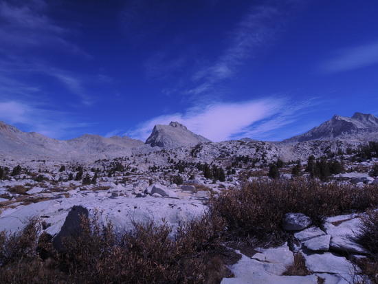
Ampitheater Lake area


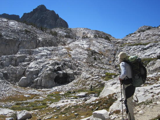
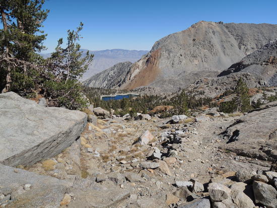
Cataract Creek Pass
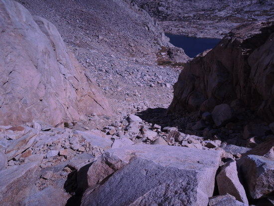
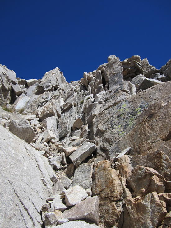
End of "Terrible Talus" It was a lot more serious further down the chute, to the point where taking pictures was the last thing on our minds.
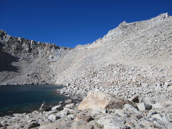
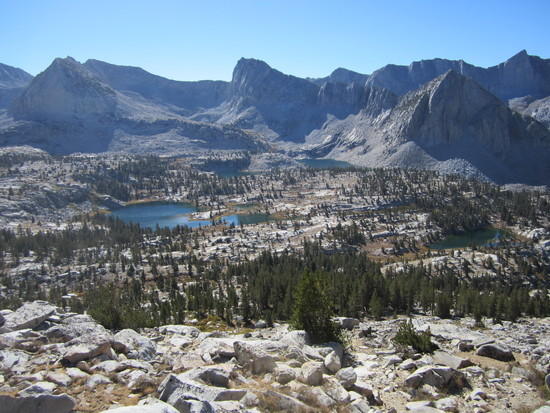
Lake Basin from Dumbbell Lake Pass

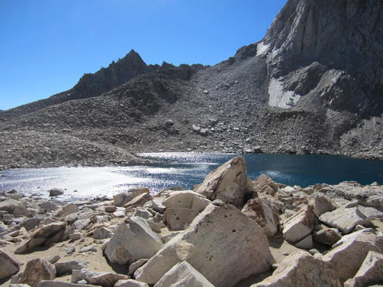
Looking up toward Dumbbell Lake Pass from Camp
Day 6
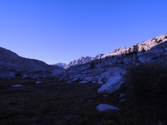
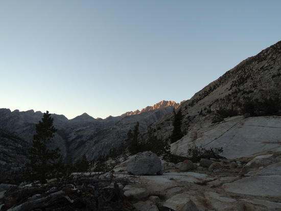
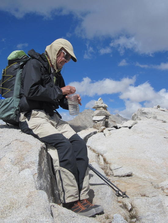
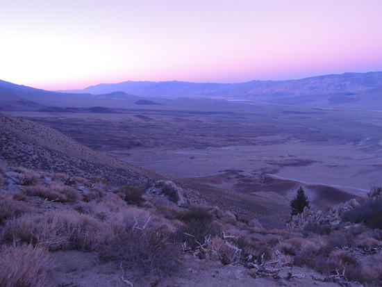
We awoke to a vintage Sierra autumn morning, crystal clear and cold. Our water bottles had about 1/2 inch of ice at the top, so it took a little more time to brew up, but that was a small price to pay for the eye watering beauty surrounding us. We took our time easing into the day and got off to a late start, around 9:30 AM. Our proximate goal was Cartridge Pass, about 2 miles away as the crow flies. However, we decided to take a circuitous, slightly descending traverse, which would avoid losing any significant altitude and also take us thru some very pleasant terrain, crossing small streams, bushwhacking thru stands of willow clad in their golden fall foliage, and ambling across gently sloping granite slabs shimmering in the intense sunlight. After an hour or so we reached the foot of the Cartridge Pass "trail". It doesn't get any easier if one just stands there and contemplates it, so we started up without delay. About that time, I did my habitual scan of the western horizon and noted the first wispy clouds drifting in. A sense of unease followed, and I resolved to pay close attention to the western horizon. We had several hours of slow, strenuous hiking ahead of us before we reached the JMT where it crosses the South Fork Kings River, and it would not be particularly enjoyable to be caught out in a storm enroute. By the time we reached Cartridge Pass, a threatening bank of cumulo-nimbus clouds had appeared on the horizon, and was moving rapidly in our direction. At this point, it became a race against the clock. We picked our way down the steep, loose south side of Cartridge Pass as quickly as we safely could, crossed the first of 3 talus fields, skirted the remaining two via a faint trail, and high tailed it for the JMT. We arrived there and quickly set up camp just before the first snow flakes began to drift down. By the time we had finished dinner, the snow was coming down hard enough to drive us into our tents. The snow continued intermittently throughout the night, but never really accumulated to any degree, and we were occasionally treated to a surreal scene of silvery white forest floor contrasting with the darkness of the pines as the nearly full moon shone thru gaps in the clouds.
Hiking thru Lake Basin

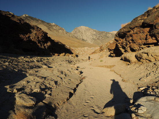
Ascending Cartridge Pass
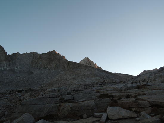
Atop Cartridge Pass

Day 7
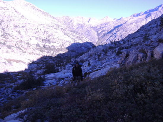
We awoke to a crisp, crystal clear day with not a cloud in the sky. After a leisurely breakfast, we broke camp and headed south on the JMT, with the goal of reaching Woods Lake on the Sawmill Pass Trail by the end of the day. The previous night's storm had left a half inch or so of snow on the ground, and the effect was sheer magic. Millions of points of light glittered on the snow, and the mountains were dusted with a light coating of "powdered sugar". The overall effect was dramatically different from what we had experienced over the previous 6 days, when the landscape was dry and subdued by comparison. We mosied along the JMT toward Pinchot Pass in no particular hurry, stopping frequently to take pictures or just soak in the beauty around us. It was one of those special fall days in the Sierra that would stay in our memories through the long, dismal Pacific Northwest winter ahead. We did not linger on Pinchot Pass, as a cold wind was whipping thru the saddle and we still had a ways to go. The trip down to the Sawmill Pass turnoff was uneventful, as we wound our way down over easy terrain. By now, the snow had mostly melted, and we were probably a little let down at the relative drabness of the landscape. Finding the Sawmill Pass Trail turned out to be a bit more complicated than we had anticipated. After turning onto the trail at a well signed junction, we crossed a stream and promptly lost the trail. Puzzled, we backtracked and tried the other bank of the stream, but there was no indication of any foot traffic there, so we retraced our steps, recrossed the stream, and paused to take a closer look at our map. It quickly became clear that we were in the right neighborhood, even though the trail had petered out. I took a quick compass bearing and we followed it, casting back and forth to either side of the bearing. Sure enough, in a hundred yards or so, the trail reappeared and our troubles were over. Another 2.5 miles of easy hiking brought us to a lovely lakelet just west of Woods Lake, where we found an excellent campsite in a meadow, well back from the shoreline. There was no need to go farther, as Sawmill Pass was less than 2 miles away, so we stopped for the day, settled in, and were treated to another magnificent sunset playing itself out on the mountains around us, including Mt Cedric Wright to the north and yet another of those magnificent unnamed ridges that have always seemed to me to be worthy of a name to the south.
JMT vistas from South Fork Kings River to Pinchot Pass


Along the Sawmill Pass Trail

Camp view

Day 8
The weather gods continued to smile on us, for we awoke to another beautiful day. We did not plan to hike far that day, as Fred's partner was not scheduled to pick us up until around noon the following day. So, we lolled around camp and then walked around the lakelet where we were camped, looking for photo opportunities, before departing around noon. It was a very pleasant walk up to Sawmill Pass over easy terrain and we topped out a little after 1 PM. The views from the pass were truly awesome, with the Woods Creek drainage falling away to the West, and the Owens Valley nearly 7000' below to the East. We paused for a few minutes to savor it all before continuing on our way. Our plan was to stop for a mid afternoon lunch break at Sawmill Lake, and then hike on down to Sawmill Meadow or possibly a little lower, behind the Hogsback, to spend our last night of the trip. We had a very enjoyable break at Sawmill Lake, but tarried over long. By the time we got back on the trail, much refreshed and, in Fred's case, carbo loaded, it was ~4 PM. We fell into a comfortable rhythm as we descended thru magnificent stands of old growth Jeffrey and Lodgepole Pine, with an occasional Red Fir mixed in. They were, by far, the largest trees we had yet encountered and instilled a certain sense of awe at their silent grandeur, mixed with a feeling of deep sadness that we have managed to all but wipe them out in less than 200 years. When we arrived at Sawmill Meadow there was still well over an hour of daylight remaining, so we told ourselves that the reputed campsites behind the Hogsback would put us in much better position to be out before noon the next day. This was the beginning of a familiar routine for Fred and me, called "the horse smells the barn syndrome". When we reached the Hogsback, with ample daylight remaining, we surrendered to the inevitable and decided to make a run for TH, knowing we would be headlamping the last couple of miles. It was cooling down by now, and the sun had sunk behind the mountains, bathing the canyon walls in soft red and purple hues. It was perfect hiking conditions and we moved on at a steady pace, pausing from time to time to take in the spectacular views unfolding before us. The Sawmill Pass Trail is very scenic in general, but the final section, where Sawmill Creek plunges precipitously into a narrow gorge that drops it ~3000' in perhaps 2 miles between soaring granite walls with numerous knife edged ridges dropping steeply into into the abyss. Bathed in the soft light of the setting sun, the effect is one I shall long remember. The trail contours along the north side of the gorge, with a steep drop off that borders on the vertiginous at times. What a way to wind up our trip, I thought to my self. Eventually, we reached the Owens Valley floor and our progress came to an abrupt and unexpected halt. We found ourselves standing on the edge of a massive flash floor/mud flow channel that had completely obliterated the trail. We saw one cairn a few yards down stream in the bottom of the channel, so we decided to hike downstream, in hopes of reacquiring the trail. By now, we had been headlamping for over an hour, and were getting tired, but we doggedly pressed on. Finally, Fred called a halt to the proceedings and strongly suggested we bivy for the night and sort things out in the morning. I didn't have any better ideas, so bivy we did, under a nearly full moon with the cars on Highway 395 clearly visible a scant 2 miles to the east. It turned out to be a wise decision.
Woods Lake from Sawmill Pass
Descending the Sawmill Pass Trail


Day 9
We rose early, had a quick cup of coffee, and retraced our steps back up the flood channel, looking for signs of the trail on our right. Sure enough, we picked up the continuation of the trail after a half mile or so, but still a half mile or so short of where we had left it the previous night. It turns out the trail had curved parallel to the flash flood for the intervening half mile and been wiped out, thus creating a discontinuous gap. We would have been hard put to detect this at night. Relieved, we resumed our journey and arrived at the trail head about 20 minutes later, elated at having finished a challenging, deeply satisfying trip in good form. As we sat there, my initial elation was attenuated by an insidious, yet familiar, melancholic mood that has always accompanied the end of any really good sojourn in the mountains lasting long enough to shed the trappings of civilized life. I invariably come back in an altered state, which is very much at odds with the realization that I am on the verge of reentering a world that seems increasingly chaotic and uncomfortable with every passing year. Inevitably, the mood passes and elation regains the upper hand, but there is always a brief period of grieving for what I am leaving behind. This time was no different and, as usual, I resigned myself to letting it wash over me as part of the total experience, a personal metaphor for life in general, where nothing is pure, unmitigated joy or pain.
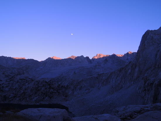
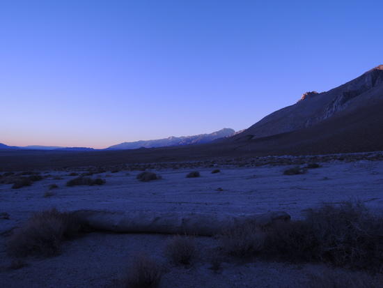
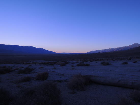
Dawn in the Owens Valley
Sawmill Pass Trail washout
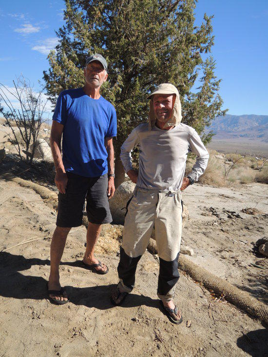
2 happy campers