Years and years ago I bought a map from Offroute.com and when I got to actually using it in the mountains the image quality (or lack thereof) proved to be a problem. I could not make out any of the forestry road labels- they were just illegible rectangle red blobs on the map, among other things. I have really good eyesight and could make out some of the finer text, but a lot of it is just a smudge on the paper.
So, I mistakenly assumed offroute.com became mytopo.com (offroute.com no longer exists) and emailed mytopo with photos of my map compared to an actual USGS 7.5' map of the same area. They informed me that they were not affiliated in any way with offroute.com and that they should be able to do better, so I went ahead and ordered a couple of maps from them. Overall, they may be better than my old map, but are still a far cry from a real USGS topo.
Now, the customizations are great- not having to grid them yourself is great, and I LOVE the waterproof paper, but the resolution still bothers me. Now I hear time and time again on many different forums how great and wonderful mytopo is so I'm wondering- do most people not care about the quality of the map very much, or are they getting better quality than I'm seeing? If you have some mytopo maps and usgs maps of the same area, post a few side by side comparison pics.
For now, unless I really NEED some of those custom features, I'm just going to stick with USGS maps. I don't know what's the best method to waterproof them and improve the tear resistance. I'm afraid laminating will make them too thick, and aquaseal map sealer probably won't improve the strength very much. USGS maps are only $8 a pop for normal 7.5' quads so I should just probably plan on replacing them when they wear out.
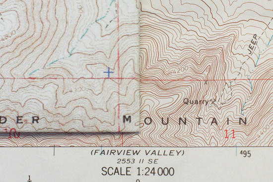
Here's are some close crops of my maps- I don't think I need to say which is the USGS map and which is the mytopo map.


BM


