Topic
Down to the River – Dominguez Canyon Backpack
Forum Posting
A Membership is required to post in the forums. Login or become a member to post in the member forums!
Home › Forums › Campfire › Member Trip Reports › Down to the River – Dominguez Canyon Backpack
- This topic is empty.
-
AuthorPosts
-
May 2, 2013 at 5:26 pm #1302479
A weekend backpacking trip to Dominguez Canyon outside of Grand Junction, CO.
As I went down in the river to pray
Studying about that good old way
And who shall wear the starry crown
Good Lord, show me the way !One of my favorite places to immerse myself is the Colorado Plateau. The canyons, washes and arroyos lead to place that seem both mysterious and beautiful. The stark red rocks against the blue sky are vibrant. And each turn of the canyon wall seems to be following in the footsteps of ancient people.
The Colorado Plateau is one of those special places seems to always call back. It is up there with the quiet lakes in the Maine woods, the High Sierra and The Winds. Place where I always long to return.
Desperately needing a backpacking fix, my mind naturally turned to this area. Moab would be too far of a drive. Northern New Mexico would also be a trek.
I then remembered a place I passed many times on the way to and from other places: Dominguez Canyon.
Being only a four hour or so drive, it was just at the raw edge for a weekend backpack.
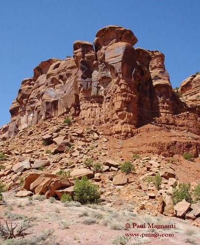
It would also be snow free and have that wonderful red rock country I so love. Being so close to Colorado National Monument, Dominguez Canyon should also prove to have impressive scenery.
I did not leave until Saturday morning due to a cold I was recovering from.
The later departure time did let me drive to the area in the daylight. The scenic drive helped to emphasize what I've always felt about the American West: The state lines that make up the states do not reflect the reality on the ground.
Glenwood Springs always felt to me like the last town of the Rockies in Colorado. It is a border town. Straddling the line between the Colorado Rockies and the Colorado Plateau.
Somewhere just west of this town, it feels more like the Utah region. And by the time I arrived near Grand Junction. I truly was in Utah. Perhaps not by state lines, but the geology, culture and "feel" of the area felt more like Colorado's neighbor to the West.
And like every time I've been in Utah, I was glad to have arrived.
Saddled up, locked the door and off I went into the canyon country of the Colorado Plateau.
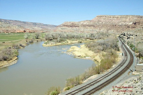
Upon arriving at the trail head, I followed the footprints to the top of the bluff and snapped a photo of the Gunnison River.

I continued my walk along the railroad easement and took a photo from the quiet boat launch.
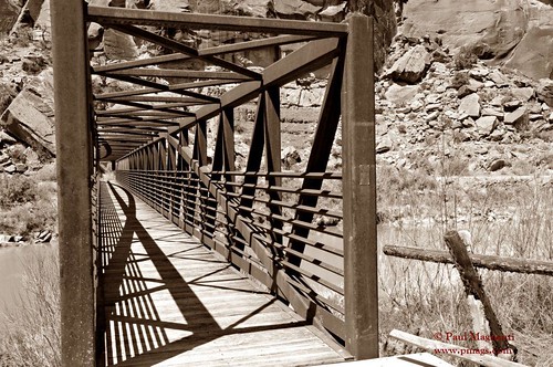
Crossed "The Gunni" at the trestle and took the shot that seems to be mandatory on this trip :) :
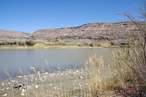
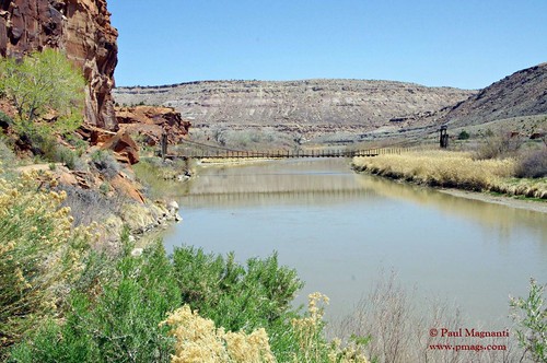
From the trestle, I had a nice look down the river and over to an older bridge that leads to a (closed-off) conservation area.
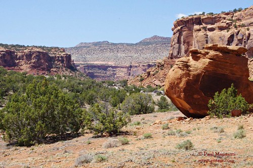
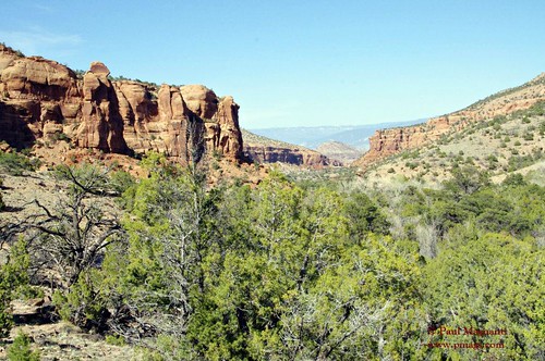
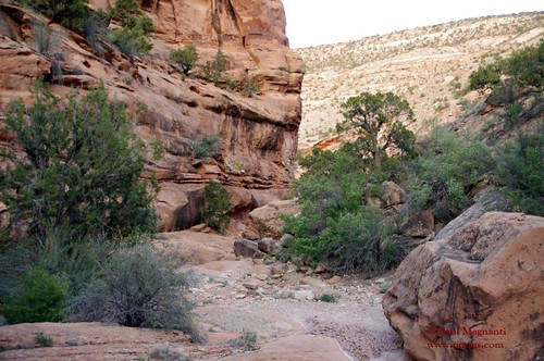
After the river I entered in Big Dominguez Canyon and was reminded more and more of the parts of Utah I love.

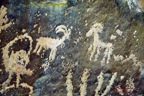
And much like Utah, there were signs of the ancient people…Utes in this case.
Further into the canyon I went. And I further enjoyed my Utah-like bliss.
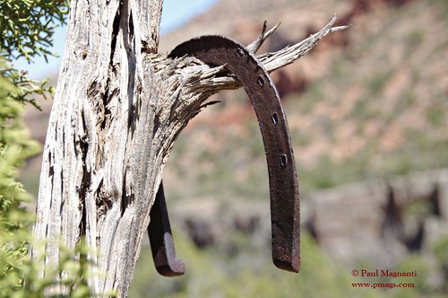
Down into the canyon, I saw signs of more recent inhabitants.
Further down the "trail" I went. The "trail" become more of a worn path marked by the occasional cairn.
Shortly before exiting the canyon proper and rising to the top of the Uncompahgre Plateau, I made camp for the evening.
Being an overnighter, a luxury was packed that made for pleasant evening in camp.

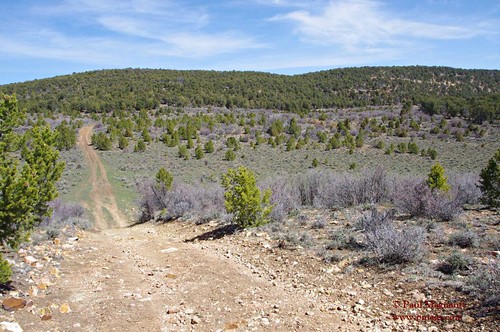
The plateau was reached and the dirt road walking portion of the trip began.
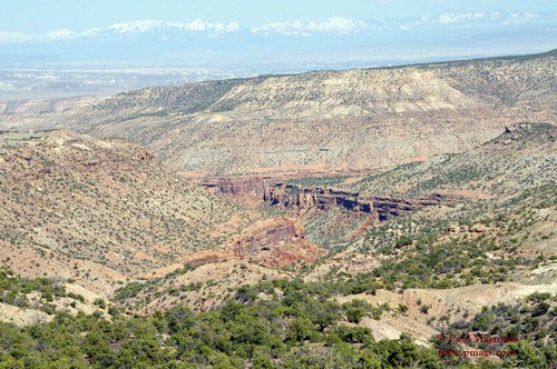
A last look was taken into the canyon.
Followed the dirt roads for a bit and entered the Wagon Park area.
The plateau was nice, but time to enter the canyon again.
Into the Little Dominguez Canyon area (did some off trail hiking in some washes…delayed me, but was oh-so-beautiful) I went.
Hooked up to the creek, The Gunnison and made it back to the trail head.
It was late. I was tired.
But I was happy.
I needed this trip. I needed to be out backpacking, sleeping under the stars and being out in Nature.
Dominguez Canyon gave me what I needed at the right time.
IF YOU SHOULD GO
Getting There: Take 50 East off I70. Follow 50E for until just after Mile Marker 51. Turn onto Brideport Rd for ~3 miles or so to get to the TH.
The Route: The classic loop is ~35 miles connecting "Big D" and "Little D" canyons with some dirt road walking in the Wagon Park area. The portions of both canyons near the river are well used and easy to follow. Further away? Not so much. A decent amount of people seem to make base camp near the creek and explore the area with a day pack.
Maps: This map is decent for general navigation esp near the river. You'll want to bring a topo for the more detailed navigation needed away from the popular areas and/or exploring the washes, however.
http://on.doi.gov/110aHqcWater: In the spring, water flowed quite abundantly in the Little D and Big D canyons. On the dry plateau, plan appropriately.
When to go: Fall and Spring are ideal. Spring will have more water. Winter is going to have less people but it can get cold (and there will be less water). Summer? Too hot!!!
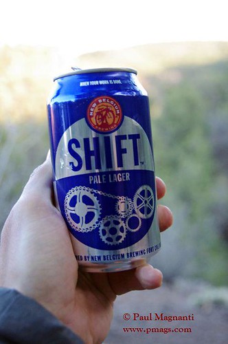
Post-hike: I finished too late and had a longish drive back to enjoy any post-hike libations. If you have the time, the area is known for its wonderful peaches and wine! I keep up promising Mrs Mags a wine tasting sometime post trip. :)
May 2, 2013 at 5:50 pm #1982708Nice. I tried to do this loop in Feb and it was just too damn muddy and cow hammered up on top to enjoy it (ended up just camping up above Little and finding a route to the floor the next day). How far up did you drop into Little? I went up Little and climbed out before I should have to follow the old stock trail on the rim. The floor's a lot nicer despite a bit of 'shwacking. Great area though; I especially love the upper part of both canyons. Nice swim holes too.
May 2, 2013 at 9:13 pm #1982746Not very far to be honest. Ended up cutting down a wash (interesting at times), hooking up a to well worn use trail, schwacked to the gunni and shwacked back to the car. Got sick of looking for an obscure trail so I just x-countried it. Basically the last part of my trip was mini-canyoneering adventure.
Looking back, probably would have been better to reverse my route as Big D was a more obvious place in terms of where to drop in vs Little D. In other words, head up Little D to the plateau and follow the more obvious road to Dominguez Campground into Big D canyon.
Still, a great trip.
May 3, 2013 at 5:08 am #1982799Really nice report Mags, I enjoy your writing style and photos.
May 4, 2013 at 1:14 pm #1983169In case it helps anyone, the following link starts Gmap4 and displays a 'live' topo map centered on Big Dominguez Canyon. Usually I prefer the 't4' high resolution topos but they are rather light so in this case the link I am posting will use the medium resolution 't6' topos from ESRI.
http://www.mappingsupport.com/p/gmap4.php?ll=38.816567,-108.39541&t=t6&z=14
Joseph, the Gmap4 guy
-
AuthorPosts

- You must be logged in to reply to this topic.
Forum Posting
A Membership is required to post in the forums. Login or become a member to post in the member forums!
Our Community Posts are Moderated
Backpacking Light community posts are moderated and here to foster helpful and positive discussions about lightweight backpacking. Please be mindful of our values and boundaries and review our Community Guidelines prior to posting.
Get the Newsletter
Gear Research & Discovery Tools
- Browse our curated Gear Shop
- See the latest Gear Deals and Sales
- Our Recommendations
- Search for Gear on Sale with the Gear Finder
- Used Gear Swap
- Member Gear Reviews and BPL Gear Review Articles
- Browse by Gear Type or Brand.
