This trip report is woefully late coming, but over this last winter, fellow BPL member Jhaura and I completed a couple of longish weekend loops through the Southern section of Los Padres National Forest, primarily in and around the Sespe Wilderness, and starting and ending each hike near the town of Ojai, CA.
As luck would have it, neither trip went as planned. Weather/environmental challenges and highway closures foiled our initial plans both times and we had to scramble to make on the fly changes to our initial itineraries.
Our first attempt was to be a 65-mile two-night loop bordering the edge of the Matilija Wilderness area before crossing Hwy 33, traversing the Sespe high country, dropping back down to the Sespe River, then climbing back up and over the Nordhoff Ridge and dropping back into Ojai to walk home. Anticipated elevation gain and loss over the course of the hike was estimated at around 15,000′ each. The forecast called for a cold winter storm to hit the region, one of the first of the season, with snow levels forecast down to around 2,500′. Our route would take us up to around the 7,000′ mark so we were sure to hit snow at some point along the way.
The first stretch of the hike followed a trail mostly used by the OHV crowd. Not the most pleasant walk but it allowed us to create a semi-loop for the purposes of the trip. Highlight of this section’s walk was unknowingly walking into the makeshift shooting range a couple of knuckleheads had decided to set up ON THE TRAIL. Thankfully, they were taking a beer and reloading break when we happened to come around the bend in the trail and be standing just behind their set-up targets. Close call.

Looking out over the ocean and Ventura, CA from up high on the Ortega Trail.

Just to the left of center, off in the distance, are the peaks we would be climbing over the next afternoon.
The hike continued on uneventfully, steadily gaining elevation as we reached the confluence of the Ortega, Matilija and Cherry Creek trails. We worked hard through this section and easily went through most of the initial 1-1.5 liters of water we were each carrying. Normally, in the winter, the area would have enough seasonally running creeks and streams that this amount of water would have been sufficient and so we didn’t initially worry too much when our reserves were getting low and we had yet to find any running water as we were coming up on Cherry Creek.

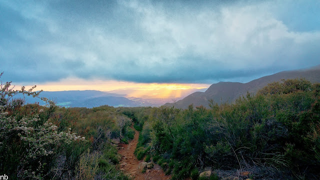
First hints of the change in weather started to creep in that afternoon.
We hadn’t really considered the chances of NOT finding water. But it turned out our local backcountry had not quite recovered from the previous year’s drought at this early point in the winter. Of course, not discovering that you’ve embarked on an ambitious dry hike until you’re about 15 or 16 miles and 6,000′ vertical feet into it can throw a kink into the best laid plans. Oops.
With just enough water left for a couple of sips, salvation was upon us when we rounded a corner on the OHV route we had been following and found a beautiful, clear pool of water in an otherwise dry creek bed. Score! We both quickly drank the last of our water and promptly filtered/treated and refilled our bottles. Imagine our surprise to discover upon those first sips that our beautiful, clear, rejuvenating and refreshing pool of water was actually a sulfur spring. Yuck! Nothing quite breaks the spirit like a nice big surprising swig of rotten egg water.

Cherry Creek continued to dole out punishment for us with a thick, gloppy couple of miles of mud walking to the highway. What better way to boost morale than adding a few pounds of mud to each shoe!
Upon reaching the highway, a quick check of the Sespe River and all of the nearby tributaries confirmed we were still left high and dry. Considering our options, we decided road walking along the highway until we could find a section of river with running water was a better bet than sticking to the original route which would have seen us hiking another 5 miles or so and gaining another 3,000’+ of elevation to reach the next chance of water at a “reliable” spring.
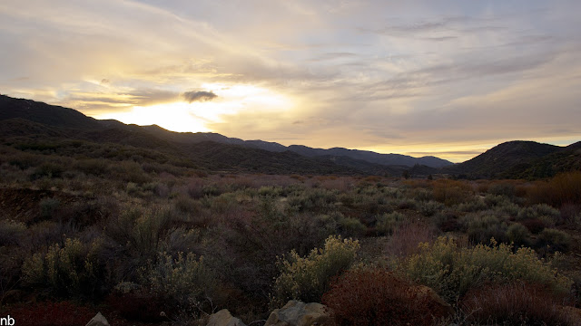
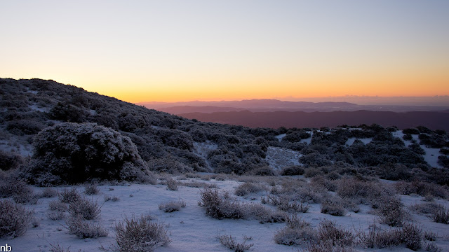
During our road walk we had ample opportunities to enjoy the sunset.
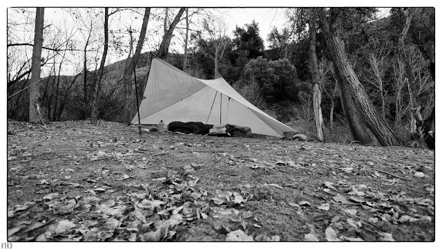
A few miles into our road walk, a car pulled off to the side and offered us a ride. We accepted and instantly cut our road walk by more than half. From where we were dropped off, we continued on into the night to re-connect with our original route. Tired, hungry and happy to be back along running water, we quickly set up camp, ate some dinner and turned in.
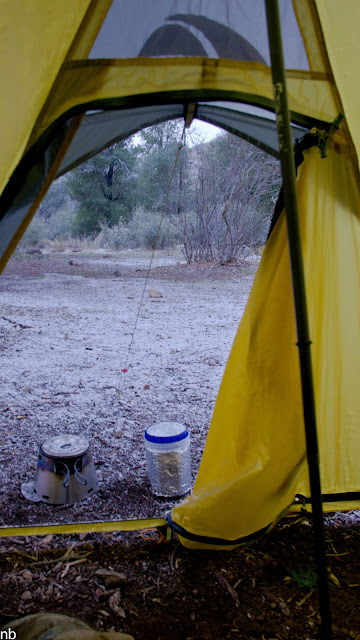
The next morning dawned eerily quiet. Pulling back the door to the tent confirmed that snow had begun to fall. It would proceed to snow more or less throughout the rest of the day with brief breaks when the clouds would part and the sun would shine through.

Exploring around the area a little bit later that morning turned up evidence of historic use of the camp. The year “1868” along with some now-faded names are carved into this boulder.
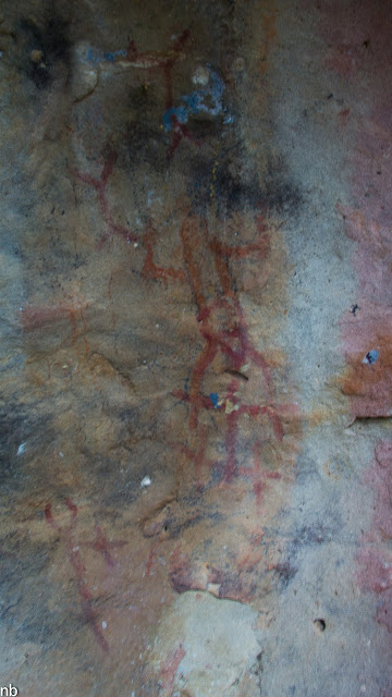
Nearby was evidence of yet even older occupation of the area. This is an image of one of several fading Chumash Native American pictographs to be found in the area.

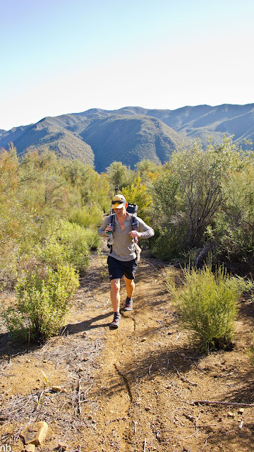
We eventually got on with our walk, heading back toward the Sespe River.

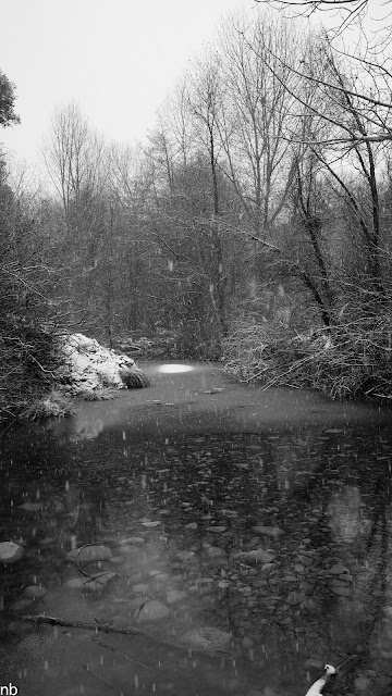
At the confluence of the Sespe River and Lion Creek, we were surprised to find Lion Creek frozen over. The novelty of this quickly becomes apparent when you consider we’re only about 30-40 miles inland of the ocean in Southern CA.


Afternoon snow flurries were the order of the day as we climbed higher on the last of three big climbs the original route followed.


A brief respite from the clouds and snow. Temps mostly hovered at or below freezing, we were both happy to be hiking in our mid layers and rain gear.

From atop the ridge, we could catch brief glimpses down the canyons leading toward the Ojai Valley.
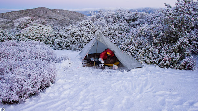
We eventually decided to call it a day and camp at a seasonal car camp along the ridgeline overlooking Ojai to the south and the Sespe River to the north. There is no water available in the area, so we ended up having to melt snow for cooking and drinking water. On esbit stoves with 550-600 ml pots. Talk about stupid light. After this trip Jhaura promptly got himself set up with a Kovea Spider remote cannister stove and I fished out and repaired my MRS Simmerlite for future snow camping trips.

Just as it got dark, we were hit by the next wave of the storm which over the course of an hour or two dumped about 3 or 4 more inches on us. Just as quickly as the cell moved in, it blew on out, revealing clear skies for the rest of the night.

I incorrectly assumed it wouldn’t get too much colder this second night than it did the first night and so I didn’t take any special measures to keep shoes, socks, etc. from freezing overnight. I was rewarded with socks, gloves and shoes frozen rock solid the next morning.
Another test of patience Sunday morning with the next round of melting snow.


Jhaura pretty stoked on the circumstances nonetheless.

Last full moon of 2012 setting to the west over the Santa Barbara backcountry.
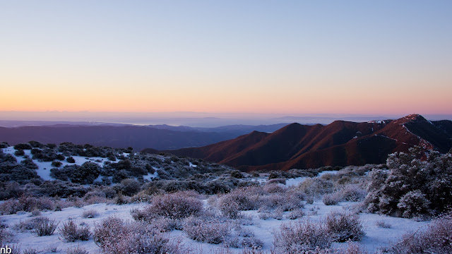
The winter sunrise was spectacular with the fresh snow blanketing everything around us. Off in the distance on the horizon are Anacapa and Santa Cruz Islands, two of the islands that comprise Channel Islands National Park, site of some of my other adventures.
The sun just about the creep up over the mountains to the east. Famous Malibu Beach is just on the other side of the ridgeline in the distance.
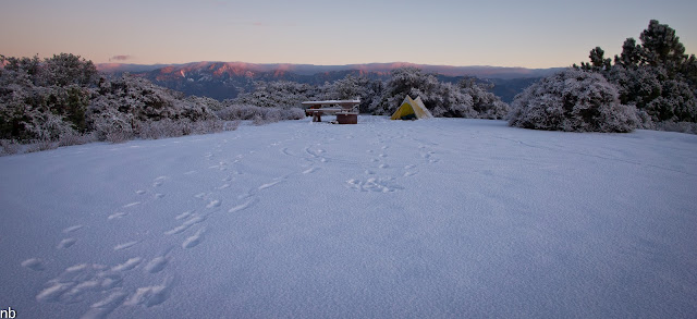
A pulled back view of camp. The ridgeline in the background is Pine Mountain, in the vicinity of where we hiked from the previous day.

One more moonset shot before breaking down camp.

The hike back into town quickly warmed up. It wasn’t long before we had shed all extra layers and left the snow behind as we rapidly descended one of the front country trails into Ojai and walked back into town.