January 19-21, 2013
Julie and arrived at Badger Pass some time around 11am and headed straight to the Ranger Station to pick up the permit. At about 11:30am we were finally on the trail — along with many others, ranging from people just out for the day to a rather large group with overnight backpacking gear that was likely headed towards Dewey Point. Once we passed the trail leading to Dewey Point, the crowds thinned out considerably and most of the people we saw from then on were cross country skiers.

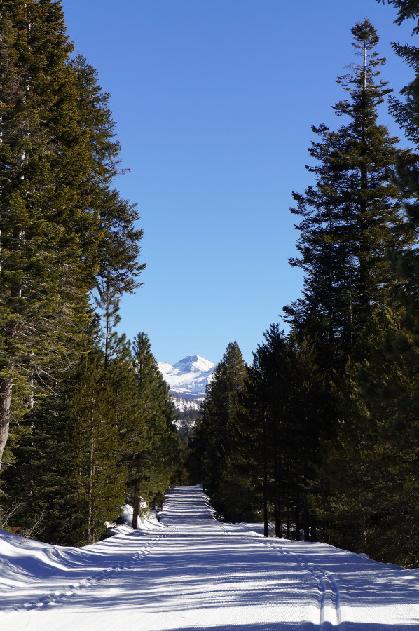
Hiking along the road didn’t really provide much scenery at first, just a path through the trees. We eventually stopped for a break at about 1pm near Bridalveil Campground, ate a few snacks, and chatted with a couple that was trying cross country skiing for the first time. After a few minutes they continued on the trail along Bridalveil Creek and then we continued along Glacier Point Road while discussing the idea of trying cross county skis on a future trip. Shortly after that we finally got our first view of one of the peaks in the distance.
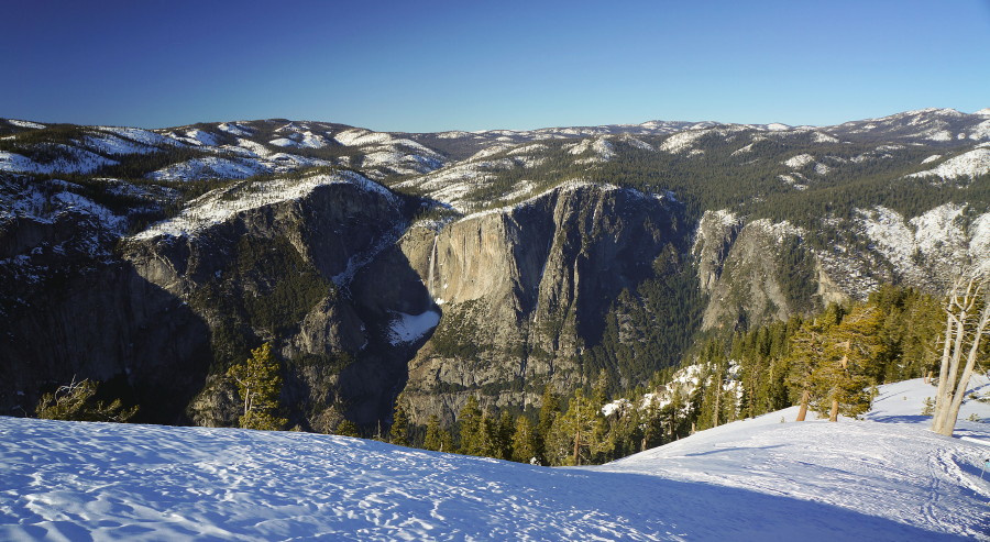
Then we rounded a bend in the road and were treated to outstanding views of the Clark Range to the east.

Earlier in the day we decided that we’d aim to find a campsite by 4pm, so at about 3:30 we started looking for a spot. At first, the options weren’t too appealing, but within about 10 mintues the terrain started to level off and we found a nice spot just off the road north of Ostrander Rock. We were close enough to the road that we could faintly hear people as they went by, but far enough away that they could not see us. There was also a large boulder where we turned off the road, making it easy to find our campsite the next day after coming back from our day hike.
Part of our camp setup included a nice little kitchen area overlooking the meadow we camped next to. After I dug out the big stuff, Julie finished up with the details.

After we finished setting up camp and getting settled in, we sat down for a candlelight dinner of angel hair pasta with cherry tomatoes and olive oil. We followed that up with some hot chocolate before crawling into the tent for the night.

That night it did get rather cold and pushed the limits of my 15 degree sleeping bag, making for a slightly uncomfortable night’s sleep. I decided not to wear too many additional layers in my sleeping bag after being uncomfortable the prior weekend when the layers would get tangled in each other as I tossed and turned. Julie, on the other hand, wore just about every layer she had and seemed to be a bit warmer that night. However, she had some of the same problems I had the previous weekend with layers getting tangled.
The next morning we didn’t get out of the tent until the sun made its way over the trees and began to shine on our campsite. After we got up, we let some of our stuff dry out and made some oatmeal and coffee for breakfast.

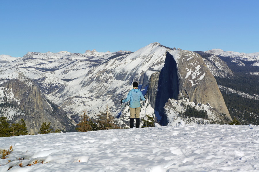
Once we finished up, we finally decided to head out for our day hike to Sentinel Dome, which wasn’t too far away.

When we got to what I think was the parking lot for the summer trail to Sentinel Dome, we left the road and started breaking a trail towards the dome. It seemed a little strange that there wasn’t a trail already there since we surely were not the first people to head up there since the last snowfall. Sure enough, after taking a look at the map we noticed there was a shorter trail to the top further on down the road, so we reconnected with the road and went that way. Once we got to the turn off it became obvious that many people had done this hike before us as there was a well-defined trail leaving the road. About 15 minutes of hiking on this trail brought us to the base of the dome.

Surprisingly, nobody else was there when we got to the top. It was perfect! We both love finding scenic lunch spots and this definitely ranks up there with the best of them. We ate our lunch while enjoying views of Half Dome, the Clark Range, the Cathedral Range, Yosemite Falls and El Capitan.


I also took a short video, which can be seen here: Video from Sentinel Dome
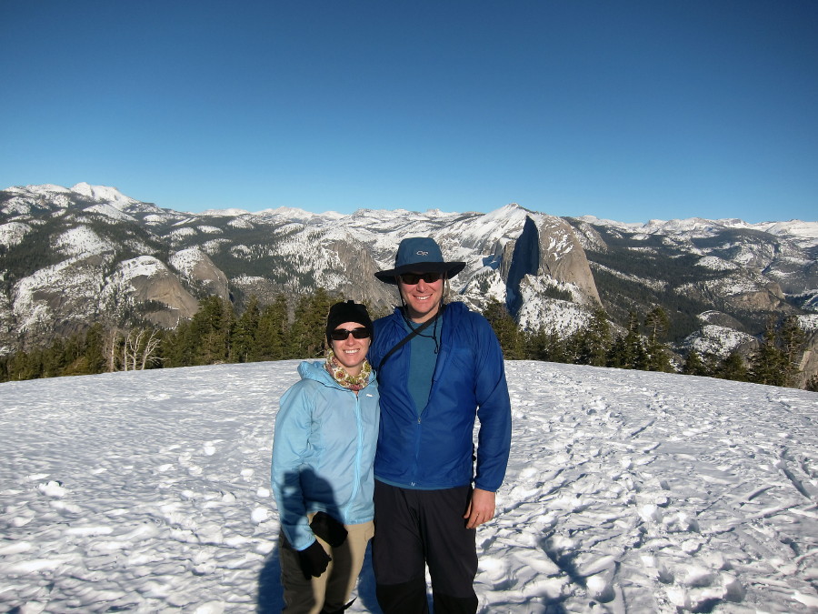
Eventually, one other guy made his way up to the top. He was on his way to Glacier Point, so he didn’t stay too long, but about 15 minutes after leaving he came back up with his friend who originally decided to wait at the bottom. We took their picture for them and they returned the favor.
We decided to head back to camp shortly after they left. The hike back only took about an hour even though the hike there took about two hours, partly because we had more energy after eating lunch, partly because it was more downhill, and partly because we stayed on the road this time.
When we got back to camp, we changed into warmer clothes, lounged around a little bit and the started preparing another candlelight dinner. This time it would be a nice big bowl of soup – and, of course, hot chocolate afterwards. We also prepared a couple hot water bottles to bring into our sleeping bags that night, which worked beautifully. We both slept much more comfortably (warmer) that night. Overnight lows were somewhere between 15 and 20 degrees.
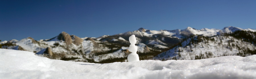
We emerged from the tent at about 7:45 the following morning and had a quick breakfast of pop tarts and coffee. After eating, packing up our stuff and cleaning up our campsite, we were finally on the trail on our way back to the car about 2 hours later. We didn’t stop much along the way this time other than for a few snacks and a few more pictures. When we passed the Clark Range View we noticed that someone had built a tiny snowman, so of course we had to take a picture.
And then there was this tree hugging tree.

We ended up getting back to the car by 12:45pm and then on the road at about 1pm. It was a perfect way to spend the holiday weekend.