We (Amy and James) spent the four-day Thanksgiving holiday backpacking in the Silver Peak Wilderness area of Los Padres National Forest, hiking a figure eight shaped loop. Besides taking advantage of the holiday break, our goal was to hike some trails we had not previously walked. The weather was spectacularly fine with warm days, clear skies, no wind, no fog, and unexpectedly mild nights. In fact, it felt more like April than the end of November. Below are two map images of the route we walked.


Here’s a link to our route at CalTopo.com. There, you can zoom the map, change the map background, and get a copy of the gpx and kml files.
One area of particular interest to us was the Lottie Potrero Trail. While planning this trip, we used the excellent website provided by the Ventana Wilderness Alliance. The VWA is a very effective grass-roots organization whose mission is to protect, preserve, and restore the wilderness qualities and biodiversity of the public lands within California’s northern Santa Lucia Mountains and Big Sur coast. Last year we decided to send them a donation whenever we hike in Big Sur, and consider that a form of entrance fee.
This group maintains extensive trail status pages updated by trail users as well as large amounts of other pertinent information. Although it shows up on old Forest Service maps, the VWA didn’t have any public data about the Lottie Potrero Trail, which formed a critical link in our planned route. Lack of data often means one thing in the Big Sur area: the trail is brushed over and has been abandoned by the Forest Service. Those of you who have hiked in the Santa Lucia Mountains have almost certainly experienced how incredibly fast trails can be obliterated by both encroaching vegetation and the loose unstable soils. The Forest Service spends almost no money on trail maintenance and many of the mapped trails have effectively disappeared.
We posted some inquiries about the Lottie Potrero Trail on the VWA and BackpackingLight sites and received encouraging and very helpful responses. These included a GPX track made by someone who had recently been on the northern portion of the trail along with the news that, while not a wilderness freeway or marked on the ground, the trail was mostly findable and useable. It turned out that by Big Sur standards, the trail was actually in better shape than others we have walked and with not too much work, could be resurrected into a decent route. We wouldn’t recommend it to a novice, but it is usable by experienced hikers with a gpx track in hand (although we would not walk it when the leaves are on the poison oak due to encroachment).
The Lottie Potrero Trail descends a fine, wild drainage and leads to some completely unexpected and lovely pocket meadows. It also passes through a Buddhist Hermitage which is part of the Foundation for the Preservation of the Mahayana Tradition. We quietly and discreetly walked by without seeing anybody. Although the Baldwin Ranch Road is publicly accessible to walkers, the Hermitage is privately owned land, and we do not know if hikers are welcomed or discouraged.
A few others notes:
• We had to walk a couple of miles on Highway 1 to connect trails on our route. Fortunately this was at first light Sunday morning, so there was almost no traffic. At other times of day, the number of cars could be bothersome to some people (and potentially even dangerous), although the views from the road are spectacular.
• We stealth camped by the edge of the Pacific on a bluff in Pacific Valley. This was a fantastic campsite.
• On Thanksgiving, we had the longest and most intense Green Flash sunset either of us had ever seen before. And on Saturday, we had six Green Flashes in rapid succession as the sun spread out into pancake layers as it set.
• South Coast Ridge Road is a publicly accessible Forest Service road. However, we saw very few vehicles, even on a perfect-weather holiday weekend. This road is essentially waterless; plan ahead and carry what you might need.
• Willow Creek Road is also a publicly accessible road, and it provides access several active inholdings. We saw about a half dozen vehicles when walking this piece of road.
The full sets of photos is over at AmyL.SmugMug.com
A few images from our trip:

An early morning start to make the most of the short days.
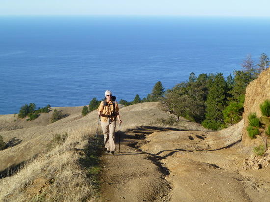
Climbing up toward the South Coast Ridge Road.
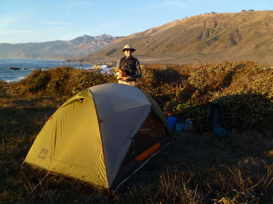
A five-star campsite on the first night.

Two big peaks in the distance: Cone Peak (5155′) on the left of center, and the more distant Junipero Serra (at 5862′ the highest point in the area) on the right of center.
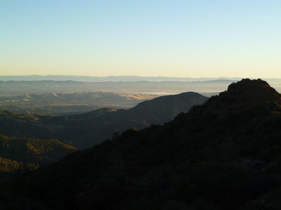
Looking out over Fort Hunter Ligget to the east of the mountains from the South Coast Ridge Road.
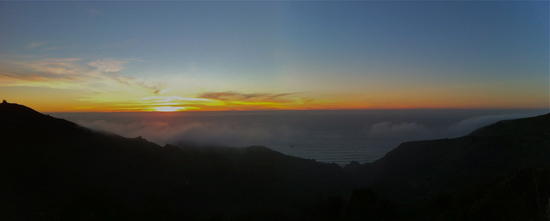
Sunset the last day of the trip: fog starting to come in.

