GR5 – Grande Traversée des Alpes
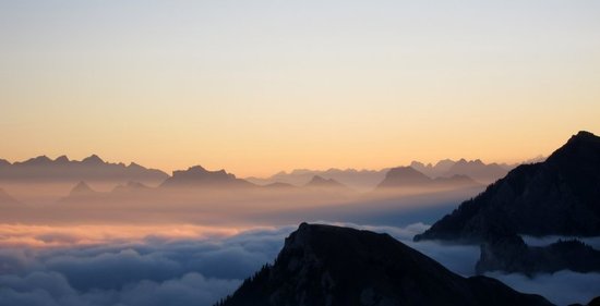
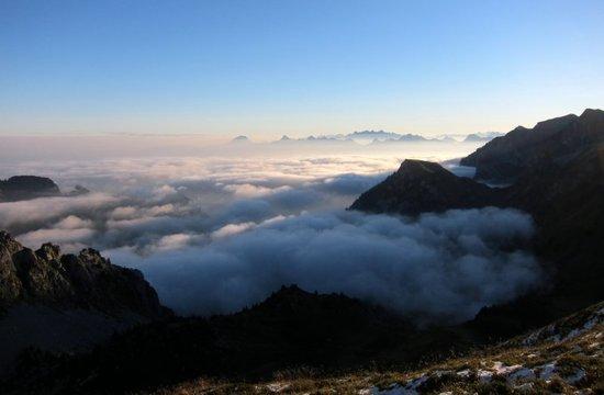
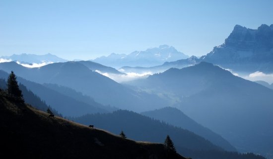
In September 2012 I walked the GR5 from Thonons-les-Bains to Val d’Isere over 7 days and then spent a further week walking in the Vanoise region to the southwest of Val d’Isere (including some more of the GR5) before heading home. As there is a good guidebook to the route, and the excellent reports by Roger Caffin from 2008, this trip report has been put together to add a little more detail for anyone considering a late season trip to this area, i.e. after mid September when a lot of shops in Alpine villages close until December and the start of the ski season. The photos are for Roger so he can see what the northern section of the route is like when it’s not covered in fog and snow…..
Following the same format as my GR54 report
Trip Details:
This report is primarily to provide logistics information for the northern section of the GR5 and provide some idea of the range of terrain the route passes through rather than any kind of narrative. I completed the trip late in the season (for this area) and many of the refuges and resupply points are closed or operate restricted hours after around mid September.
• Dates: 7 days hiking, September 14 to 20, 2012 to get from Thonons to Val d’Isere and then a further 8 days in the Vanoise. The weather is often excellent in the Alps at this time of year but many refuges close by mid September and some of the shops are also closed until the start of the ski season at the beginning of December. This can make the trip a little more awkward than during the summer but the route is very quiet (except in the Mont Blanc area) and the temperatures are great for hiking.
• Route: I followed the route described in Paddy Dillon’s 2008 Cicerone Press guide using the variant from Thonons-les-Bains rather than St Gingolph, because it was easier to get to in a day from the UK. I found the terrain to be a bit easier than the GR54, on which there are a number of loose and slippery passes, and the route uses a fair number of agricultural (jeep) tracks. Apart from the section over Le Brevent and the Cretes des Gittes, I felt that the terrain wasn’t particularly susceptible to increased difficulty in rain or after fresh snowfall.
• Accommodation: It is more difficult to wild camp on this route than my experience in the Pyrenees and the route is definitely set up for staying in refuges and gites which tends to be the custom in the Alps. I had a mix of wild camping, huts and one hotel; wild camping less than I was hoping for.
Many gites were already closed for the season and most of the refuges were also closed but significantly were operating in winter mode, which worked well. As I was covering about a stage and a half a day I often ended up out of sync with the areas where wild camping was allowed or tolerated.
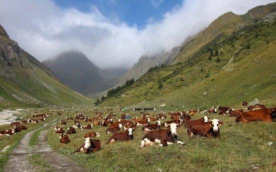
Day 1: wild camp near Lac de Darbon. Aesthetic location but a cold and damp bowl overnight and a better spot in calm weather would be up on the Col de Pavis. There is a water source ~50m down the path to the Lac de Darbon as you arrive at the Col which may not be obvious. Good camping and water source before this at Grand Chesney as described in Roger C’s article but too early to stop for me and lots of cows this time (a common theme).
Day 2: Camping on Portes de l’Hiver. The immediate surroundings are not great but a flat spot available and a fine view of the Dents Blanche. Carry water from streams running down to Lac Vert ( or camp lower down near Lac Vert if windy).
Day 3: Chalets d’Anterne (Alfred Wills). This is in a protected zone and camping is not permitted (more on this below). I arrived at the Chalets relatively late assuming that they would be closed and that I would able to bivouac nearby. This appeared to be the case until the guardian turned up from clearing one of the higher refuges. It turned out that the dormitory building was actually open and I was able to sleep in that.
Day 4: Hotel in Les Houches. I was on the way to the campsite in town when I passed a hotel with significant end of season reductions and was unable to resist….
Day 5: Refuge de la Croix du Bonhomme. Ended up here after first thinking I would stop at one of the bivouac sites above Les Contamine as the weather forecast was poor for late afternoon and the following day. Arrived at the bivouac site too early and pressed on to the refuge. This worked out well as the night was very wet and the following day was no better. The refuge is in winter mode from mid September, which means the main room is open along with the cooking area. This has gas but no water which is available at the trough outside. Firewood is provided for the stove in this room which would be nice later in the year.
Day 6: Campsite in Landry. This was the first site reached on the way into the village (Camping Caravaneige l’Eden de la Vanoise). Very helpful staff but no supplies apart from beer, wine and coffee and you can pre-order bread to be delivered at around 7:00, (so I suppose they do have most bases covered….)
Day 7: Hotel in Val d’Isere meeting up with a friend to walk in the Vanoise area
• Cost: Not including transport to and from the route, I spent 280Euro for accommodation, food and beverages.
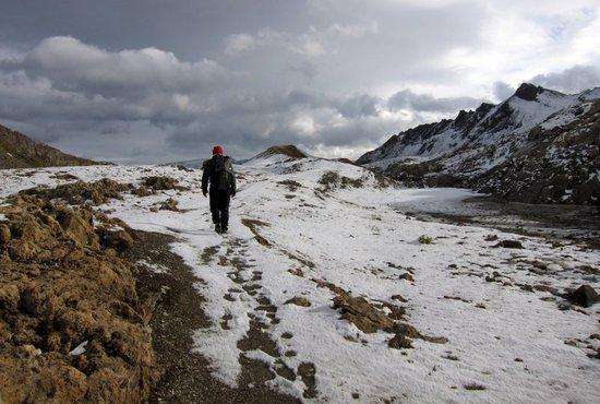
• Weather: I had excellent weather for the first five days with cool nights (~freezing) and mostly comfortable hiking conditions. I then had a day of rain/sleet with the rest of the trip a little more mixed but no further significant precipitation. I would advise going a week or two earlier for a bit more daylight and slightly improved chances of uninterrupted good weather (and more resupply options).
• Bugs: No bug problems at this time of year
• Re-supply: Resupply is fairly easy; although many places were closed there was enough to avoid having to carry any more than three days food. I resupplied at the following locations:
Day 0: Thonons-les-Bains: several grocery stores are available and an excellent looking boulangerie is passed within the first hour on the route.
I bought a gas canister in Geneva en route so didn’t check any of the stores in Thonons for availability but there is an Intersport and Vieux Camper (both outdoor shop chains) which I would expect to have canisters in this area. The sports shop on the main road in Les Houches was still open and stocked canisters as did the Carrefour supermarket. Alcool a bruler (alcohol) is also generally available in French supermarkets and I definitely spotted it in Les Houches.
Day 2: Chapelle d’Abondance (end stage 2). This had a small but quite well stocked supermarche just past the turn off by the metal cow sculpture mentioned in the guide so it might be missed.
Day 4: Les Houches (end of stage 6). Lots of options here with a well stocked Carrefour and boulangerie. Restaurants also available. Les Contamines is slightly off route but has a decent range of shops which are open (but not between 12:00 and 15:00)
Day 6: Landry (end of stage 9). Small epicerie with a limited stock.
Day 7: Val d’Isere (end of stage 11). Decent supermarket on main street with good range of food but only pierceable canisters available (why, when they are on the GR5 and the Tour of the Vanoise route?)
• Restaurants and Refuge food: I didn’t eat in any of the refuges (most were in winter mode apart from Refuge Moede d’Anterne on stage 5-6 and an auberge on stage 3) but I did stop at the auberge at the Cascade de Rouget, which was welcome after the Samoens shop was closed. Les Houches, Les Contamines and Landry all had restaurants open.
• Peaks: There are a number of opportunities for taking in peaks en route I stuck to the main route as I thought I might be pressed for time. In the event I finished a day early so used the day to climb a peak in the Val d’Isere area.
• Water: Water was generally available from streams and rivers en route, apart from the higher reaches of some of the passes. There are a large number of water troughs with a running water supply to provide drinking water and I carried no more than a litre at a time. I treated water as a matter of course as there are sheep and lots of cows grazing even at the higher levels.
• Gear: This is a great hike for going light with the guidebook route climbing over passes and descending to valley level each day, although I often ended up high. I had a base weight around 4.5kg. I carried 3 season gear, but with a Trailstar tarp to allow higher campsites. A light down bag (Summerlite) was plenty warm enough even at higher levels and I wore trail running shoes (Sportiva Crosslites, which were great on the looser/muddier sections).
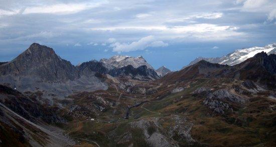
• Scenery: The scenic quality of the route is fairly high and the walking is interesting although the early part of the route is agricultural and there is a lot more walking on jeep tracks and bits of road than the GR54, for example. As is the general rule with the GR routes this is not a wilderness hike, with some form of village no more than ½ to 1 days walk away at any point, but the walk is enjoyable with the frequent resupply possibilities giving a light pack and the chance to enjoy fresh French bread at reasonably regular opportunities… I did find the all pervasive presence of cows, and their inevitable waste products, a bit wearing at times.
• Up and Down: As indicated in the introduction, the route is a walking rather than a mountaineering trip but there is a fair bit of total ascent and descent each day ranging from 900m to 3,500m per day if done over eleven days (based on guidebook figures). Done over 7 days my ascent varied from 1,800m to 2,500m a day.
• How much time? The route is around 250km and around 13,905m of ascent (and 12,415m descent) and the guidebook recommends 11 days to take advantage of the accommodation options. I did the trip in 7 days which worked fine for me and felt fairly relaxed, although the last day into Val d’Isere was quite long..
• Technical difficulties: There are no real scrambling sections en route apart from the section from Col de Pavis to Col de Bise if the short cut is taken (I suspect the GR5 route is chosen to avoid this) and the section up Le Brevent if the ladders and steps are ignored. Le Brevent would be distinctly more interesting in snow however and the Crete de Gittes would be exciting(!) in icy or snowy conditions.
• The quality of the trails is fairly good but a bit too much road/track. The section past Pont d’Arleve to Le Brevent deserves special mention as a particularly fine piece of path with clearly a lot of care and maintenance lavished on it. Generally there is a lot of terrain where you can cruise and enjoy the scenery.
• Altitude: The GR5 tops out at 2,770m (9,088′) on the Col de l’Iseran (after Val d’Isere) so shouldn’t give any problems for those who visit the high mountains reasonably regularly.
• Navigation was very straightforward. I used the 1:50,000 French Hiking Map A1 and A2 and the Libris 1:60,000 No 1: Leman, which is fine as the waymarking is pretty consistent with the standard red/white stripes. I carried a compass, which I would always take, but not a GPS and felt that this would be redundant.
• Cooking: I carried a canister stove, which was a combination of a MSR Superfly base and Gosystems Fly (Monatauk Gnat/Fire Maple) burner to allow me to use Camping Gaz press fit and standard screw fit canisters. In the event, I found a screw fit cartridge, which lasted the week and beyond, and these do seem to be becoming more prevalent in France .
• Refuges: I started out with no intention of sleeping in refuges, as I don’t sleep well with lots of snoring people around me! However, a combination of the time of year, the huts being in winter mode with no food available and mostly being mid-week meant that I had them to myself. Still slept better in the tarp though…. It would be possible to sleep indoors on every night of the trip during the main season, mid-June to mid-September, using a combination of refuges, gites and hotels.
• Crowded? Not in late September. I met a lot of day hikers as I was coming down from Le Brevent but apart from that it was pretty quiet. I saw one very heavily laden party on Le Brevent who might have been on the GR5 but were more likely on the Tour de Mont Blanc, which follows the same route at this point. The French do seem to give up on the area after early September.
Overall: This is a route I would recommend, particularly in September when the crowds have died down, although I do have some reservations relating to some of the tracks used and the ever present cows. I have generally enjoyed the GR20, the GR54 and my walking in Pyrenees more than this route, but it has great views of the peaks of the Dents Blanches and Mont Blanc and there are some very good sections approaching Le Brevent and also on the Crete des Gittes.
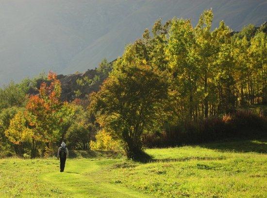
Some photos:
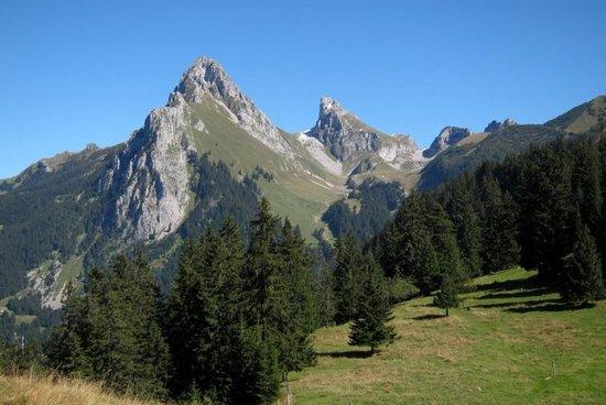
1 Dent d’Oche from west

2 Looking south from Tetes des Fieux to Mont Blanc
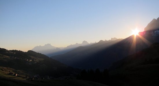
3 Looking east from Col de Pavis
4 East from Col de Pavis
5 looking south from Pas de la Bosse
6 in switzerland just north of the Dents Blanches
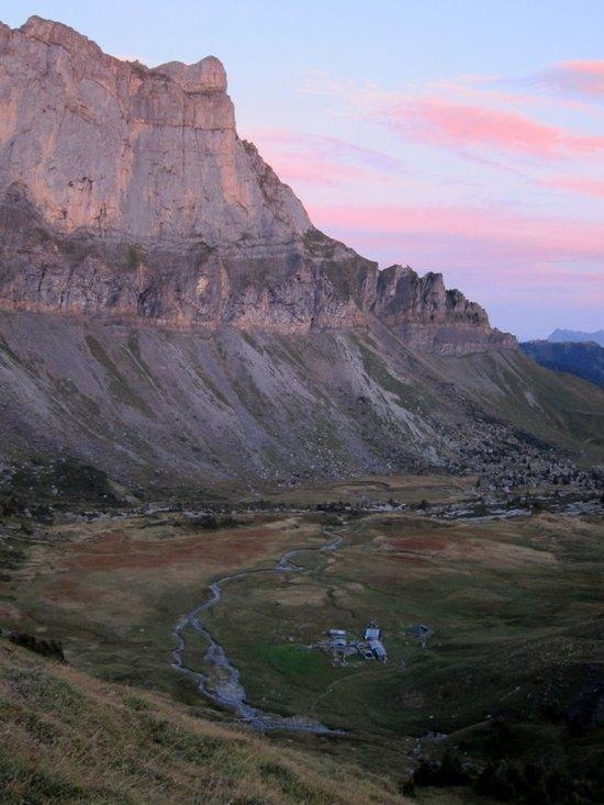
7 looking down to Chalets d’Anterne
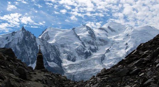
8 Mont Blanc and Aiguille du Midi from Col du Brevent

9 Aiguille Rouges from Le Brevent
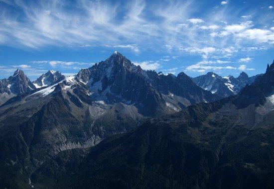
10 Aiguile Verte and the Dru from Aiguille Rouges
11 Camping, it flattens the grass…..

12 Lac de la Plagne and Refuge d’Entre-le-Lac

13 Lac de Grattaleu

14 Vallon de la Lenta

15 R de Plan du Lac and Le Grande Casse

16 below Lac des Vaches in Vanoise
17 Col de la Leisse
18 south from Col de Fresse
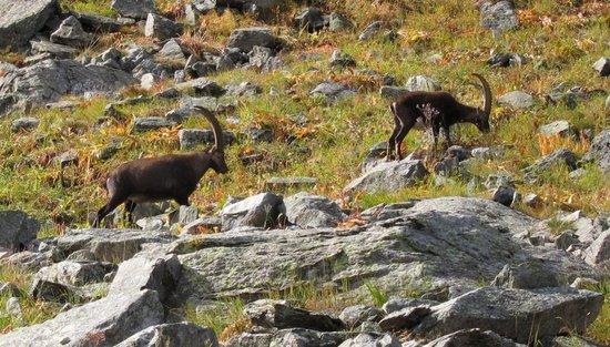
19 Bouquetin in Vanoise

19 View to Vanoise from above Bonneval sur Arc
20 Maurienne Valley near Bonneval sur Arc
Edit route stats

