Topic

SEKI National Park 10 day Loop


Forum Posting

A Membership is required to post in the forums. Login or become a member to post in the member forums!

Home Forums Campfire Member Trip Reports SEKI National Park 10 day Loop

  • This topic is empty.
Viewing 14 posts - 1 through 14 (of 14 total)
  • Author
    Posts
  • #1293649
    Amy Lauterbach
    BPL Member

    @drongobird

    Locale: San Francisco Bay Area

    August 22-31, 2012 we (Amy and James) hiked a ten-day loop through Sequoia and Kings Canyon (SEKI) National Parks. The goal was to take a long trip through the high Sierra with only modest amounts of cross-country travel and not too much time spent on the John Muir Trail (aka JMT). We also wanted to visit a few places we had not been to previously. It was also designed as a loop so that transit back to the car at the end of the trip would not be a hassle.

    Our route started at Road’s End in Kings Canyon NP. We crossed Avalanche and Colby Passes and descended into Kern Canyon to Junction Meadow. Heading north, we followed trail to about the 10800 foot level in the Upper Kern Basin. We traveled cross-country to Lucy’s Foot Pass, but didn’t descend the pass as neither of us felt comfortable on the extremely loose rock in the descent gully. We headed back south to Lake South America and contoured around to the JMT. We followed the JMT north to its junction with the Middle Fork of the Kings River (with an off-trail diversion from Glen Pass through 60 Lakes Basin) crossing Forester, Glenn, Pinchot, and Mather Passes. Then down the Middle Fork Kings to Simpson Meadow, followed by a crossing of the Monarch Divide via Kennedy Canyon and Kennedy Pass and back down to Kings Canyon via Lewis Creek. Along the way, James summited Mt. Genevra, Mt. Wynne, and Kennedy Mountain. Overall, this route was about 140 miles of fantastic high mountain walking.

    A few notes:
    • we had exceptionally good weather: day one was overcast and day ten offered a half hour’s worth of light precipitation, but the rest of time was perfect Sierra weather
    • mildly annoying insects were present only below 7000 feet
    • while a bit dryer than average, there was plenty of surface water available
    • steam crossings were not a problem anywhere; there is a log bridge across the Middle Fork of the Kings River just off of the JMT
    • the Kennedy Canyon Trail descending Dead Pine Ridge and then through Kennedy Canyon itself is, as the Park Service calls it, “faint” and requires much attention not to lose it: we would not recommend it to those who are navigationally challenged
    • the Kennedy Canyon Trail from Kennedy Pass to Frypan Meadow is in poor condition and on the verge of being seriously overgrown
    • we saw three bears, all on the Monarch Divide; one was cooling off in a shallow stream.
    • During three days walking on the JMT, we saw many dozens of people. Otherwise, we encountered two other parties on the trail, two other parties at a distance, and one trail crew. The concentration of people on the JMT is very dramatic, but it doesn't take much effort to find solitude in the southern Sierra.
    • Amy made a brand new 35 ounce down double top-quilt, with nice footbox, just prior to the trip. This replaced a worn out modified Nunatak Backcountry Blanket. It was great. She will post a report on that over in the MYOG forums.

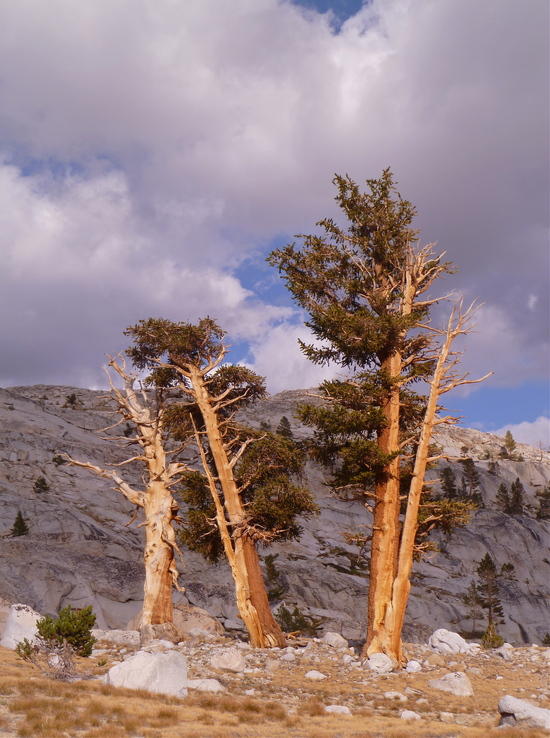
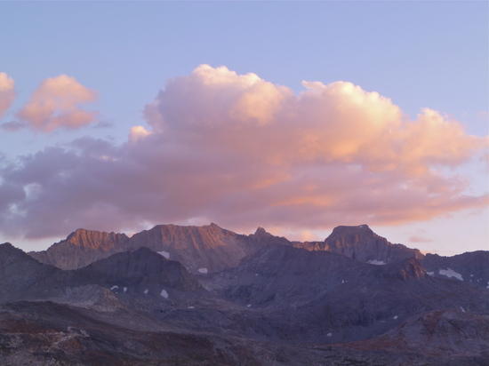
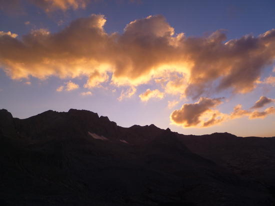
    Below are a few images from the trip. The full show is posted in our SmugMug gallery.

    seki-316
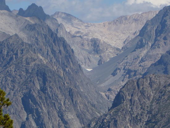
    southeast of Colby Pass

    seki-320

    seki-347
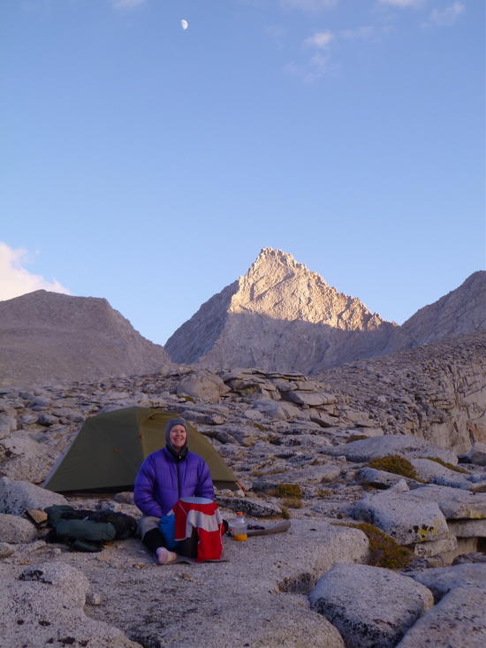
    campsite at 12,300 feet just north of Forester Pass

    seki-349

    seki-399
    looking west down Palisade Creek

    seki-428
    Enchanted Gorge and Disappearing Creek from the trail up to Monarch Divide; we descended the Gorge from the Ionian Basin to Goddard Canyon many years ago.

    #1908602
    Bob Gross
    BPL Member

    @b-g-2-2

    Locale: Silicon Valley

    Amy, did you consider Milly's Foot Pass or else Harrison Pass?

    –B.G.–

    #1908607
    Amy Lauterbach
    BPL Member

    @drongobird

    Locale: San Francisco Bay Area

    Bob asked "Amy, did you consider Milly's Foot Pass or else Harrison Pass?"

    Jim went to the top of Milly's Footpass when he climbed Genevra, and decided that I wouldn't like the class-3 descent on the north side. About 20 years ago we crossed an un-named pass just west of Genevra (which we now call Amy's footpass), but when we looked back at our old photos we didn't think I'd care for it this time. We've been over Harrison Pass and Deerhorn Pass into Vidette Canyon. On the ground, we considered crossing the pass north of CalTech to go directly from the upper Kern Basin to the base of Forester, but we hadn't taken notes on that pass from Secor, and we couldn't remember what the east side of the pass looks like.

    And so we decided that the best choice for us was to follow the trail from South America down and around. This was done in large part because I absolutely love that bighorn plateau area south of Forester and was eager to walk through it yet again, and partly because the trip was largely designed to be on trail or easy off-trail, so I wasn't in a frame of mind to cross class-2 passes that have steep loose scree.

    In the past few decades, we've been over many of the classic off-trail passes (Roper's Sierra High Route, etc) and down some of the classic tough descents (Muro Blanco, Enchanted Gorge/Disappearing Creek, and Goddard Canyon etc), but as I age I'm finding that I enjoy the easy relaxed walking that trails enable. Jim is still passionate about climbing peaks, so our last few Sierra trips have included summits that were easily accessible as side trips.

    We're lucky that there is such a diversity of options available in the southern Sierra. My only disappointment (from a selfish viewpoint) is that the JMT has become so darn crowded that it is now almost worth avoiding. The good news is that one only need to go about 200 meters from the JMT to leave the crowds behind.

    #1908704
    Bob Gross
    BPL Member

    @b-g-2-2

    Locale: Silicon Valley

    "August 22-31, 2012"

    Just be glad that you were there in late August. I was there in the second week and got rained on for five straight days. Friends of mine were just north of there in the second and third weeks and got rained on badly.

    In the future, we are all going to have to carry microscopic copies of Secor.

    –B.G.–

    #1908885
    chris smead
    BPL Member

    @hamsterfish

    Locale: San Jose, CA

    Hi Amy,
    What were the average high/low temps you encountered?
    I always check weather.gov and such, but find those numbers can vary greatly from reality depending on the area.

    #1908943
    Amy Lauterbach
    BPL Member

    @drongobird

    Locale: San Francisco Bay Area

    "What were the average high/low temps you encountered?"

    The Charlotte Lake weather station (10,400') records all data and there are good plots. There are plenty of other stations to check, but not all stations record all data.
    http://cdec.water.ca.gov/cgi-progs/staMeta?station_id=CRL

    Our temps were higher or lower depending on our altitude and depending on whether we were in a frost pocket. To summarize – we were in t-shirt and shorts every day, and nights were in the 30s or 40s depending on our altitude. It's possible we had one night in the 20s.

    #1912257
    Casey Bowden
    BPL Member

    @clbowden

    Locale: Berkeley Hills

    Great trip Amy. Are you going to put more photos on SnugMug? Also, did you and Jim follow your typical no-cooking approach? If so, would you mind commenting on your food choices?

    #1912259
    Amy Lauterbach
    BPL Member

    @drongobird

    Locale: San Francisco Bay Area

    Casey,
    We will get the photos up to smugmug in the next month or so. It takes us a while to sort them.

    As per food – you are correct that we did not cook. It's been 15 years and I don't think we'll ever go back to cooking. We've dialed in our food as follows. Amounts are FOR 2 PEOPLE, PER DAY :

    5-6 oz cheese (pre-cut and wrapped in saran wrap)
    5 oz meat (jerky, westfalian ham, high quality salami or pepperoni)
    6 oz crackers
    5 oz nuts (we really liked the candied pecans and walnuts from Trader Joes!)
    5 oz dry fruit
    5 bars (ClifBuilder & ProBars are favorites)
    3.5 oz chocolate and chocolate covered coffee beans
    5-6 oz Tang or Lemonade mix
    0.5 oz Trader Joes Wasabi Peas
    0.5 oz tic tacs, lemon drops, life savers, etc

    Total of 25 oz per person per day.

    Cheese, meat, crackers, Tang, Wasabi Peas = we get those out for lunch and dinner.
    Nuts, fruit, bars, chocolate, candy = we get our share each morning and eat throughout the day.

    Not much diversity, but by carrying different cheese for each meal and different crackers for each meal, and mixing up the meat selection, we don't get bored. Also, we carry 5 or 6 different kinds of dry fruit. And it's all compact and overall is calorie dense.

    #1912278
    Casey Bowden
    BPL Member

    @clbowden

    Locale: Berkeley Hills

    Thanks Amy!

    #1912293
    Jay Wilkerson
    BPL Member

    @creachen

    Locale: East Bay

    That's a great food list! I will print that out for sure. Looking forward to more pictures.

    #1913203
    Steven Paris
    BPL Member

    @saparisor

    Locale: Pacific Northwest

    Amy,

    For the cheeses & meats, did you have any trouble keeping them fresh on this kind of trip, i.e., not traveling through towns where you usually buy food daily/every few days?

    #1913212
    Amy Lauterbach
    BPL Member

    @drongobird

    Locale: San Francisco Bay Area

    No problem at all keeping that food fresh for 10 days in the Sierras. Day temps are 60s at altitude and 80s down in the lowest valleys (on this route only down at Simpson Meadows). It's a bit harder, but still possible, for trips in southern Utah or Big Sur. Here's what we do…

    All of the cheese is medium-hard or hard cheese, nothing as soft as Monterey Jack for example. All cheese is precut into one-meal units and wrapped in saran wrap. Same for the meat. I carried hard-boiled eggs (instead of meat) for lunch on days 1 and 2 — those wouldn't keep for much longer than that, but the jerky and hard salami and cured ham do just fine. Chocolate is easy at those temps as long as it's never exposed to direct sun.

    I carry all the food that needs to stay cool. Jim carries the food that can get warm. In the bottom of my pack is our sleeping quilt. The food bag sits on top of that, with clothing surrounding it. In addition to my own clothes, I carry Jim's down jacket, which gives me more insulation to work with. I never expose the core of my pack during the day. So all that food has at least an inch of insulation around it. At dinner time, I open the food bag and put the following day's breakfast and lunch food into a separate ziplock, which I can subsequently access without opening the core my "ice chest".

    Because I carry all the bulky stuff (down double quilt and two down jackets), I have a bigger volume pack than Jim's (ULA Circuit vs ULA Ohm-2).

    Hard cheese and cured pork are the staples of shepherds world-wide, where they are out for days with no refrigerators. Nothing innovative about it :)

    #2060872
    Amy Lauterbach
    BPL Member

    @drongobird

    Locale: San Francisco Bay Area

    We finally finished editing and annotating and posting our images. Here's the link to the full set of photos.

    #2060940
    Andrew F
    Member

    @andrew-f

    Locale: San Francisco Bay Area

    Thanks Amy. Those photos were a breath of fresh air now that cabin fever is starting to set in.

Viewing 14 posts - 1 through 14 (of 14 total)
  • You must be logged in to reply to this topic.
Forum Posting

A Membership is required to post in the forums. Login or become a member to post in the member forums!

Get the Newsletter

Get our free Handbook and Receive our weekly newsletter to see what's new at Backpacking Light!

Gear Research & Discovery Tools


Loading...