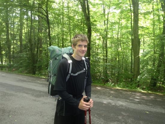
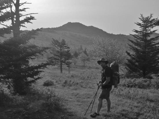
I wanted to take my 13 year old brother on a really epic backpacking trip with high mileages and new places to explore. What I settled on was a loop hike in southern Virginia. We’d link the Iron Mountain Trail (which we’d never done) with a section of the AT through Grayson Highlands, to make a loop.
We planned a trip that we could just barely complete without it becoming a death march. The total mileage would be about 40-45 miles. We knew this would not be a leisurely trip but we didn’t realize how un-leisurely it would be.
Day 1
Distance Covered – 8 miles

We got a late start but were in the parking lot by afternoon where we left our car below the Iron Mountain Trail.
As we readied our packs for the hike when I realized a problem; somehow in the hurry to pack up I’d neglected to bring both the head net I sleep with and the bug spray. There wasn't much we could do so off we went hoping for the best.
Our hike started out badly. The map showed a split in the trail. We came to a fork in the trail and took the left fork as the map indicated. As it turned out it was the wrong fork.
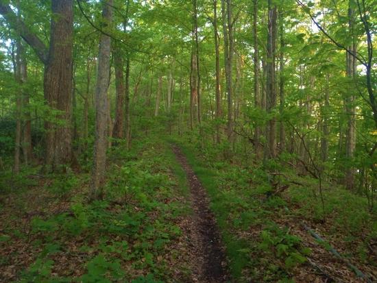
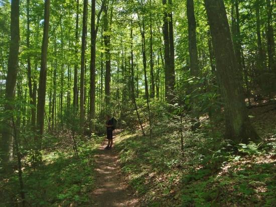
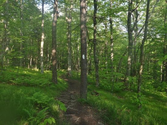
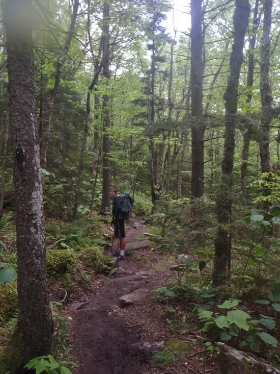
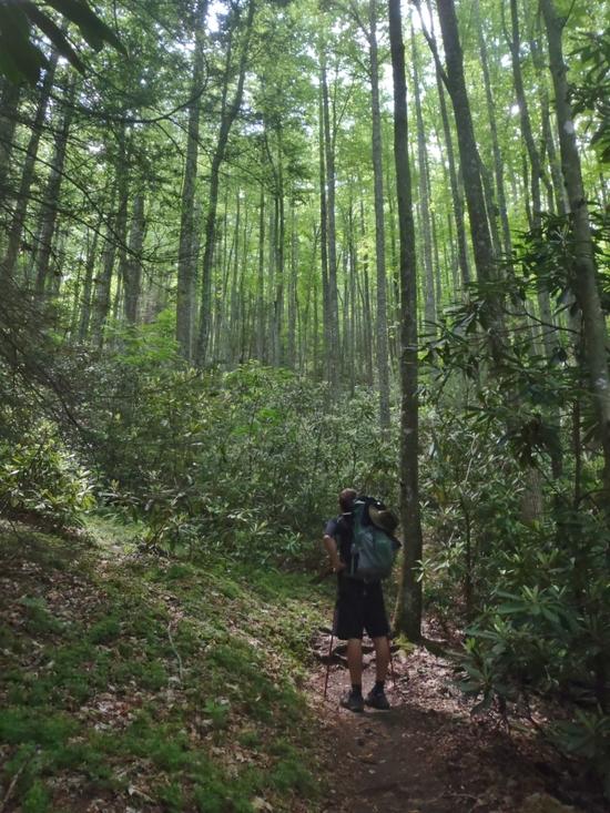
We quickly hiked back to the correct trail but we had wasted precious time. After a short walk up an abandoned dirt road we joined the Iron Mountain Trail which was the old AT until it was rerouted sometime in the 1970s to go through Grayson Highlands. The trail lacked the vistas of Grayson Highlands but it made up for it with solitude and beautiful woods.
We were really behind schedule at this point so we flew down the trail. I taught Joseph some of the tricks of efficient hiking like minimizing the number of stops made and keeping things like water bottles and maps easily accessible.

We reached the shelter as the sun was setting. We hadn't made as much distance as we'd hoped but I figured we could make up for it the next day.
Day 2
Distance Covered – 22-23 miles
The next morning we packed up quickly and started hiking without eating breakfast. We went a mile or so than stopped when it had warmed up a bit and ate our breakfast.
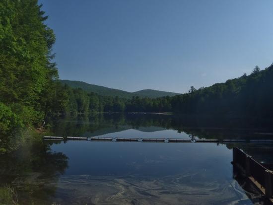
We descended from the Iron Mountain Trail and a short road walk took us to a connecting trail to the AT and past a nice lake. People were out enjoying the lake fishing and swimming. It looked like a fun place to spend a weekend but right now we were enjoying a more rigorous form of relaxation.
After crossing Highway 58 the trail plunged back into the thick green forest. I really loved these forests. This area had denser and more scenic forest than the areas I normally hike farther north in Virginia.
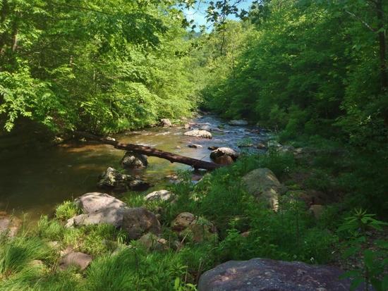
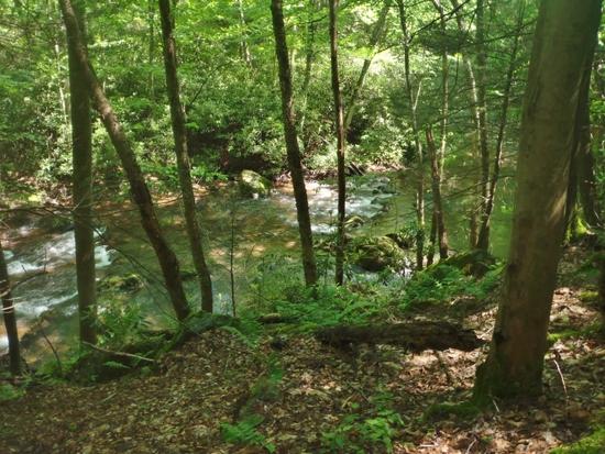
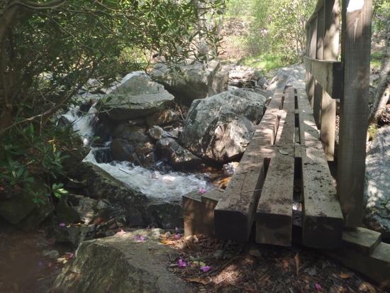
We joined the Virginia Creeper Trail and were pleasantly surprised at the scenic river crossings in this section. We stopped for lunch a bit early so we could sit on a rock and enjoy the rushing river.

We were moving along at a pretty good pace but we were still a bit behind where I would have preferred to be. Our late start the day before and my navigational error had put us several miles behind where I wanted to be.
The problem with being behind was that I'd underestimated how much food we'd need. At the rate we were going through it we'd be basically out the last day.
There wasn't much point in worrying so I organized a ratio of food for the last day and on we went.
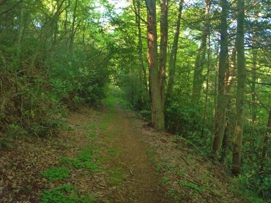
After the short but scenic section of the Creeper the AT split off and went back to being a foot traffic only trail through dense green forests.
Our long term problem of food gave way to an immediate issue with water. We drank more then normal in the hot and humid weather and as we climbed up Whitetop Mountain there were suddenly no creeks or springs to be found. We slowed our pace a bit and took frequent breaks in the shade to cool off. This stretched our water supply out a bit but it meant we were slowing down and falling behind schedule again.
In the past I would have stressed over this but not now. After plenty of stressful days on the Colorado Trail I’d learned to role with the punches and trust that things would work out. The two problems of food and water were a challenge that motivated me to think more carefully about what I was doing but they did not ruin my enjoyment of the trip.

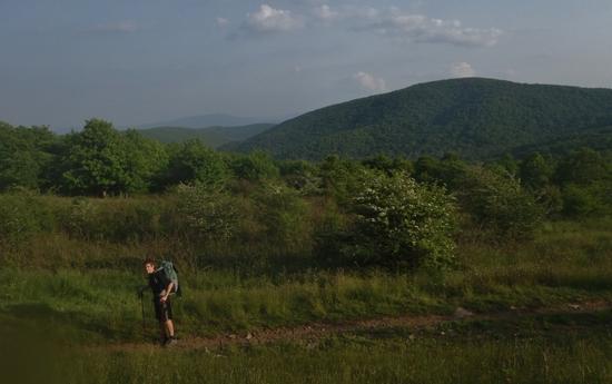
As the summit of Whitetop Mountain appeared closer I was encouraged that if nothing else we’d soon be going down hill.
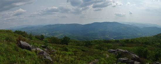
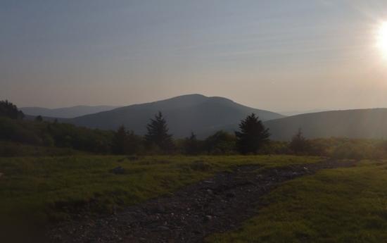
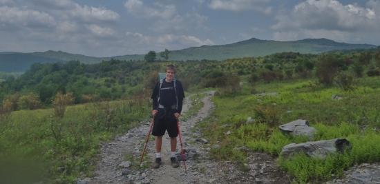
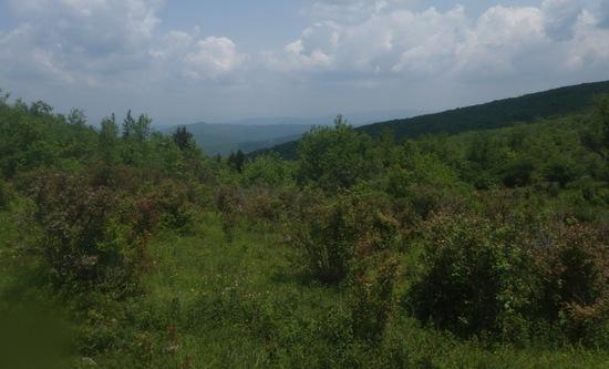
The balds near the summit of Whitetop were a pleasant surprise. I hadn’t expected them. From the balds there was a dramatic drop to the valley below and a view of other mountains off into Tennessee. Thirsty or not I was determined to enjoy the scenery.
We stopped at Buzzard’s Rock for a small snack and drank the last of our water. My plan was to enjoy the scenery while we cooled off than push on at a slow steady pace until the next water. I didn’t say so but I wanted Joseph to soak up the scenery. If we had to cut the trip short and skip Grayson Highlands this would be the scenic highlight of our trip.
After snapping a few pictures and resting enough to cool off we packed up again for the hike down.
Our water problem suddenly resolved itself when a day hiker told us that there was a very nice piped spring about half a mile ahead.
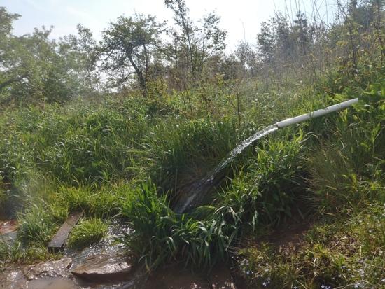
The spring was a piped thing of beauty. I quickly filled a Platypus and drained it all unpuridfied. Then while I mixed Aqua Mira I drained most of another and splashed water on my face. We sat for a few minutes while our Aqua Mira mixed to purify the remaining water and let our bodies take in the water we had guzzled. We were both a bit dehydrated at that point and the unexpected water was a real help.
With more water in our systems we flew down Whitetop Mountain hardly breaking stride.
At Elk Garden we met Phoenix, a thru-hiker. While we rested I looked at our food situation and broke the news to Joseph that we probably needed to take a shortcut past Grayson Highlands unless he wanted to hike 12 miles with nothing but a couple granola bars.
Phoenix heard us discussing this and offered us her leftover food since she was about to catch a ride into town. She gave us a bag of noodles and some fruity trail mix. I figured it was barely enough to get us through without it being miserable. That made up our minds we were going all the way (even though realistically we'd still be hungry).
Our food situation had improved but we needed to find a campsite. As we headed up the hill along the AT I had an idea. A quick look at the map showed that the Virginia Horse Trail ran parallel to the AT but had less elevation gain and loss. We cut across the meadow to the horse trail and began moving quickly along.

We were really racing the clock now because Joseph's lousy flashlight would make night hiking difficult. A snack would have been nice but we didn’t want to stop.

In a meadow on Cabin Ridge (I think) we spotted the famous (or infamous) ponies of Grayson Highlands and cut back across to the AT for the final mile or so of the hike. We took a quick look at them then pressed on again.
We caught a glimpse looking back at Whitetop Mountain were we’d been earlier. It was funny to think that just a couple hours ago we’d been way on top of that mountain.
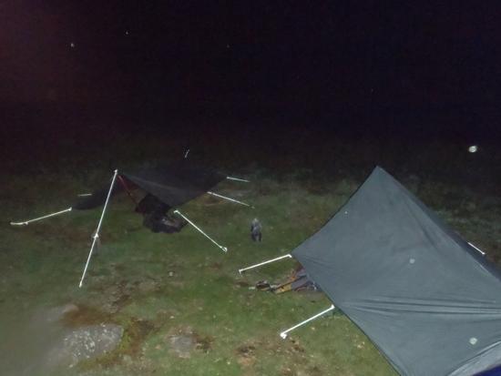
As the sun was setting we reached the Thomas Knob shelter and quickly cooked dinner at the shelter. We then pitched camp in a dark meadow.
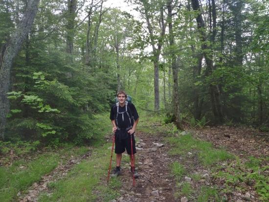
We'd covered an estimated 23 miles. Not my farthest day but Joseph had never done more then 15 miles in a day so it was exciting for him.
Day 3
Distance -11 miles
We awoke to tarps and bivies soaked with condensation. I rolled the tarps up and strapped them to the sides of my pack to dry. We grabbed some water from the spring than we were off.

After going a little ways we stopped on a rock outcrop for breakfast. Even with the food Phoenix had given us we were cutting it close. The plan I had was to hike as quickly as possible and try to be out of the woods by noon. To spread our food out we agreed to eat most of it in small spaced out snacks. We’d always be a bit hungry but I figure a constant stream of small snacks would work better than simply eating breakfast and lunch.
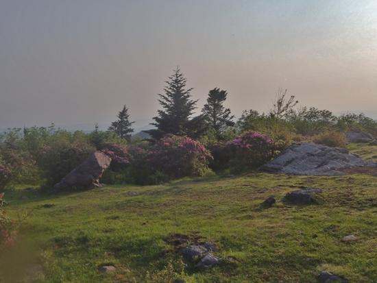
We were now in the area loosely referred to as “Grayson Highlands." This area is high and often open which creates a different climate and feel from the typical Appalachian Mountains in Virginia.
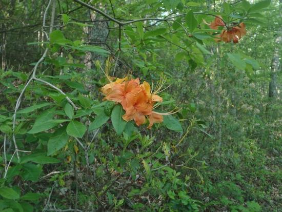
The Rhododendrons were beginning to come out which was nice. Joseph had never seen them before.
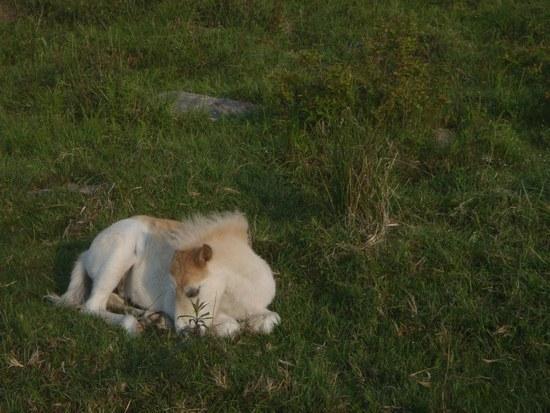
We also passed another herd of wild ponies. This cute little guy let us come close but he refused to strike a good pose for the camera.

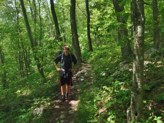
After Rhododendron Gap we slowed down a lot. There were two reasons for this. For one the trail was very rugged. It was more of a rock hop in places than a hike. Second we slowed down because it was so pretty we wanted to enjoy the views.

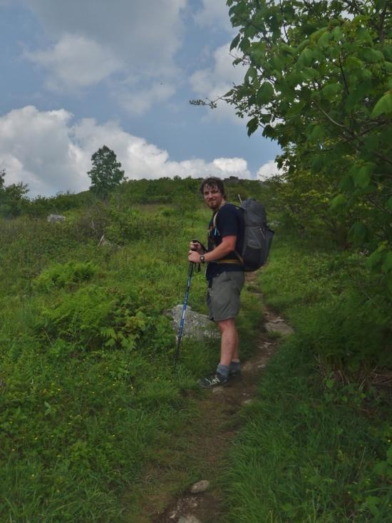
We stopped for a snack at Massie Gap. I took a picture of my latest homemade pack. Overall I was very happy with this pack. The side packets turned out to be too tight for my Platypuses and it put a bit more weight on my shoulders than I’d wanted but I was happy with it as a weekend pack.

After Massie Gap the trail was a lot better so we again picked up the pace to make up for lost time.
We stopped at Wilson Creek for some water before continuing on. A group of Boy Scouts came by as we were getting water and asked if we’d seen the rest of their troop. We said we had not. A few minutes later another group came by and I spotted a BSA shirt. “Did you make a wrong turn up there?” I asked. Yes they had. Apparently they had taken the wrong trail now they were catching up to the rest of the troop.
We were slowing down so we took a minor shortcut. We took the Scales trail instead of the AT to the Scales. This saved a mile or two off our total distance and saved us a climb that I knew wouldn’t add much to the trip as far as scenery. At this point we were starting to think about fatty fast food.
At Scales we reconnected with the AT for the final leg of the trip. The trail down led through another beautiful forest. We hiked fast now. Our packs were light and we were hungry. When the trail wasn’t too rough we jogged.
At the parking lot we were lucky to catch a ride and skip the road walk to our car. Soon we were on the way home (with a stop for lunch along the way of course).
I read a quote of a French outdoorsmen that went something like “What use are dreams to use unless we occasionally make them come true?” I felt like we had made a dream come true. We could have cut our trip short worrying about bugs but we didn’t. We could have worried about food and cut the trip short but we didn’t. I was glad we’d taken our chances and made a good trip of it.

