Emigrant Wilderness Stanislaus National Forest
Dates: May 26-29
Appx 30 Mile loop
Tom Harrison Trail Map
Temp: Night 28-35F Day 50-60F
Crabtree trail head to Upper Buck loop
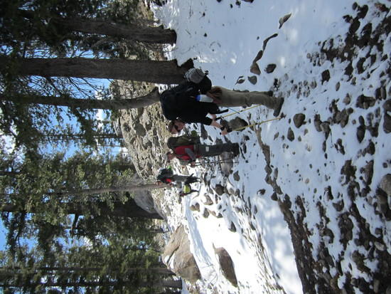
Check in at ranger station around noon on Saturday as it started to drizzle. Since no hikers had been out and back, they had little information about the condition of the trails. We did get an updated weather report and were told snow until evening. It had snowed 5 inches a few days before, so there was snow on ground at the trailhead. As we were packing up to move out, the rain turned into snow.
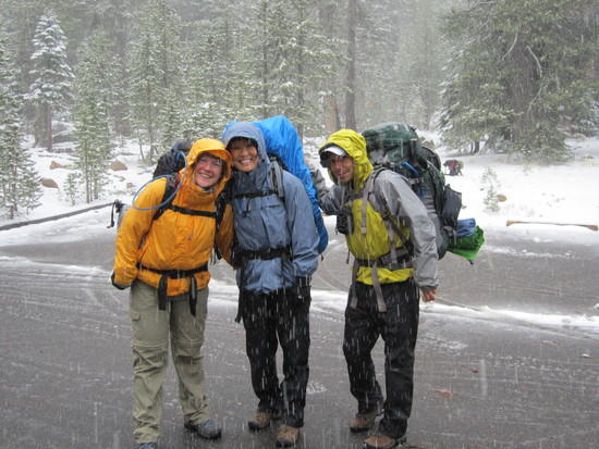 Crabtree Trailhead – Snow…It started to come down.
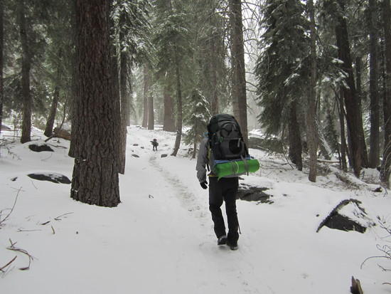 Starting our climb toward Camp Lake
We ran into 2 rangers. They confirmed that the snow should be stopping before dark.
 Camp Lake
After seeing Camp Lake, we came across 2 groups of hikers. The first was heading back to trailhead to get out of snow. The second, heading back to trailhead after a long cold night and said they were not prepared for the cold and snow. We were pretty confident with the warm rain gear we had.
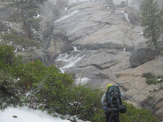 Snow really coming down
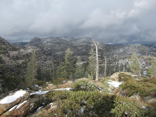 Looking down toward Piute Meadows
Besides snow on the ground, the trails to Piute Meadow, where we camped the first night, were ok. Crossing the creek east of Camp Lake was a little wide, but we were able to cross. We set up camp and Piute Meadow, the snow stopped and we had a nice evening.
 Day 2 AM Piute Meadow
Day 2: We headed towards Buck Lake where we planned to camp
 Snow for 3 days prior and the night before…was melting very quickly
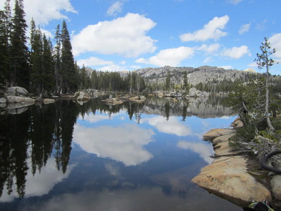
 Gem Lake. Saw a few hikers here.
 Deer Lake
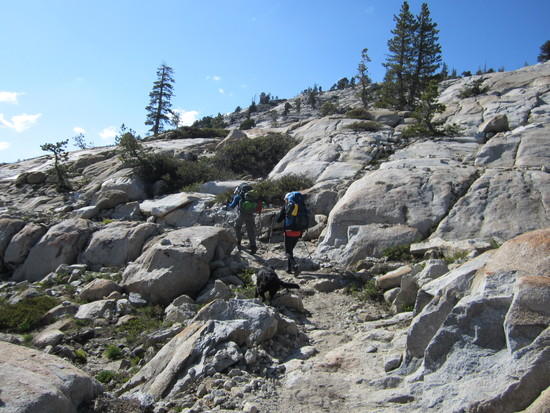
 Descending down to Upper Buck Lake
 Day 3 morning: Buck Lake
 Crossing between Upper and Lower Buck not easy and the water is moving fast.
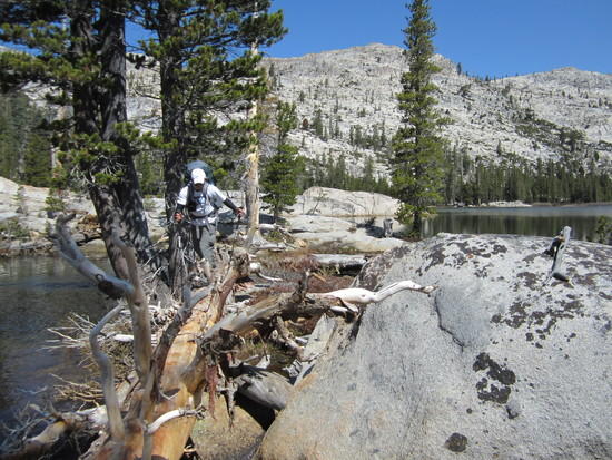
We were moving fast until we hit Wood Lake. There is a cove that we had to cross, but was impassable because the water level was so high. We were forced to go around. It was very hard and took a long time to figure out how to get up and around. Then we had a hard time finding trial due to snow.
 Climbing to get around the impassable Wood Lake cove
The trail from Wood Lake to the point where you cross Buck Meadow Creek is very hard to follow due to snow pack. Snow was melting fast but covered 50%+ trail.
 Snow covered the trail sounth of Wood Lake
 Buck Meadow Creek running really fast
 Once we crossed Meadow Creek to the north, there was no snow to be seen. Thank God!
 More heavy water flow.
 Groundhog Meadows – The mosquitos begin!
One of the places we thought to camp was Groundhog Meadow. We decided to keep moving onto Grouse Lake because of the millions of hungry mosquitos breeding in the meadow that was now all swamp. We then planned to camp at Grouse Lake, but there were signs everywhere that said no camping within 100 feet, which was kind of strange since the ranger at the ranger station didn't mention this as when we were telling her our destinations for our permit. No big deal. We just continued down the creek to find a spot. Nothing great, but we made it work.
 Night 3 camp
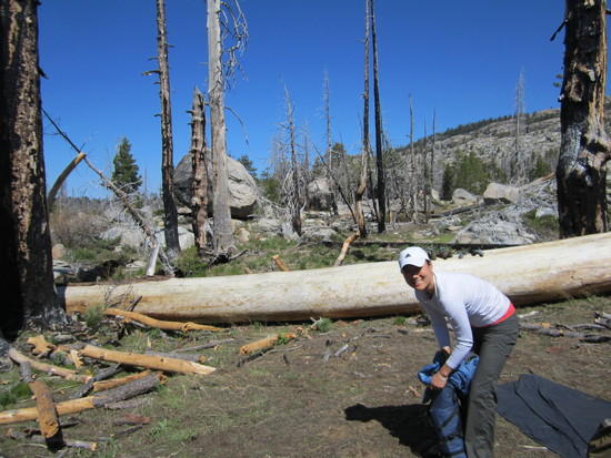
 "Deathly Hollows" Still a lot of fire damage, but slowly starting to come back
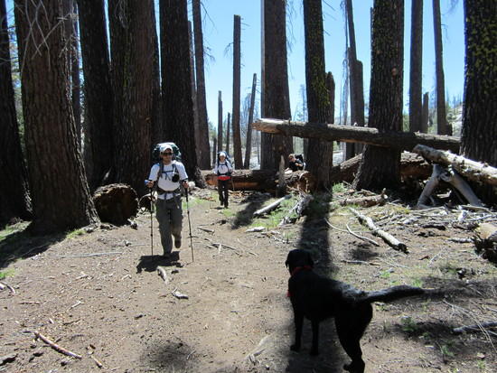
 Heading back to Crabtree. Same trail as the first pics
Great trip all around. We definitely had problems following the trail south of Wood lake and some water crossings were moving fast and wide.


