We visited the Pescardero Creek County Park in San Mateo early this May. Five of us pulled up to an empty lot in Sam MacDonald County Park early on a Friday. The route we we hiked was roughly what we had pulled out of a local bay area trips guide book, and as described, was beautiful redwood terrain. Overall the park is incredible for being so close (we drove a little over an hour), and the proximity to Pescadero and the water means you have a half day of other fun on your way out if you want.
– First-come, first-served trail permits issued at the HQ (though it was unattended both when we arrived and departed), there are no reservations for the camps themselves. Access from Big Basin, Sam MacDonald and Memorial parks.
– We spent 2.5 days, and hiked 28 miles with plenty of leisure time
– Hardly anyone else out, both nights we shared 6-8 trail camps with only 1-2 other groups, very quiet
– Most trail camps had decent seating, fire rings and several sites
– Trail network signage was sometimes spotty and map was not always conclusive (trails were marked in a way that you always ended up where you needed to go, but you weren't always on the trail you thought you were on, and we are a group of experienced navigators)
– Info and best map: http://www.co.sanmateo.ca.us/portal/site/parks/menuitem.f13bead76123ee4482439054d17332a0/?vgnextoid=067bc8909231e110VgnVCM1000001d37230aRCRD&cpsextcurrchannel=1
– Tons of excellent water, a few stream crossings
– Some poison oak, some ticks
– Feel free to PM if you want more info on the route or are planning a trip here and have questions
Bottom line: really good for a quick local overnighter or couple days, and especially (as in our case) good if you have new group members or those new to backpacking in general.
Day 1:
Brooks trail to Shaw Flat camp, and then on to Tarwater Camp via Old Haul Road and Snag Trail for night one. Here we had intended to take Pomponio Trail and ended up on Old Haul Road.
Day 2:
Departed Tarwater and took the direct route via Pomponio trail to Shaw Camp and laid down camp. We packed up for the day and did a loop up to Butano Ridge (Shaw Flat Trail, Butano Ridge Trail Loop, back on Old Haul Road to Shaw Flat Trail). Beautiful redwoods, well-maintained trails, good climb (1200+ ft). The loop run counter-clockwise (heading south on the ridge) made for a less intense and knee-busting descent.
Day 3:
Hiked out on Brook Trail Loop via the southern half (paralleling and then on to Towne Fire Road). Here we had intended to take Brook trail the other direction, and at least two trails (if not three) all said "back to Sam MacDonald park" and there were multiple intersections all in the same area that didn't really show up with the resolution of the map we had.
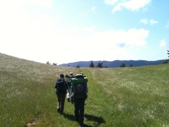
First meadow near the hiker's hut:
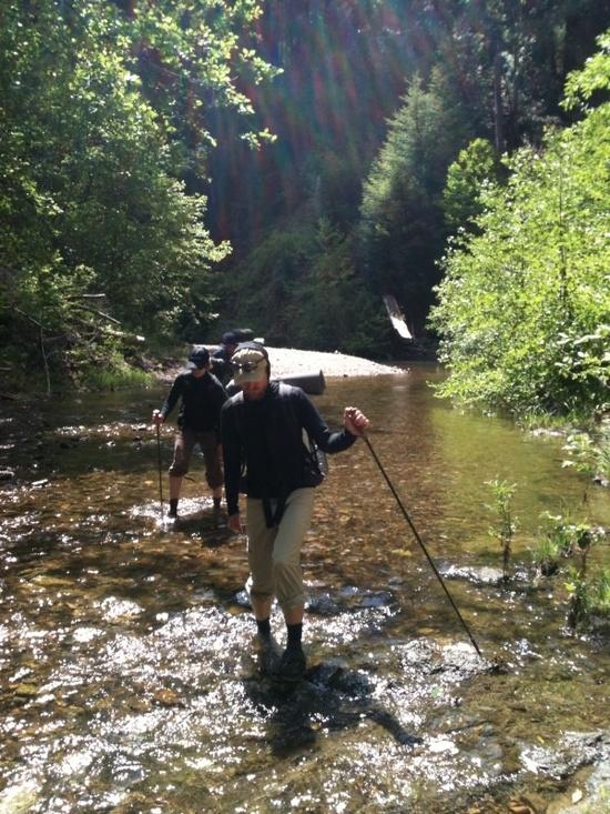
One a few creek crossings:
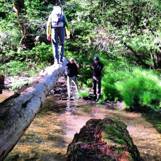
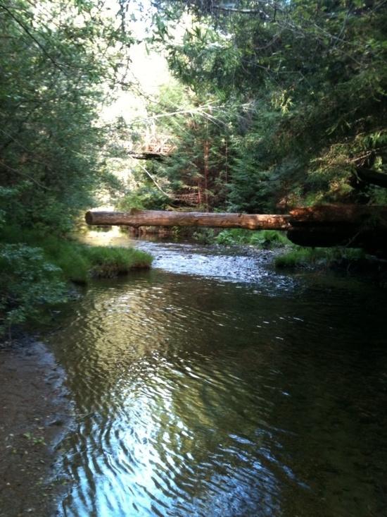
Optional log-ride creek crossing:
Alternate view, really pleasant dusk hang-out while getting water for the evening:
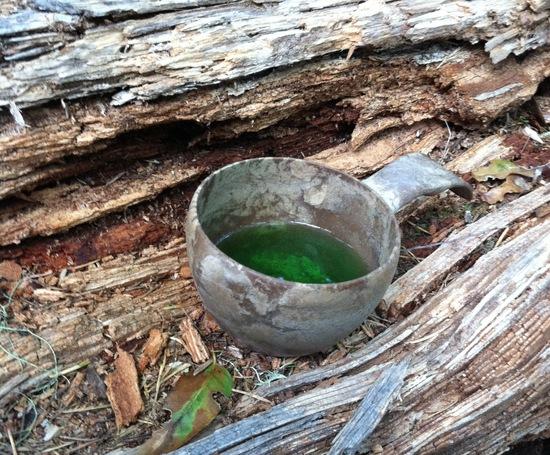
…and that cold mountain water becomes mountain margaritas!:
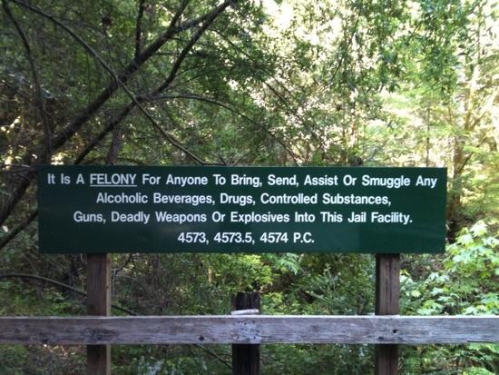
There is a Sheriff's honor camp within the park system, not exactly sure what is all about:
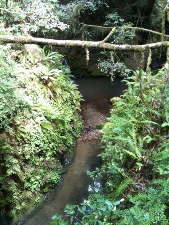
Lush little spot for a dip maybe?: