Topic

Iceland Lake Route/Emigrant Wilderness

  • This topic is empty.
Viewing 11 posts - 1 through 11 (of 11 total)
Jay Wilkerson BPL Member
PostedMay 7, 2012 at 10:05 pm

Is there a distinctive land mark you would look for? I have been out to Lower Relief Valley and all the way to Deer Lake. I know it is a cross country route to Iceland Lake and I am looking for some help. Has any body been out there who can give me some pointers. Thanks

026

Richard Gless BPL Member
PostedMay 8, 2012 at 12:25 am

Jay,

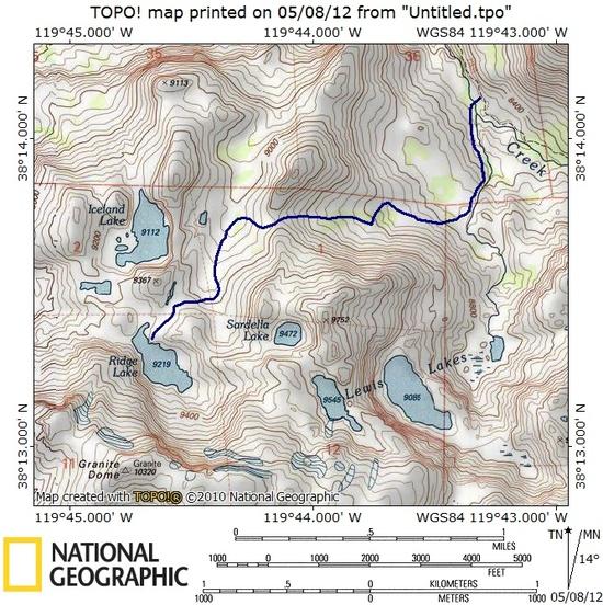
Some years ago I did a trip where we went cross country from Long Lake up over the top of Granite Dome and down to a camp at Ridge Lake. In the afternoon I hiked over to Iceland Lake to fish. We hiked out by working our way NE from Ridge Lake then E over a notch down to the creek that drains the Lewis Lake basin to Summit Creek. We crossed Summit Creek just below where the creeks joined. With a bit of judicious route finding we managed to stay pretty much on Class 2 slabs or easier terrain. I'm sure route finding was easier going down than it would be climbing back up. The hardest part was the last several hundred yards just before crossing Summit Creek.

route

Hope this helps.

Richard

USA Duane Hall BPL Member
PostedMay 8, 2012 at 5:54 am

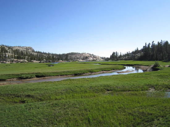
It's been a few years, but I followed the faint trail down in some places, then once down to the meadow, you're on your own amongst the cattle. Avoid the cliffy part, stick close to the creek/drainage seems that was where the old trail was. One of those areas also where there are old trails working your way up, so take your time to see where they go. Consult your topo often.
Duane

Jay Wilkerson BPL Member
PostedMay 8, 2012 at 11:45 am

Thanks Duane and Richard for the topo map much appreciated! I am looking forward to getting into the high country. I will play it by ear and see if it is a better option to go Long Lake instead. I car camped at Brightman Flats a few weeks ago and saw little or no snow at all but that will be different at the higher elevations and back country. Backpacking in May in the Sierras who would of thought?

PostedMay 8, 2012 at 10:32 pm

Just a heads up Jay, I spent this last weekend at Kennedy lake and the snow level on the northern facing mountains was about 8500 ft. Night time temps were in the mid to low 20's.

Jay Wilkerson BPL Member
PostedMay 11, 2012 at 4:53 pm

Thanks for the info Jason-I will be my 20 degree bag. I thought about bringing my 35 degree bag. How were the bugs? Did you fish?

PostedMay 11, 2012 at 5:33 pm

I didn't see a single mosquito despite how wet it was. Temps were still pretty low though, even during the day so I'm sure the mosquitos will be coming quick. Fishing was excellent, both in the lake and the stream flowing out of Kennedy lake. It sure was nice being out in May!

Rick Dreher BPL Member
PostedMay 11, 2012 at 5:45 pm

Hi Jay,

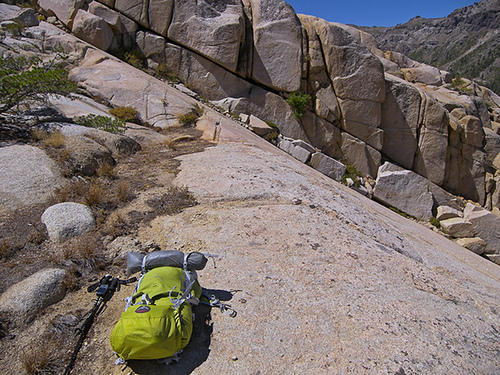
Just don't do what I did and go in directly from the north. I found myself on increasingly steep slab that tested the adhesion limit of my shoes. It was not my happiest backcountry hour.

Steep and slabby

Took this shot while considering retreat/continue. The book of lies, er, guidebook says there's a route that way but if I were to try it again I'd head farther west and come in at an angle from the northwest.

A hiker from the Bay Area was caught at Iceland in a snowstorm a year later and died trying to descend to the north. I've always wondered whether he tried that route down, which would be literally impossible in foul weather without rope and belay.

Anyway, nice lake.

Cheers,

Rick

Jay Wilkerson BPL Member
PostedMay 11, 2012 at 5:46 pm

May–I cannot believe I am going to the Sierras in May. The only benefit of a low snow year.Heading up tonight and sleeping at the TH.

Jay Wilkerson BPL Member
PostedMay 11, 2012 at 6:29 pm

Thanks Rick, I heard about that hiker who fell and died a few years ago-sad. I will probably go to Long Lake and try to get to Iceland Lake from from there and play it safe.

Thanks for the picture-very steep!

David W. BPL Member
PostedMay 11, 2012 at 9:17 pm

+1 on Richard's Map and on Rick's comments about the other routes that are shown on my Wilderness Press Map. I tried to make a loop using some of cross country routes and I did not find a safe way down after half a day of searching. The approach from Cascade Creek is fairly strait forward. The topography will funnel you to the right spot.

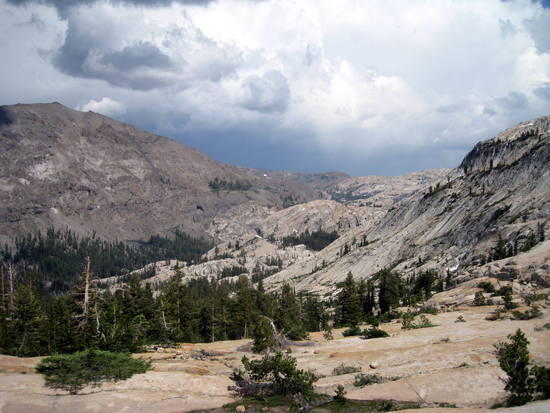
8 View from the top looking east towards Cascade Creek


Viewing 11 posts - 1 through 11 (of 11 total)
Loading...