Topic

Garmin Foretrex 101

  • This topic is empty.
Viewing 25 posts - 1 through 25 (of 27 total)
PostedFeb 10, 2007 at 4:18 pm

I can't get a straight answer from Garmin, so I will try here.

The Foretrex 101 is a light small GPS, but will it give me what I want?

All my hiking life I have used a map and compass. Now I only want two things from a GPS to make life a little easier: (1)where I am and (2)a bearing to where I want to go. When I get this from the GPS, I will turn it off (save batteries) and go merrily on my way.

So, I guess I can get the UTM coordinates of the location I am at (although the pdf manual for the Foretrex 101 doesn't say so), plot them on my map, and I now know where I am.

My second need is a little more complicated. I visualize that I have stored a set of way points in the GPS and also have them plotted on my map. So now I want the GPS to tell me the bearing (e.g., N 30 deg W, or 330 deg from north) from where I am to a way point I select from my map. I will then set the bearing on my compass, turn off the GPS, and off I will go toward the selected way point.

Will the Foretrex 101 do these two things?

p.s. Forgive me if it sounds like I am talking down to you, but I really couldn't get Garmin to tell me where in the manual this is explained.

PostedFeb 10, 2007 at 6:09 pm

I don't have the 101, but I do have the 201. I LOVE it! It does everything I want, and nothing more. Ok, the window showing your trek does suck a bit, but it holds waypoints nicely. And it deals well in cold weather. And is very light.
And yes, it gives coordinates nicely, and acts as a compass.

PostedFeb 10, 2007 at 6:48 pm

Ok, I know it has a little dial compass, but does it give you the bearing in numbers (like: N 30 deg W), and does the little dial compass point to a specific way point you choose or only to the LAST way point on the route?

PostedFeb 10, 2007 at 7:09 pm

I know on mine (the 201) it gives you the long/lat and elevation on one page, on another page it gives you a digital compass. I tend to use the trip odometer the most, as it helps me with knowing where I am. The elevation helps tremendously in figuring out exactly where I am.

I haven't used the hookup with the cable to my computer since I run on a Mac, and I need a different cable or something.

I know I can do waypoints, tracks, routes, etc.

jdubhikes BPL Member
PostedFeb 10, 2007 at 9:04 pm

John,

Did you see the 101 review here on BPL?

http://www.backpackinglight.com/cgi-bin/backpackinglight/garmin_foretrex_101_gps_review.html

I have the 101 and recommend it over the 201 for two reasons:

1. battery type (2 x AAA instead of built-in rechargeable).

2. cost (since it does not come with the cable it is cheaper), all the same features though.

As for the two features you need, YES. It gives UTM cords or any other wide variety you choose from a drop down list.

As for the bearing, yes but it is a GPS compass, not a magnetic one like on the Geko 301, so you must be moving to get a bearing. It does show the bearing numerically on the compass page. The GOTO feature used from current position or waypoint to a chosen waypoint will point you in the right direction (bearing) after which you can turn it off.

PostedFeb 11, 2007 at 4:34 pm

I have the Foretrex 101 (as well as the Garmin Geko 201).

I am still learning about the Foretrex 101, and am far from an expert on its features. However, I will try to help you answer your specific questions.

You ask whether the 101 will display the bearing for you to travel from your current location (determined, for example, by marking that spot as a waypoint in the 101 while you are standing there) to another location on your map (a location that you have stored as a waypoint in the 101, either in advance or from a UTM that you identify as your desired destination on your map as you stand in your current location). It appears the answer to that question is at page 55 of the manual for the Foretrex 101, in the Appendix, where information ("data field options") that can be displayed on the Navigation Page and/or Computer Page of the 101 is described as follows:

"available data field options for the Navigation Page and Trip Computer Page" include "Bearing – The direction from your current location to a destination."

From the above, it seems clear that the Foretrex 101 will display the bearing to use for traveling from one location on your map (for example, your current location with its waypoint entered into the 101 as you stand there) to another location on your map (with its waypoint entered into the 101 in advance of your trip, or even as you stand at your current location). You can then set your compass with the bearing provided by the 101 and be on your way, but with two caveats:

First, make sure that the settings for the 101 and your compass are "on the same page" as far as any declination adjustment for True North and Magnetic North that may be required by your map. The 101's manual, at page 50 in the Appendix, discusses these adjustments and settings, as well as noting minimal effect of "Grid North" as a factor.

Second, make sure the settings for "angle unit" in the 101 are set to "degrees" rather than "mils" so that bearings data will be displayed by the 101 in the format that you will no doubt want for transferring the bearing data to your compass. The setting for the "angle unit" is also described at page 50 of the manual.

Your first question is also answered by the above effort: Yes, you can very easily determine your current location with the Foretrex 101, so long as your batteries aren't dead and a large portion of the sky can be accessed.

Note: Another poster mentioned that the 101 displays a compass direction when you are moving, but not when you are standing still since the 101's compass function is not magnetic (differing from the 201, which has a magnetic compass). I believe the compass reading displayed by the 101 when you are moving is actually your "heading" (your moving direction), which is not as precise as a "bearing" that can also be displayed by the 101 re your destination.

For me, the 101 is an amazing item, definitely worth it's weight of 2.61 oz w/2xAAA Lithiums and w/o wrist strap. I made my decision based on the BPL review cited by the other poster to this thread, as well other reviews and resources elsewhere.

I purchased my 101 through Amazon for only $84.99, per this link: http://www.amazon.com/Garmin-Foretrex-Wrist-mounted-GPS-Navigator/dp/B000255I8W. A data cable to upload/download data between the 101 and a computer is also worthwhile if you use mapping software, but a data cable is extra expense since it doesn't come with the 101.

JRS

PostedFeb 12, 2007 at 1:54 am

John, I own one of the geko models, so let me see if I can assist you.

1. Enter the lat/long of the waypoints you mentioned in your first email. This is explained in the foretrex manual page 21. Enter as many as you need at your present location; then change the names and lat/long to the actual values, as described.

2. From anywhere, you can 'Goto' any waypoint, as explained on page 25. The waypoint you want is chosen from a list.

3. That is not a compass on your dial, it is a heading(bearing) indicator. Read the number (mag) to the waypoint, set it on your compass dial, and turn off the GPS.

That's the minimum you need to know. Just turn it on when you need a position fix, or bearing to a waypoint.

You will gain confidence and more advanced features as you go..
http://www.garmin.com/manuals/Foretrex101_OwnersManual.pdf

PostedFeb 12, 2007 at 11:06 am

Thank you all for very clear answers. Now I know the Foretrex 101 will do what I want.

It is too bad Garmin technical support can't give straight answers.

I am glad to hear that Amazon.com is the best place to buy it. This is the conclusion I also came to searching on the internet.

Happy Traversing

PostedFeb 12, 2007 at 6:29 pm

edited..

For the specific tasks John mentioned, the GPS does not need to know which way it (or John) is facing. It uses its present position, and the position of the Goto waypoint to determine a bearing-to in either magnetic or true degrees.

Lets look again at his requirements..
"(1)where I am and..
(2)a bearing to where I want to go.
My second need.. I want the GPS to tell me the bearing from where I am to a way point I select from my map. I will then set the bearing on my compass, turn off the GPS, and off I will go toward the selected way point."

Of course the GPS will tell him (1), in any coordinate system.
If the next waypoint is visible, he does not need the GPS, he can take a bearing directly on his compass. In any case, visible(or not), his GPS will also tell him the bearing to that store waypoint regardless of which way he, or it, is facing.

How do I know this works? My personal navigation setup is a geko 101(no compass), Brunton 9020 with adjustible declination (surprising feature for a $10 compass) and a waterproof map. And I use it just as John proposed; turn it on, get a 'hit', then turn it off again.

PostedFeb 12, 2007 at 10:27 pm

Brett,

Good catch… should have read more carfully. Disregard my last comments.

PostedFeb 14, 2007 at 9:36 am

All good comments, I have nothing technical to add. I've owned the 101 since BEFORE there were E2 lithium aaa's on the market. It works very well for me, better than the e-trex it replaced. Of course, if you hike in really dense forests and want continuous path readouts, you may need one of those new chip GPS's. IN CO and WY I've never come close to such needs.

Get the computer interface for the $10-12. I paid about $35 for my old e-trex cable!!

One thing. The band on mine is just too narrow for many siuations, and the extention band makes it too wide.

PostedFeb 17, 2007 at 12:14 pm

Hi Brett

Your comment about being able to set the declination on the Brunton 9020 compass caught my eye. It looks a lot lighter than my Silva Ranger that I have been user for umpteen years, but I do love it.

How much does the Brunton 9020 weigh?

What is your experience sighting with it and being able to follow a bearing?

Thanks

PostedFeb 17, 2007 at 2:59 pm

Hi John,

Brunton spec on the weight of the 9020 compass is 1.1 oz.

Here is their link:

http://www.brunton.com/product.php?id=116

Personally, I carry a heavier mirrored compass like my Suunto MC-2 Global Compass (2.6 oz) for accurate compas readings though I also carry a Sun Micro Compas (.2 oz) for general readings. The Suunto MC-2 Global (global needle and same weight as my Ranger) has replaced my Silva Ranger; the mirror as the one on your Ranger also doubles as a signaling devise.

Rich

PostedFeb 18, 2007 at 6:03 am

John,
The 9020 is the lightest and least expensive compass I have found which has keyless adjustable declination; and it even has an incinometer. They go on sale at REI sometimes for $10; I bought a few and gave them to the newbies at my hiking club.

To answer your question, I find the needle boxes quickly, but not as quickly as a liquid damped orienteering compass though. Being green red and white, the 9020 is highly visible day or night.
I do not follow a bearing on the compass, I sight a distant landmark and follow that. I usually navigate by terrain association, checking bearings or reverse bearings, or gps hits, at decision points, handrails, etc. I keep a tritium Cannmega on my wrist for gross navigaion 'sanity checks'.

I get the feeling compass navigaion is becoming a lost art. Ive never met anyone younger than myself who knows the finer points of using one.

Have you bought your gps yet?

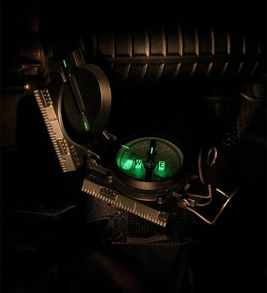
Separate subject.. If I thought I would need more precision than the 9020 I would carry my lensatic:
http://store.cammenga.com/scripts/prodView.asp?idproduct=47
tritium cammenga

PostedFeb 18, 2007 at 6:37 am

I agree with you guys – for the most part the under 40 crowd doesn't know how to use a compass.

I grew up hiking and sailing. I truly learned to use a compass by sailing, particularly when racing where I had to watch for course changes due to wind shifts. When I eventually got to bluewater, you had to keep one eye on the compass – no land marks out there!

Now everyone relies on a GPS, on land and sea. That's great until it breaks, or the batteries give out. Of course people know they should also keep a compass course, but few do. Having compass skills gives me the confidence in either environment to find my way.

PostedFeb 18, 2007 at 7:13 pm

Right – navigating with a compass is a lost art. I learned how to do it in 1959 as a Blister Rust Control Checker for the USFS in the Sierras. We used to run parallel statistical sampling lines for a mile at a stretch using a Silva Ranger and counting paces on a clicker. We would sight ahead as far as we could see then walk measuring all the Ribes bushes (i.e., Gooseberry and Current) 3 feet on each side of the line. The concern was that the White Pine Blister Rust would come to the Sierras. By eliminating the Ribes bushes(contractors did that) the alternate host would be eliminated (Blister Rust lives alternate years on the Ribes and White Pine). Years later I found out that Blister Rust did eventually come to the Sierras, but it hasn't been a big problem yet.

Often we would tie our survey lines into Quarter or Section points, if we could find them (not very often). After doing this for 3 months I leaned how to use a compass and go from point A to point B.

I am waiting to get my GPS device until I am near my next hike. Maybe someone will come out with a smaller and better model in the mean time – not likely, but what the heck.

What I was wondering about using the Brunton 9020 compass is how well you can sight with it and follow a bearing (i.e, pick out distant points on your bearing accurately)? The Silva Ranger is great because of the mirror and the gun sight. I got so in reasonable terrain that I could follow a bearing using the Ranger for a mile and be within 30 feet of where I was supposed to be. I know I could not do that well now though. The Ranger weighs 3 oz., but it is hard for me to part with it.

jdubhikes BPL Member
PostedFeb 18, 2007 at 8:15 pm

John,

Did you check out the Brunton 54LU compass? I have one and really like it because it has a unique sighting system for a baseplate model. The sighting is amazing (to half a degree) and no external mirror. Check out the Silva Denmark site for more info on this compass. There is also a user review on BPL of it too.

PostedFeb 19, 2007 at 1:07 pm

The Brunton 54LU compass looks great – only 1.4 oz, but you can't set the declination.

jdubhikes BPL Member
PostedFeb 19, 2007 at 5:46 pm

John,

That’s correct, no decl. adj. on the 54lu. I set my fortrex 101 to display magnetic readings and use magnetic bearings when using the compass. When needed I adjust for declination by adding or subtracting on the fly. This the method that is recommended on the maptools.com (54LU page) website as well. He sells the 54lu and recommends it.

PostedFeb 19, 2007 at 5:59 pm

It is still preferable to have the compass declination adjusted to make easy switching from map to field readings and vice versa however. If you forget about adding or subtracting for declination…..

Rich

PostedFeb 19, 2007 at 6:36 pm

I agree with Rich on the declination adjustment. I have a Gecko 301 and a Suunto M-2D Locator Compass (1.3 oz). You can adjust the declination. Pretty good price at Amazon.com

PostedFeb 19, 2007 at 11:39 pm

Or maybe we should all give up compasses now that the Bushnell GPS shows an underlaing satellite photo on the screen.

http://www.bushnellgps.com/products/products.htm

Catch is youve got to buy the photos one by one from Bushnell.

As a low cost alternate you could carry printouts of aerial photos of your hike area from the free application; google earth. It will overlay lat/long. (I can hear the next question, but what reference system? hmm I dont know)

PostedFeb 20, 2007 at 7:57 pm

I also agree that setting the declination is important – otherwise too much effort screwing around with adding, subtracting and making mistakes.

I see the purchase of a GPS device as an need to compromise, but come out ahead. What I visualize is trading my Silva Ranger compass and wrist watch – about 4 oz, for a Foretrex 101 and a lighter compass like the Suunto M-2D Compass or the MCA-D Challenger Sighting Mirror Compass (42g). I realize this compass isn't as good as my Silva Ranger which I often use to fix my location by triangulating on two known features. But now I have GPS coordinates which I transfer to my map with the little credit card size Backpacking Light UTMCard 1:24k UTM Grid & Map Scale (4 grams). I still will set a bearing on my compass (that I get from the GPS device) and navigate to where I want to go. But my compass doesn't have to be as good as before because I can turn on my GPS device periodically and check how I am doing and adjust accordingly.

So I think there is a good argument why I don't need the power of the Silva Ranger if I have a GPS device. If my batteries go dead I still have a reasonable compass to get me through.

Also I don't need a watch (which I probably never really needed – except on the last day when I need to catch a boat or something). I will just check the time on the GPS device if I need it.

PostedFeb 21, 2007 at 1:09 am

John, you obviously know what you are talking about regards navigation. The Silva Ranger looks like a great compass, with all necessary features, including adj. declination. And you are familiar with it.. you might want to keep that for a while after you buy your 101, so you have some familiar equipment?

Navigaion is one of the 10 essential systems, so weight is a secondary concern for me. You might also consider replacing your wristwatch with a multi-function compass/altimeter/watch; they are getting smaller every year. The most recent ones look like a regular watch, not like a tuna can on your wrist.

I always keep a coin sized compass with my essentials, the 9020 hanging around my neck, and the Casio 6-function watch on my wrist. A knife, fire making tools, and navigation are critical, and I don't mind a few ounces of redundancy.

Sounds like you are hiking in a remote area, since you are catching a "boat" back to your car? Dont mean to pry, but that does sound really interesting.

Viewing 25 posts - 1 through 25 (of 27 total)
Loading...