Topic
24 Photo Essay: Gene Marshall Trail, Ventura, CA Backcountry
Forum Posting
A Membership is required to post in the forums. Login or become a member to post in the member forums!
Home › Forums › Campfire › Member Trip Reports › 24 Photo Essay: Gene Marshall Trail, Ventura, CA Backcountry
- This topic is empty.
-
AuthorPosts
-
Mar 21, 2012 at 10:14 am #1287583
Completed a quick sub 24-hour thru-hike of the ~19 mile Gene Marshall/Piedra Blanca Trail through the Sespe Wilderness in the Ventura County Mountains 3/16-17. The trail starts at the Reyes Creek Campground near Camp Sheideck in Lockwood Valley off Hwy 33 (elev ~4,000'). From there the trail steadily gains elevation as it follows Beartrap Creek up to the Pine Mountain Ridge (high pt elev ~6,400') and then down the other side, following a fork of Piedra Blanca Creek to its terminus at the Sespe River (elev ~3,000').
The trail is listed by the Forest Service as a National Recreation Trail, presumably becuase of its scenic qualities and historic use to connect a network of long gone ranger stations, fire lookouts and lodges during the early years of the Santa Barbara (and later renamed Los Padres) National Forest.
The sections of the trail near either end see relatively heavy use due to their proximity to major trailhead parking areas. The high country camps on top of Pine Mountain are the real treasures of the trail and see much less use. While fairly short for an overnight hike, the trail is considered strenuous due its constant (and steep) elevation changes. In winter, it's not uncommon to encounter snow around the high camps. Summers are dusty and dry.
I wanted to hike the trail to get a sense of current water and snow conditions for a more ambitious hike coming up this weekend that will pass through some of this same area.
We got a late start on Friday, not leaving the trailhead until after 6:00 p.m. We hiked the approximately 5 miles to our camp for the night in the dark by headlamp. The trail is well worn in this area and hiking by moonlight and/or headlamp is no great challenge. We set up in a stealth camp hidden just a little ways from the official campsite, grilled some fresh deer steaks over the campfire and turned in for the night.
After a lazy, slow-moving Saturday morning, we got moving and knocked out the remaining 14-mile balance over the course of the day, taking some time to look over each camp, enjoy the scenery and poke our heads into the various nooks and crannies along the way. We wrapped up the hike a little after 5:00 pm on Saturday, just in time to enjoy the setting sun.

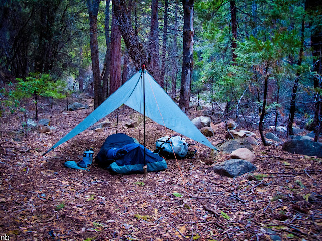
Friday night's camp amidst the trees.
The official nearby campsite is quite scenic; a small meadow surrounded by large Cedars. There's a few stone fire pits and old FS-issued ice can stoves/grills tucked in under the trees ringing the meadow. The nearby creek provides year-round water.
Evidence of recent fires is prevalent along the trail. The area seems to get burned out every 30 years or so.
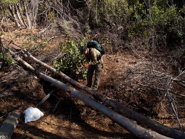
Patches of old snow hang on in all of the shady sections. The white trash bag KC is carrying is full of trash collected along the way. By the end of the trip, the bag was just about full.
As on most of our hikes, we carried a folding pruning saw which we used to clear about 10 blowdowns along the way. There's a few bigger ones we had to leave for a future sawyer crew.
Bear carcass along the trail.
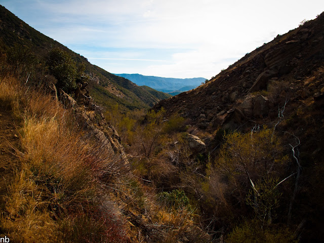
A view looking north from the upper reaches of Beartrap Creek towards the Cuyama Badlands.
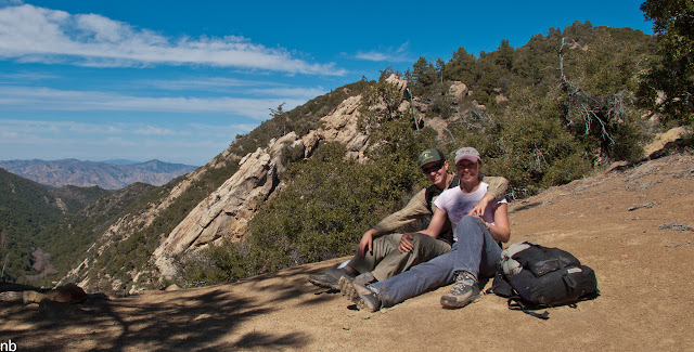
KC and Sherri taking a breather at the saddle (around 6,000' elev). This was Sherri's first time doing an UL trip. Final verdict? She loved it!
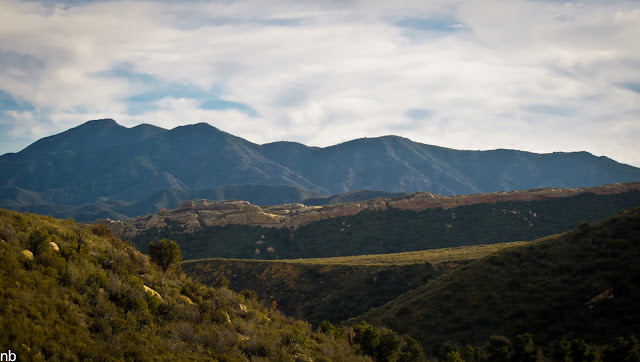
Sespe High Country
Haddock Camp. Only a small trickle of water in the nearby creek at the moment.
3 Mile Camp. Nice site up along the high country. Plentiful water in the creek that runs through camp.
KC and one of the larger Cedars along the trail.
From Haddock to Pine Mountain Lodge (~ 5 miles), the trail repeatedly drops into and climbs out of, small steep gullies and ravines.
Much of the trail through the high country follows the historic route used by the rangers to access the various lodges, lookouts and similar structures that dotted the Pine Mountain ridgeline. While the structures are long gone, you can still find some of the remnant poles that supported the telegraph wires off to the side of the trail. Similarly, the occasional strand of wire and the odd wire insulator can be found tangled up in the trees.
Another of the old school wood FS signs at the Pine Mountain Lodge camp. While arguably not as durable, the older wood signs sure have a lot more character than the modern plastic signs showing up in the Sespe in recent years.
PML camp overview.
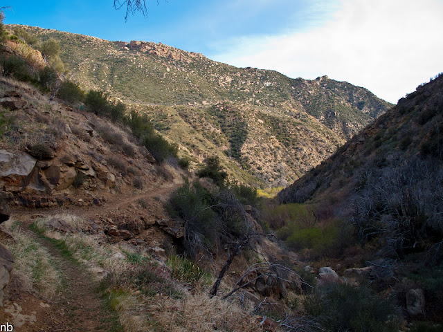
Starting the descent down the south-facing slope of Pine Mountain towards the Sespe River.
The much hotter, drier southern exposure of Pine Mountain is covered in the typical Southern CA dense scratchy, tough chapparal. While the tread is in good shape at the moment, the brush is quickly encroaching again.
A view looking back towards the north from where we came.
And the view from the same vantage, but looking south towards our destination.
At the moment, there's no water from PML camp until you hit Twin Forks Camp, about 3 miles away. From Twin Forks to the Sespe however, there is abundant water available in Piedra Blanca Creek.
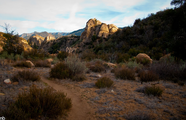
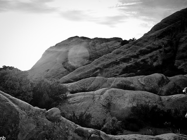
The backside of the trail's namesake Piedras Blancas (White Rocks) formations.

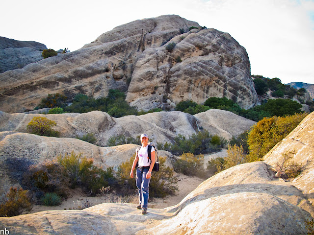
Amidst the Piedras Blancas
The Piedras Blancas spread over a massive area, providing ample opportunities for cragging and off trail scrambling.
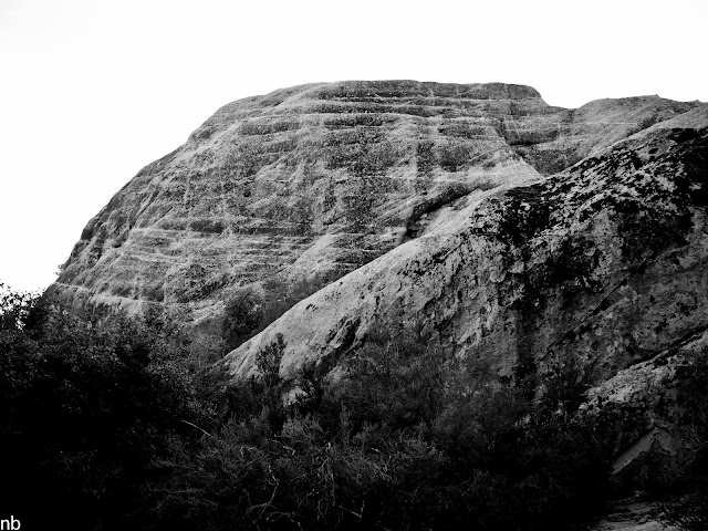
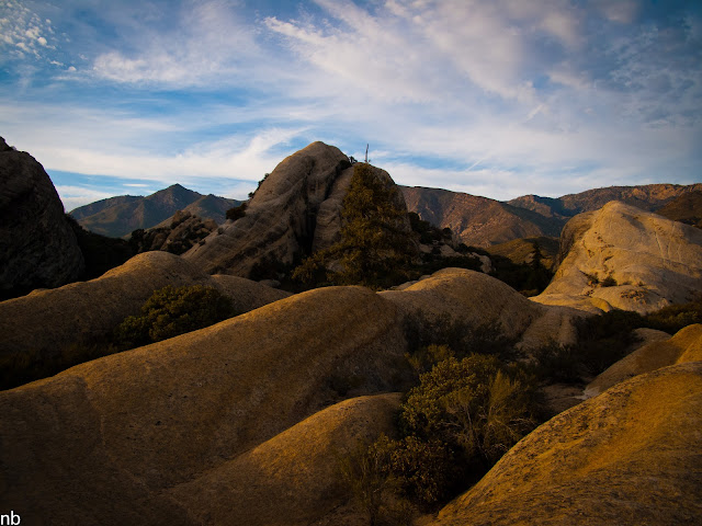
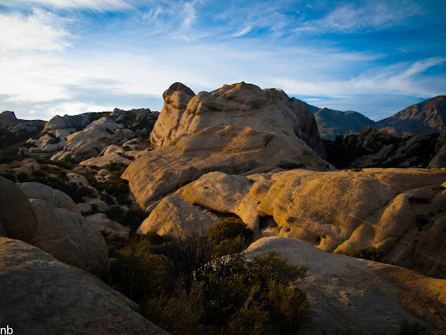
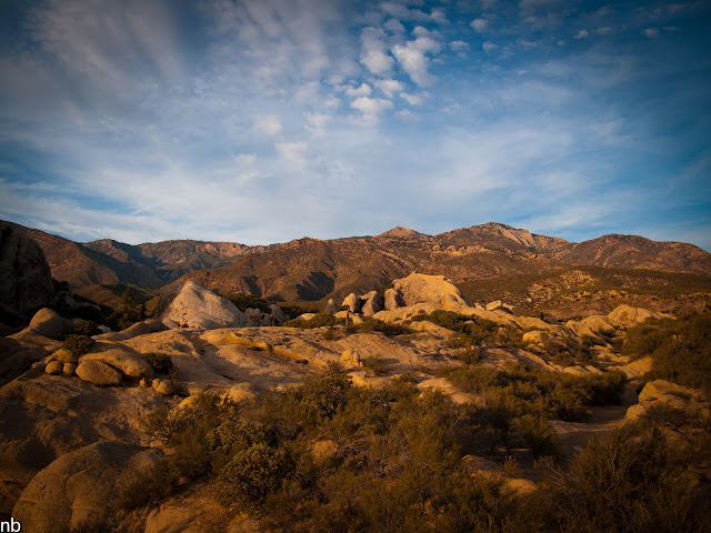
As the sun sets lower, the sandstone takes on gold hues.
In the background, you can see the saddle that we descended.
A pulled back view of some of the formations.
Setting sun and encroaching clouds over the Piedras Blancas and Sespe River Valley.Mar 21, 2012 at 11:38 am #1857167Gorgeous, Nick. I loved the White Rocks formations. Thanks for posting this!
Mar 23, 2012 at 7:56 pm #1858482Thanks for the post. I get out that way once a year, will bring the bag next trip.
Mar 24, 2012 at 5:47 pm #1858834nice report nick conditions look pretty descent out there right now
other than the blow downs and leftover snow
i plan to do the hike from the reyes creek side one of these days i think it will be fun and not too far from home
by the way what tarp were you using on the trip ?? looks like a pretty nice one
kevin
Mar 25, 2012 at 2:59 pm #1859214Great photo Nick! I'm heading out to Sespe in a few weeks. What kind of camera are you using?
Mar 25, 2012 at 3:26 pm #1859222Thanks for the compliments. The Sespe is really nice right now; I just finished up another trip through the same area (partially) last night. It's an excellent time to visit the area.
Kevin, the tarp is a Gossamer Gear SpinnTwinn purchased used off Gearswap a couple years ago.
Andy, those shots were taken with a Canon G10 and cleaned up in Lightroom 3. I just picked up my new camera though which is a Sony NEX 5n last night from my office. Excited to get out on another trip and learn how to use it.
Mar 25, 2012 at 3:30 pm #1859224Stellar photos Nick! Looks like a great route, must get on this one sometime.
Mar 26, 2012 at 1:31 pm #1859581Nick,
Thanks for taking the time to work up a great trip report with great narration and tons of photos.
I have only been to that area once and it was before the fire, which made for a very grown over set of trails.
Love the shots of the rock formations with the blue sky and wispy clouds.
-Tony
Apr 2, 2012 at 10:42 am #1862560Oh so pretty. I was there in November and saw that same bear carcass, only it was a little bit fresher. There wasn't much of it there, but it still smelled like meat and the gums on the skull were still healthy and pink.
-
AuthorPosts


- You must be logged in to reply to this topic.
Forum Posting
A Membership is required to post in the forums. Login or become a member to post in the member forums!
Our Community Posts are Moderated
Backpacking Light community posts are moderated and here to foster helpful and positive discussions about lightweight backpacking. Please be mindful of our values and boundaries and review our Community Guidelines prior to posting.
Get the Newsletter
Gear Research & Discovery Tools
- Browse our curated Gear Shop
- See the latest Gear Deals and Sales
- Our Recommendations
- Search for Gear on Sale with the Gear Finder
- Used Gear Swap
- Member Gear Reviews and BPL Gear Review Articles
- Browse by Gear Type or Brand.
