Topic

Clark Range from Tuolumne Meadows, Yosemite National Park, California

  • This topic is empty.
Viewing 5 posts - 1 through 5 (of 5 total)
PostedDec 10, 2011 at 12:58 am

A 92 mile, 6 day solo hike through Yosemite’s remote southeast backcountry in late August. It was a couple of years ago – sorry, busy =0| – but you might still enjoy if you have any interest in the area. It hasn’t changed! The real work was getting all the larger pics, panos and trip report up on my site PlanetRambler.com. Hope you can visit.

Washburn Lake
Washburn Lake

A noisy cascade near the junction of Lyell Fork Creek

Upper Ottoway Lake
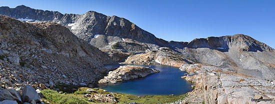
Upper Ottoway Lakes below Red Peak Pass

Anne Lake
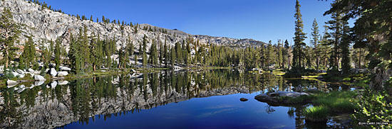
Anne Lake is a hidden gem

Day 4, looking west and north from atop Post Peak Pass.
Day 4, looking west and north from atop Post Peak Pass. Beautiful country, despite the Oak Flats wildfire which had just started – a little disconcerting but it blew away to the north so conditions stayed nice.

PostedDec 10, 2011 at 9:07 am

Your blog or website or whatever you call it is excellent.

What maps did you use for this trip?

PostedDec 10, 2011 at 1:22 pm

Terrific website, just spent almost an hour looking at some of your other hikes, and bookmarked it to read more later.
Awesome report

PostedDec 10, 2011 at 4:02 pm

Thanks for the comments!

I prefer old-fashioned "website". I used the Tom Harrison Yosemite map.

PostedDec 10, 2011 at 5:12 pm

Thanks for the trip report – I really enjoyed your pictures.

Andrew

Viewing 5 posts - 1 through 5 (of 5 total)
Loading...