Ever since returning from the JMT earlier this summer I have been trying to get one last trip into the high Sierra. I’ve considered taking off Thursday right after work to get three days/two nights to do the North Lake/South Lake loop. . . or maybe over Lamark Col into Darwin Canyon to get right into the ‘good stuff’. . . or just a quick out and back into Miter Basin from Horseshoe Meadow. Everyday I check the NOAA website. . .and my final weekend was looking good, until the Monday before I was planning to take off. Severe Weather Advisory with lows in the single digits and snow. Lots of snow.
I surrendered to mother nature and decided to make it an abbreviated trip into Joshua Tree. I had been wanting to do a loop hike in JT since last December and this looked like a good time to do it. Without a bear canister I could keep it simple and go SUL. . . and these days simple is good. One of the themes from Fight Club continues to remind me, “don’t let the things you own begin to own you”. Less is more.
The forecast called for typical fall weather in the desert. Highs around 55, a low of 30 and winds over 30 mph. I brought a small MYOG cuben pack, MYOG momentum 90 windshirt, shorts only, t-shirt and silk l/s shirt, plastic disposable poncho, small cuben tarp and MYOG bivy. My only insulation was a MYOG wearable quilt. I planned on caching some water on the drive out so I would only have to carry a few liters at a time. Even with a camera, SPOT II and Kookabay Taperlite inflatable torso pad my base weight was under 5 lbs. If you’re interested here’s a link to my SUL gear list
My pack was ready and waiting by the door Friday night. I’m out the door early Saturday morning, but by the time I get out to the desert, cache some water and get to the trailhead it’s already almost 1:00pm. I’m feeling good and ready for some much needed trail meditation.
I start at mile 7 on the California Riding and Hiking Trail, near the far east side of the park at the Twin Tanks parking lot. The miles pass by easily on the lightly rolling terrain and I fall into a familiar groove. I’m quickly reminded of the peaceful silence and calm that came with the long summer days of hiking solo in the Sierras. I feel rejuvenated, reconnected to the feeling I used to get from improvising progressive jazz for hours and hours in a different life.
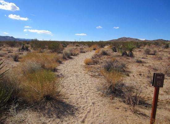
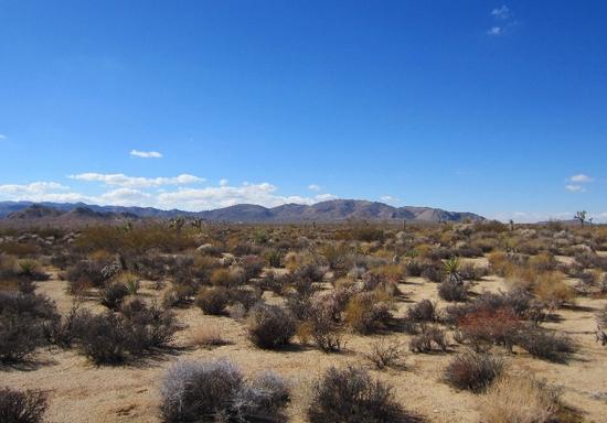
The 8 mile marker on the California Riding and Hiking Trail:
After a few miles Ryan Mountain appears in the distance. I will follow the trail over a small notch on the left side of Ryan Mountain:
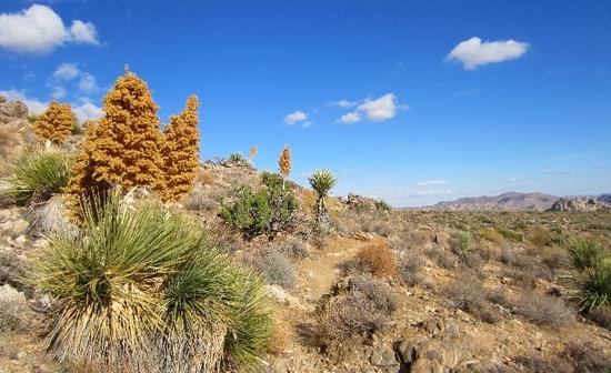
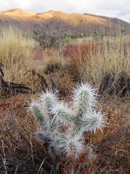
The ‘pass’ through a small canyon in Ryan Mountain is full of fall colors:

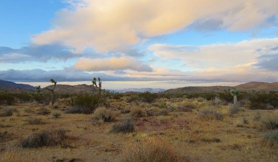
Soon the afternoon shadows are getting long. I’m at the other side of Ryan Mountain, headed off-trail through Lost Horse Valley and towards Hidden Valley:

Some campers taking in the sunset near the Hidden Valley car campground:

Sunset on the rocks near Hidden Valley. I ended up hiking for another hour into the desert and eventually found a spot to set up my tarp:

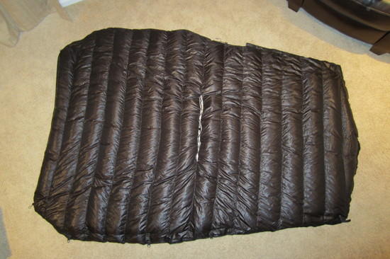
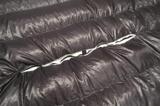
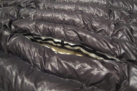
The forecast was for a low of 30 degrees so I decided to try out a new MYOG quilt. For the fellow gear heads out there: I used SevenD from TiGoat for the inner and outer shell material, 0.34 oz/sqyd cuben for the baffles, 9.9 ozs of 900 f/p down from Thru-Hiker and included an opening in the middle baffle to make it wearable. The baffles are 1.5” and I overstuffed it by 30%. The plan was for it to be ok down to around 30 degrees. It is 56” at the shoulders, 40” at the foot end and 6 ½ feet long. 16 ozs on the dot.
My watch thermo said 38 degrees under my tarp/wind shelter at around 3:00 am. The wind was blowing all night and I slept ok. I think I need to trim down the foot end of the quilt a few inches to reduce the amount of empty air space.
I used a 5.5’ x 8.5’ cuben tarp from Zpacks. 3.5 ozs with guylines:

The second day I headed north toward the Barker Dam Loop. I was using the Tom Harrison map and it was ok for the main hiking trails and roads, but I would not recommend it for finding the smaller trails. Many times I would just head east (or whatever direction) into the desert when I couldn’t find the trail, which seemed to work out fine. I ended up seeing a lot of stuff that I wouldn’t normally see.
SUL kitchen in the rocks near Barker Dam:

I forgot to pack some camp suds to wash the esbit smell out of my coffee cup. Not good.

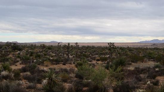
Soon I was off-trail heading east through the Queens Valley. The storm clouds were gathering:
My water cache near a trail intersection:

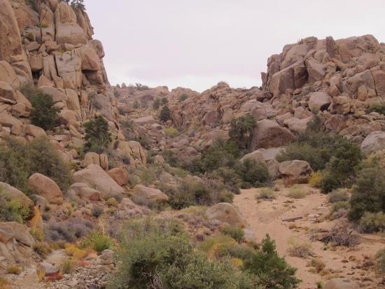
For the next several miles I followed this dry sandy creek-bed as it winded through the rocks. I realized that I probably wasn’t on an actual trail, but that didn’t really seem to matter anymore. It was just good to be out with an entire day to wander back toward the car:

The ‘trail’ ended at this rock fall. It started raining as I bouldered over this area and I took some nice falls:
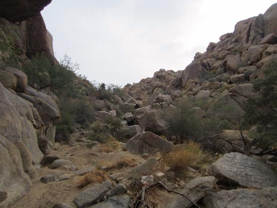
Some more bouldering:
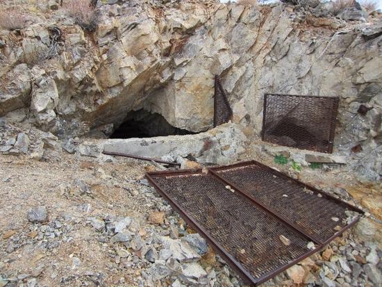
A side trail headed up the hillside toward the abandoned Desert Queen Mine:

“Chicago Pneumatic Tool Co.”:

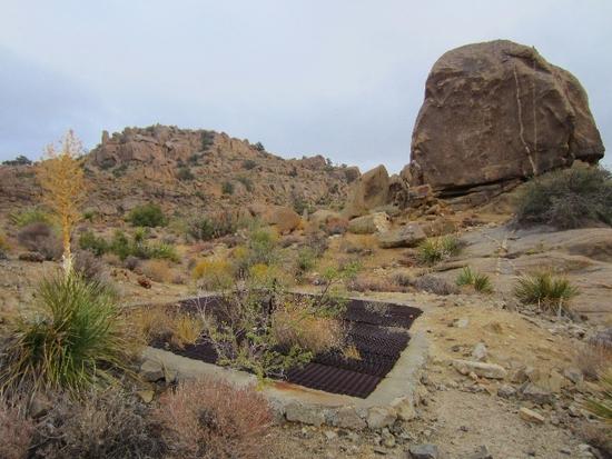
The area was littered with old mine shafts:
The top is called the Lucky Boy Vista:
The view from the top of Lucky Boy Vista. I would be heading east along that dry creek bed below:

This felt like hiking on a sandy beach:

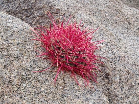
The rain made bouldering over the many granite rock falls a challenge. Some of these colorful cactus somehow grow in the granite. It seemed like every time I came across an area with boulders, it would start raining again. I remembered that it was times like these that I usually look back on as the best. Eventually my windshirt completely wet through. I finally stopped to put on my cheapo plastic poncho and it stopped raining almost immediately. Nice.
After hours of following various dry creek beds I made it back out to the desert. The rain brought the fall colors alive just as the storm cleared at sunset:

That is 29 Palms in the distance. The sun set quickly and it got cold and windy. I layered up with everything I had and headed back toward the car through the desert. The plan was to reconnect with the beginning seven miles of the California Riding and Hiking Trail and follow it back to the Twin Tanks trail head. I soon realized that fiding the trail in the diminishing light was not going to happen, so I just headed south through the desert back toward the car. After a few more hours I made it back and headed home. Another great trip.
Trip Details: The loop came out to be 32.4 miles. Day 1: 14.4 miles. Starting at Twin Tanks trailhead and follow the California Riding and Hiking Trail over Ryan Mountain then north across Lost Horse Valley toward Hidden Valley. Day 2: 18 miles. North toward Barker Dam, then east across Queens Valley toward Desert Queen Mine. The rest is off trail following the dry creek bed east/southeast past Lucky Boy Vista and east toward Goat Basin Mine. Finally, follow the California Riding and Hiking Trail south to the Twin Tanks trail head. PM me if you’re interested in the KMZ files.