Topic

A Week in the Sierra’s – Ideas for a clueless Canuck

  • This topic is empty.
Viewing 25 posts - 1 through 25 (of 37 total)
PostedSep 17, 2011 at 8:05 pm

I've got 3 weeks off work coming up in October (Oct. 1 – 21st) and my wife and I are planning on a hiking road trip from Western Canada (Whistler, BC) down to California and then back up through Utah. I'm making some good progress on planning the Utah stuff (ie. Zion Nat Park) but I could use a little advice on Cali.

Essentially, my wife and I are looking for an awesome hiking trip idea about a week long in the Sierra's. She's up for 10-15 miles per day (or less if it's rough trail or high elevation gain), so there's no need to suggest a weeklong rip through the entire 211 mile JMT. Normally I would do more research myself, but it's coming up quick and I'm working 12 hr days right now until I leave for this trip.

Criteria:
– In Sierra's (or it better be good if it's elsewhere)
– Awesome
– Not ridiculously hard for my wife (she hikes 10 -15 miles per day on normal trail).
– Logistically not too hard (ie. plausible to get back to car, to get permits etc)
– 5 to 8 days long
– Low risk of hitting serious winter weather (this hike would be starting roughly Oct 6th)

One idea is hiking the 70 miles or so of the JMT/PCT through Yosemite. I've always wanted to check out Yosemite, so this would be cool but I'm for anything that is awesome and not going to be too hard for my wife. She's a good hiker, but she doesn't like cranking full throttle for 14 hours a day. My assumption (naive?) is that in October it wouldn't be hard to get passes for Yosemite. Is this a good time of year down there or getting a bit late to be in the mountains? I'm also open to great trails anywhere in Cali, like a section of the PCT or whatever. Summiting Whitney would be cool but I imagine it's getting late in the season for that.

Thanks!

Bob Gross BPL Member
PostedSep 17, 2011 at 8:38 pm

Doing something like Yosemite Valley to the Devil's Postpile would be a reasonable trip. There can be good news and bad news. The good news is that there aren't so many backpackers on the trail by Oct. 6, so wilderness permits and things like that ought to be easier. The bad news is that there aren't so many backpackers on the trail then for a reason, and many of the trailhead services have closed up for the season, so you would want to be self-sufficient. The weather gets iffy in October. It might be raining or snowing a bit, but that shouldn't stop a couple of Canucks. Also, this section of trail always leaves you within a day or two of some emergency exit trailhead should the weather get impossibly bad.

–B.G.–

PostedSep 18, 2011 at 8:22 am

Hi Dan,

I don't know how the situation in Tuolumne is then, but if it's OK, then there's a nice loop of about 57mi.
You start at the Glen Aulin trailhead in Tuolumne Meadows. Follow the Pacific crest Trail over Glen Aulin, Virginia Canyon (nice campsite right at the turnoff), Matterhorn Canyon to the turnoff near Rodgers Lake. Here you go south through Rodgers Canyon down into Pate Valley. Then turn east up through the Grand Canyon of the Tuolumne River (really beautiful) back to Glen Aulin and Tuolumne Meadows.
You will be above 10000ft for only a short time.

If you look for something lower (eg because of snow), then go somewhere around Hetch Hetchy. I haven't been there but I only heard good things about it.

Tell me if you have any more questions!!

Sabine

PostedSep 18, 2011 at 4:51 pm

"Is this a good time of year down there or getting a bit late to be in the mountains?"

No, but you do have to be prepared for the possibility of a significant dump that could make it difficult to exit over the higher passes of the southern Sierra, not to mention the significant elevation gain generally involved that might interfere with your wife's enjoyment. I think the other posters have some pretty good suggestions for trips further north that would lessen the possibility of an epic should the weather go bad on you and involve less elevation gain as well.

"Summiting Whitney would be cool but I imagine it's getting late in the season for that."

Yes, unless you go very well prepared for bad weather. It also involves 6000' of elevation gain, starting at ~8400'.

PostedSep 18, 2011 at 8:37 pm

Thanks a lot for the help so far guys. I really appreciate it. I work at a gold mine in the arctic circle and I work 3 weeks on (very long days) and then 3 weeks off, so when I'm at work I barely have an hour a day of free time after I'm done dinner and a shower to research this stuff.

Bob, the Devil's post pile sounds cool. I saw a pic of it on a PCT trip report here on BPL early this year and it sure looked like a neat spot. Generally, what would this trail be like? Would I be in the alpine mostly? Not at all? How severe is the elevation gain/loss?

Sabine, I like the idea of a loop as I wouldn't be seeing the same trail twice. What is this 'situation' at Tuolumne? Was there a natural disaster (ie. flood) or something there? Beyond camping at the Virginia Canyon turnoff (night 1?), what locations would you suggest for camping? Sorry for all the questions…I'll try to actually look some of this stuff up on a map soon. Maybe tomorrow but every 2nd night I call my wife so that bit of free time ends up gone.

General Question – Does Yosemite rent/lend bear canisters at the same spot you get your permit? Or do I need to acquire one elsewhere?

"Yes, unless you go very well prepared for bad weather. It also involves 6000' of elevation gain, starting at ~8400"

I'm surprised the road goes all the way to 8400'…that's impressive. Around BC, Canada, the high roads through mountain passes are maybe 4000'. Assuming good trail, it sounds like Whitney could be done in a day. I was expecting you'd have to start down around 3000' and spend 2-3 days doing it. I don't think my wife would be having fun on a 6000' foot day, but it's something I'll keep in mind.

Bob Gross BPL Member
PostedSep 18, 2011 at 9:05 pm

The trail from Yosemite Valley to the Devil's Postpile goes through lots of different terrain. Donahue Pass is well above timberline, and the Devil's Postpile is way down in the forest.

Renting a bear can is somewhat problematic unless you plan to return to the same spot.

About Mount Whitney… Yes, the Whitney Portal trailhead is around 8365 feet, give or take a few, and many cars overheat on the road to there. Generally, if you are trying to do Mount Whitney, you have four choices. One is to do it at the start or at the finish of an entire John Muir Trail backpack, but you don't have the time for that. Two is to do it as a two-day or three-day backpack, starting and ending at Whitney Portal. Three is to do it as a four-day or five-day backpack starting from the west side of Sequoia National Park at Giant Forest. Four is to do it as a one-day dayhike, starting and ending at Whitney Portal. One day is problematic for everybody unless you are adapted to the elevation, and on your schedule you probably won't be. One day is not so bad as long as you start incredibly early in the morning.

You will be OK if you just bring along some samples from your work.

–B.G.–

PostedSep 19, 2011 at 6:25 am

Although any crossing of Donohue Pass could become a real chore in the event some "weather" hits, I'll suggest a version of the Yosemite to Postpile that you may like:

-Tuolumne Meadows to Devils Postpile: Take Lyell Canyon up toward Donohue Pass, but camp your first night after only a short day, maybe 6 or 8 miles. Consider using the Ansel Adams campsite along the east side of the creek, or go to the end of the canyon before the climb toward the pass. This will get you a classic, high alpine Yosemite camp.

Day two, climb and cross Donohue Pass and head down to camp above Island Pass. This day will take you up above treeline, over a great pass in view of Mt.Lyell and more, and then back down in altitude for sleeping.

Day three, descend to Thousand Island Lake and make that a short day, so you can relax and enjoy this beautiful place, while planning your route for the "two days out".

Day four, options: 1) take JMT from Thousand Isle over the passes to Ruby, Emerald and Garnet Lakes, then down to Shadow Lake, before hanging a right turn and heading up to Ediza Lake to camp (since you may not camp at Shadow). This is a high country lake bonanza day. 2) Take JMT to Shadow, and follow it down to the River Trail (way down), camping low that evening. 3) Leave Thousand Isle via the River Trail and camp halfway to Devils Postpile. 4) Leave Thousand Isle via the High Trail (PCT) and spend a night near Agnew Meadows or better, down toward Soda Springs, closer to the Postpile.

Day five, connect your dots and hit the Postpile.

Bear Canisters a MUST, as you will see/get ursine visitation in Lyell Canyon and likely at Thousand Isle, and points below.

PostedSep 19, 2011 at 11:44 am

These options are sounding really good. Is there any reasonable way to turn the Devil's Postpile into a loop trip, so I finish back at my car? (Without just doubling back on the same trail). Perhaps it would be too much distance. If I did finish at the Postpile, how do you get back to Yosemite? Is there a bus close by?

Bob Gross BPL Member
PostedSep 19, 2011 at 11:52 am

There are buses.

A shuttle bus runs from Red's Meadow out to the main part of Mammoth Lakes, a resort town. Then there is a bus service that runs from there to Yosemite.

–B.G.–

First Last BPL Member
PostedSep 19, 2011 at 5:04 pm

Shuttle in Devils Postpile stopped running September 7 according to this site http://www.nps.gov/depo/planyourvisit/hours.htm and YARTS runs ran daily until September 9, then weekends only through the end of September http://www.yarts.com/pdfs/2011/120Service082611.pdf .

Starting a Sierra backpack on October 6th is definitely shoulder season. Most services (campgrounds, stores, buses) will be closed down for the season and some roads (e.g Tioga, Devil's Postpile) will only be plowed / kept open until October 15th.

The weather can be beautifully sunny and mild or snowy and cold, impossible to tell more than a couple of days in advance. Only make the trip if you are comfortable navigating in the snow.

Another thing to keep in mind is that most of the smaller creeks will have dried up by October, so plan to stock up on water from the lakes.

PostedSep 19, 2011 at 7:58 pm

Thanks guys. I'm running out of time tonight, but tomorrow evening I'm going to try to do some more research on all of the great trips mentioned.

I talked to my wife tonight and she was pretty keen on the idea of attempting Whitney as a day trip from Whitney Portal. Is there good trail right to the top? Or does it turn into more of a route? To do 6000' in a day with my wife, it would need to be reasonable trail the whole way, so the main worries would be the elevation gain, low oxygen and weather.

Bob Gross BPL Member
PostedSep 19, 2011 at 8:15 pm

The main Mount Whitney Trail is a first class trail used by hundreds of hikers per day during the prime season. Around the end of July it got disrupted by tremendous rain-flood-sand flood-rock slides, but most repairs were completed within a couple of weeks.

To look at it a different way, the trail was covered in 1985 by an 89-year-old woman. So, how bad can it be?

Think of it this way. Wouldn't it be a great place to field test that new headlamp?

–B.G.–

PostedSep 19, 2011 at 9:28 pm

Thanks Bob…very helpful info. Is there a shelter at the top? I seem to recall there being one from someones JMT trip report, but I could be wrong.

I whipped up a rough itinerary of this Cali / Utah trip and wow 3 weeks doesn't stretch very far. I'll need to chat with my wife a bit about priorities, but it's looking like I'll need this Sierra trip to be closer to 5 days…especially if we want to attempt Whitney.

Bob Gross BPL Member
PostedSep 19, 2011 at 9:48 pm

The summit of Mount Whitney has a tiny stone shelter built in 1909, and that has been the last resort shelter for many years. Alas, I was up there in early August after another lightning incident, and the door was fastened closed. Technically, the Mount Whitney Trail is controlled by the Inyo National Forest despite the fact that the top two miles of it is inside Sequoia National Park. The summit hut is obviously within the national park, but it is such a long distance from the headquarters of the national park.

I live in California, and each time I dream up another one-week trip into the Sierra Nevada Range, I suddenly find two weeks worth of places to go.

–B.G.–

PostedSep 20, 2011 at 4:56 am

Sorry, haven't been online for a while…

By "situation" in Tuolumne I mainly mean the weather. There is the possibility of snow falling at this time but not necessarily…
You don't spend much time in the forest on this trail so you see pretty much scenery and it doesn't get boring.

Talking about campsites:
Day 1: Trailhead to Virginia Canyon turnoff (12-13mi)
Day 2: camp before Smedberg Lake at about 9400ft (11.8 mi)
Day 3: camp just behind the turnoff from the Pate Valley trail into the Grand Canyon of the Tuolumne River – elev: 4500ft (12.8 mi)
Day 4: camp either at Glen Aulin (14.3 mi) or (if that's too far – you go uphill all day…) befotre of after Le Conte Falls (about 11.5 mi)
Day 5: hike back to the trailhead (5-7 mi)

That's just an idea… All campsites have a creek/river close by.
You should avoid camping around 10000ft or higher as the nights get REALLY cold now.

You can rent bear cans at the Wilderness Center in Tuolumne (where you get your permits) – they cost 5$ per week. Say hello from me to the Rangers there – they all know me as the crazy german girl who spent 2 months hiking out of Tuolumne this summer =)

If you want to go up to Whitney: It's beautiful but 99 switchbacks require a lot of patience…

Hope that helped you!!
Sabine

PostedSep 20, 2011 at 7:12 am

If you take Eric's suggested route you have a great day 3 day hike option from camp. From Thousand Island lakes you can work your way up to Lake Catherine at the base of Mt Ritter and Mt Banner. Not a bad hike that follows a stream and then across a boulder field. If you work your way around the lake you can get an awesome view of the basin on the other side.

Brad

Jim MacDiarmid BPL Member
PostedSep 20, 2011 at 7:40 am

You should avoid camping around 10000ft or higher as the nights get REALLY cold now.

One week from today, I'm going to be doing a 6 day in the same area as Dan may be, probably doing some variation of the Tuolumne to Devils Postpile hikes suggested here. I've been doing point forecasts on weather.gov. And the 7 day forecast for say, 1,000 Island lake at ~10,000' are for lows around 39-40F. I've always found the point forecasts to be pretty accurate. And I personally don't consider anything above 25F to be 'cold'. Is that forecast inaccurate?

I was planning on bringing only my 32F Nunatak Specialist, figuring even if it got down to 20-25F I'd be at the edge of okay in my bivy, wearing my rainpants and BPL Cocoon hoody for added insulation. But I could also bring my Nunatak Arc AT that would easily push my comfort level down to 20F and below. I guess I should be doing this as last year I had my TRT hike blown up by a snowstorm the first week of October that buried Dick's Pass in thigh-high snow and forced me to turn back. In fact, more than cold temps (as I've survived a night at 20F in my Specialist in the ensemble described above) I'm worried about getting stuck on the wrong side of a high pass in the event of a snowstorm.


@Dan
– It sounds like you're settling on a Whitney trip, but if you do hit the Yosemite backcountry, I'm almost positive the only place you will be able to rent bear canisters in October are at the Valley visitor center, in addition to the Mammoth-Tuolumne YARTS bus being discontinued. So you'd have to start a trip from the valley just to get your bear canister, or pick up you canister there and then drive 1hr to Tuolumne Meadows, then drive back at the end to return it.

Jay Wilkerson BPL Member
PostedSep 20, 2011 at 7:42 am

012

Hey Dan, Consider Emigrant Wilderness just next to Yosemite. Easy self registration and no bear canisters required. You have Crabtree TH, Kennedy Meadows TH and Leavitt Meadows TH…..No mosquitoes this time of year a less people for sure.

PostedSep 20, 2011 at 9:18 pm

You guy are rad. Thanks so much for the continued help.

Regarding all the trips to Devil's Postpile, it sounds like with the bus not running in mid-October there would be no way for me to get back to my car. Is there easy hitch hiking from here to the valley? Otherwise it sounds like I'd need to rule out a trip to Postpile.

Jim, I'm thinking of doing Whitney AND a 5 day Yosemite/Sierra hike. Whitney is a maybe, but the 5-7 day Sierra hike is for sure.

Sabine – Thanks for laying out the campsites. That's super helpful. This sounds like a great trip. I like how it's a loop, so logistically it would be easy. Would this loop be better than doing a loop south out of Tuolumne? I.e. south-east on the JMT to little Yosemite valley and then back through Merced Lake and Vogulsang to finish back at the start?

Jay Thanks for the heads up on the Emigrant Wilderness. I'm really short on research time, so is there a ~5 day hike in this wilderness that you'd recommend? Something with fairly good trail and epic views would be ideal.

PostedSep 22, 2011 at 2:46 am

JIM: I've had several mornings with 25 degrees – and that was in August……… It's not only about having the appropriate sleeping bag because you will have to leave it in the morning. As sunrise gets later and later you will have ice cold mornings even if you get up at 8am or later (the coldest time of night is just before sunrise). But I agree – getting stuck in a snowstorm is far worse.

DAN: I think it's best to call the Wilderness Center and ask if they are still open at Tuolumne. They opened this spring as soon as the Tioga Road got opened even though the Camps and Visitor Center were closed until July 15.
Doing a loop south of Tuolumne is nice, too. Usually the north is less busy than the south but I think you won't have this problem at this time of year. You'll have all the High Sierra Camps (Sunrise, LYV, Merced and Vogelsang) on your trail so if you only camp there you won't have to look for campsites.

PostedSep 22, 2011 at 11:20 pm

Thanks Sabine. I will give them a call. The website indicates that everything should be open through October and it shows the historical closing dates of the Tioga Road, which are usually sometime in November only one year (in the last 40 or so) was it as early as my visit is planned).

'High Sierra' camps sound good to me. Are these campsites nicer than a northern loop? I suppose both loops are awesome and I can't go wrong, but I would like to do whatever is the most awesome. Getting a sense of what the Sierra's are all about would be nice. Having nice trail that isn't too hard (ie. senseless up and downs) would also be appreciated by my wife. I imagine down in Yosemite all of the trails are in quite nice shape.

Bob Gross BPL Member
PostedSep 23, 2011 at 12:07 am

The High Sierra Camps are a series of camps that supply tent cabin lodging and meals to people who can't or won't carry their own loaded backpack (for a hefty price). So, they tend to get used a lot by older folks a lot. These camps have already shut down for the season.

Traditionally, independent backpackers like yourself might camp nearby one of the High Sierra Camps, but there is little advantage to that unless you like more people around.

This late in the season, those standard trails around Yosemite National Park tend to be very well beaten down and well-marked at trail junctions.

It's just that we are kind of out of the prime season now.

–B.G.–

Jim MacDiarmid BPL Member
PostedSep 23, 2011 at 5:09 am

With pictures, a yosemite loop I've done most of myself.

Day 1. Lyell Canyon TH to Vogelsang High Sierra Camp -11.6 miles (starting elevation 8700', finishing 10100'

I've never been up Lyell Canyon, and at the permit office they'll tell you that Fletcher Creek is the TH for Vogelsang, and that route it more direct (~7 miles) but from all I hear, Lyell Canyon is very nice. You could pass the HSC and continue another mile or so up to Vogelsang Lake if you feel like going a bit farther.

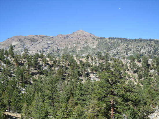
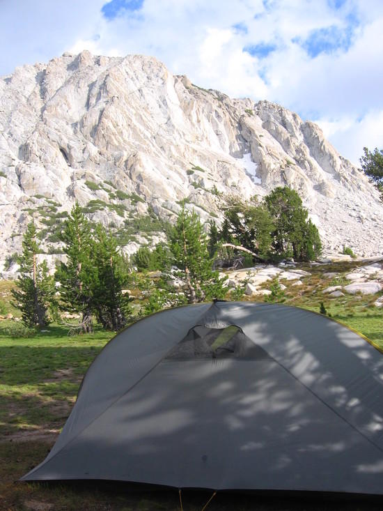
Tarptent Rainbow + Fletcher Peak@ Vogelsang HSC backpackers campground1

Day 2 – Vogelsang HSC to Little Yosemite Valley campground – 16.8 miles
A bit farther than you might like to go, but all downhill after ascending from Vogelsang HSC to Vogelsang pass (~10400'). You could stop at Moraine Dome, which would cut 1.5-2 miles off your trip, and is also undeveloped, vs LYV. It's the only legal camping area between Merced Lake HSC and LYV. I found Merced Lake HSC to be 'meh', (which is also how I'd describe LYV).
Looking back toward Vogelsang Lake and Vogelsand HSC from below Vogelsang Pass. That's the shoulder of Fletcher Peak from the previous photo on the right. HSC lies just beyond that.
2

View Southeast-ish from the other side of Vogelsang Pass3

Day 3 – Little Yosemite Valley to Yosemite Valley round trip – ~9 miles.
One way to Yosemite Vally via JMT 4.5 miles, or 4 miles via Mist Trail ans see Vernal Falls up close. Not sure what the Falls look like this late in the season. Basically a rest day. Catch the shuttle at Happy Isles and see the Valley. Resupply @ Yosemite Village. If you're up for it, return early and hike as far up Half Dome as your are comfortable ( since I believe cables are down for the year) +7 miles round trip) or do that instead of going into Valley.

Generic shot of Merced River through Little Yosemite Valley4

Day 4 – Sunrise HSC or Sunrise Lake via Clouds Rest – 13.2/~12.5 miles
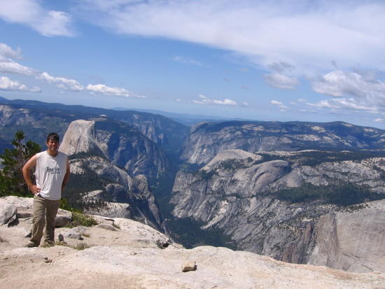
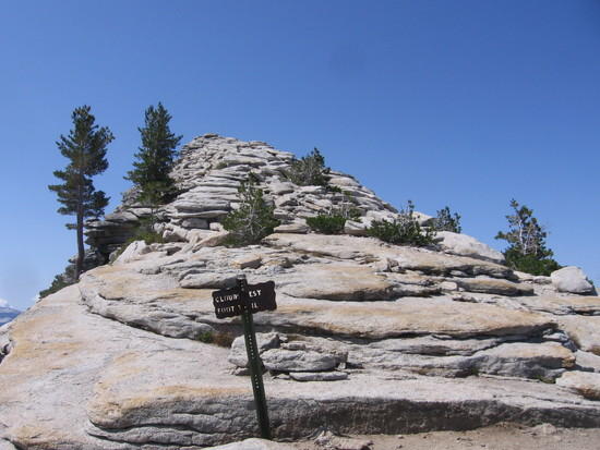
There are some killer switchback and 3000' elevation gain but, well, Clouds Rest view:56
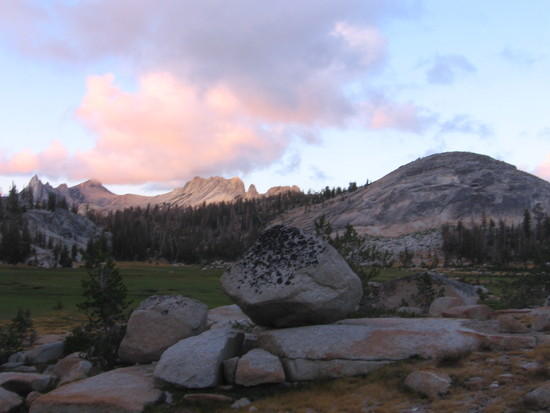
Sunrise Meadows(at dusk)
7

Day 5 – Sunrise HSC to Glen Aulin HSC – 14.3 miles

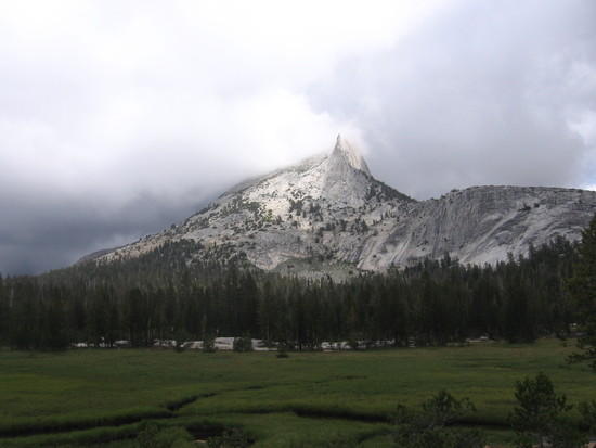
I've never been to Glen Aulin, but you can google pictures. This includes a 1 miles round trip detour to Cathedral Lakes.6

Day 6 – Glen Aulin Back to Lyell TH – ~7 miles

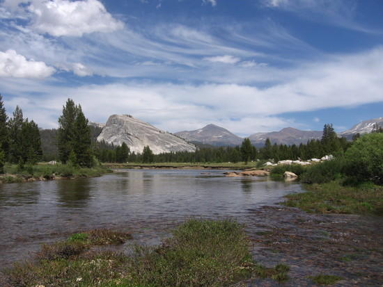
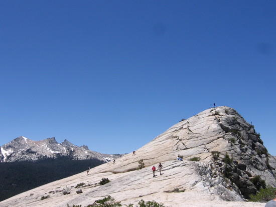
Plenty of time left to spend the day exploring Tuolumene Meadows,8, hiking up Pothole Dome and/or Lembert Dome,
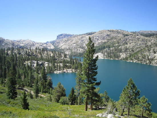
9

driving to Olmstead Point and seeing Cloud's Rest and Half Dome down Tenaya Canyon.

Jay Wilkerson BPL Member
PostedSep 23, 2011 at 5:51 am

Dan, The Emigrant wilderness loop is a 4 day trip starting from Kennedy Meadows with good fishing lakes…. Roughly is 50 miles. This is off HWY 108 just before the Sanora Pass. Easy permit picked up at Pinecrest ranger station (HWY 108) and no bear canister. Kennedy Meadows has a store, restaurant and over night ca

001mp sights.
Relief Reservoir

PostedSep 28, 2011 at 6:52 pm

From Tuolumne:

"Day 1: Trailhead to Virginia Canyon turnoff (12-13mi)
Day 2: camp before Smedberg Lake at about 9400ft (11.8 mi)
Day 3: camp just behind the turnoff from the Pate Valley trail into the Grand Canyon of the Tuolumne River – elev: 4500ft (12.8 mi)
Day 4: camp either at Glen Aulin (14.3 mi) or (if that's too far – you go uphill all day…) befotre of after Le Conte Falls (about 11.5 mi)
Day 5: hike back to the trailhead (5-7 mi)"

I think the above trip is what I'm going to do. It sounds pretty nice and the logistics are easy because it's a loop. I like that it's in Yosemite because I've always wanted to visit this park, even if it is just as awesome nearby.

Q) Does anyone have any suggestions for improvement (ie. other nice spots to camp if we come up short one day?)
Q) Any 'local' tips? Ie. nice spots to camp, where to eat after..etc.
Q) Do you think I need to book a permit for this in advance? I'd rather not, so I can keep my schedule flexible.

Viewing 25 posts - 1 through 25 (of 37 total)
Loading...